Auburn State Recreation Area
Auburn, Placer County, California. CA State Park.
Details

- Where
- 501 El Dorado Street, Auburn, CA 95603. Directions
- When
- Upper Lake Celementine: 8am to 6:30pm.
- Season
- Open 7 days a week during peak season; Closed for Winter season.
- Getting there
- From Interstate-80 take the Foresthill exit. Continue on Foresthill Road 5.5 miles, turn left onto Upper Lake Clementine Road, take the dirt access road 2 miles down the canyon, high clearance vehicles are recommended.
- Fees
- Vehicle Day Use: $10.00.
- Access
- Bring your own drinking water, there is no potable water in the park. Pets must be under control and on a leash no longer than six feet.
- Walk-in or reserve
- Upper Lake Clementine day use reservations are available 7 days a week; reservations are required on weekends during peak season - Memorial Day weekend through Labor Day.
- Phone
- (530) 885-4527
- Website
- parks.ca.gov
- Managed by
- California State Parks administers the area under a Managing Partnership Agreement with the US Bureau of Reclamation.
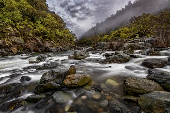
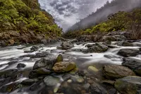
At the Confluence, below the town of Auburn, the North and Middle Forks of the American River come together inside Auburn State Recreation Area. Volunteers checked in here at 8:00 a.m. on April 18, 2026, for the American River Clean-up. The city ran shuttles to the trailheads, volunteers led hikes on historic bridges and natural history, and the Auburn Alehouse provided lunch. On Sunday, June 7, 2026, CAL FIRE and the Placer County Fire swiftwater rescue team were dispatched to the same water. State park lifeguards had pulled two people out before the engines arrived. In May of that year the park’s superintendent, Lauren Shoemaker, spoke on the Rogue Ranger Radio podcast about river safety.
Two forks south of Interstate 80
From the Confluence the park runs up both canyons, 20 miles end to end, south of Interstate 80 between Auburn and Colfax. It lies on the line between Placer and El Dorado counties. The main roads in are Highway 49 and the Auburn-Foresthill Road. State Parks counts more than 900,000 visitors a year. The park’s own pages give its location as Nisenan, Maidu, and Miwok land. The sources disagree on its size: Wikipedia gives 42,377 acres, while the State Parks planning office gives about 30,000, all but about 800 of them federal. California State Parks runs the area for the U.S. Bureau of Reclamation.
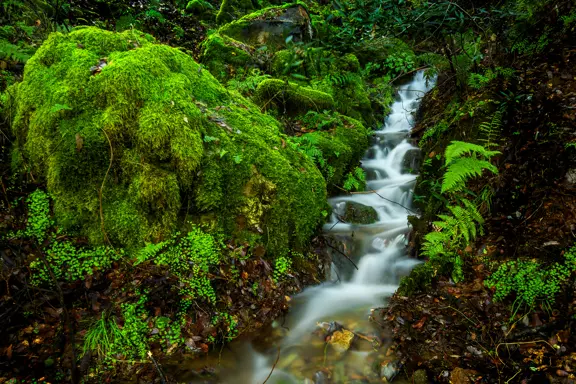
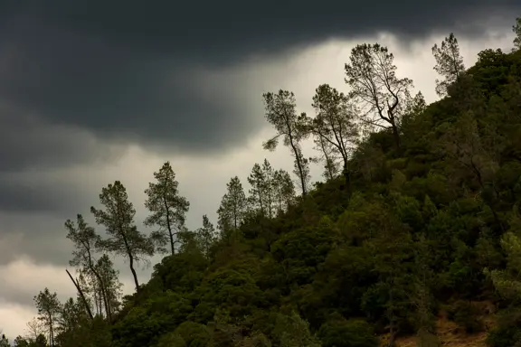
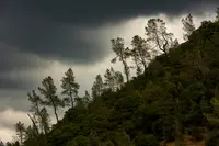
White alders, willows, Fremont cottonwoods, and creek dogwoods line the banks. The south-facing upper walls carry chaparral, and the foothill woodland holds buckeyes, interior live oaks, blue oaks, manzanita, deer brush, toyon, and poison oak. Ponderosa pine, Douglas-fir, California black oak, and madrone cover the north-facing slopes. In spring there are monkey flowers, fiddleneck, Indian paintbrush, larkspur, lupine, and brodiaea. Black-tailed deer and rabbits show themselves by day, and raccoons, opossums, gray foxes, and coyotes come out at night. Black bears, mountain lions, bobcats, and rattlesnakes live in the canyons. Canyon wrens and California quail keep to the riparian ground, and red-tailed hawks and bald eagles hunt overhead.
Summer highs run from the upper 80s to the mid-90s. Winters are wet, with highs in the mid-50s. There is no drinking water anywhere in the park. State Parks advises long pants against ticks, a trail map against the steep canyons, and company on the trail. Dogs go on a leash no longer than six feet.
Gold panning is allowed by the “hands and pans” method. The pan is the only tool permitted. Panning is confined to gravel bars that flood each year, one person may take no more than 15 pounds of mineral material a day, and muddy water from the work may not show more than 20 feet from the pan.
Lake Clementine and the white water
From Interstate 80, Foresthill Road climbs 5.5 miles to Upper Lake Clementine Road. A dirt road then drops 2 miles into the canyon, and high-clearance vehicles are recommended. Upper Lake Clementine is for day use, with no motors on the water. The lot holds 150 vehicles, and dogs, glass, and alcohol are barred. The area opens weekends only from October 1 to 14 and closes for the winter on October 15. During State Parks Week, on June 11, 2026, staff held a community paddle there and lent boats to anyone who arrived without one.
Lower Lake Clementine takes power boats. They run counterclockwise only, at no more than 40 miles an hour, and 5 inside the buoys. Wake surfing and parasailing are prohibited. Since April 14, 2025, every trailered or motorized boat has had to pass inspection and quarantine for the golden mussel before launching. From October 15 to April 14 the lake is closed to power boats, though kayaks, canoes, paddleboards, and rowing shells may still go in. Fifteen campsites on the shore can be reached only by boat, each with a picnic table and fire ring, and chemical toilets serve the campground. Anglers take brown trout, largemouth and smallmouth bass, carp, and catfish. No garbage is collected.
In August 2021 an algal mat sampled at Upper Lake Clementine showed a high level of anatoxin-a. Later samples found toxins at Mineral Bar, at Yankee Jims and Shirttail Creek, and below the Ponderosa Bridge. State Parks advised visitors to assume toxins were present along the North Fork from Mineral Bar to Rattlesnake Bar and to keep dogs away from it. The agency reported dog deaths, likely from the algae, at Oregon Bar in 2020 and 2021.
Both forks carry whitewater from Class II to Class V by State Parks’ count; Wikipedia lists II through IV. More than 30 private outfitters hold licenses to run trips in the park. Motorcycles have their own ground at the Mammoth Bar off-highway area, open year-round from 8 a.m. to sunset except in wet weather.
Runners and riders on the Western States Trail
The City of Auburn calls itself the “Endurance Capital of the World,” and the park’s 2026 calendar reflects it. The Resolution Run left Overlook Park on January 1. The Way Too Cool 50K started from Cool Staging on March 7. On April 24 and 25 the Canyons 100/25K put about 1,000 runners on the trails and closed Mammoth Bar and Ruck-A-Chucky. The Western States 100 ran June 27 and 28 from Palisades Tahoe to Placer High School, closing Driver’s Flat Road and Ruck-A-Chucky Campground for several days. On August 1 about a hundred horses and riders came down the same trail in the Tevis Cup, ending at the Auburn Staging Area, where riders had gathered for dinners on July 28 and 29.
The calendar includes more than races. Calvary Chapel Newcastle held an Easter sunrise service at China Bar on April 5, 2026. On June 13, during State Parks Week, Wild Things Outreach brought native animals to the Oregon Hill parking lot for three shows. The rest of the 2026 calendar lists the Sunset & Cider run from China Bar to Rattlesnake Bar on October 10 and the Rio Del Lago 100 from Beals Point to Cool Staging on November 7 and 8. A run called Doomsday is set for December 12. The park notes that scheduled events may change or be cancelled.
A reservoir that never filled
The Foresthill Bridge, which KQED describes as a green metal and concrete ribbon more than 700 feet above the river, was built to span a reservoir that never was. In the 2002 film XXX, a Corvette goes off it while its driver parachutes clear.
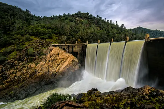
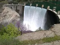
Congress approved the Auburn Dam in 1965. The Bureau of Reclamation designed it for more than 2 million acre-feet, about half the volume of Shasta Lake. Reclamation acquired or withdrew the canyon lands after the authorization, and Wikipedia gives 1966 as the year the recreation area was established. By Wikipedia’s account the project required 40,000 acres, much of it privately held, and 20,000 had been taken before the project ended.
By 1975, KQED reported, about $137 million had been spent. The following year a magnitude 5.7 earthquake struck “a little too close for comfort,” Reclamation stopped to revisit the design, and work never resumed. Wikipedia gives a fuller version. An earthquake at Oroville was traced to the Oroville Dam, and that finding led to the discovery that the Auburn site sits on a fault. Engineers feared a reservoir-induced quake could bring the dam down on Sacramento, which lies below. Drew Lessard, Reclamation’s area manager, told KQED that in the late 1970s the agency did “move the location slightly.” Hikers who go down into the canyon can still see where both walls were cut to anchor the concrete arch.
The water rights went in 2008, when the State Water Resources Board revoked them, but the idea did not go with them. In 2014 Congressman Tom McClintock called for finishing the dam and said the reservoir “could fill and refill Folsom Lake nearly 2 1/2 times.” Doris Matsui, sitting nearby, shook her head. “You know, that thing’s been studied over and over and over again,” she told KQED. “And you know what? There’s no support for it.”
Meanwhile, State Parks has managed the land since 1977, under a 25-year agreement signed in 2012. Reclamation approved its resource management plan on August 21, 2020, and the State Park and Recreation Commission approved the park’s General Plan on September 30, 2021. A ranger here, Jordan Fisher Smith, wrote about his patrols in the 2005 book Nature Noir.
Sandstone trains and the first gold
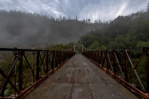
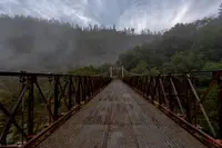
Downstream from the Highway 49 bridge over the North Fork, the Mountain Quarries Railroad Bridge crosses the river. John B. Leonard, a pioneer of reinforced concrete, designed it, and it was built in 1912 as a very early reinforced-concrete railroad bridge. From 1912 to 1942 trains crossed it carrying sandstone to Auburn to meet the Southern Pacific. It was listed on the National Register of Historic Places on February 11, 2004, and registered as a California Historical Landmark on April 7, 2014.
The canyons, in State Parks’ words, were once “teeming with thousands of gold miners.” The City of Auburn’s history credits Claude Chana as the first to find gold in the area, in May of 1848, about a quarter mile south of Old Town on the Auburn Ravine. When Hiram Hawkins arrived in July 1849, most of the fortune seekers had already left for the North and Middle Forks. Then the rains came. Some miners in the river canyons built heavier cabins for the winter of 1849–1850, but most fled to Auburn. An anonymous correspondent wrote to the Placer Times on November 25, 1849: “This sudden visitation of the liquid element has entirely checked operations and taken miners all aback.”
Notable Events
- 1848Claude Chana was the first to find gold in the Auburn area in May of 1848 about a quarter mile south of Old Town on the Auburn Ravine. auburn.ca.gov
- 1912From 1912 to 1942, the Mountain Quarries Bridge operated trains over the bridge, carrying loads of sandstone to Auburn, California to meet up with the Southern Pacific Railroad. ohp.parks.ca.gov
- 1965Auburn Dam, a long-stagnant project on the North Fork of the American River, was originally green-lighted by Congress in 1965. kqed.org
- 1966Auburn SRA comprises lands set aside for the proposed Auburn Dam. en.wikipedia.org
- 1975After about $137 million spent by 1975, a magnitude 5.7 quake occurred a little too close for comfort; Reclamation took a time-out to revisit the dam's design and work has never resumed. kqed.org
- 2004The Mountain Quarries Bridge was listed on the National Register of Historic Places on 2/11/2004 under reference NPS-04000014. ohp.parks.ca.gov
- 2014The bridge was registered as a California Historical Landmark on 4/7/2014, at Auburn downstream from the State Highway 49 Bridge over the North Fork of the American River. ohp.parks.ca.gov
- 2020The U.S. Bureau of Reclamation signed a Record of Decision approving the Auburn Project Lands Resource Management Plan and Final Environmental Impact Statement, finalizing the federal planning process. parks.ca.gov
- 2021The California State Park and Recreation Commission approved the Auburn State Recreation Area General Plan and Final Environmental Impact Report. parks.ca.gov
- A large earthquake at Oroville nearby was found to have been caused by the Oroville Dam at that location which led to examination and discovery that the Auburn dam site is situated on a geologic fault. en.wikipedia.org
People
- Claude Chana, First to find gold in the Auburn area (May of 1848).
- John B. Leonard, designed the Mountain Quarries Bridge; a renowned pioneer in the design, engineering, and use of reinforced concrete in California and the nation (1912).
Sources
- parks.ca.gov/?page_id=502
- parks.ca.gov/?page_id=1141
- parks.ca.gov/?page_id=26265
- kolotv.com/2026/06/07/2-victims-removed-confluence-american-river-cal-fire-reports
- parks.ca.gov/?page_id=26020
- parks.ca.gov/?page_id=1344
- facebook.com/auburnsra
- instagram.com/auburnsra
- en.wikipedia.org/wiki/Auburn_State_Recreation_Area
- auburn.ca.gov/459/Auburns-History
- facebook.com/auburnsra
- ohp.parks.ca.gov/listedresources/Detail/1051
- kqed.org/science/17039/auburn-dam-the-water-project-that-wont-die