

Arroyo Seco Historic Parkway (Route 110)
Los Angeles, Los Angeles County, California. California Historic Parkway.
Details

- Where
- Los Angeles, Los Angeles County, CA. No street address stated. Directions
- Getting there
- Arroyo Seco Parkway runs northeasterly from the Four-Level Interchange with U.S. 101 just outside downtown Los Angeles to East Glenarm St. in Pasadena, CA.
- Fees
- None.
- Access
- On- and off-ramps (woefully short by modern standards).
- Phone
- 323-221-9944 x117
- Website
- nps.gov
- Managed by
- Scenic Arroyo Seco c/o Mountains Recreation and Conservation Authority.
- Established
- 1940.
Northbound out of the Four-Level Interchange, the symmetrical stack on the north side of downtown Los Angeles where the Pasadena, Harbor, Hollywood and Santa Ana freeways meet, State Route 110 passes a ramp at Figueroa and Alpine streets and a junction at Hill Street that leads to Dodger Stadium. It then climbs into the hills of Elysian Park. There the northbound lanes enter four Art Deco tunnels in a row, with an interchange at Solano Avenue and Amador Street between the first and second. The southbound lanes run higher, through a cut and over low ground on bridges. The National Park Service says a driver will recognize the tunnels “from countless film and television productions,” and calls them the only known tunnels along the entire route of Route 66.
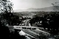
This is the Arroyo Seco Parkway, six lanes from the Four-Level to Glenarm Street in Pasadena. Caltrans puts the length at 8.2 miles. The National Scenic Byways program lists it at 9.45 miles and advises twenty minutes to drive it outside peak hours, or an hour to see all of it. No commercial vehicle over 6,000 pounds may use it, and buses need authorization from the Public Utilities Commission. The road was built for about 27,000 cars a day. The Los Angeles Times reported in 2010 that it carried about 122,000.
Ramps at five miles an hour
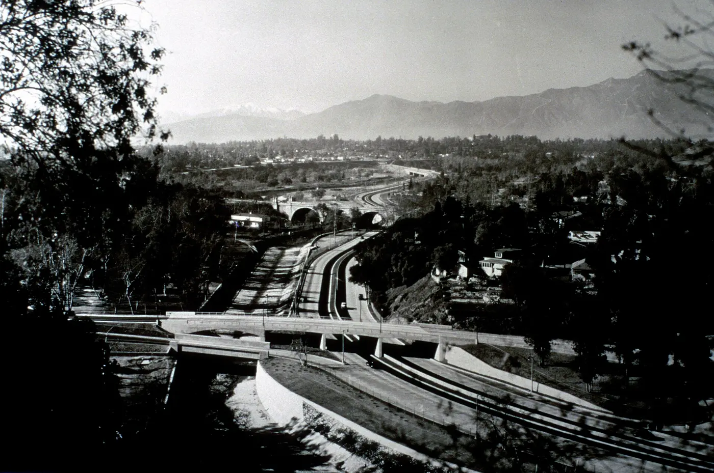
Past the last tunnel the parkway crosses the Los Angeles River on a pair of three-lane bridges, just northwest of the river’s meeting with the Arroyo Seco. It passes under the Golden State Freeway, and near the Figueroa Street ramps the original 1940 road begins. From there it follows the west bank of the Arroyo Seco, an intermittent stream that carries rain from the San Gabriel Mountains down through western Pasadena to the river.
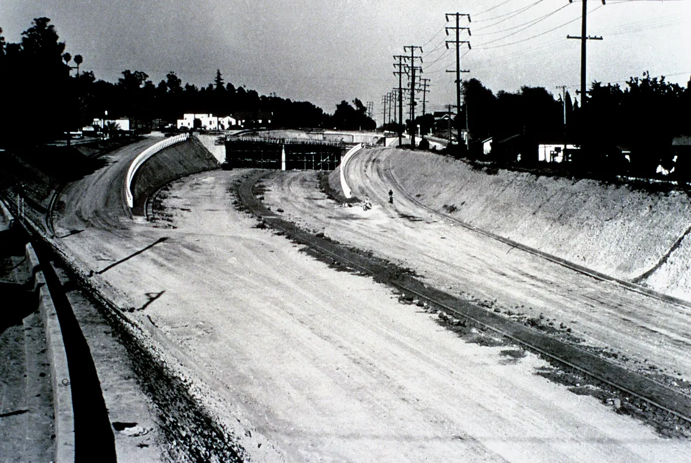
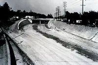
The interchanges show the road’s age. Engineers built “folded diamonds,” which they called “compressed cloverleafs.” At these, local streets often served as the ramps and met the parkway with a sharp right turn. Avenue 43 is the first of them. The Metro library’s account describes exiting at 90-degree offramps “at the posted 5-miles-per-hour” and merging “from a dead stop.” The design speed was 45 miles per hour. The original inside passing lanes were paved in black asphalt concrete and the outside lanes in white Portland cement, so that the two colors would keep drivers in their lanes. Looking south from Marmion Way, the passing lanes still show a different color from the paving. Wikipedia gives the road a crash rate roughly twice that of other freeways, mostly because it lacks acceleration and deceleration lanes.
Bridges older than the road
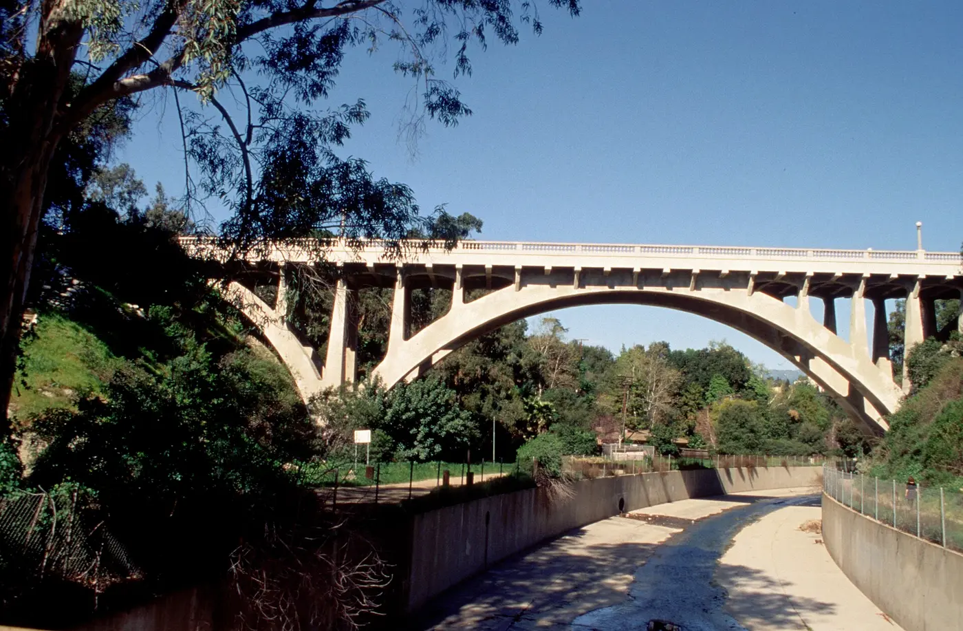
All of the parkway’s original bridges stand. So do four that crossed the Arroyo Seco before the parkway was built. Where the 1940 road begins, it passes under an extension of the 1925 Avenue 26 Bridge. Farther up is the 1926 Avenue 60 Bridge, and just beyond it the 1895 Santa Fe Arroyo Seco Railroad Bridge. That bridge is 750 feet of steel spanning the whole arroyo, 100 feet above the roadway, and it now carries Metro light rail. Then comes the 1912 York Boulevard Bridge. The Park Service notes that most of these bridges keep their historic integrity and differ in style from later freeway work.
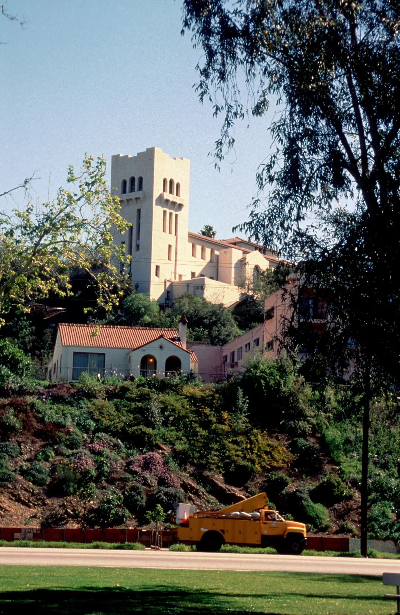
Where the stream curves north toward Pasadena, the parkway curves east and crosses it into South Pasadena. Northbound drivers pass a “City of South Pasadena” sign set into a hillside in the late 1930s, made of stones from the creek bed. The Park Service ties the sign to the region’s place in the Arts and Crafts Movement. The last segment runs in a cut beside Grevelia Street, passes under the light rail a third time near Fair Oaks Avenue, and bends around the east side of Raymond Hill into Pasadena. State maintenance ends at Glenarm Street. From there the city’s Arroyo Parkway continues north as a surface road to Colorado Boulevard, the old Route 66, and on to Holly Street.
North Figueroa Street parallels much of the parkway just to the west. It carried Route 66 from 1931, became Alternate 66 after the parkway opened, and is the main street of Highland Park.
A wooden cycleway and a fight over the route
In the dry season the arroyo served as a wagon road between the two cities, faster than the all-weather road on what is now Huntington Drive. T. D. Allen of Pasadena made the first known survey for a permanent roadway through it in 1895. Two more proposals followed in 1897, one for a scenic parkway and one for a commuter cycleway.
Horace Dobbins built the cycleway. His California Cycleway Company bought a six-mile right-of-way from downtown Pasadena to Avenue 54 in Highland Park and began construction in 1899. On January 1, 1900, about a mile and a quarter of elevated wooden bikeway opened, running from near the Hotel Green to near the Raymond Hotel, with a toll booth at the north end in what is now Central Park. The bicycle craze ended and the Pacific Electric already linked the two cities, so the cycleway never reached the arroyo. Sometime before 1910 it was taken down and the wood sold for lumber. Most of its route is now Edmondson Alley.
Automobile registrations in Los Angeles County quadrupled between 1914 and 1922. In 1916 Pasadena City Engineer Harvey W. Hincks drew a plan that left the arroyo in South Pasadena to serve downtown Pasadena. Frederick Law Olmsted Jr. and Harland Bartholomew’s 1924 Major Street Traffic Plan proposed a parkway that would give motorists “a great deal of incidental recreation and pleasure.” By the mid-1930s, the need to carry commuters had overtaken the recreational idea.
The route was contested. In the early 1930s Los Angeles City Engineer Lloyd Aldrich began grading between Avenues 60 and 66. By June 1932, residents of Highland Park and Garvanza, who had paid special assessments to improve the park, grew suspicious of what looked like a road. Merchants on North Figueroa Street objected to a bypass that would take their trade. Many South Pasadena residents opposed a road that would divide their city, but voters there elected supporters in 1936, and the state approved the route on April 4 of that year. Meanwhile, the four Figueroa Street tunnels had been built to extend that street to the river: three opened in late 1931 and the fourth in mid-1936. The Works Progress Administration built the Arroyo Seco Flood Control Channel before and during the parkway work.
In early 1938 state engineers toured roads in the East, including Chicago’s Lake Shore Drive, cloverleaf interchanges in Massachusetts and New Jersey, and Robert Moses’s parkways in New York. Construction began that year. It was the first road in California built under a 1939 law that allowed access to be limited to specified points. Metro’s history adds that the work put many people to work during the Depression.
December 30, 1940
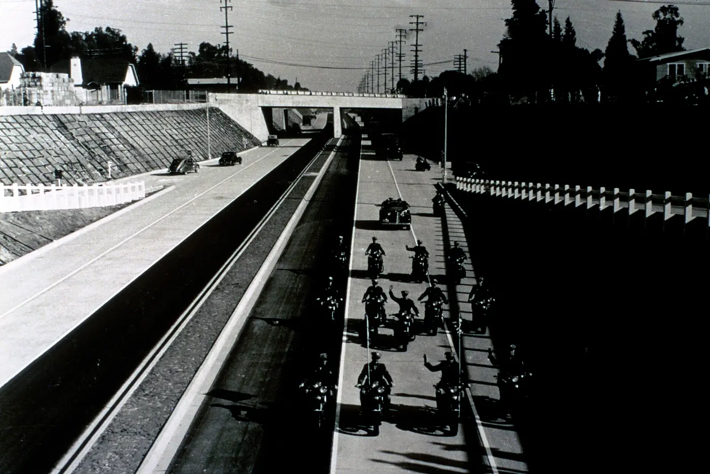
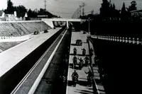
The parkway was dedicated on December 30, 1940. Caltrans calls it “California and the US’ first freeway” and dates the state’s freeway era from it. Metro calls it the oldest freeway in the United States, and Wikipedia calls it one of the oldest. According to the Historic American Engineering Record, Governor Culbert L. Olson declared it the “first freeway in the West.” The opening section ran about six miles, from Pasadena to Avenue 22. It was landscaped with native plants and trees along stone-accented shoulders, and it cut the trip between the two cities from 27 minutes to 12.
On completion it became an alignment of Route 66. The Park Service calls it the first stretch of the Mother Road to run on a modern limited-access highway. The United States entered the war a year later, and traffic on the new road stayed light and mostly local. After the war, Route 66 travelers bound for the Pacific drove it as an example of where highways were headed.
Changes came in stages. In 1943 the southbound lanes took a new alignment over the Los Angeles River, and Metro records that trucks and buses were banned that year; the bus restriction was later dropped. The weight limits now on file with Caltrans come from city ordinances passed in 1953. About 50 safety bays for disabled cars were added in 1949 and 1950. A two-mile southern extension reached the Four-Level Interchange in 1953 and joined the parkway to the Hollywood, Harbor and Golden State freeways. On November 16, 1954, it was renamed the Pasadena Freeway. The engineering record says postwar growth pushed engineers toward the “stripped-down esthetics which would characterize much subsequent freeway development.” The plants in the median gave way to a steel guardrail, and later to concrete.
The old name restored
In the early 1990s the Legislature designated the road a California Historic Parkway, the first of two; the other is State Route 163 through Balboa Park in San Diego. In 1999 the American Society of Civil Engineers named the original segment a national engineering landmark, and the Historic American Engineering Record completed its documentation. On Sunday, June 15, 2003, the whole road was closed to motor vehicles to draw attention to projects planned along the Arroyo Seco.
In 2010 Caltrans began a $17 million safety project. Caltrans spokeswoman Judy Gish said decorative concrete center dividers and rock-like side walls topped by fencing would replace the metal guardrails, along with new lighting. The Highland Park Heritage Trust and other preservationists had tried to stop the demolition of median sections and other features. When Caltrans then sought the city’s backing for a National Register listing, the Trust supported it but objected that “not enough was written in the nomination to easily understand all the elements that are part of the road, how much is still intact and can/should be preserved going forward.” The city’s Cultural Heritage Commission voted on October 7, 2010, to support the motion with modifications. Route 66 News reported, citing a Park Service e-mail, that the Arroyo Seco Parkway Historic District was listed effective February 4, 2011. Wikipedia gives February 17, 2011.
Caltrans spent about $650,000 on new signs, and the original name returned on December 30, 2010, seventy years after the dedication. Not every driver welcomed it. “Pasadena is where it goes. I don’t see the point in calling it something else,” said Ignacio Solis of East Los Angeles. Margo Seguria of Montecito Heights said, “Of course, we know freeways by their numbers. Our parents were the ones who knew them by name.”
Notable Events
- 1940The Arroyo-Seco Parkway, California's and the nation's first freeway, was dedicated, marking the beginning of the freeway era in California. dot.ca.gov
- 1943Trucks and buses were banned in 1943, although bus restrictions have been dropped. metroprimaryresources.info
- 1953After a World War II interruption, a two-mile extension to the downtown four-level interchange opened in 1953, and the highway became known as the Pasadena Freeway, later the 110 Freeway. latimes.com
- 1954On November 16, 1954, its name changed to the Pasadena Freeway, as the northern extension of State Route 110. metroprimaryresources.info
- 1999In 1999, the American Society of Civil Engineers named the initial segment a national engineering landmark. latimes.com
- 2010Caltrans decided to rechristen the Pasadena Freeway back to its old name, the Arroyo Seco Parkway, commemorating new lighting, an improved center divider and decorative low walls. latimes.com
- 2011The Arroyo Seco Parkway Historic District was added to the National Register of Historic Places on February 17, 2011. en.wikipedia.org
- The Arroyo Seco Parkway Historic District, a highway that once carried Route 66 in Los Angeles County, was named to the National Register of Historic Places, per a National Park Service announcement. route66news.com
- The Cultural Heritage Commission on Thursday, Oct. 7 voted to support the motion with modifications. theeastsiderla.com
People
- Culbert L. Olson, California governor who declared the parkway "first freeway in the West".
- Frederick Law Olmsted, Jr., co-author of the 1924 Major Street Traffic Plan for Los Angeles that suggested the new parkway be built (1924).
- Harland Bartholomew, co-author of the 1924 Major Street Traffic Plan for Los Angeles that suggested the new parkway be built (1924).