
Angel Lake Scenic Byway
Wells, Elko County, Nevada. Scenic byway.
Details

- Where
- Angel Lake Road, Wells, NV 89835. Directions
- Season
- Open seasonally, dependent on snowpack and road conditions; typically accessible from June through October.
- Getting there
- To get there from Wells, head south on State Route 231, AKA Angel Lake Scenic Byway.
- Fees
- Angel Lake, NV camping is $16 per night for a single campsite and $32 per night for a double unit.
- Access
- The short but mighty Angel Lake Road begins in Wells and ascends along rushing Angel Creek through sagebrush-swept high desert, groves of piñon pine, mountain mahogany, and aspen, ultimately arriving at the Angel Lake's slice of glacier-carved paradise.
- Walk-in or reserve
- 26 campsites available by reservation; reservations can be made in advance.
- Phone
- (775) 752-3357
- Website
- travelnevada.com
- Managed by
- Humboldt-Toiyabe National Forest.
Up Angel Creek on Route 231
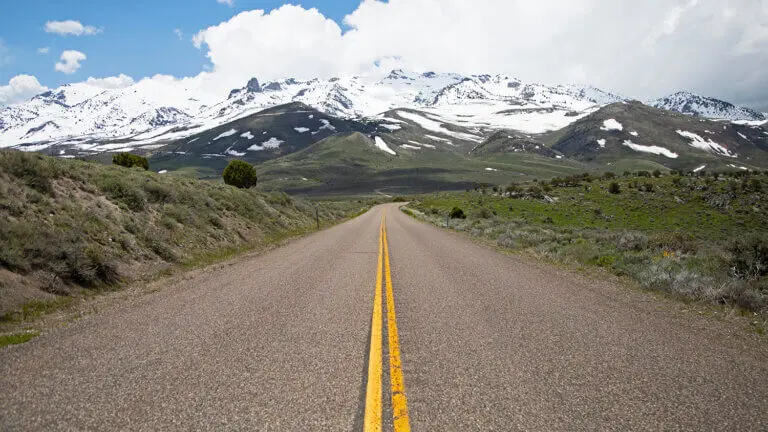
Angel Lake Road leaves Interstate 80 at the West Wells exit and runs south as State Route 231. It is paved to its end at the lake and climbs about 3,000 feet on the way. Travel Nevada gives the distance as 12 miles, and the National Scenic Byway Foundation gives it as 11.7. Nevada lists the road as a state scenic byway. The Forest Service notes that it is sometimes called the “highway to heaven” for the height it gains.
The road follows Angel Creek up out of sagebrush and piñon pine. Richard Moreno, writing his Nevada Traveler column in 2021, described the lower miles as “rolling foothills of sagebrush and pinon pine trees.” Higher up, he wrote, groves of mountain mahogany and fields of thick grass take over from the piñon, and at one point the road cuts through a grove of quaking aspen. The Forest Service adds limber pine to the list near the top. Ahead stands the crest of the East Humboldt Range. Moreno wrote that the snow-capped peaks at one moment “resemble the jagged teeth of a giant feline.” At other moments they were simply uneven stone carved by wind and rain.
At about 9 miles a side road branches off to Angel Creek Campground. From that junction, by Moreno’s account, the town of Wells appears tiny in the valley below. Farther on is the turnoff for the Winchell Lake trailhead, about halfway between Angel Creek Campground and the campground at the lake. Moreno called Winchell a small reservoir recessed on the side of the range. Signs mark the trails that leave the road for the mountains. Near the top the grade levels off.
Travel Nevada names bighorn sheep, mountain goats, mule deer, and pronghorn antelope among the animals that may be seen from the road or at the lake. The Nevada Department of Wildlife adds Himalayan snowcock, golden eagles, Clark’s nutcrackers, yellow-bellied marmots, squirrels, and chipmunks. It also notes migratory birds in summer.
A tarn behind a dam
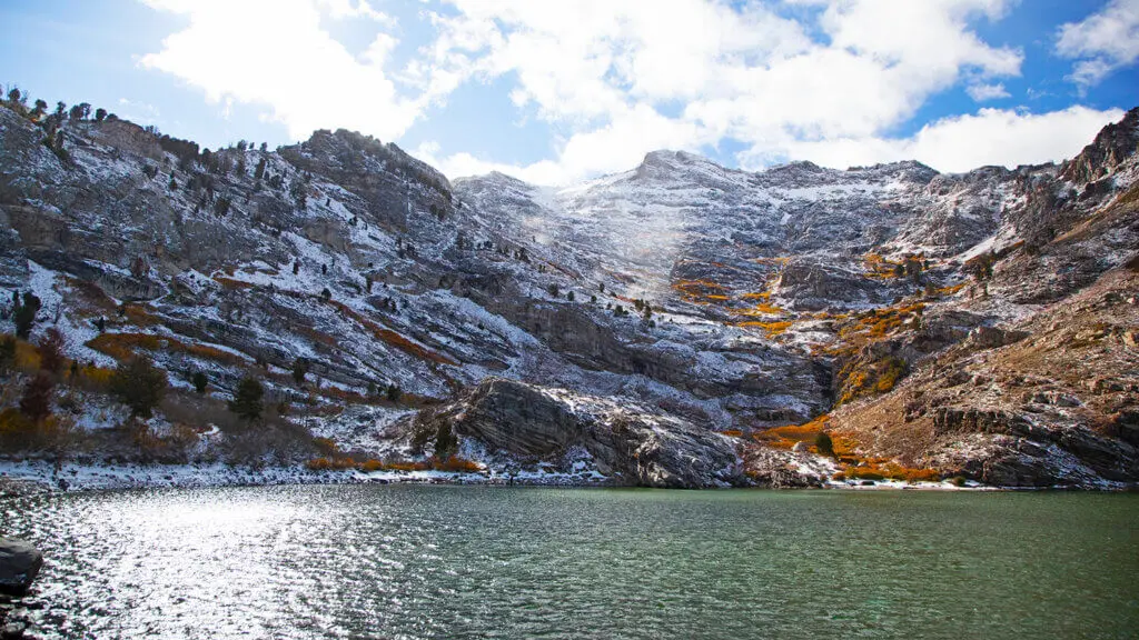
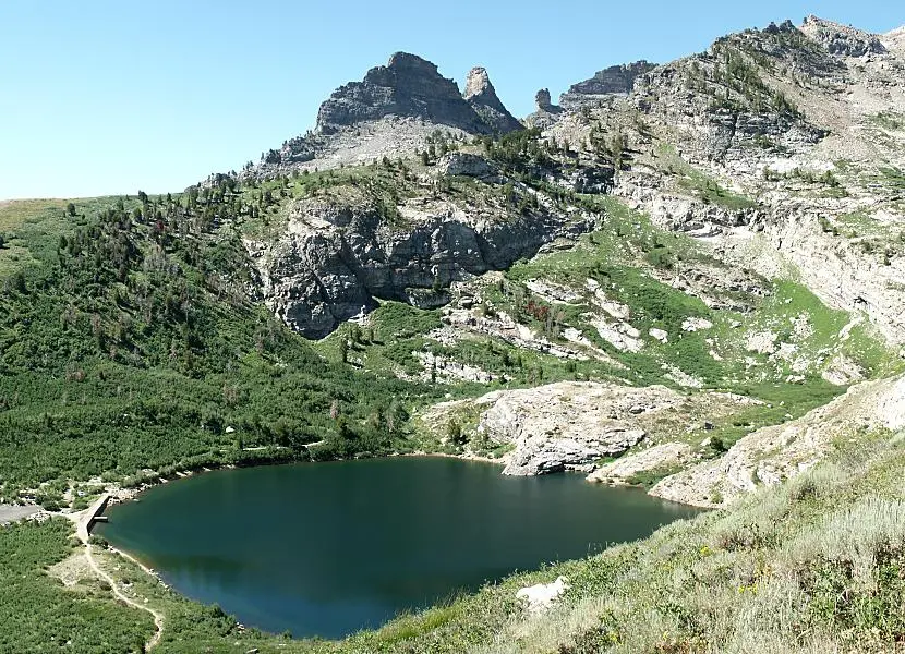
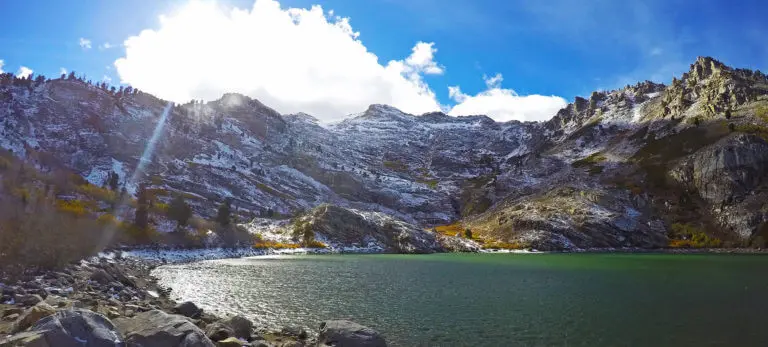
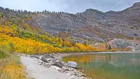
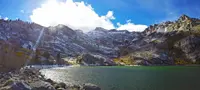
The road ends at the eastern shore of Angel Lake. The Forest Service calls the lake a tarn tucked into a glacial cirque. Its rock walls rise on three sides to cirques that top out around 10,000 feet, according to Recreation.gov. On the fourth side, the east, Moreno wrote that “a manmade dam on the east side cups the water into a circular basin.” The Department of Wildlife describes the lake as a natural high-elevation alpine lake that was modified to increase irrigation storage. It gives the surface area as 13 acres and the greatest depth as 35 feet.
The sources do not agree on the lake’s elevation. Moreno and the Byway Foundation give 8,378 feet. Travel Nevada gives 8,500, and the Department of Wildlife gives 8,000. The Forest Service lists the campground at 8,350 feet and Recreation.gov at 8,400.
Moreno described the cliff walls as crumbly, cracked rock worn by constant heating and cooling, with “scarecrow limber pines” clinging to the mountainside. The Forest Service lists the rocks at the core of the range: gneiss, granite, migmatites, quartzose schist, and calc-silicate rocks. Glaciers left cirques, domes, arêtes, and hanging valleys along the crest and moraines along the base. The East Humboldts are an extension of the Ruby Mountains. Moreno gave the size of the East Humboldt Wilderness, which the lake borders, as 36,000 acres.
Trout, trails, and a camp in the dwarf aspen
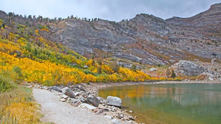
The Forest Service campground at the lake has 26 sites, single and double. Some have lake views, and each has a picnic table, a fire ring, and a grill. Recreation.gov says dwarf aspens cover the campground and screen the sites from one another but give little or no shade. A day-use picnic area runs along the lakeshore beside it, and there are vault toilets. The sources disagree on drinking water. The Forest Service says no potable water is available, while the Byway Foundation lists potable water and on-site hosts. Travel Nevada recommends the campground in spring wildflower season and for its autumn foliage.
The whole shoreline can be fished. No motorboats are allowed, so anglers go out in canoes and float tubes. The Department of Wildlife stocks rainbow, brook, and tiger trout each year, and its records also show cutthroat in 2025 and 2026. In late June 2026 it stocked 1,883 rainbows averaging 10.5 inches, then 1,125 tiger trout the next day. Because the growing season is short, the agency says, the fish grow little after stocking and usually run 8 to 12 inches. It reports that anglers catch one or two an hour and about five a day, mostly on nightcrawlers, salmon eggs, and power bait, along with small spinners, spoons, and flies.
The Smith Lake Trail begins at the campground entrance and leads into the northern part of the wilderness. Moreno recorded a sign at the lake giving mileages to Greys Lake, Smith Lake, Ackler Creek, and Boulder Lake. Travel Nevada points hikers toward Hole-in-the-Mountain Peak, the highest point in the East Humboldts, which has wildflowers and cliffs several hundred feet high.
Snow sets the season. The Department of Wildlife says the road closes after the first heavy snow and usually stays shut from November until Memorial Day weekend. Travel Nevada gives the open months as roughly June through October.
Warren Angel’s name and a new dam
The lake’s name has nothing to do with the “highway to heaven.” Moreno traced it to Warren M. Angel, who owned a large ranch in Clover Valley, near the range, in the 1870s.
The dam on the east shore became news in 2026. On September 3, 2026, 2 News Nevada reported that the campground and day-use area would close for the season on Tuesday, September 8, so crews could begin work on a new dam. A Forest Service alert gave the same date and called the project the “long-awaited new Angel Lake Dam.” A Recreation.gov notice gave the closing date as Monday, September 7. The Department of Wildlife reported that as of September 8 there was no access to the lake at all.
According to 2 News, the new dam is meant to provide more reliable infrastructure and safe water storage. The project also promises wider shoreline access, better fishing conditions, and more room to launch kayaks, paddleboards, and other non-motorized craft. Wendy Markham, Deputy District Ranger for the Mountain City-Ruby Mountains-Jarbidge Ranger District, told the station: “Improving the safety and stability of the dam is our top priority, and we’re excited that this project will also create new recreational benefits.” The Forest Service expected construction to continue through the fall, and its closure alert ran to October 31, 2026.
Notable Events
- 2026The closure would allow crews to begin construction on the long-awaited new Angel Lake Dam. fs.usda.gov
- 2026Campground and day-use area were scheduled to close for construction and repair of the dam. recreation.gov
- The campground and day-use area would close as crews prepared to construct a new dam; the project was intended to improve infrastructure and long-term visitor safety. 2news.com
People
- Wendy Markham, Deputy District Ranger for the Mountain City-Ruby Mountains-Jarbidge Ranger District speaking about the new Angel Lake dam project.
- Warren M. Angel, Clover Valley rancher for whom Angel Lake is named (1870s).
Sources
- travelnevada.com/travel-guides/angel-lake
- travelnevada.com/tours-cruises/angel-lake-scenic-byway
- nevadaappeal.com/news/2021/apr/13/nevada-traveler-angel-lake-surprising-discovery
- fs.usda.gov/r04/recreation/geologic-wonders/scenic-byways-areas-and-overlooks
- nsbfoundation.com/sb/angel-lake-road-route-231
- travelnevada.com/travel-guides/angel-lake