Rifle
Garfield County, Colorado. County seat.
Rifle, a Colorado River town founded in 1882 west of Glenwood Springs, has two stories of how a misplaced rifle gave it its name.1,2,3
Details
Point at a dot to see the place.Tap a dot to see the place. Road map of Rifle.
In Rifle
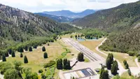
- Rifle Falls Fish HatcheryRifle · Cold water hatcheryColorado's largest state-owned trout hatchery, fourteen miles north of Rifle beneath 300-foot limestone cliffs, where rare Uncompahgre cutthroat rescued from a wildfire went into isolation tanks in July 2026.
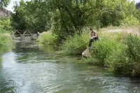
- Rifle Falls State Park TrailheadRifle · State parkRifle Falls State Park's lush vegetation and waterfalls have attracted photographers and movie crews from around the country to capture the area's unique scenery. Mysterious limestone caves beneath the falls entice spelunkers and other curious visitors to explore.
The Calendar
History
Railroad Avenue at Rifle Creek
Railroad Avenue, Rifle’s main street, runs north and south through a town at the confluence of Rifle Creek and the Colorado River, west of Glenwood Springs.1,2 The Colorado Encyclopedia gives Rifle 9,172 people, in a Garfield County whose seat is Glenwood Springs.1 In 1941 the Writers’ Program guide counted 1,287 people at an altitude of 5,310 feet and called Rifle a Saturday-night town for a large, sparsely settled cattle-raising area.4
Maxfield’s Homestead and the Lost Rifle
Utes lived in the country around present-day Rifle until they were forcibly removed in 1881, after the 1879 conflict near Meeker, forty miles to the northwest.2 In 1882 Abram Maxfield left a mining community and homesteaded in the valley where Rifle Creek joined the Grand River, now called the Colorado.2 Local accounts cited in the state register nomination say that prospectors or trappers left a rifle at a camp on the creek and called it Rifle Creek after they went back for the gun.2 A state marker erected in 1998 tells a different story: during the U.S. Geological Survey of 1876, A.C. Peale wrote “rifle” on his map where a firearm had been misplaced, and the gun was never found, but the name stuck.3 According to the nomination, the railroad (D&RG) reached the area in 1889, and Maxfield then platted eighty acres of his land as a townsite named for the creek.2 The Colorado Encyclopedia dates the Denver & Rio Grande Railroad’s arrival to 1890 and says the town grew into a hub for farming and ranching.1 By 1896 the Odd Fellows, the town’s earliest fraternal organization, had built a two-story wood-frame lodge and opera house at a corner of Railroad Avenue, the main street.2 A fire on 3 May 1902 destroyed half the commercial district, and Rifle incorporated in 1905.2 In 1903 O.V. Coulter took a 99-year lease to build a lake on Coulter Mesa, which supplied extra irrigation water to his farm and orchard on the north side of Rifle.5
Hunters, Masons, and the Flu Hospital
The state marker says tourism became a third staple after President Theodore Roosevelt’s 1905 bear hunt in Garfield County, and by the 1910s anglers and hunters were coming to Rifle.2,3 Five years after incorporating, the town bought Box Canyon from the federal government and named it Rifle Mountain Park, on the condition that the land always be used for public recreation.5 Apparently thirty Masons lived nearby when they first tried to form a lodge in 1905, but Rifle Lodge No. 129 was not chartered until 21 September 1908.2 On 27 June 1914 the Masons laid the cornerstone of a two-story brick lodge on Railroad Avenue, designed by F. (Fred) Elwood Jenkins, an architect whose career is little known.2,6 For several months in 1918 the lodge served as a temporary hospital for influenza patients, and by the middle of January 1919 the number of severe flu cases had dropped.2,6
Shale Claims, the CCC, and Christo’s Curtain
When World War I cut into fuel supplies, speculators filed thousands of claims in and around the Piceance Basin between 1916 and 1920, and two hundred oil shale companies were formed.3 Refining the shale cost more than it yielded, and by 1930 the business had hit rock bottom.3 On May 17, 1934, 180 CCC workers set up camp in Huffman Gulch in Rifle Mountain Park and built the Rifle Creek Community House, a timber and brick building that is still used as a gathering place.5 The state marker says the uranium used in the atomic bombs that ended World War II was processed near Rifle.3 Gale-force winds shredded Christo’s first attempt in October 1971, but on August 10, 1972, his 360-foot-high orange curtain went up across Rifle Gap and hung for twenty-eight hours.3
Black Sunday, 1982
High energy prices in the late 1970s drove oil companies back to western Colorado, Rifle and Parachute had the boom that had escaped them decades earlier, and in 1975 Exxon built Battlement Mesa north of Parachute to house its workers.1,3 On the day the marker calls Black Sunday in 1982, Exxon ended its project and fired 2,100 workers, and the Colorado Encyclopedia says two thousand people left the area at once.1,3 The state marker says Rifle avoided some of the boom-and-bust upheavals that hit neighboring towns, and it names agriculture, hunting, and recreation as the town’s base.3
Within 30 Miles
Measured in a straight line from the town, nearest first.
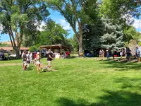
- Silt HeydaySilt · Annual silt heydayLive Music: The Colorado Currys
- Burning Mountain FestivalNew Castle · Annual town festivalNew Castle, Colorado's two-day September town festival in Burning Mountain Park, held since 1973 and named for the ridge above town where an old mine fire still burns.
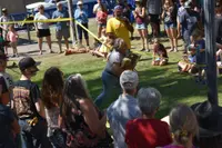
- Grand Valley Days (Parachute)Parachute · Annual summer celebrationGrand Valley Days is Parachute, Colorado's four-day August run of parade, CPRA rodeo and ice cream social, and its 2026 parade on Second Street was billed as the 118th annual.
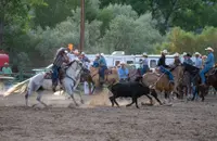
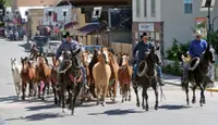
- Plateau Valley Heritage DaysCollbran · Heritage days celebrationPlateau Valley Heritage Days is a three-day Fourth of July rodeo celebration in Collbran, Colorado, where cowboys herd the bucking horses down Main Street to the arena.
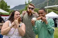
- Strawberry Days (Glenwood Springs)Glenwood Springs · Free community festivalGlenwood Springs' free festival on the third weekend of June, begun in 1898 by a farmers union, where Kiwanis still hand out strawberries and ice cream after the parade.
- Iron Mountain Hot SpringsGlenwood Springs · Hot springs resortHot springs resort with 35 pools, Sauna Summit, cold plunges, cafes, and locker rooms in Glenwood Springs, Colorado.
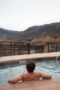
- Glenwood Hot Springs ResortGlenwood Springs · Hot springs resortA collection of beautifully large hot springs pools; at the center of the property is the historic Grand Pool, the world's largest hot springs pool, immediately adjacent to the historic 104-degree Therapy Pool.
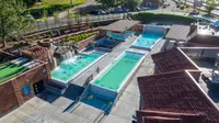
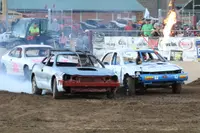
- Wild Horse DaysDe Beque · Annual community eventParade, live music, vendors, poker run, corn hole tournament, mud run, burnout and bump n jumps.
Nearby towns: Palisade and Paonia. All the towns of Colorado. More of Colorado: Fairs & Rodeos and Factory Tours.
Sources
- Colorado Encyclopedia coloradoencyclopedia.org/article/garfield-county
- colorado state register of historic properties historycolorado.org/sites/default/files/media/document/2021/Garfield%20County_Rifle%20Masonic%20Lodge_SR_Web.pdf
- Rifle ⎯⎯⎯ The Rock That Burns ⎯⎯⎯ Colorado Wilderness ⎯⎯⎯ Rifle Country (historical marker) hmdb.org/m.asp?m=120749
- Colorado: A Guide to the Highest State (1941), p. 240 archive.org/details/coloradoguidetoh00writ_0/page/240
- Early days of Rifle Mountain Park postindependent.com/citizen-telegram/early-days-of-rifle-mountain-park
- Rifle Lodge No. 129, A.F & A.M. historycolorado.org/location/rifle-lodge-no-129-af-am