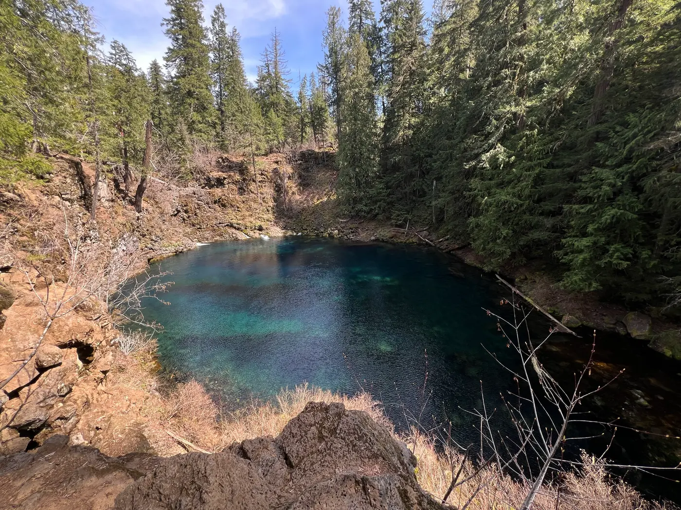
Tamolitch Falls (Blue Pool), USFS Willamette NF, Lane County, OR
McKenzie Bridge, Linn County, Oregon. Swimming hole.
Details

- Where
- McKenzie Bridge, Linn County, OR. No street address stated. Directions
- When
- Day use only: open 6:00 a.m. to 10:00 p.m.
- Season
- Day use only; forest service roads are not maintained for snow and ice.
- Getting there
- From the McKenzie River Ranger Station, take Highway 126 east 10 miles to Trail Bridge Reservoir. Turn left on Forest Service Road 730 (at the sign to Trail Bridge Reservoir). Cross the river and turn right on FSR 2672-655, travel 1/2 mile to parking area. Walk slightly uphill up the road to trailhead sign, begin walking upstream.
- Fees
- No fees are required for this site.
- Access
- The steep cliffs surrounding the pool are 10-60 feet tall and the average water temperature is 37 degrees Fahrenheit. While it is not against the rules to jump in, people have been severely injured or died at this site in the past. There is minimal to zero phone reception in the area and it can take hours for emergency responders to arrive.
- Walk-in or reserve
- Walk-in day use; no reservation required.
- Phone
- (541) 822-3381
- Managed by
- US Forest Service, Willamette National Forest, McKenzie River Ranger District.
- Coordinates
- 44.2907, -122.03537.
A cliff-rimmed basin on the McKenzie River where the river resurfaces at the base of normally dry Tamolitch Falls, fed by underground springs. Renamed 'Tamolitch' in 1933 by William Parke, a Willamette National Forest recreational engineer, after the Chinook jargon word for bucket.
Notable Events
- 1933William Parke renamed the basin Tamolitch after the Chinook jargon word for bucket. fs.usda.gov
People
- William Parke, Willamette National Forest recreational engineer who renamed the basin Tamolitch (1933).
Sources
- fs.usda.gov/r06/willamette/recreation/tamolitch-falls-blue-pool-3507
- fs.usda.gov/r06/willamette/recreation/tamolitch-falls-blue-pool-3507
- fs.usda.gov/r06/willamette/recreation/mckenzie-river-trailhead-tamolitch-blue-pool
- bendbulletin.com/2025/05/08/heading-outside-tamolitch-falls-along-the-mckenzie-river-trail-makes-for-a-great-springtime-destination