Lyons Ferry State Park
Washtucna, Franklin County, Washington. Day-use state park with sandy beach and swimming; Apr. 1 - Oct. 31.
Details

- Where
- 620 Marmes Road, Washtucna, WA 99371. Directions
- When
- Summer: 8 a.m. - Dusk; Winter: Park closed Nov. 1 - March 31.
- Fees
- Discover Pass: Annual Pass $45, One-day Pass $10; Watercraft Launch Fee $7 for the day; Entrance fees: Varies.
- Access
- Day-Use Only; Dogs Allowed on Leash; Fires Allowed in Designated Areas. Sheltered and unsheltered picnic tables are available on a first-come, first-served basis. Kayaks and paddleboards are available to rent on weekends on a first-come-first-served basis.
- Walk-in or reserve
- Walk-in day use only; no overnight stays.
- Managed by
- Washington State Parks.
- Coordinates
- 46.5971, -118.2189.
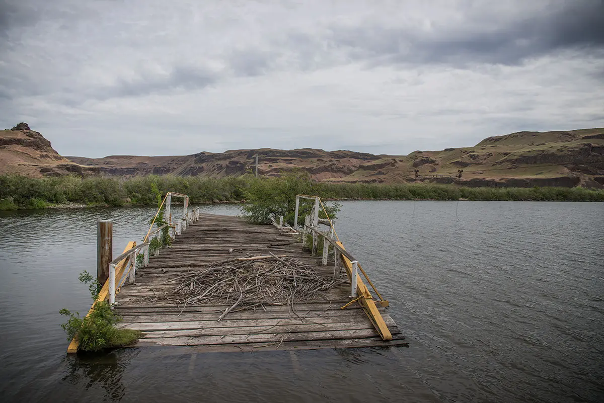
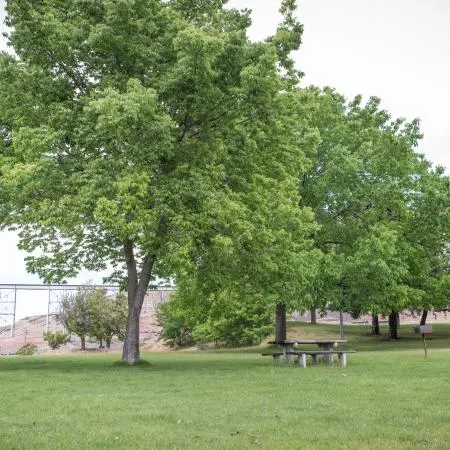
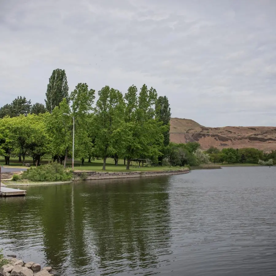
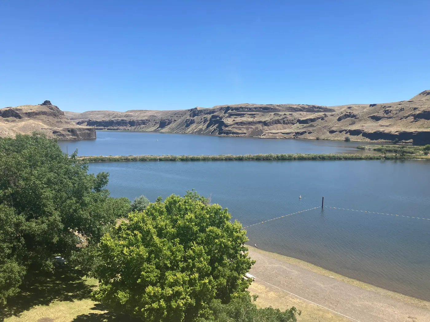
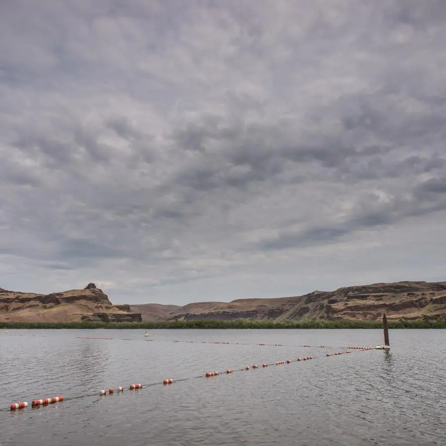
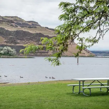
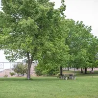
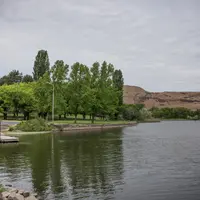
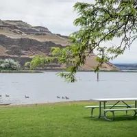
Lawns under shade trees slope down to a sandy beach at Lyons Ferry State Park, where the Palouse River runs into the Snake. Swimmers use the beach, boats go in at the ramp, anglers work from the dock, and on weekends kayaks and paddleboards are rented first come, first served. Picnic tables stand in the open and under shelters on the grass. The park covers 168 acres in Franklin County. It is open for the day only, from April 1 through October 31, and closes for the winter. State Parks sends campers to Lewis and Clark Trail State Park, 45 minutes away.
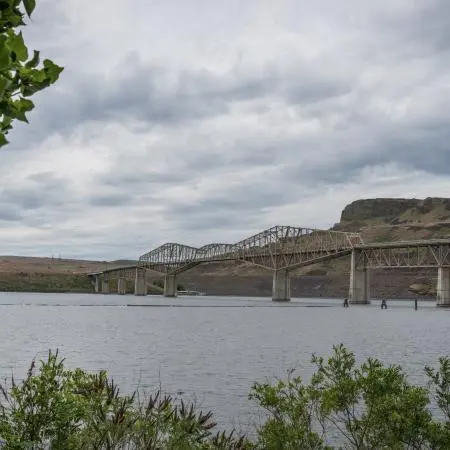
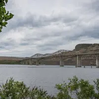
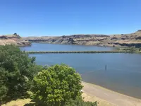
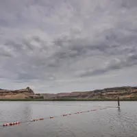
Basalt cliffs rise over the park, and the Palouse hills lie beyond the water. The wide stretch of river in front of the beach is a reservoir, Lake Herbert G. West, 28 miles long behind Lower Monumental Dam. The National Park Service counts more than 52,000 feet of shoreline. A State Parks planning page gives more than 5,200. There are accessible trails, bird watching, and wildflowers in season. Across the Snake, State Route 261 runs over a narrow two-lane steel bridge near Starbuck. From that bridge the Union Pacific Railroad’s Joso High Bridge is in view.
Floodwater and basalt
The cliffs are layers of basalt from lava flows that erupted from vents in southeast Washington. The ancestral Palouse River once flowed from the foothills of Idaho’s Bitterroot Range west along the route of today’s Washtucna Coulee to the Columbia. In the last stages of the most recent ice age, glacier ice repeatedly dammed meltwater to the north, and when the dams gave way the floods swept across eastern Washington. State Parks says this happened dozens of times over thousands of years.
At some point the floodwater overtopped the south wall of Washtucna Coulee. It poured through a weakened fracture in the basalt and drained into the Snake near the present park. The water tore columns of basalt off the edge of the plateau and worked its way back up the fracture, a process called headward erosion. That cutting made the Palouse River Canyon, nearly 400 feet deep. It stopped at the present site of Palouse Falls, Washington’s designated state waterfall, which has its own state park up the river.
Palús village and Drewyer’s River
The park lies in the traditional territory of Sahaptin-speaking people. Their descendants today include members of the Yakama Nation, the Confederated Tribes of the Umatilla Reservation, the Nez Perce Tribe, and the Confederated Tribes of the Colville Reservation. People have lived at the confluence for more than 10,000 years. The band that made its seasonal home there was known to its neighbors as Palúšpam, “people of Palús,” after the name of their village. The Palouse River takes its name from them, and so does the spotted horse they developed, the Appaloosa.
The Palús people crossed the swift Snake at their village long before any ferry. Just below the mouth of the Palouse a basalt pinnacle, later called Anchor Rock, stood above the water. They tied a long hemp rope to its top and a shovel-nosed canoe to the other end, and the current swung the canoe across the river in a semicircular sweep.
On October 13, 1805, the Corps of Discovery paddled past the confluence on the way to the Pacific. The crew had just come through a “long bad rapid,” and the non-swimmers had gone around it by land carrying rifles and instruments. Sergeant John Ordway wrote that the site held “a great number of fishing camps where the natives fish every Spring. They raft all their wood down the [Snake] River a long distance and the put it up on Scaffels and take great care of it.” Two Palús horsemen crossed the river and rode along the bank. Private Joseph Whitehouse noted that they “had to ride fast, to come up with us,” because the current was strong. Lewis and Clark gave a Palús chief one of their silver Jefferson Peace Medals. On their maps they named the river Drewyer’s River, after George Drouillard, the expedition’s tracker, hunter, scout, and interpreter. The Union-Bulletin cites state archives that the first white men to spend any time at the site were fur traders of John Jacob Astor’s Pacific Fur Company, in 1812.
In 1855 the local tribes ceded the area to the federal government under duress in the Yakima Treaty of Camp Stevens. They kept the right to harvest in their usual and accustomed places, the Snake and Palouse among them. The treaty required them to move to the Yakama Reservation, yet many Palús stayed at the confluence. Government surveyors who began work in 1875 counted “three hundred Indians” at the village. After the surveys closed in 1879, 156 acres of today’s park were patented by “William, an Indian,” under the Indian Homestead Act, with title held in trust by the government. When that land was sold to Edward Harrison in 1921, the sale needed the approval of President Woodrow Wilson. The rest of the park ground went to the Northern Pacific Railroad in 1895 under its land grant.
Ferry fares in gallon buckets
On January 11, 1859, the Washington Territorial Legislature authorized Edward L. Massey to run a ferry on the Snake at the mouth of the Palouse. The act set the fares:
- $1.50 for a man and horse
- 50 cents for a foot passenger or a loose head of cattle
- 10 cents for a sheep, goat, or hog
Massey “shall not charge more than one-half the aforesaid rates of ferriage to emigrants, crossing the plains with the intention of settling on this coast.” The Union-Bulletin calls his boat the first ferry on the Snake River.
The crossing lay on a military wagon road. Lieutenant John Mullan received orders on March 15, 1858, to build a road from Fort Walla Walla to Fort Benton at the head of Missouri River navigation. He broke off to join Colonel George Wright’s campaign that ended at the Battle of Spokane Plains on September 5, 1858. He resumed work in May 1859 with a $100,000 appropriation.
The 624-mile route crossed the Snake at the present park. State Parks dates its completion to 1860. HistoryLink says the crossing, at first called Palouse Ferry, became important when the road opened in 1862. The Mullan Road is estimated to have carried more than 20,000 people, 6,000 horses and mules, and 5,000 cattle before rail access made it obsolete in 1883.
Daniel Lyons acquired the ferry right from Massey in 1860 and ran the crossing until 1916. The sources describe the boat’s power in different ways:
- State Parks says it was powered by the current and held in line by cables stretched across the river.
- HistoryLink says it was a private toll ferry run only by the current.
- The Union-Bulletin says the ferry was steam-powered and relied on the current to help it across, and that it carried six cars.
Fares came in silver coins and were collected in gallon buckets. Lyons purportedly buried the buckets in his back yard between his infrequent trips to the bank in town. A later owner named the crossing Lyons Ferry in 1926. The Union-Bulletin calls it the longest continuous cable-ferry operation west of the Rockies. In 108 years on the route it shut down only twice, in the winters of 1948–49 and 1949–50, when the Snake froze over.
The reservoir, the rockshelter, and the bridge
In 1945 Congress authorized four dams with locks on the lower Snake, over the objections of fishery managers worried about salmon runs upstream. Work on Lower Monumental Dam, 15 miles downriver, began in 1961. Because the village site would be flooded, Washington State University archaeologist Richard D. Daugherty was contracted to salvage what he could from it. He found the ground too disturbed. Instead he turned to the Marmes Rockshelter, a deep alcove a short way up the Palouse that the rancher John McGregor had shown him in 1952.
In the summers of 1962 through 1964, Daugherty, Roald Fryxell, Carl Gustafson, and their students dug there. They found evidence of people going back 11,230 years, at the time the oldest site studied in North America. Ash from the eruption of Mount Mazama marked a layer of 7,700 years ago, and pollen recorded changes in climate. The diggers also found a Jefferson Peace Medal, likely the one Lewis and Clark had given. The Union-Bulletin reports that the oldest human remains yet found in the state came from there, along with a cremation hearth more than 11,000 years old.
The rockshelter was dedicated a Registered National Historic Landmark on June 3, 1967. Daugherty and Fryxell spoke, and Senator Henry M. Jackson gave an address. The two scientists asked for a delay in filling the reservoir. They did not get one. With Senator Warren Magnuson’s help, though, they reached President Lyndon B. Johnson, who ordered $1.5 million for a Corps levee to keep the site dry. Filling began in February 1969. Three days later water seeped through the gravel beneath the levee and flooded the rockshelter completely.
As the reservoir rose, the current slowed and the crossing grew wider, so the ferry’s trips took longer. The state turned to a bridge it had in storage. The steel bridge had carried the Sunset Highway over the Columbia at Vantage since 1927. It came down in 1963 because the reservoir behind Wanapum Dam would have covered it. The Union-Bulletin says the pieces were shipped 85 miles to Lyons Ferry and stored there for several years. Ironworkers then sandblasted the sections, ground out rivet holes, and straightened kinks, and a writer of the time compared the parts to a giant Erector set.
Peter Kiewit and Sons of Vancouver, Washington, built ten tall concrete piers founded on rock just below the river bottom. Murphy Brothers of Spokane reassembled the Pratt truss and built new approach spans. The two center spans are cantilevered, each supported at only one end. The project cost $976,261, and the finished bridge is 2,040 feet long.
The bridge opened on December 26, 1968, and the Lyons Ferry made its last trip that day. The Corps of Engineers bought the boat and moored it in the park. According to the Union-Bulletin, the bridge was not considered complete for another six months, when a 10-ton weight limit was lifted.
Craig E. Holstine called it “the longest bridge in Washington to be rebuilt at a location different from its original construction site, and the oldest steel cantilever highway bridge still in service in Washington.” HistoryLink disputes the claim to age. Its corrected essay says the Wenatchee Bridge, opened in 1908 and now a footbridge, is the older of the two.
The bridge is listed on the National Register of Historic Places and recorded in the Historic American Engineering Record. When it opened, officials expected more than 1,000 vehicles a day by 1985. The Union-Bulletin reported a 2022 estimate of 780.
A lease on Corps land
On June 20, 1971, the Washington State Parks and Recreation Commission leased a tract of Corps land in the Lower Monumental project. It named the tract Lyons Ferry State Park on November 15, 1971, as mitigation for the dam. Budget cuts closed the park on October 1, 2002, and the Corps looked for private contractors to run it. In 2013 the legislature appropriated $600,000 “provided solely for capital expenses associated with re-establishing Lyons Ferry State Park.” A new lease was signed in January 2015, and the park reopened with a dedication ceremony on June 5, 2015.
Notable Events
- 1805On October 13, 1805 the Corps of Discovery paddled its canoes past the confluence of the Palouse and Snake Rivers on the way west to the Pacific Ocean, having just come through a long bad rapid on the Snake. parks.wa.gov
- 1812Lewis and Clark passed through the area, but according to state archives the first white men to spend any time at the site were fur traders working for John Jacob Astor's Pacific Fur Company in 1812. union-bulletin.com
- 1855Local tribes ceded ownership of the area to the US federal government under duress in the Yakima Treaty of Camp Stevens in 1855, keeping rights to harvest resources in their usual and accustomed places, including the Snake and Palouse. parks.wa.gov
- 1859The Washington Territorial Legislature authorized Edward L. Massey to establish a ferry at the Palouse-Snake confluence. parks.wa.gov
- 1859Traffic at the crossing picked up after 1859, when the first ferry boat on the Snake River began operating there as part of what became the U.S. Army's Mullan Road; a ferry then worked the site for more than a century, the longest continuous operation of a cable ferry west of the Rockies. union-bulletin.com
- 1860Daniel Lyons acquired the ferry right and operated the crossing until 1916. parks.wa.gov
- 1860The Mullan Road's 624-mile military wagon route between Fort Walla Walla and Fort Benton crossed the Snake River at today's Lyons Ferry State Park, and the road was completed in 1860. parks.wa.gov
- 1862Lyons Ferry became an important ferry crossing in 1862 when the Mullan Road was opened, and for many decades after a private toll ferry powered only by the current carried traffic across the river. historylink.org
- 1921When the land in today's park was sold to Edward Harrison in 1921, the transaction required the approval of the President of the United States. parks.wa.gov
- 1926A later owner designated the ferry as Lyons Ferry. parks.wa.gov
- 1948When the ferry was taken out of service it was noted that in 108 years on the route it had been shut down only twice, in the winters of 1948-49 and 1949-50, when the river froze over. parks.wa.gov
- 1963When Wanapum Dam was completed on the Columbia River in 1963 the existing Vantage Bridge had to be removed because rising reservoir waters would have inundated it, so the highway department dismantled and stored it for reuse at another location. parks.wa.gov
- 1967Marmes Rockshelter, the site up the Palouse River that the reservoir would drown, was dedicated as a Registered National Historic Landmark on June 3, 1967, with speeches by the excavators and an address by a US senator. parks.wa.gov
- 1968Peter Kiewit and Sons of Vancouver, Washington, constructed the reinforced concrete piers and Murphy Brothers of Spokane reassembled the bridge and built the new approach spans, at a total project cost of $976,261. historylink.org
- 1968The bridge opened December 26 and the Lyons Ferry made its final crossing. parks.wa.gov
- 1969Construction of Lower Monumental Dam began in 1961 and the main structure and first three generators were completed in 1969, with filling of the reservoir beginning in February 1969. parks.wa.gov
- 1971Washington State Parks officially named the park November 15 and designed it to provide recreation and reservoir access as mitigation for Lower Monumental Dam. parks.wa.gov
- 2002Budget reductions led Washington State Parks to close Lyons Ferry State Park on October 1. parks.wa.gov
- 2013The Washington State Legislature approved an appropriation of $600,000 provided solely for capital expenses associated with re-establishing Lyons Ferry State Park. parks.wa.gov
- 2015Washington State Parks and the Corps negotiated a new lease in January, and the park reopened with a June 5 dedication. parks.wa.gov
People
- Carl Gustafson, the colleague who co-directed the 1962-1964 Washington State University excavations at Marmes Rockshelter (1962-1964).
- Daniel Lyons, Ferry operator (1860-1916).
- Edward Harrison, the buyer of the land in today's Lyons Ferry State Park in 1921, in a sale that needed the President's approval (1921).
- Edward L. Massey, holder of the Washington Territorial Legislature act authorizing a ferry on the Snake River at the confluence of the Palouse (1859).
- George Drouillard, the civilian tracker, hunter, scout and interpreter of the Corps of Discovery whom Lewis and Clark honored by naming the Palouse River Drewyer's River on their maps.
- Henry M. Jackson, the US senator who addressed the June 3, 1967 dedication of Marmes Rockshelter as a Registered National Historic Landmark (June 3, 1967).
- Herbert G. West, the Inland Empire Waterways Association vice president for whom the 28-mile-long reservoir behind Lower Monumental Dam, the park's primary attraction, was named by an act of Congress (1900-1974).
- John McGregor, the local rancher who showed Daugherty the Marmes Rockshelter alcove up the Palouse River (1952).
- John Mullan, the army lieutenant ordered to build the military wagon road whose route crossed the Snake River at today's park (1858).
- John Ordway, the sergeant whose journal first recorded the great number of Indigenous fishing camps at the site of today's park.
- Joseph Whitehouse, the private whose journal noted two Indigenous horsemen crossing the Snake and riding to catch the explorers at the confluence.
- Lyndon B. Johnson, the president who issued the executive order authorizing $1.5 million for a protective levee around the Marmes Rockshelter site.
- Richard D. Daugherty, the Washington State University archaeologist contracted to investigate the ancient Palus village site before the reservoir and who directed the Marmes Rockshelter excavations (1962-1964).
- Roald Fryxell, the Washington State University investigator who co-directed the Marmes Rockshelter excavations and spoke at its landmark dedication (June 3, 1967).
- Warren Magnuson, the Washington senator whose help carried the plea to delay the reservoir flooding up to the President.
- William, an Indian, the patentee of 156 acres within today's park under the Indian Homestead Act, with title held in trust by the US Government.
- John Jacob Astor, the fur trader whose Pacific Fur Company men were, according to state archives, the first white men to spend any time at the Snake River crossing (1812).