Lost Horse Guard Station
Darby, Ravalli County, Montana. Cabin.
Details

- Where
- Darby, Ravalli County, MT. No street address stated. Directions
- When
- Summer rentals from mid-July to mid-September; Winter rentals mid-January to mid-March.
- Season
- Summer Reservation Season: mid July - mid October; Winter Reservation Season: mid January - mid March.
- Getting there
- From Darby, Montana, head north on US-93 for 7 miles. Turn left (west) onto Lost Horse Road (National Forest Road #429) and continue for 17.8 miles.
- Fees
- $50 per night.
- Access
- Water is not available at the cabin. Guests will need to bring their own water.
- Walk-in or reserve
- Reservations can be made at https://www.recreation.gov/camping/campgrounds/10176101.
- Phone
- 406-821-3913
- Managed by
- Bitterroot National Forest.
- Established
- 1938.
- Coordinates
- 46.13055556, -114.4927778.
Eighteen miles up Lost Horse Road
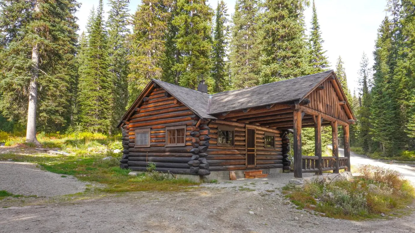
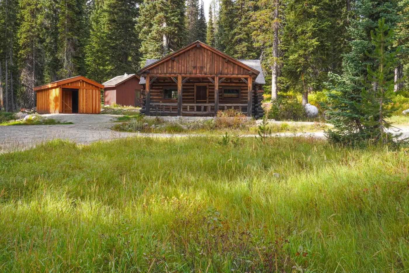
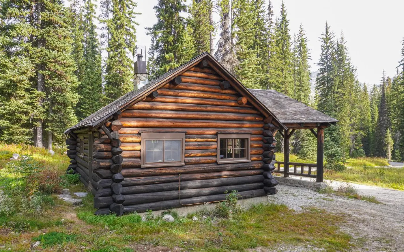
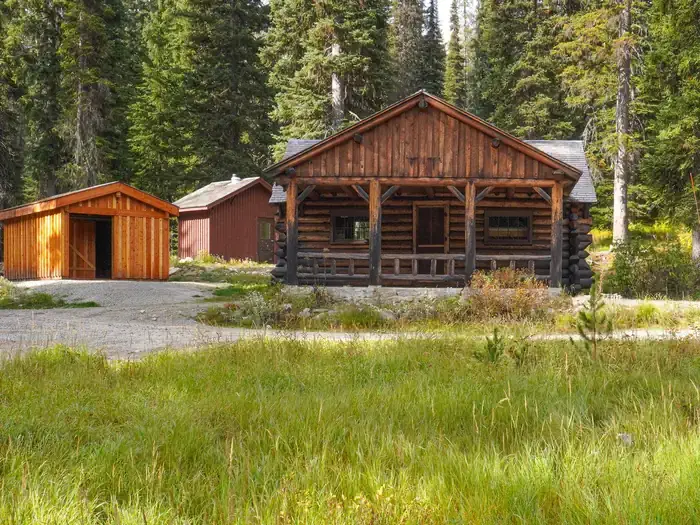
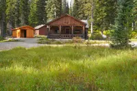
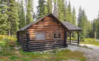
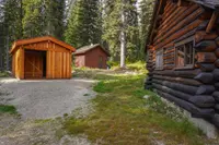
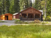
The porch runs all the way through. On the east wall of the cabin a roofed bay twelve feet wide and twenty feet long stands open at both ends, its posts ten inches thick and set on mortared native stone, a four-foot railing of four-inch poles strung between them. Behind it the building measures eighteen by twenty-four feet, eleven logs high, lodgepole pine eight to ten inches in diameter, saddle-notched with random-length log crowns cut to points, chinked with tar outside and quarter round inside, roofed in sawn cedar shingles.
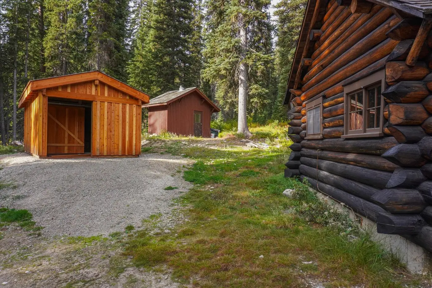
To reach it, go north from Darby on US-93 seven miles, turn west onto Lost Horse Road — National Forest Road 429 — and keep on 17.8 miles; at the junction with Road 5605 stay left, and the driveway is about 130 feet farther on the right. The Forest Service calls it 24.8 miles from Darby and just over an hour on highway and forest roads. Elevation is 6,030 feet. Bear Creek Pass lies a mile south of the cabin, Twin Lakes a mile and a half north. There is no cell service.
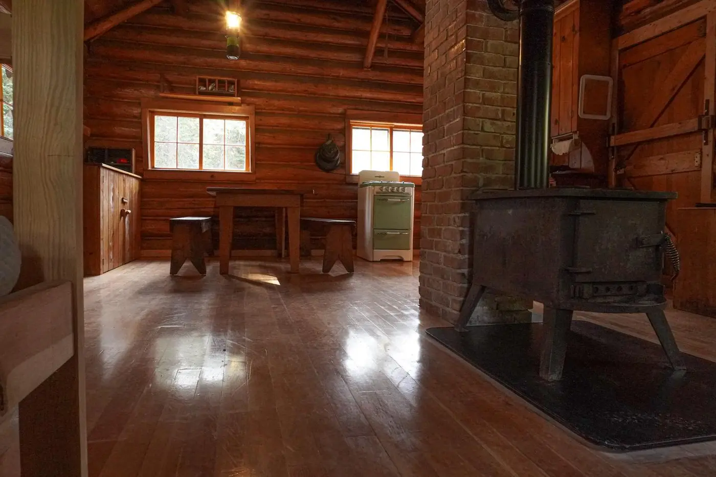
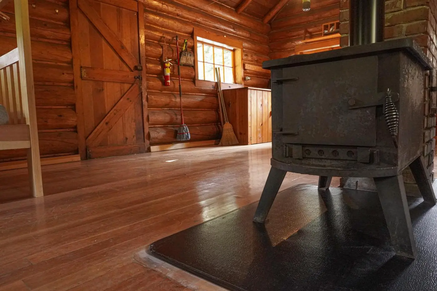
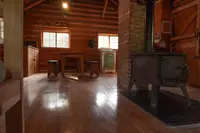
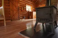
Inside are two sets of full-sized bunk beds, a wood-burning stove for heat, and a propane cook stove; the propane valve is on the north side of the building, to be turned on before each use and off after. There is no water at all — drinking, cooking, washing, all of it comes in with the guest — and no garbage service. Outside is a vault toilet. Parking holds two vehicles. Pets are not allowed. Mice may be in the cabin, and supplies to trap them and remove them safely are kept there; the reservation notices mention the risk of hantavirus exposure in remote cabins. The door stays locked, and the key code comes from the Darby Ranger District by telephone a week before arrival. The fee is $50 per night.
The Bailey Lake Trailhead is within walking distance, a one-mile trail beginning at a roadside pullout nineteen miles up Lost Horse Road, just past the station. A mile west, Bear Creek Pass opens onto the Bear Creek Trail, Upper and Lower Bear Lakes, Coquina Lake, Fish Lake, and the South Fork of Lost Horse Creek; two miles north are the Twin Lakes and Wahoo Pass trails and the Selway-Bitterroot Wilderness, where motorized travel is not permitted. Anglers in the drainage and its lakes find brook, westslope cutthroat, rainbow, bull, and brown trout and mountain whitefish, and are warned that some of the lakes are in Idaho and want an Idaho license. Hunters go after whitetail and mule deer, black bear, elk, and mountain grouse. The canyon’s microclimate carries ponderosa pine on the lower, drier sites, Douglas-fir and western hemlock and western red cedar along the creek, and lodgepole, subalpine fir, Engelmann spruce, and whitebark pine higher up.
A stickler for the pointed log ends
In 1936 the Civilian Conservation Corps, working out of the Darby Camp, built the road to Lost Horse and Bear Creek Pass. Two years later George Case, the Moose Creek District Ranger, asked for a cabin up that road to house back country workers and help the Forest Service administer the high country of the southern Bitterroot Range.
The plan was Region 1 standard but for the drive-through porch, which the National Register form credits to Clyde Fickes. The same form hedges the money — “WPA? funds were used to construct the building” — while the Forest Service’s own recreation page states flatly that Works Progress Administration funds paid for it. Emil Schwartz, of Wisdom, Montana, ran the construction with six helpers. According to Edward Morris, a retired civil engineer who gave the nomination’s preparer his recollections in 1987, Schwartz was a stickler for detail, going so far as to make the pointed log ends match the architect’s plan as to angle and length. Matt Werle, the Bitterroot National Forest archaeologist, put the same thing in an email to the Ravalli Republic in 2017: “It was constructed by Emil Schwartz, who had a great attention for detail, even matching the ‘random’ log ends to the architect’s design.” The Forest Service place-names compilation records a different hand, crediting the foreman Charlie Engbretson with building the cabins at Paradise, Lost Horse, and Horse Heaven. Both the Bitterroot Star and the Ravalli Republic, reporting in October 2017, credited the cabin itself to the CCC.
Crews maintaining trails and telephone lines for fire suppression used it as a base, and so did game wardens working the drainage — this from Ruth Lewis, also in 1987. The registration form sets the period of significance from 1938 to 1945, “the end of World War II,” when Forest Service practice changed with the arrival of wartime technology and the beginnings of the baby boom. Kirby Matthew, an archaeological technician out of the forest’s Hamilton office, signed the form on January 29, 1988. The cabin was listed in 1989 as the Lost Horse Fireman’s Cabin, site number 24RA197, on half an acre bounded by a 150-foot square drawn around the building. A Region One photograph dated February 10, 1968 shows men on snowmobiles at the station in several feet of snow; the library that holds it notes the print “was originally misidentified as Lost Horse Cabin which is a different log cabin located near Helena, Mont.”
Horseshoes on the stove, a board in the window
When Eve Byron of the Ravalli Republic went up in October 2017, the cabin was not yet a rental. She found the interior wood floors brightly polished and the exterior logs freshly coated with linseed oil. Horseshoes sat on top of the cast-iron wood stove to keep pots from burning. The kitchen was to the left of the doorway, with a wooden table and an old gas stove; the cupboards held instant coffee, a jar of peanut butter, a container of honey. An oil lamp stood on the counter. To the right of the door was a carved bunk bed with a round wooden rail to keep the sleeper in the upper berth. Above the stove the logs fanned out to stiffen the roof — useful, since Darby Ranger District employees had shoveled ten feet of snow off it the previous year. One window was patched with a board and the propane needed adjustment.
Erica Strayer, the forest’s recreation program manager, had been at the question a long while. “We started looking into this in 2005 to turn it into a rental,” she said. The work had to be done “while enhancing the historic integrity,” she added. “That can be a challenge when it comes to maintaining and improving these cabins. But a lot of people stop here, look through the windows, then call and ask if it’s available.” Tod McKay, the forest’s information officer, called the place “a great base camp for any kind of recreational activity.” The proposed $50 nightly fee was part of a package of changes due to take effect in May 2018.
Snowmobiles in February
Winter 2025–2026 was the first winter the cabin was offered. From January through March it can be reached only by snowmobile or other over-snow vehicle, on a fourteen-mile route that may not have been groomed recently. Firewood is supplied only in those months. Guests are told to watch for snow sliding off the roof as the cabin warms, and to park machines and stow gear with that in mind. The posted seasons of use are July 15 to October 15 and January 15 to March 15, though the same Forest Service page elsewhere describes summer rentals as running mid-July to mid-September.
The horse that drowned about 1881
The creek, the canyon, the road, and the station all carry a name the Bitterroot National Forest dates to the spring of 1881: according to early accounts, a party of prospectors tried to ford the swift, swollen creek in high water, one of their horses was swept downstream and drowned, and afterward the men called it the lost horse creek. The forest’s place-names compilation notes the name already on Lieberg’s 1898 map and on General Land Office plats of 1889 and 1897, and keeps its distance from the rest: “the story for the name is that it was named by a party of prospectors who crossed it in high water and had one of their horses drowned.”
Notable Events
- 1881According to early accounts a party of prospectors fording the creek in high water lost one of their horses, which was swept downstream and drowned; the men called it the lost horse creek and the name endured for the creek, the canyon, the road and the guard station. fs.usda.gov
- 1936The Civilian Conservation Corps built the Lost Horse Road. fs.usda.gov
- 1989Lost Horse Fireman's Cabin (24RA197) was listed in the National Register of Historic Places. nps.gov
- 2018The Bitterroot Star reported the Forest Service proposal to add the historic station to its cabin rental system, with the fee changes to go into effect in May, 2018. bitterrootstar.com
People
- Emil Schwartz, from Wisdom, Montana; in charge of the construction of the cabin with six helpers, a stickler for detail who made the pointed log ends match the architect's plan as to angle and length (construction in 1938).
- George Case, Moose Creek District Ranger who requested the construction of the cabin to house back country workers (requested before the 1938 construction).
- Charlie Engbretson, Forest Service foreman who, in the Service's own place-names study, built the cabins at Paradise, Lost Horse, and Horse Heaven.
- Clyde Fickes, developed the cabin's drive-through porch, the one departure from the standard Region 1 plan (design for the 1938 building).
Sources
- recreation.gov/camping/campgrounds/10176101
- recreation.gov/api/camps/campgrounds/10176101
- fs.usda.gov/sites/nfs/files/r01/bitterroot/publication/Place%20Names%20of%20the%20Bitterroot%20National%20Forest_0.pdf
- npgallery.nps.gov/NRHP/GetAsset/NRHP/88003437_text
- fs.usda.gov/r01/bitterroot/recreation/lost-horse-guard-station
- ravallirepublic.com/news/local/article_254498e1-c4d4-59e4-ae0b-734b51fc2ab0.html
- nps.gov/state/mt/index.htm?program=all