Hogan Cabin
Wisdom, Beaverhead County, Montana. One-room log cabin; Available year round for reservations.
Details

- Where
- Wisdom, Beaverhead County, MT. No street address stated. Directions
- When
- 24 hrs/day.
- Getting there
- Travel west on Highway 43 from Wisdom, Montana for about 25 miles; four access routes from there depending on conditions.
- Fees
- $45 per night.
- Access
- There is no water at this cabin. There are solar panels. No garbage service; pack out what you pack in. Firewood provided but not guaranteed. Propane is not provided; bring your own small canisters. No cell phone coverage in the area. Vault toilet.
- Walk-in or reserve
- Reservations through recreation.gov (Make Reservations Here).
- Phone
- 406-689-3243
- Website
- fs.usda.gov
- Managed by
- Wisdom Ranger District.
- Established
- 1920s.
- Coordinates
- 45.70896, -113.88141.
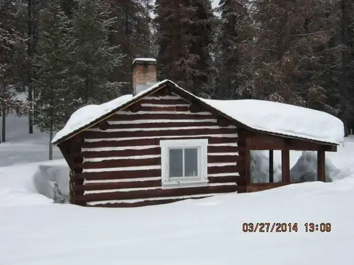
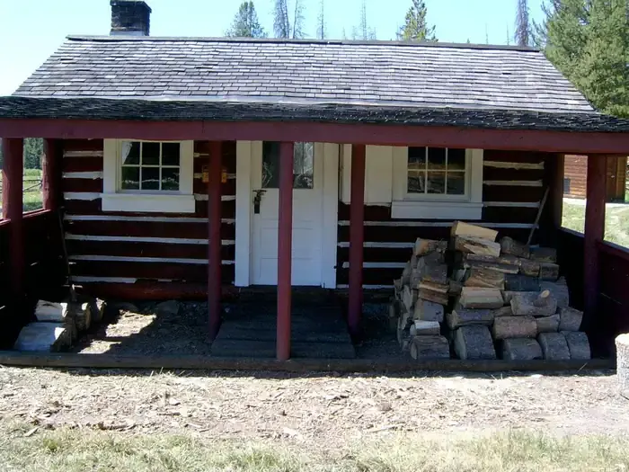
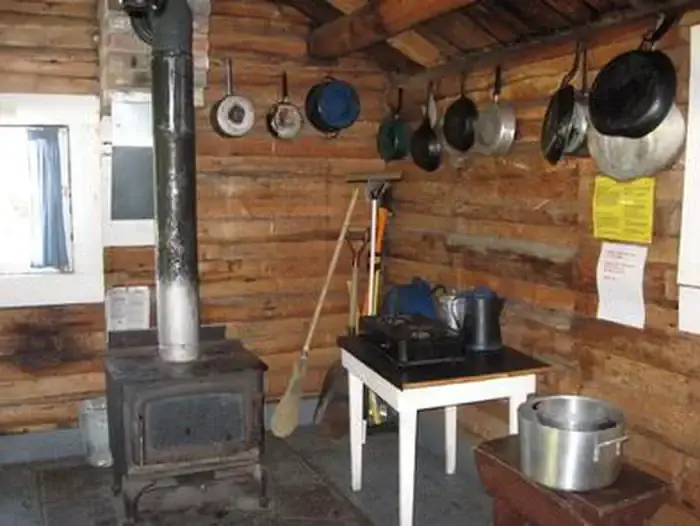
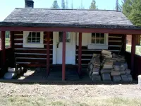
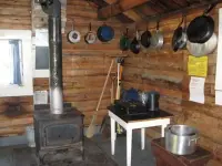
Hogan Cabin is one room of logs on the Lewis and Clark National Historic Trail. It stands at about 7,300 feet at the southwestern end of the Anaconda Mountains, near the Sapphire Range, in the Beaverhead-Deerlodge National Forest. Inside are bunk beds with mattresses for four, a table and chairs, a propane stove, a propane lantern, cooking and eating and cleaning equipment, and a wood stove for heat. An outhouse with a vault toilet and a campfire ring with a grill stand nearby. The door stays locked. The Wisdom Ranger District manages the cabin, and the code goes to whoever holds the reservation.
There is no electricity, no running water, and no cell phone coverage. Guests carry in their own water for drinking, cooking and washing, along with small propane canisters for the stove and lantern. They also bring their own bedding, food, matches, flashlights and toilet paper. They carry out all trash and food and clean the cabin before leaving. Solar panels now light the room on a low-voltage disconnect, and recreation.gov warns that after several cloudy days the lights might not work.
Firewood and an axe are supplied for part of the year, though the sources give different dates. Recreation.gov’s description of the facilities says September 16 through June 15, and its notices say October 1 through June 15. On the Forest Service’s own page, firewood is “provided, but not guaranteed.” Recreation.gov also cautions that remote cabins carry a risk of exposure to hantavirus.
The Anacondas hold mountain lions, elk, deer, moose and bears. Creeks and streams run near the cabin, and the country around it is hunted and fished and watched for birds. In summer and fall guests hike and backpack the meadows, peaks and valleys. In winter they ski, snowshoe and snowmobile.
Trail Creek, Shoofly, and the road from the pass
From Wisdom, Highway 43 runs west. In summer, while the forest roads are open, a vehicle can reach the cabin. Recreation.gov puts the turn about 20 miles out, north onto Trail Creek Road #106, then about 6 miles to the cabin on the west side of the road. The Forest Service counts about 25 miles along the highway before the routes divide. From December 2 through May 15 the last miles must be covered by snowmobile or other oversnow vehicle, or on skis or snowshoes. The Lewis and Clark Trail Alliance adds hiking and horseback.
Trail Creek Road #106 is marked with orange diamonds. It is the main snowmobile route and the flattest way in, and skiers on it should expect to meet machines. Shoofly Trail #101B leaves the highway parking area by the Cabinet Creek sign. It is the shortest route and the hardest, with steep pitches mostly in the trees, and it is marked with blue diamonds. The Shoofly Alternate leaves Shoofly at the north end of the meadow and rejoins it at the top of the hill. It offers a gentler climb, and the Forest Service suggests it for the return when snow is poor or the fast downhill on Shoofly is unwelcome.
The sources describe the remaining route differently. The Forest Service starts it at the Gibbons Pass parking area at Highway 93 and Highway 43. From there it follows Forest Service Road #1260, shared by skiers and snowmobiles, about 6 miles. Recreation.gov starts it at the Chief Joseph Pass cross-country ski parking area. Its version runs a mile north on the Broadway Trail, open to skiers only, before joining #1260, and recreation.gov recommends it for novice skiers. Before booking, recreation.gov asks visitors to learn bear, water and weather safety, including avalanche danger.
Quarters for smoke chasers
The cabin went up in the 1920s as field quarters for the men the Forest Service sent into this country: trail crews, smoke chasers, timber cruisers and grazing inspectors. Today anyone can book it by the night, year round, for $45.
The ground under it carries an older route. The national historic trail it lies on runs 4,600 miles, according to recreation.gov. The Lewis and Clark Trail Alliance places the cabin on the Gibbons Pass route, which William Clark followed in 1806 on his return by way of the Yellowstone River.
Notable Events
- 1920sThe cabin was built to house trail crews, smoke chasers, timber cruisers and grazing inspectors. fs.usda.gov