Hager Mountain Lookout
Silver Lake, Lake County, Oregon. Cabin Nonelectric; November 15 to May 15, winter only.
Details

- Where
- 65600 HWY 31, Silver Lake, OR 65600. Directions
- Getting there
- From Silver Lake, drive to County Road 4-12. Travel south on County Road 4-12, which turns into Forest Road 28. Continue south to milepost 9. The car pull-off is on the left. Walk, ski or snowshoe 4 miles to the National Recreation Trail to get to Hager Lookout.
- Access
- There is no water at the look out. Carry in your own water or melt snow when available. Be prepared for winter conditions and the possibility of having to camp out on the trail overnight. Let others know of your travel plans, and carry communication, water and food. The trail to the lookout is uphill and can be very strenuous depending on snow conditions.
- Walk-in or reserve
- Required; contact the Silver Lake Ranger District at (541) 576-2107 prior to arriving.
- Phone
- (541) 576-2107
- Website
- recreation.gov
- Managed by
- Fremont-Winema National Forest, Silver Lake Ranger District (65600 Hwy 31, Silver Lake, OR 97638).
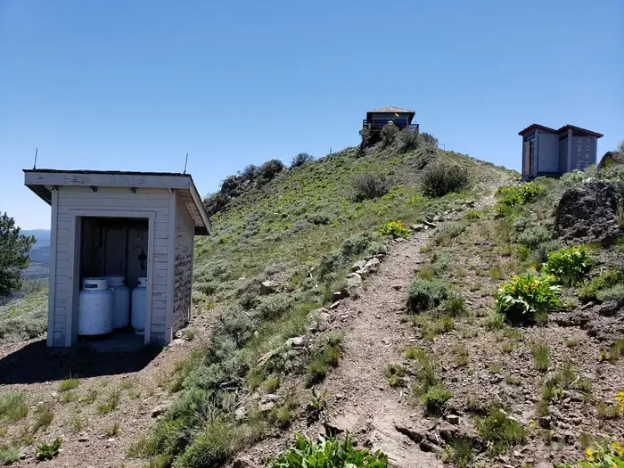
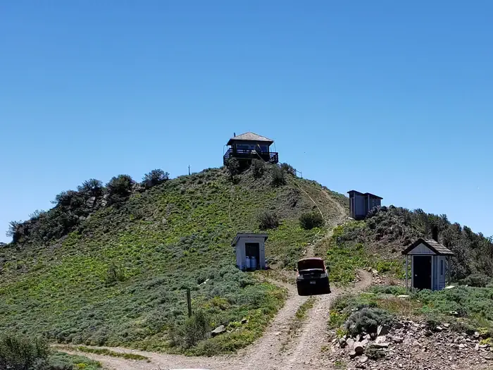
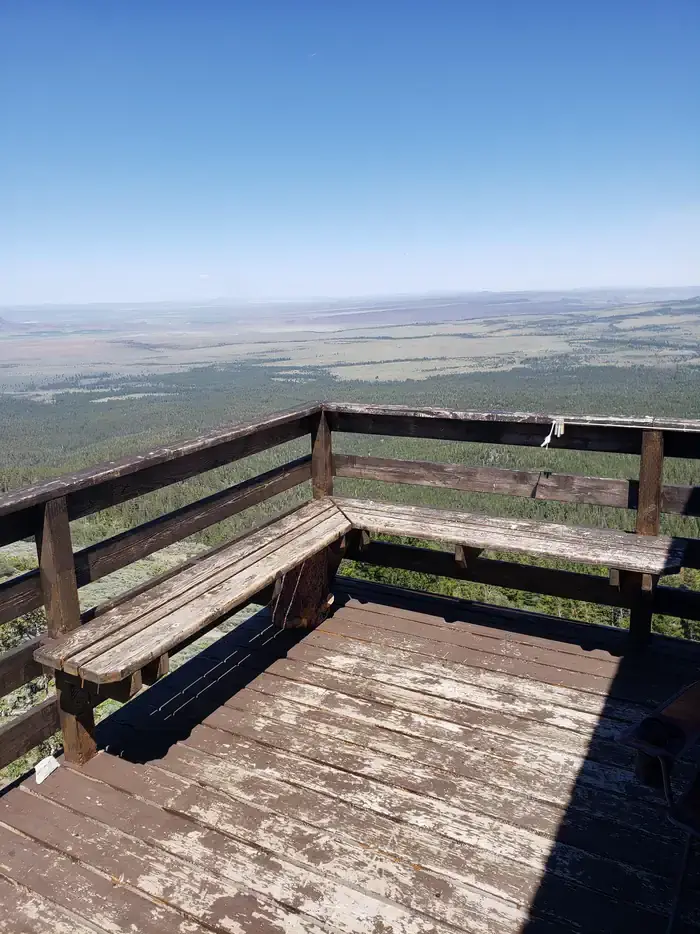
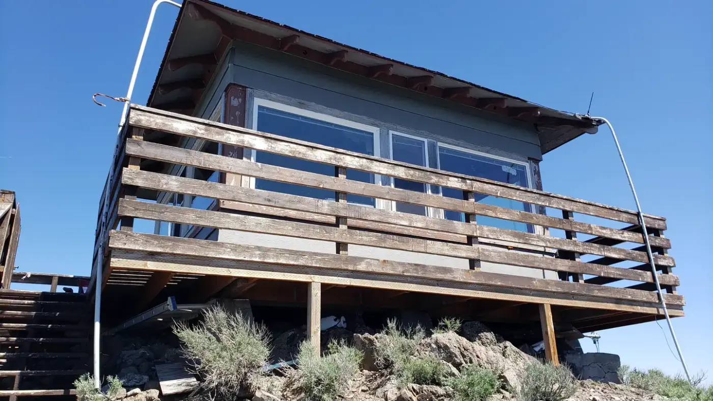
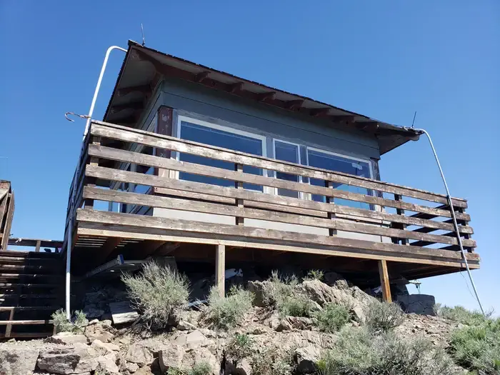
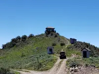
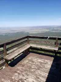
A fire lookout cabin stands on the bald cap rock of Hager Mountain at 7,195 feet, with views on every side over volcanic country and open sage basins. On a clear day the view reaches Mount Hood and Mount Shasta. The National Historic Lookout Register gives the elevation as 7,188 feet. From May into November, Forest Service personnel staff the cabin and watch the flat lands below for smoke. The Forest Service calls it one of a diminishing number of lookouts still staffed for fire detection every season. From November 15 to May 15 it is rented to anyone who can reach the top on foot, on snowshoes, or on cross-country skis.
The climb from Forest Road 28
The way in leaves the town of Silver Lake on County Road 4-12, also called East Bay Road, which becomes Forest Road 28. Recreation.gov directs winter guests to a car pull-off on the left at milepost 9 and a four-mile route up the west side of the peak on the National Recreation Trail. The Forest Service’s own page tells travelers to ask first about conditions at the Pole Butte Sno-Park. In summer the trail is 2.1 miles, and a four-wheel-drive road reaches the summit, but the public may not drive it without permission.
By ski or snowshoe the trip takes a couple of hours to half a day or more. The agency counts it among the best snowshoeing climbs in southern Oregon. It also warns of wind, of weather that changes quickly and dramatically, and of a possible night spent out on the trail. Several groups have lost their way and needed search and rescue teams to assist them.
Fourteen feet square
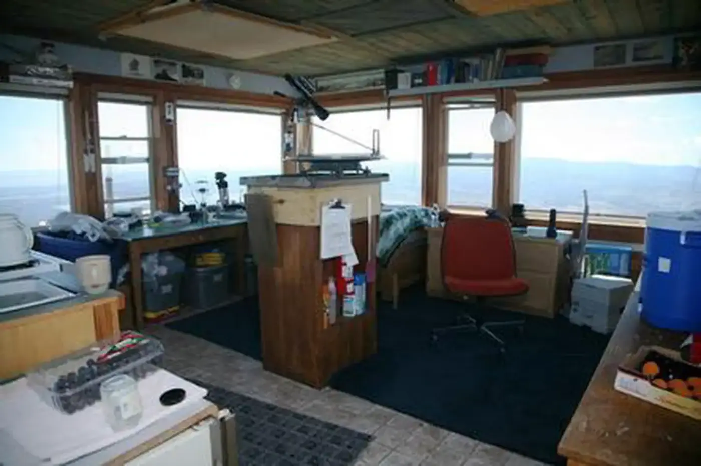
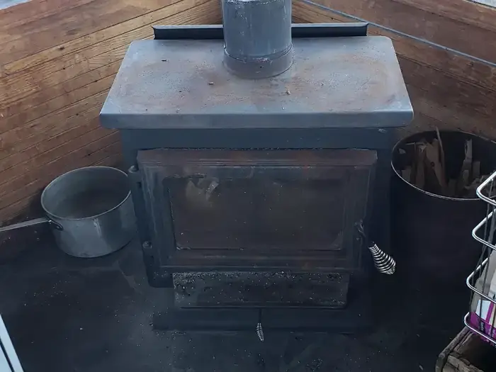
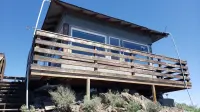
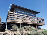
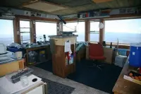
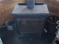
The cabin is a single room that sleeps four. The two federal pages describe its furnishings differently. Recreation.gov lists three beds with mattresses, a countertop, a woodstove with firewood provided, and a propane stove, and says cookware is not provided. The Forest Service rental page lists a bed and mattress with three folding cots, a table and chairs, a propane stove, a heater, and a refrigerator, and says limited cookware is available. Outside are a picnic table and a toilet, called a pit toilet on one page and a vault toilet on the other.
There is no water at the lookout. Guests carry it in or melt snow. Splitting wood on the porch or inside has damaged the cabin, so wood is split down by the shed. The agency lists stargazing among the winter pursuits on the summit, along with wildlife viewing.
A dome on the basin rim
The Forest Service says the mountain was formed by a series of dome-building eruptions about 8 million years ago. A U.S. Geological Survey field guide to the maar volcanoes of the Fort Rock–Christmas Lake Valley basin cites MacLeod and others (1976) and gives a different age: a silicic dome 5.9 million years old on the basin’s southwestern rim. The guide’s road log runs south on Highway 31 toward Silver Lake and marks the mile where Hager Mountain stands straight ahead.
Oregon Geographic Names places the mountain in Lake County, about ten miles south of the town of Silver Lake. It was once called Hagerhorst Mountain, after a pioneer settler in Silver Lake Valley. The book says the shorter modern name “seems well established.” The Klamath Indian name was Chok-chock-lisk-se, and some old maps call it Bald Butte.
Ranger McComb and Ethel Caldwell
Scott McComb came to the Silver Lake District as a guard in 1911. He was named assistant ranger in 1912 and was the district’s ranger from 1913 to 1917. He built the first lookout house on Hager Mountain. In August 1913 his third child was born at the Silver Lake Ranger Station. Walt L. Dutton and Lynn Cronemiller suggested the name Fremont, after the national forest, and the McCombs accepted it.
Supervisor Gilbert D. Brown reported that McComb had many times ridden horseback all night to meet a permittee at 7 a.m. McComb was transferred to Paisley in January 1917 and died there on October 25, 1917, at forty-five. It was said that he had done a lifetime’s work by that age.
The National Historic Lookout Register records Hager Mountain as a fire detection site since 1915. According to Fred Cronemiller’s account, it became the first lookout to be manned full time that year. Under Brown, roads, telephone lines, and a system of lookouts replaced the horseback trails of the Fremont. In those years the telephone line north was extended to Ingram Station and on to Silver Lake.
Ethel Caldwell appears on the forest’s 1920 roster of lookout firemen. A local account of her time on Hager recalls that she nearly ran out of food during the worst fires, had nothing to read, and lost her crochet hook. By then she had not seen another person for three weeks. The account says she never complained and felt it was all in the game. On a September 12, in the lookout house on the summit, she married Charles McCulley.
In 1945 Phil Brogan of Lakeview was stationed on the lookout, and the National Archives holds a photograph of the lookout from that year. The sources disagree on the date of the present building. The Forest Service says the current lookout and its deck were both built in 1954. The register dates the present structure, an R6 Flat Top ground cabin, to 1967, and records that its roof was changed to a slight hip in 1992. The cabin was entered on the register on June 23, 2022, on the nomination of Brad Eells, as US 1620 and OR 143.
Notable Events
- 1915Hager Mountain became the first lookout to be manned full time, according to the quoted account. npshistory.com
- 1915Hager Mountain has been a fire detection site since 1915. web.archive.org
- 1954The Forest Service rental page says the lookout was built and its deck added in 1954. fs.usda.gov
- 1967The current structure, an R6 Flat Top ground cabin, was constructed. web.archive.org
- 1992The cabin roof was modified with a slight hip roof. web.archive.org
- Ethel Caldwell married Charles McCulley at the lookout house on top of Mt. Hager in the Silver Lake Ranger District. npshistory.com
People
- Hagerhorst, Pioneer settler in Silver Lake Valley for whom Hager Mountain was at one time named.
- Scott McComb, Builder of the first lookout house on Hager Mountain (Died October 25, 1917, at age forty-five).
- Charles McCulley, Married Ethel Caldwell in the summit lookout house.
- Ethel Caldwell, Fire lookout on Mt. Hager; the account praises her good work and persistence.
- Phil Brogan, Lakeview person stationed on the Hager Mountain lookout in the Silver Lake District (1945).
Sources
- recreation.gov/camping/campgrounds/234187
- npshistory.com/publications/usfs/region/6/fremont/history/chap3.htm
- npshistory.com/publications/usfs/region/6/fremont/history/chap4.htm
- nhlr.org/lookouts/us/or/hager-mountain-lookout
- web.archive.org/web/20110425021752/http://www.cr.nps.gov/history/online_books/geology/publications/circ/838/roadlog6.htm
- npshistory.com/publications/usfs/region/6/fremont/history/chap6.htm
- fs.usda.gov/r06/fremont-winema/recreation/hager-mountain-lookout-recreation-rental
- traveloregon.com/plan-your-trip/places-to-stay/campgrounds/hager-mountain-lookout
- en.wikisource.org/wiki/Page:Oregon_Geographic_Names,_third_edition.djvu/300