Grant PUD Visitor Center
Beverly, Grant County, Washington. Visitor center.
Details

- Where
- 14352 Highway 243 S, Beverly, WA 14352. Directions
- When
- Recreation Season: open 7 days a week 9am - 4pm (May-Sept.); Winter 9am - 4pm (Oct.-Apr.).
- Season
- Open from 9 a.m. to 4 p.m. every day from May 1 to Sept. 30.
- Getting there
- Located south of Interstate 90 on Highway 243; head south on Highway 243 approximately 4 miles and turn onto Wanapum Dam Road.
- Fees
- Free admission.
- Access
- Dam tours by inquiry - the education page directs tour questions to publicaffairs@gcpud.org; no public tour schedule is published.
- Managed by
- Grant PUD.
- Established
- 2015 (opened December 1).
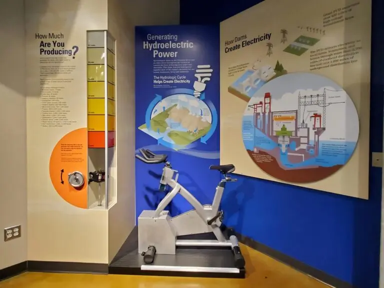
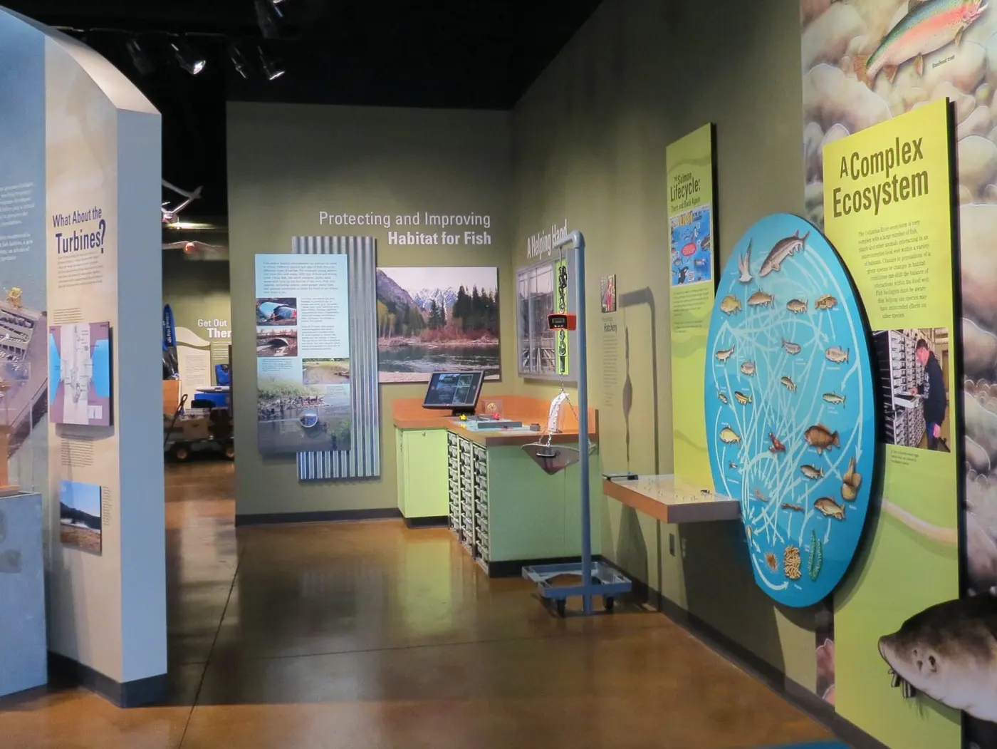
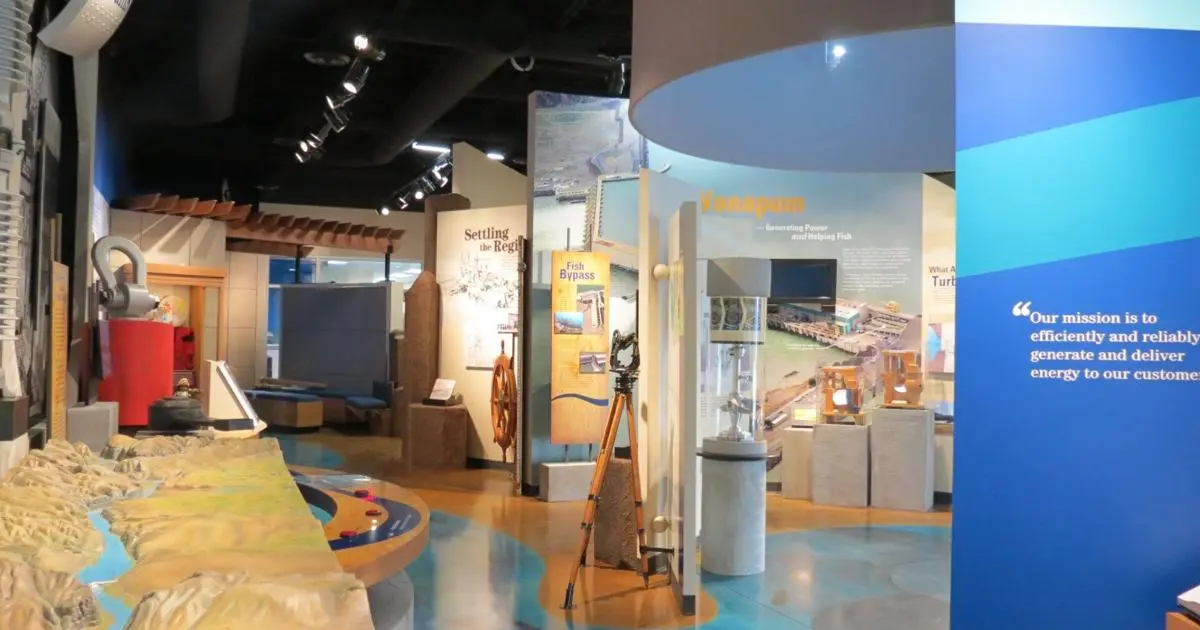
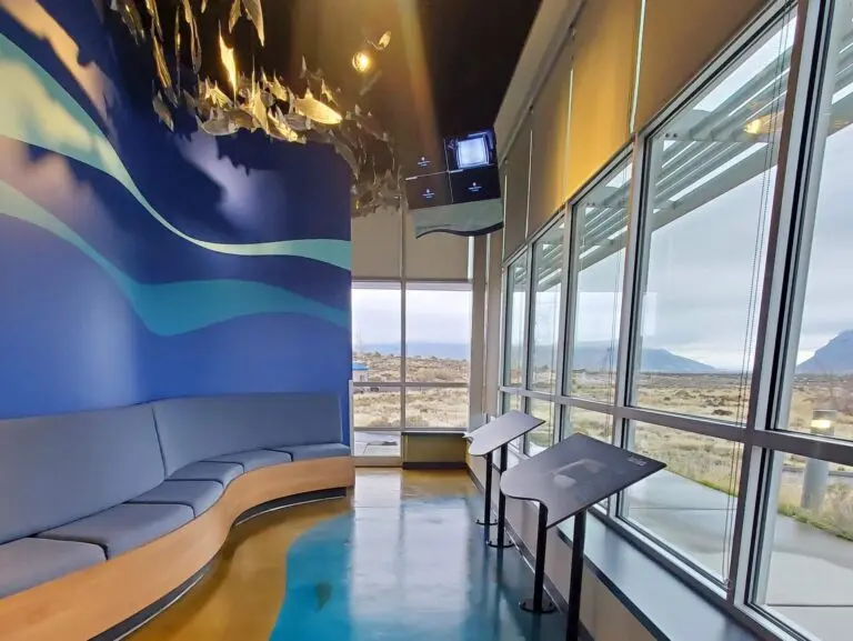
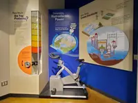
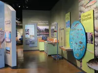
A light fixture shaped like turbine blades hangs over the exhibit floor, and schools of fish swim from the ceiling. The Grant PUD Visitor Center fills about 2,000 square feet of the office building at Wanapum Dam, on Highway 243 south of Interstate 90 in Grant County, Washington. The road in is Wanapum Dam Road, about 4 miles down the highway. Grant PUD opened the center on December 1, 2015, under the name The Power of the Columbia River; the utility’s own history calls it Experience the Power of the Columbia. Admission is free, and visitors can take free Grant PUD swag. The doors open daily from May through September and on weekdays only from October through April.
A wrench, a control room, and fish at life size
Children and adults can operate the dam from a mock control room. At another exhibit visitors generate their own electricity. A relief map shows the river between Rock Island Dam and Priest Rapids Dam. The fish of the Columbia are shown at life size, along with an account of how biologists harvest fish to sustain and enlarge their populations. A theater plays videos on how the Columbia Basin was formed and how Wanapum Dam works, and video tours go into parts of the dam the public is usually kept out of. Tools used to build the dam are on display beside tools used now, among them a massive wrench from the construction. In November 2015, Tom Stredwick, public information specialist for the PUD, demonstrated for the Columbia Basin Herald that the wrench is no fun to work.
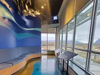
“Hands-on interactive,” Stredwick said of the exhibits, which were meant especially for children. Live cameras show fish passing the dam. Displays take up how the river is shared among hydropower, fish passage, recreation, and natural resources, and where to camp and boat along the Columbia. Outside is a viewpoint of the dam, and Grant PUD’s recreation planner sends visitors on to Wanapum Dam Turbine Park. Back toward the interstate, the South Grant County chamber places the Wanapum Dam Overlook 7 miles south of I-90 on SR 243. It sits above the reservoir with views of the dam and the surrounding mountains, and has a viewing platform with binoculars, interpretive panels, picnic tables, and a restroom.
The exhibits were developed by a company called Formations, working with PUD employees, and the building cost about $1 million. They replaced an older museum near the base of the dam. That building now stands inside a fenced area that requires permission to enter. The old museum carried exhibits on the Wanapum people, for whom the dam is named, along with hydropower and the river’s ecosystem. When it closed, the PUD built a separate Wanapum Heritage Center at Priest Rapids Dam, a 50,000-square-foot building that opened in October 2015. The visitor center itself is part of what Grant PUD’s federal license requires: educational opportunities and access for its customers. “We want this to be a center where schools, families and members of the community can visit and use as an educational resource,” said Dale Walker, president of the PUD commission, at the 2015 opening. The center closed in March 2020 for the COVID-19 pandemic and reopened in the spring of 2022.
Mist off the spillway, February 2014
The same Tom Stredwick had spoken for the PUD a year and a half before the opening, when the river behind the dam was drawn down. In early to mid-February of 2014, Jim Claussen, a hydro mechanic for the PUD, saw water leaking from two adjoining gates on the downstream side of the spillway. After a spill cycle the leak grew worse, “creating mist you could see from...the highway coming into the dam.” From the dam crest he saw that the curbs and handrails of the roadway deck across the spillway had taken a pronounced curve. On February 26 divers found a crack 2 inches wide and 65 feet long running the full length of spillway Monolith 4 at a concrete lift joint.
“That was the hard thing, once we saw the problem, to try to get your own mind to accept that that has moved or something that size is moving, that amount of concrete, that weight, how it can move,” Claussen said later. “It takes a while for your own mind to come to grips with that.”
By the first week of March the reservoir stood 26 feet below normal pool. Engineers spent 11 weeks in the historical records. The field calculation they needed turned up in a basement repository. They concluded that errors in the original design calculations and late changes to the spillway design had left the concrete too light to resist the water against it. They also found that a weekend of unusually hot weather during the pour may have weakened the joint. Crews installed thirty-five tendon anchors up to 260 feet long through the spillway piers and sixty-nine solid-bar anchors through the ogee section. Grant PUD’s history says the reservoir was raised again in December. The case study of the Association of State Dam Safety Officials puts the return to full pool in March 2015.
The lowered water uncovered ground the pool had covered for more than 50 years: culturally significant sites, petroglyphs, and graves. In March 2014 two sets of Native American remains were found near Crescent Bar, about 500 yards apart. “Anytime there’s a reduced river elevation, there are always the risk of exposing human remains,” Stredwick told KNKX. Rex Buck, Jr., leader of the Wanapum band, said the state was treating the remains and artifacts with respect.
Gates sixty-seven feet high
The dam began with a county vote. In 1938 Grant County PUD No. 2 was created, 2,166 to 828. In 1951 the Grant County Chamber of Commerce asked the PUD board to consider a dam at Priest Rapids. In 1955 the Federal Power Commission licensed the PUD to build and operate two dams, known together as the Priest Rapids Project. Construction at Wanapum began in 1959. First power came in 1963, at a total project cost of $93 million. The tenth and last generator went into production in 1964, rated at 1,040 megawatts, which made Grant PUD the third-largest non-federal producer of hydroelectric power in the nation.
The dam stands 186.5 feet tall and runs more than 8,600 feet from bank to bank, about six miles downstream of Vantage by the PUD’s reckoning. Its reservoir covers 14,680 acres. The spillway’s twelve radial gates are each 50 feet wide and 67 feet high, and when the dam was built they were the tallest in the world. At the dedication in 1966 about 1,900 people attended, and the day’s activities centered on a new heritage center opened to the public for the first time.
The decades since are compressed in the PUD’s timeline. A new 44-year federal license and the Wanapum Fish Bypass Unit, which gives juvenile salmon a safer passage over the dam, both came in 2008. All ten original turbines were replaced by 2013, and in 2020 the rehabilitation of the last generating unit ended a 20-year project. The dam is now rated at 1,203.6 megawatts.
Skee mooin, the river people
Wanapum means “river people.” The PUD says the band lived along the river from Vantage south toward Pasco. The state marker at the White Horse Monument rest area on I-90 puts their range from Beverly Gap to the mouth of the Snake River, about 75 miles. The Wanapum call the river Chiawana, its name before it was the Columbia. In 1956 they and the PUD made an agreement in which the PUD promised to maintain and protect the Wanapum way of life. When Carlotta Collette visited for High Country News in 1997, Rex Buck, a descendant of the prophet Smohalla, worked at the PUD. She found the last Wanapum village at Priest Rapids, eleven buildings dwarfed by Priest Rapids Dam.
The prophet’s name is spelled two ways in the sources. HistoryLink writes Smohalla and places him in the 1850s at the village of P’na near the foot of Priest Rapids, where the Wanapum kept their Washani religion. Among his predictions, HistoryLink says, was that whites would someday build dams across the Columbia and stop the salmon. High Country News, spelling him Smowhala, prints the prophecy as Click Relander reported it in Drummers and Dreamers: “In time to come the white men will build dams which will close the Columbia River to the salmon. At Priest Rapids, there is nothing the white people want in our little life, and there we may live unmolested.” Alton S. Dam made the first call for a dam at Priest Rapids in 1906; his proposal was shelved. Smohalla’s nephew Puck Hyah Toot, known to whites as Johnny Buck, waged a long fight for his people’s right to a home and a place to fish. In a dictated plea before the state allowed the Wanapum to take salmon at Priest Rapids in 1939, he said: “I want to catch salmon and want white man to catch salmon but I don’t want to break no law, and if we can catch salmon we can live.”
The first written description of these people dates to July 1811. The Canadian explorer David Thompson passed a night plagued by mosquitoes at the mouth of Crab Creek. The spot lies just below the present town of Beverly, which H.R. Williams named about 1905 after Beverly, Massachusetts. In the morning Thompson’s party sailed through Priest Rapids and beached half a mile below a large village. A chief on horseback came down to look and returned with “an old white headed Man, with the handle of a Tea Kettle for an ornament ab[ou]t his Head.” The man “was quite naked & ran nearly as fast as the Horses,” Thompson wrote; “we could not but admire him.” Thompson called the people Skee mooin and watched them fish with a seine net of wild hemp about 180 feet long. Those rapids are now drowned behind Priest Rapids Dam. The village site Thompson recorded is still occupied by Wanapum, who still gather hemp for cordage and sew tule mats to roof their longhouses. Elders still tell stories about a man named Fast Runner, who kept up his speed to a very great age.
Notable Events
- 1811After a night near the mouth of Crab Creek, just below the present-day town of Beverly, Thompson described the Wanapum Indians and the landscape along the Columbia from Crab Creek to the mouth of the Snake River. historylink.org
- 1906Alton S. Dam made the first call for a dam at Priest Rapids; his proposal was shelved. historylink.org
- 1908A hydroelectric plant was constructed at the foot of Priest Rapids, its water diverted into a long chute and forced through the turbines. historylink.org
- 1938Grant County PUD No. 2 was created by a majority vote of 2,166 to 828, absorbing Grant County PUD No. 1 into the new, county-wide utility. grantpud.org
- 1950sBrought together in the 1950s with the federal licensing of Priest Rapids and Wanapum dams, Grant PUD and the Wanapum Band of Native Americans committed to a long-lasting relationship built on mutual trust and respect. grantpud.org
- 1951Representatives of the Grant County Chamber of Commerce appeared before the Grant PUD Board of Commissioners and asked the PUD to consider constructing a dam at Priest Rapids. grantpud.org
- 1955The Federal Power Commission issued Grant PUD a license to build and operate two dams, known collectively as the Priest Rapids Project. grantpud.org
- 1956An agreement between the Wanapum and the Grant County PUD was made in 1956, in which the PUD promised to maintain and protect the Wanapum way of life. dahp.wa.gov
- 1959Construction began at Wanapum Dam, which was authorized as part of the Priest Rapids Project. grantpud.org
- 1960sWhen the dam was constructed in the early 1960's its radial gates were the tallest in the world. damfailures.org
- 1963The dam was designed before 1959, the year construction started, and construction was completed in 1963 with a total project cost of $93 million; the initial estimate for the repairs then coming was $61 million. columbiabasinherald.com
- 1963It was built over four years with the first power generation beginning in 1963. grantpud.org
- 1964The 10th and last generator went into production at Wanapum Dam, which at the time had a capacity of 1040 megawatts. grantpud.org
- 1966Wanapum Dam is dedicated. Activities focused around the new heritage center, which opened to the public for the first time. Approximately 1,900 people were in attendance at the ceremony. grantpud.org
- 2008The Federal Energy Regulatory Commission awarded Grant PUD a new 44-year license to operate the Priest Rapids Project. grantpud.org
- 2008The Wanapum Fish Bypass Unit, which allows migrating juvenile salmon a safer passage over Wanapum Dam, began operating. grantpud.org
- 2013Grant PUD celebrated completion of its Advanced Turbine Replacement Project at Wanapum Dam, which included replacement of all 10 of the dam's original turbines. grantpud.org
- 2014Repairs were expected through the summer, allowing the utility to raise the reservoir behind Wanapum Dam in the fourth quarter of 2014 to an operating elevation of 560-562 feet above sea level, after which limited public access to the Wanapum shoreline and reservoir would likely be restored. columbiabasinherald.com
- 2014Divers on February 26, 2014 observed a 2-inch-wide, 65-foot-long crack that spanned the full length of Monolith 4 at the concrete lift joint. damfailures.org
- 2014A fracture was discovered in February below the water line on the upstream side of the dam, running across the 65-foot width of one of the 13 spillway-pier monoliths. grantpud.org
- 2014A fracture was discovered on the spillway in February; Grant PUD lowered the Wanapum reservoir by 26 feet, then reinforced the spillway with post-tension anchors and metal rods, before raising the reservoir in December. grantpud.org
- 2015The reservoir was restored to full pool in March 2015, just over one year after the issue was discovered. damfailures.org
- 2015In December, Grant PUD opened its new visitors center near Wanapum Dam; Experience the Power of the Columbia allows visitors to see how the Columbia River has shaped Grant County. grantpud.org
- 2020The Visitor Center at Wanapum Dam had been closed since March 2020 as a response to the COVID-19 pandemic before Grant PUD reopened it. grantpud.org
- 2020Grant PUD completed the rehab of the final generating unit at Wanapum Dam, described as a 20-year project. grantpud.org
People
- Tom Stredwick, public information specialist for the Grant County PUD who described the new hydro museum and its coming grand opening.
- Jim Claussen, hydro mechanic for Grant County PUD whose observations of leaking gates and a curved deck led to finding the spillway crack (2014).
- Dale Walker, Grant PUD Commission President who presented the new center as an educational resource for schools, families and the community.
- Ulysses S. Grant, Civil War general and eighteenth President of the United States, for whom Grant County, and so the Grant County PUD that runs this center, is named.
- Rex Buck, Wanapum spiritual teacher, a descendant of the prophet Smowhala, who worked at the Grant County Public Utility District.
- Robert Tomanawash, Wanapum tribal elder, described as the last full-blooded member of the 60-member tribe.
- David Thompson, Canadian explorer who made the first written description of the Wanapum Indians and of this reach of the Columbia, and whose maps codified their village site (1770-1857).
- Alton S. Dam, made the first call for a dam at Priest Rapids (1906).
- Puck Hyah Toot (Johnny Buck), successor and prophet of the Wanapum who waged a long battle for his people's rights to a home and a place to fish (1878?-1956).
- Smohalla, prophet of the Wanapum, under whose guidance the band kept its Washani religion at its village of P'na near the foot of Priest Rapids (1815?-1895).
- Rex Buck, Jr., leader of the Wanapum band of Native Americans who said the state was treating the uncovered remains and cultural artifacts with respect.
- H.R. Williams, named the railroad community beside the dam site, Beverly, after Beverly, Massachusetts (around 1905).
Sources
- grantpud.org/locations
- 509river.org/day-trips/grant-pud-visitor-center
- fwee.org/new-grant-pud-visitor-center-opens
- visitsouthgrantcountywa.com/information
- yoursourceone.com/columbia_basin/wanapum-dam-visitor-center-wanapum-heritage-center-reopened-to-the-public/article_6a2702d0-c259-11ec-8a93-2f89be931c35.html
- services6.arcgis.com/yIPFYZqx6a8IC4Hk/arcgis/rest/services/DAHP_%E2%80%93_Register_Properties/FeatureServer/0/query
- hmdb.org/m.asp?m=92610
- columbiabasinherald.com/news/2014/may/26/cause-of-wanapum-dam-damage-determined-2
- knkx.org/2014-03-13/wanapum-dams-river-drawdown-churns-up-old-bones-inundates-guards
- historylink.org/File/9010
- columbiabasinherald.com/news/2015/nov/16/wanapum-dam-museum-just-months-from-opening-2
- damfailures.org/case-study/wanapum-dam-washington-2014
- ephrata.org/291/Our-History
- historylink.org/File/9524
- hcn.org/issues/issue-120/a-visit-with-the-river-people-of-hanford-reach
- grantcountywa.gov/824/County-History
- grantpud.org/history
- fwee.org/new-grant-pud-visitor-center-opens