

Godman Guard Station
Dayton, Columbia County, Washington. Guard station cabin rental.
Details

- Where
- Dayton, Columbia County, WA. No street address stated. Directions
- When
- Check in time is 1:00 PM, and check out time is 11:00 AM.
- Season
- Year-round; automobile access approximately mid June through the end of October, depending on weather conditions.
- Getting there
- From Dayton, Washington (approximately 28 miles): (summer route)Travel south on 4th Street for 6 blocks, and turn east (left) onto Eckler Mountain Road (also turn off for the cemetery) for approximately 15 miles. Turn right at the Y in the road. Continue on Forest Service Road 46 for 9 miles to Godman. The guard station will be on the left.
- Fees
- $60 per night from May 1 through September 30 (up to 8 people); $75 per night from October 1 through April 30 (up to 8 people).
- Access
- Automobile access to this site runs from approximately mid June through the end of October, depending on weather conditions.
- Walk-in or reserve
- Reservation required; reserve through Recreation.gov.
- Phone
- (509) 843-1891
- Managed by
- Umatilla National Forest, Pomeroy Ranger District.
- Established
- 1933-34.
- Coordinates
- 46.1005, -117.7852.
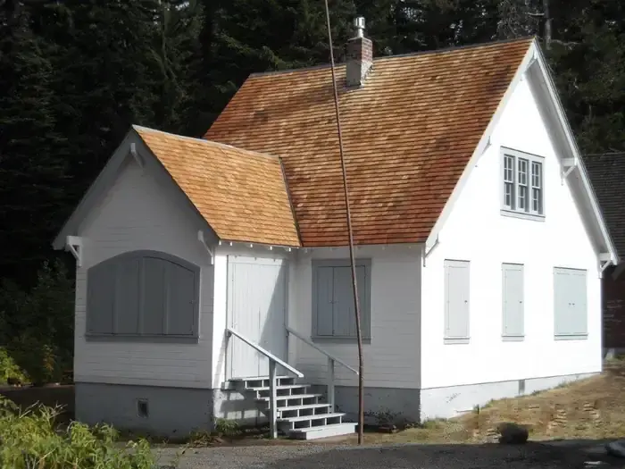
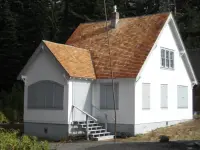
Godman Guard Station is a two-story, wood-frame building at the end of about 28 miles of road out of Dayton, Washington. Grand fir, Douglas fir, Engelmann spruce, lodgepole pine, and subalpine fir crowd its walls and close their branches overhead. The Forest Service gives its elevation as 5,700 feet, and Recreation.gov gives 5,600. The Umatilla National Forest’s Pomeroy Ranger District rents it by the night, year-round, to parties of up to eight. The door has a combination lock.
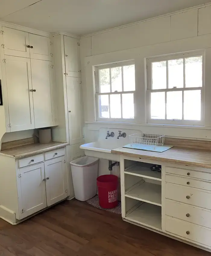
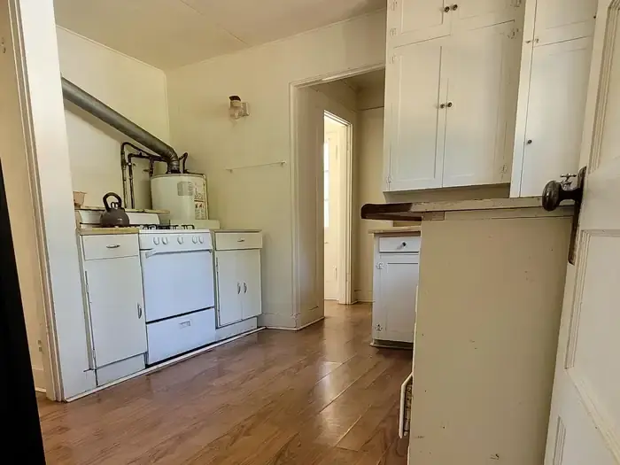
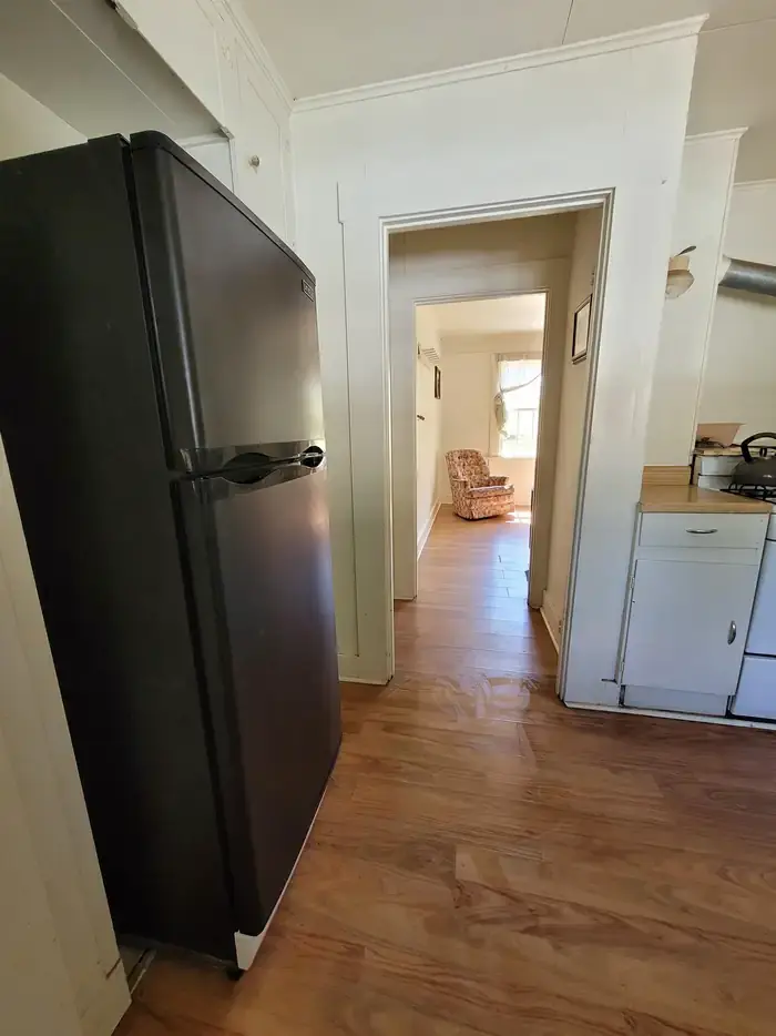
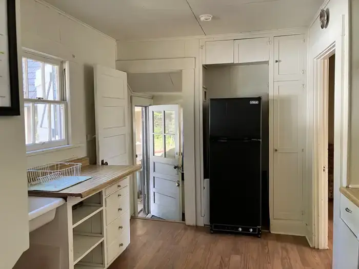
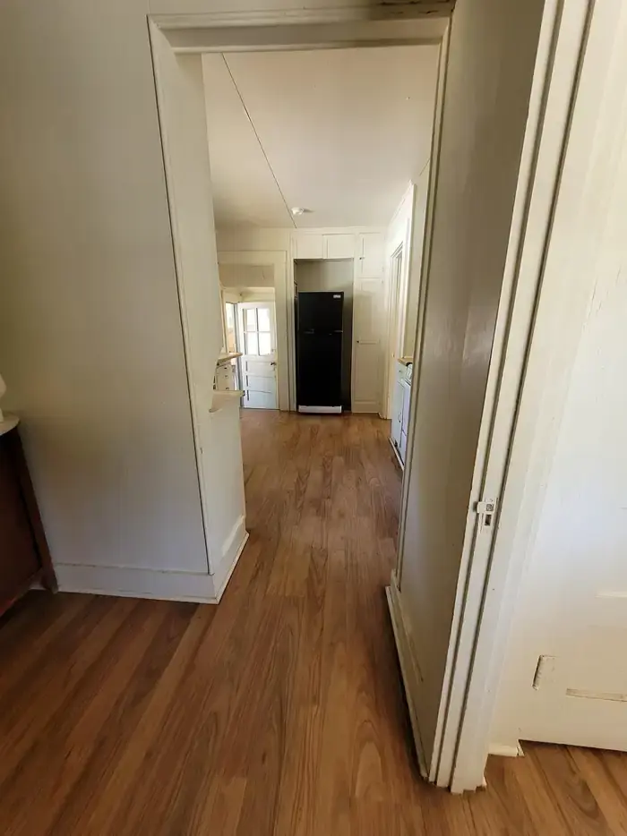
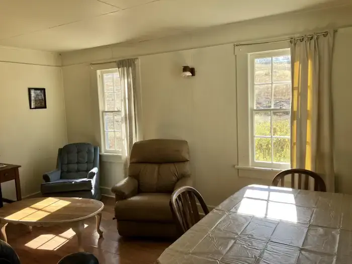
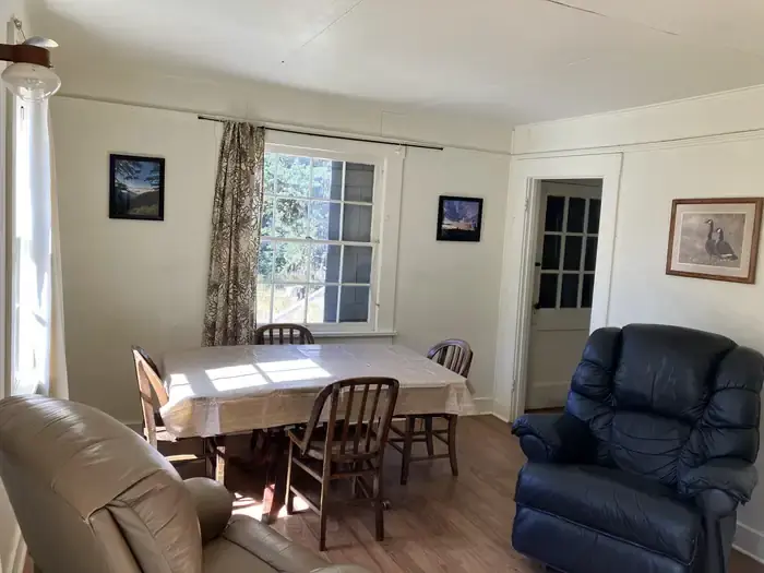
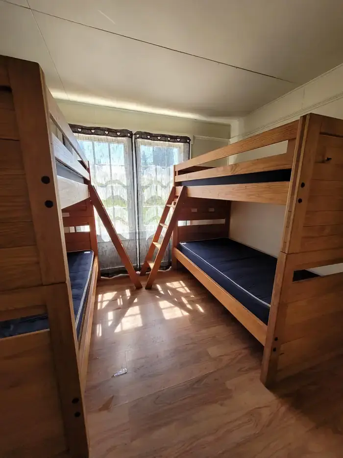
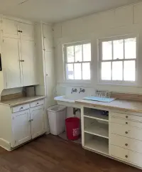
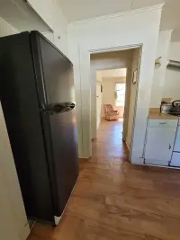
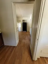
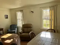
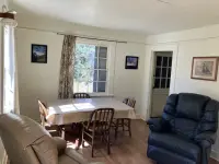
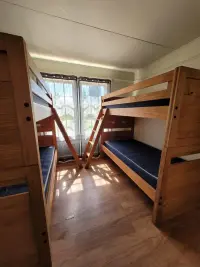
Inside are two bedrooms, a living area, and a kitchen. The two listings furnish the rooms differently. The Forest Service counts three bunk beds, two single beds, a couple of chairs, and a table. Recreation.gov counts two bunk beds, three single beds, recliner-style chairs, a couch, and a kitchen table and chairs. Both list the same propane appliances: a cook stove, a refrigerator, lights, and heat. There is no running water and no indoor toilet. A vault toilet stands near the cabin, and a picnic table and fire ring sit outside. Renters bring their own water, bedding, pots, and food, and carry their garbage back out. A mop, bucket, and broom are left for the cleaning expected before departure.
Barn, spring, and the West Butte Trail
Horses are kept away from the cabin. Less than 200 yards up the hill stands a barn, closed to the public, with hitching rails and feed bunks that riders may use. A spring with a trough is near the barn, and Recreation.gov notes it for those who treat and boil their water. From the barn there are long views over the wilderness.
The historic Godman Campground next door was built by the Civilian Conservation Corps. From the Godman trailhead, West Butte Trail #3138 enters the Wenaha-Tucannon Wilderness, the nearest way in from the cabin. The Endangered American Wilderness Act of 1978 created this wilderness in the northern Blue Mountains of southeastern Washington and northeastern Oregon. Its size depends on the page:
- 177,465 acres on the cabin listing
- “nearly 180,000” on Recreation.gov
- 176,557 on the Forest Service’s own wilderness page
The wilderness is a country of basaltic ridges and deep canyons. Elevations fall from 6,401 feet at Oregon Butte to 2,000 feet on the Wenaha River. Rocky Mountain elk, bighorn sheep, white-tailed and mule deer, black bear, cougar, coyote, and pine marten live there. Chinook salmon and steelhead spawn in the Wenaha and Tucannon Rivers, and most trails drop steeply into their canyons. The main use has traditionally been the fall elk hunt, with hunters packing in on horses. In recent years more anglers and backpackers have come in summer and early fall.
Thirteen miles in on snow
The summer road leaves Dayton south on 4th Street. After six blocks it turns east onto Eckler Mountain Road, which is also the turn for the cemetery, and runs about 15 miles to a Y. There Forest Road 46 bears right for the rest of the way: 9 miles by the Forest Service’s count, 12 by Recreation.gov’s. Cars usually get through from about mid-June. The Forest Service puts the end of the driving season around the end of October, and Recreation.gov puts it as late as early November, with the weather deciding either way.
From December 1 to March 31 the cabin can be reached only over snow. Parties park at the Touchet Corral Sno-Park, before the entrance to Bluewood Ski Area. From there they follow a groomed snowmobile route about 13 miles, taking every left, past direction signs put up by the local snowmobile club. The route can be skied, but the Forest Service calls it difficult and for advanced skiers only. The club keeps a second building at Godman, a warming shelter that is not for rent, and its riders stop there through the winter. Guests at the guard station should expect snowmobiles coming and going on the groomed trail.
Summer headquarters of the Touchet District
According to the Forest Service, settlers from Dayton and from Columbia and Garfield Counties have used the ground around Godman for recreation since the turn of the century. On May 12, 1905, President Theodore Roosevelt proclaimed the Wenaha Forest Reserve from lands withdrawn from homestead entry in 1902 and 1903, and its headquarters stayed at Walla Walla. On November 5, 1920, the reserve, by then called the Wenaha National Forest, was joined to the Umatilla.
The guard station went up in 1933-34 as part of an administrative complex. On November 21, 1939, Forest Supervisor Carl Ewing sent a history of the Umatilla to E. J. Griffith of the Works Progress Administration’s Survey of Federal Archives. In it Godman appears as Godman Ranger Station, the summer headquarters of the Touchet District, whose winter headquarters were in Dayton. The district then covered 161,078 acres in Columbia County, Washington, and Wallowa County, Oregon. One district ranger ran it, with five forest guards in the summer months.
The report also described the country before the reserve was created. Somewhat more than 275,000 sheep plus their increase, 40,000 cattle, and 15,000 horses had grazed the Wenaha Reserve each year. The report called that use “no doubt responsible for the present condition of the range.” Game numbers hit their low point about 1905, when one report read: “There are quite a few deer in these hills but they are decreasing rapidly. It is also claimed that there is a small bunch of elk here.” By 1938 the estimate for the whole forest was about 10,000 deer and 7,000 elk.
A ranger mistaken for a deer
The 1939 report lists W. H. Kendall among the Wenaha’s rangers between 1905 and 1920. In the Columbia County mountains near Dayton, a brass plaque on a basalt rock stands where Forest Road 4620 meets the Kendall Skyline Road. It credits William H. Kendall, who worked for the Forest Service from 1907 to 1931, with conceiving, promoting, surveying, and building that mile-high road, completed in 1928. The plaque also tells what happened to him before the road was built. While hunting in the backcountry, Kendall was shot in the shoulder by a hunting partner, and rescuers from Dayton carried him several miles to the nearest road. The partner who mistook him for a deer was Dr. W. W. Day, whose emergency treatment, the plaque says, probably saved his life.
Notable Events
- 1905President Theodore Roosevelt created the Wenaha Forest Reserve on May 12, 1905 from lands withdrawn from homestead entry in 1902 and 1903, the reserved land this country later became part of. fs.usda.gov
- 1920By presidential proclamation of November 5, 1920 the Wenaha Forest Reserve, by then called the Wenaha National Forest, was made part of the Umatilla National Forest, the forest that built and staffed Godman. fs.usda.gov
- 1928The mile-high scenic road that carries Forest Service travel above the Dayton end of the Touchet District was conceived, promoted, surveyed and built under William H. Kendall, and completed in 1928. hmdb.org
- 1939The forest's historical information listed Godman Ranger Station as the summer headquarters of the Touchet District, whose winter headquarters was at Dayton, Washington. fs.usda.gov
- 1978The Endangered American Wilderness Act of 1978 created the Wenaha-Tucannon Wilderness in the northern Blue Mountains of southeastern Washington and northeastern Oregon, the country the guard station sits beside. fs.usda.gov
People
- Carl Ewing, Forest Supervisor of the Umatilla National Forest, signatory of the historical information report that lists Godman Ranger Station as the Touchet District summer headquarters (November 21, 1939).
- William H. Kendall, U. S. Forest Service employee under whose direction the mile-high Kendall Skyline Road above Dayton was conceived, promoted, surveyed and built (employed by the U. S. Forest Service from 1907 to 1931).