Glendo State Park Sandy Beach
Glendo, Platte County, Wyoming. Swim beach.
Details

- Where
- 397 Glendo Park Rd, Glendo, WY 82213. Directions
- When
- The park is open year-round for day use and camping. Day use permits are required from 6AM to 10PM, and camping permits are required from 10PM to 6AM. Fee booths are open Mon-Sun, from Memorial Day to Labor Day.
- Season
- Year-round; fee booth open Memorial Day through Labor Day.
- Getting there
- To access Sandy Beach, follow the standard directions to access the Glendo State Park Main Fee Booth. However, once you are headed south on Glendo Park Road, follow it past the main fee booth and over the dam.
- Fees
- Day use fees apply.
- Access
- While access to the area is open year-round, the Sandy Beach Fee Booth is only open seasonally. Normal operating season is Memorial Day through Labor Day.
- Phone
- 307-735-4433
- Managed by
- Wyoming State Parks, Historic Sites, & Trails.
Sandy Beach is a long stretch of white sand on the eastern side of Glendo Reservoir. It slopes gradually into the water, and Laramie Peak stands across the reservoir to the west. A cottonwood grove lines the shore behind the sand, and the campsites run in and out of its shade. Wyoming State Parks, Historic Sites, & Trails counts the beach among the park’s most popular summer destinations. Its no-wake zone, like the one at Shelter Point, is set aside for safer swimming. The park posts that all swimming is at one’s own risk.
The road out is long. From the town of Glendo, Glendo Park Road runs south past the main fee booth and across the dam, then another 8.5 miles to a large sign for Sandy Beach. A left turn leads to a second fee booth. That booth is staffed from Memorial Day through Labor Day. Outside that season the beach stays open and fees go into canisters and kiosks.
Dune and Willow under the cottonwoods
At the booth the campground divides. To the left is Dune, the southern portion of the beach, with 67 sites. Half lie beneath the cottonwoods and half sit outside the grove, slightly farther from the lake.
- Sites 1 through 19 have electric hookups and established pads, with very little shade.
- Sites 1421 through 1458 are down on the sand, most with at least partial shade.
- Sites 1423 through 1456 sit fully on a dune, where the park recommends only small camping units with four-wheel drive.
- Seventeen sites are tent-only.
The large Dune Shelter at the south end can be reserved. Three smaller shelters nearby go to whoever arrives first, and the mountain bike trails start there.
To the right is Willow, the northern portion. Sites 1501 through 1521 are established back-in pads set against the cottonwood grove. Past them, sites 1522 through 1570 lie in the trees on deep sand and are first come, first served all year. The Willow Shelter stands on the north side. Between the two campgrounds the park lists drinking water and seven vault toilets.
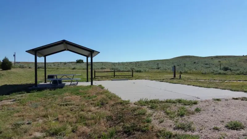
In summer a volunteer camp host lives at Sandy Beach on a cement pad in the open, with a metal shade roof over the picnic table. The host drives a Polaris side-by-side among Dune, Willow, Cottonwood, Indian Point, and Broken Arrow campgrounds. Most of the host’s time goes to the three closest to the beach. The park describes the campground as very popular in July and August. Most of the first-come sites near the water are shaded by cottonwoods.
A shoreline that moves fifty-five feet
Glendo Reservoir was built for irrigation, flood control, and power generation. Its level rises and falls through the year, on average about 55 feet in elevation. Through the winter, water coming down from Gray Reef is stored here, and spring runoff adds more. The reservoir usually reaches its highest point in June, and it is full at 4,635 feet above sea level.
In April, May, or June, the sites nearest the water at Dune and Willow can flood. Through July and August the water draws back farther and farther. The park writes that “it is not uncommon to have a ¼ mile of beach between the campgrounds and the water in August.”
The park also explains how the lake drains:
- The allocated water, called the conservation pool, runs down to 4,570 feet.
- Below that lies an inactive pool about 25 feet deep.
- Below the outlet structure, at 4,545 feet, is the dead pool, water that cannot leave Glendo.
- The old river channel bottoms out at 4,508 feet.
The park itself covers 22,000 acres: 10,000 of land and 12,000 of water. It is known for walleye. Trail crews built a non-motorized singletrack system here from 2010 to 2015, and the park now counts about 45 miles of hiking and mountain bike trail. The Dune Shelter is one of four trailheads. The Town of Glendo puts the mileage at over 40 and says the trails stretch from the Marina to Sandy Beach. The park also oversees cultural sites that include visible tipi rings.
Three states and a dam
The reservoir is the product of a long quarrel over the North Platte River. Wyoming and Nebraska had tangled over its water since the 1880s. One lawsuit ran 11 years before the Supreme Court ruled in 1945 that Nebraska was entitled to 75 percent of the river’s flow and Wyoming to 25 percent.
Glendo Dam was authorized in 1944 to operate under that decree. Its first purpose had little to do with irrigation. It was meant to reduce the silting that was costing Guernsey Reservoir its capacity. It would also store water released from upstream power plants so those plants could run year-round.
Preliminary investigations began in 1944, but the states held construction up for a decade. Nebraska feared the reservoir would reduce the flow into Lake McConaughy at Ogallala. Colorado thought the added storage might give it grounds to claim more water in its North Park region, at the headwaters of the North Platte. Congress, in Public Law 841, refused to appropriate any money until the three states agreed on a plan.
The Bureau of Reclamation drew up a plan all three accepted, and bids opened on November 9, 1954. The reservoir would hold 800,000 acre-feet:
- 100,000 for irrigation
- 115,000 for sediment control
- 275,000 for flood control
- 310,000 for power
Only 40,000 acre-feet of the irrigation water could be used in any one year: 15,000 for Wyoming and 25,000 for Nebraska.
The C. F. Lytle and Greene Construction companies began excavation in mid-December 1954. By the account of the National Park Service, they finished the dam in the early fall of 1957. The state park’s own history says construction ended in 1958. The result is an earthfill dam 190 feet high, with a crest 2,096 feet long that the road to Sandy Beach crosses. A low area on the south side of the reservoir needed nearly half a mile of dikes. Builders moved three miles of Chicago, Burlington, and Quincy Railroad track and four miles of U.S. 87, now part of Interstate 25 along the reservoir’s west side.
The dam was dedicated on June 9, 1959. A Bureau of Reclamation photograph from that day shows five people:
- Dedication Queen Jane Waters
- Miss Cheyenne, Vedana Blomquist
- Miss Casper, Marilyn Schipporeit
- Miss Wyoming, Linda Phillips
- Roy Amick, mayor of Glendo
The Glendo Museum in town keeps a pictorial history of the dam’s construction.
Horseshoe Creek and a town named for a valley
The town that gives the park its name was once called Bellewood. Bridgett McDermott served as postmaster for both the Bellewood and Glendo post offices. According to the Alliance for Historic Wyoming, the name Glendo comes from glean, the Gaelic word for valley. The town was incorporated on May 20, 1922, and Platte County’s tourism office counts just over 200 residents. In 2017 the town sat at the center of the path of totality for the solar eclipse, and the county office says it welcomed hundreds of thousands of visitors before and after the event.
The town traces its start to the Horseshoe Stage Station, one of the first five telegraph stations of the Overland Stage Express. It moved to its present site when the railroad came through. A state marker on South Glendo Highway, about 1.5 miles south of town, tells the station’s earlier story.
In 1856 the Brigham Young Express and Carrying Company, operated by the Church of Jesus Christ of Latter Day Saints, built the Horseshoe Creek Station complex. Wagon freighters fed and watered mules and oxen there, and stagecoaches changed horses. In 1857 a U.S. military expedition was mounted to replace Utah Territorial Governor Brigham Young. Accounts of what followed vary, but the marker says the station was set ablaze. That August the company disbanded its stations between Fort Laramie and Salt Lake City. The complex was rebuilt, and other operators, among them the short-lived Pony Express, used it for several years. The museum in town holds hand-forged relics from the Twin Springs blacksmith shop, burned during the Battle of Horseshoe Creek.
In December 1866, John “Portugee” Phillips stopped at Horseshoe Creek Station. He was riding 235 miles through a blizzard from Fort Phil Kearny to Fort Laramie. His errand was to telegraph the military that troops were surrounded by Sioux and Cheyenne warriors and needed help.
Notable Events
- 1856The Church-operated Brigham Young Express and Carrying Company constructed the Horseshoe Creek Station complex near present-day Glendo in 1856, beginning a new community on the spot. hmdb.org
- 1857Tensions between the U.S. government and the Church led to a U.S. military expedition in 1857, and while accounts of the event vary, the Horseshoe Creek Station site fell victim to the violence and was set ablaze. hmdb.org
- 1857In August 1857 the Brigham Young Express and Carrying Company disbanded its stations between Fort Laramie and Salt Lake City; the station complex was later rebuilt and other operators, including the short-lived Pony Express, used it. hmdb.org
- 1866John 'Portugee' Phillips stopped at the Horseshoe Creek Station during his legendary 235-mile ride through a blizzard from Fort Phil Kearny to Fort Laramie to telegraph the military that troops were surrounded by hostile Sioux and Cheyenne warriors. hmdb.org
- 1922The town of Glendo was incorporated May 20, 1922; it began as one of the first of five telegraph stations of the Overland Stage Express at the Horseshoe Stage Station and was established at its present location when the railroad came through. townofglendo.com
- 1944Wyoming's Glendo Dam was authorized in 1944 and would operate under the 1945 Supreme Court decree ruling that Nebraska was entitled to 75 percent of the North Platte's flow. nps.gov
- 1944Preliminary investigations for Glendo Dam and Reservoir began, but competing state interests delayed construction until December 1954. wyohistory.org
- 1954The C. F. Lytle and Greene Construction companies began excavation for Glendo Dam in mid-December 1954. nps.gov
- 1954The Bureau of Reclamation opened bids on November 9, 1954, and Glendo Reservoir was designed to store 800,000 acre feet of water. nps.gov
- 1957The contractors completed Glendo Dam, an earthfill structure 190 feet high with a 2,096-foot crest, in the early fall of 1957. nps.gov
- 1958The park's own history page states construction on Glendo Dam started in 1954 and was finished in 1958. wyoparks.wyo.gov
- 1959Dedication ceremonies were held June 9, 1959, attended by four young women crowned queens in Wyoming and the mayor of the town of Glendo. nps.gov
- 2010Since 2010 Glendo State Park has established over 40 miles of non-motorized trails stretching from Marina to Sandy Beach, making the park a trails destination. townofglendo.com
- 2015A new non-motorized single track trail system was created at Glendo State Park, with construction beginning in 2010 and continuing until 2015, leaving over 45 miles of trails for mountain biking and hiking. wyoparks.wyo.gov
- 2017Glendo has held true to its small-town roots with one notable exception, the total solar eclipse of 2017: at the center of the path of totality, the town of just over 200 residents became a hot spot for sky-watchers, welcoming hundreds of thousands of visitors before and after the event. wyplatteco.com
People
- Bridgett McDermott, Postmaster of both of Platte County's pioneer post offices, Bellewood and Glendo.
- John "Portugee" Phillips, Rider whose legendary 235-mile blizzard ride from Fort Phil Kearny to Fort Laramie took him through the Horseshoe Creek Station at Glendo (December 1866).
- Roy Amick, mayor of Glendo, Wyo., who took part in the Glendo Dam dedication ceremonies (June 9, 1959).
- Brian Johnson, Superintendent of Glendo State Park, whose message the park's own page points visitors to.
Sources
- wyoparks.wyo.gov/index.php/activities-amenities-glendo/swimming-glendo
- wyoparks.wyo.gov/index.php/about-our-campgrounds/1705-sandy-beach-dune-and-willow-glendo
- wyoparks.wyo.gov/index.php/cat-list-sphst/76-state-parks/glendo-state-park
- historicwyoming.org/profiles/women-pioneer-postmasters-and-their-post-offices
- hmdb.org/m.asp?m=92129
- wyplatteco.com/glendo
- wyoparks.wyo.gov/index.php/about-glendo
- nps.gov/articles/wyoming-glendo-dam.htm
- wyohistory.org/encyclopedia/history-glendo-dam
- townofglendo.com/about-glendo