.jpg)
Gird Point
Ravalli County, Montana, Ravalli County, Montana. Fire lookout rental; Mid June - Mid September.
Details

- Where
- Ravalli County, Montana, Ravalli County, MT. No street address stated. Directions
- When
- Overnight use.
- Getting there
- From Hamilton, MT travel 2 miles south on Highway 93. Turn east (left) on Skalkaho Highway 38 and travel 8.5 miles. Turn north (left) onto Gird Point Rd/FS 714 and follow this winding mountain road approximately thirteen miles to the Gird Point Lookout Trailhead parking area.
- Fees
- $30 per night.
- Access
- Drive partway, then hike a short, moderate trail to the lookout.
- Walk-in or reserve
- Open for reservations mid-June - mid-September on recreation.gov.
- Phone
- 406-821-3913
- Website
- recreation.gov
- Managed by
- Darby-Sula Ranger District, Bitterroot National Forest.
- Coordinates
- 46.2075, -113.9105556.
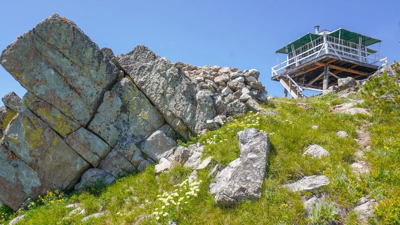
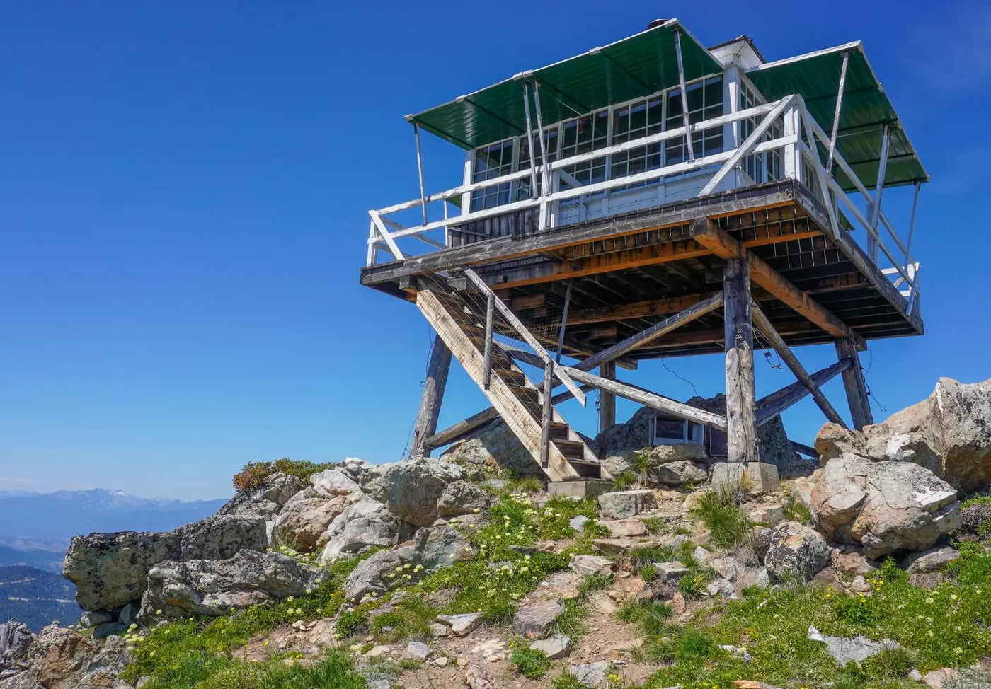
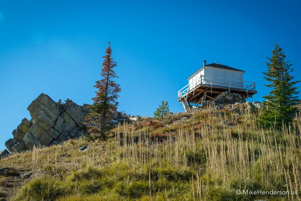
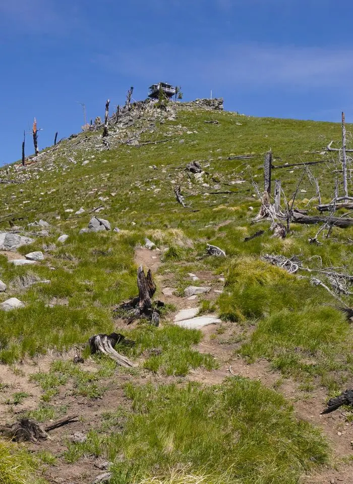
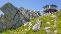
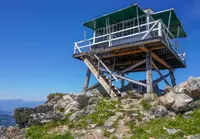
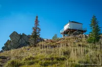
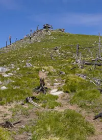
The road to Gird Point leaves the Skalkaho Highway east of Hamilton and climbs Forest Road 714 for about thirteen winding miles to a trailhead with room for two or three vehicles. From there a footpath of moderate grade covers the rest. The Forest Service gives its length as a half mile in one line of its page and three-quarters of a mile in another, and the Bitterroot Valley’s visitor bureau says three-quarters. At the top, on a talus outcrop, stands a square wooden cab with glass on all four sides and a pyramidal roof of sawn cedar shingles, raised on a cross-braced log tower.
The Forest Service and the National Historic Lookout Register call the tower eight feet high. The 2018 National Register nomination measures it at ten. The Forest Service puts the summit at 7,702 feet; the lookout register gives 7,595. The Forest Service and the visitor bureau place the lookout about 11 miles east of Hamilton, and Recreation.gov says 20.
The cab on the talus
Gird Point is the high point of a ridge that runs northeast to southwest on the west slope of the Sapphire Mountains, on the east side of the Bitterroot Valley. Only low grasses and forbs grow on the summit. The slopes below once held stands of subalpine fir, and most of them were killed in the 1990 Gird Point wildfire. Recreation.gov notes that the mountainsides around the point have burned in several large fires in the last few decades and now show a mosaic of recovering vegetation. Dead snags still stand, and hikers are warned to take care among them in high winds.
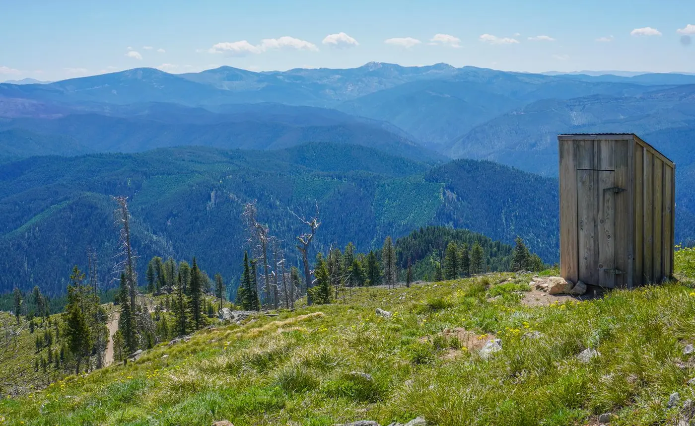
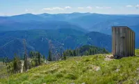
A 30-inch catwalk runs around the cab. From it the Sapphire, Bitterroot, and Anaconda-Pintler ranges are all in view, with the Bitterroot Valley and Bitterroot Mountains to the west. The visitor bureau says the lights of Hamilton show in the late evening. A small helipad of concrete blocks, laid into the talus, lies about 25 feet east of the tower. A peeled log pole for communications stands about 40 feet northeast, and an outhouse about 120 feet in the same direction. When the nomination survey was made, the outhouse had lost its roof, its Z-braced board door lay on the ground, and the Forest Service meant to replace it. The Forest Service now lists an outdoor toilet at the site.
Fourteen feet by fourteen
The cab measures 14 by 14 feet, and tower and cab are both set at a 45-degree angle to the cardinal directions. A single-flight stair climbs the southeast side. Its outer railing is hog wire fastened to a lumber handrail. At the top, a trapdoor opens onto the catwalk beside a spring-loaded safety gate. Each wall carries two top-hinged shutters. When they are open, their struts are fixed to the bottom rail of the catwalk railing. Most of the windows are nine-light wood sash, and two on each of three walls slide sideways for air. The building still carries its lightning protection.
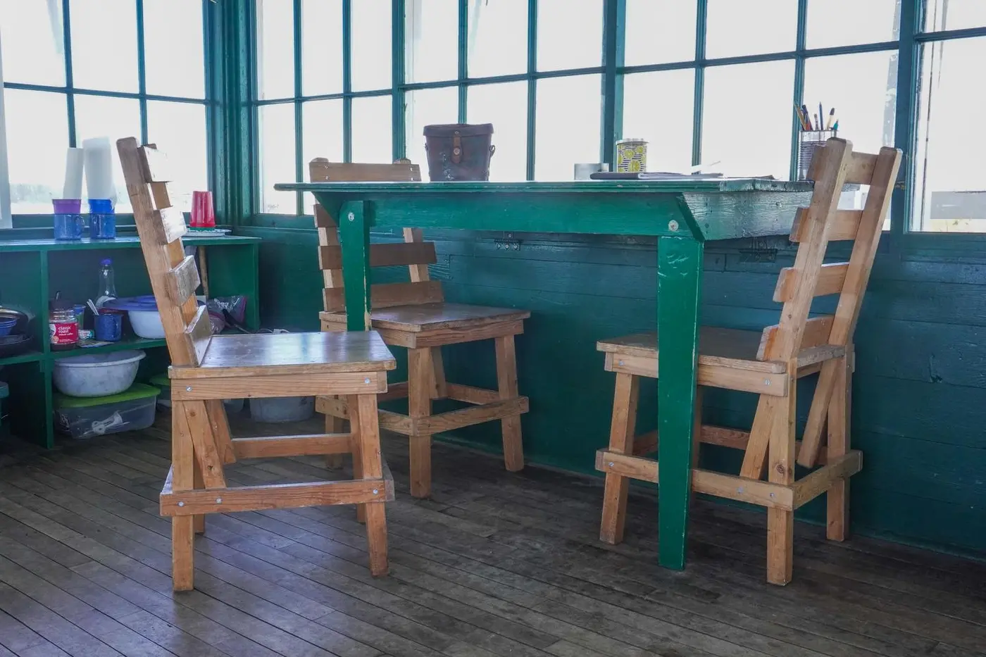
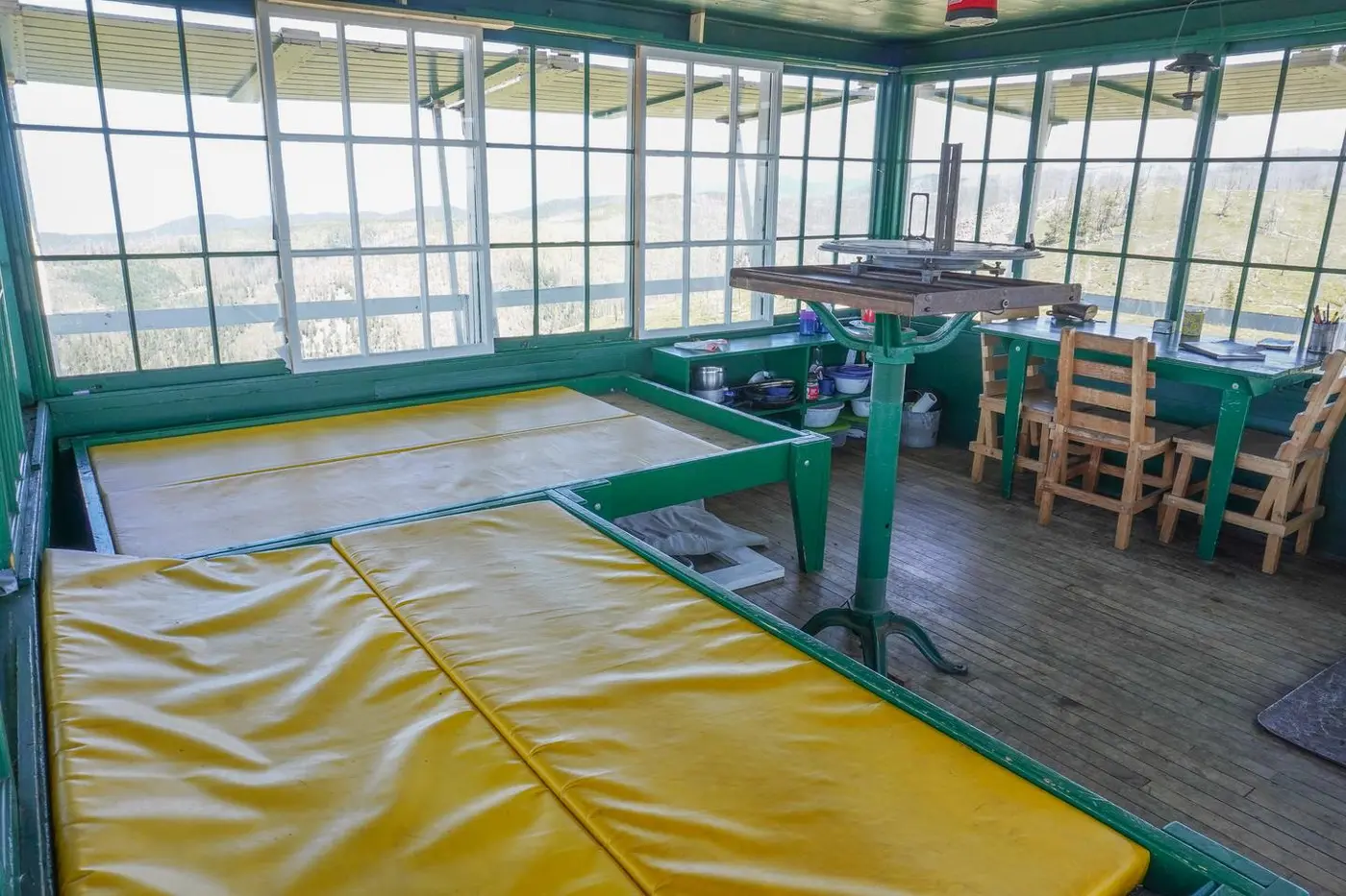
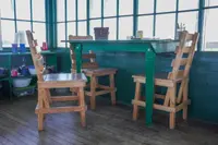
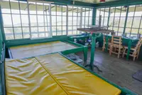
Inside, the nomination survey recorded the original maple floor, a plywood platform bed, a small wood heating stove, a table, a storage bench, and a metal stand holding an Osborne fire-finder. According to Recreation.gov, the restoration furnished the room in the manner of the 1940s. Renters now find two beds that sleep four, a table and chairs, a propane stove and lantern, pots and utensils, and the wood stove for heat and cooking. Firewood may be at the tower but is not promised. There is no water and no electricity, so guests carry in their own water and one-pound propane canisters. Candles are not allowed. The cab stays locked, and a key code comes by phone from the Darby Ranger District a week before arrival. The lookout is rented from mid-June to mid-September.
A date in the concrete
The Bitterroot National Forest marked Gird Point as a lookout site sometime before 1933, when it appeared on a forest base map with five other Darby District points: Skalkaho Mountain, Bald Top, Black Bear Point, and Deer Mountain in the Sapphires, and Ward Mountain across the valley in the Bitterroots. It was rated an “average season” lookout. In 1937 Elers Koch counted seven lookout points on the Darby District and found none improved to current standards.
Gird Point received its first and only major improvements in 1939. The cab follows the 1931-pattern L-4, the “Readicut” lookout house whose designer the nomination names as Clyde Fickes. The nomination says the lookout is believed to have been built with Civilian Conservation Corps labor, probably under the direction of an experienced carpenter. Four log legs rest on battered concrete footings poured in place. The footing at the base of the stair is etched “Aug. 18 1939.” Medicine Point Lookout, on the Sula District to the south, carries a similar inscription showing that it was being built that September.
During the region’s lookout replacement program of the 1950s, an inspector climbed Gird Point and classed it an “overload, temp” lookout, one manned only in extreme fire seasons. The cab needed new beds and cabinets, he noted, but with proper maintenance the structure had an estimated “20 years of safe life.” In 1967 it was one of sixteen lookouts manned on the Bitterroot. By 1992 the forest manned ten, and Gird Point was not among them.
Slated for removal, wrapped in fire
The National Historic Lookout Register records that in 1984 Gird Point and seven other inactive lookouts on the Bitterroot and Lolo National Forests were slated for removal, and that three were saved and restored. The sources differ on when the work at Gird Point began. Recreation.gov gives 2001. The lookout register says the cab was rehabilitated in 2002. The National Register nomination says the forest began restoration in 2003, after nearly two decades of abandonment. During that work the log tower legs were replaced in kind, the catwalk rebuilt, and the roof reshingled. A modern board-and-batten door now stands where the original multi-light door hung. According to the nomination, the project took three years, and Gird Point then entered the forest’s cabin rental program. On January 8, 2003, the lookout register entered it as US 459, MT 35, on the nomination of Gary A. Weber, Montana Registrar.
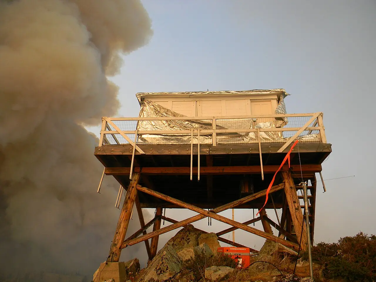
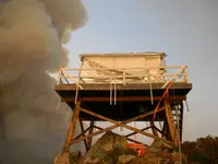
In 2011, five lightning-caused fires, called the 41 Complex, burned more than 15,200 acres on the Darby Ranger District, all in the Sapphires about 10 miles east of Hamilton. The largest, Up Top, grew past 12,300 acres and crossed the Skalkaho Highway, closing it to motorists for several weeks. More than 350 firefighters were assigned to the complex. They dropped more than 530,000 gallons of water and 150,000 gallons of retardant. The Up Top fire burned completely around Gird Point, and firefighters saved the lookout. A Forest Service photograph taken on September 8, 2011, is titled “Wrapped Gird Point Lookout.”
The National Park Service accepted Gird Point’s nomination to the National Register of Historic Places on April 6, 2018. The form lists the lookout’s historic function as “fire lookout” and its current one as “Domestic: hotel (USFS cabin rental).”
Notable Events
- 1933The forest identified Gird Point as a lookout site sometime before it appeared on a forest base map. npgallery.nps.gov
- 1939The 1931-pattern L-4 cab on a pole tower was built, the same year as Medicine Point Lookout. mhs.mt.gov
- 1939A date inscribed in its stair-base concrete footing indicates the lookout was under construction. npgallery.nps.gov
- 1950sDuring the region's replacement program, Gird Point was inspected; it was then an overload, temporary lookout, manned only during extreme fire seasons. npgallery.nps.gov
- 1984Gird Point and seven other inactive lookouts were slated for removal; three were saved and restored. nhlr.org
- 1990Most subalpine fir on slopes below the lookout were killed in the wildfire. npgallery.nps.gov
- 1992Gird Point was absent from the ten lookouts the Bitterroot still manned. npgallery.nps.gov
- 2001The lookout was restored beginning in 2001 and now has vintage 1940s furnishings. recreation.gov
- 2002The L-4 live-in cab on its timber tower was rehabilitated. nhlr.org
- 2003Registered as US 459, MT 35. nhlr.org
- 2003The project took three years to complete; Gird Point joined the cabin rental program. npgallery.nps.gov
- 2003Log tower legs were replaced in kind, the catwalk rebuilt and the roof reshingled. npgallery.nps.gov
- 2011The Up Top fire burned completely around the historic lookout, which firefighters saved. flickr.com
- 2018The nomination was accepted. npgallery.nps.gov
People
- Gary A. Weber, Montana Registrar who nominated the lookout.
- Clyde Fickes, Designer.
- Elers Koch, Identified seven unimproved lookout points in the Darby District (1937).