
Gem Peak Lookout Rental
Noxon, Sanders County, Montana. Fire lookout rental; End of June.
Details

- Where
- 2693 MT Hwy. 200 TROUT CREEK, Noxon, MT 59874. Directions
- When
- Check-in 2:00 PM; check-out 11:00 AM.
- Getting there
- From Noxon: Travel the Pilgrim Creek Road 149 for approximately 13 miles to Road 2205. Follow Road 2205 for approximately 2 miles to the lookout.
- Fees
- The cabin rents for $45.00 a night.
- Access
- Full vehicle access depends on weather conditions, but typically visitors can drive straight to the lookout.
- Walk-in or reserve
- Call the Ranger District at 406-827-3533 before arrival to confirm the stay and access; check-in is 2:00 PM and check-out is 11:00 AM.
- Phone
- (406)-293-6211
- Website
- recreation.gov
- Managed by
- Cabinet Ranger District, Kootenai National Forest.
- Established
- 1921.
- Coordinates
- 47.91361, -115.90727.
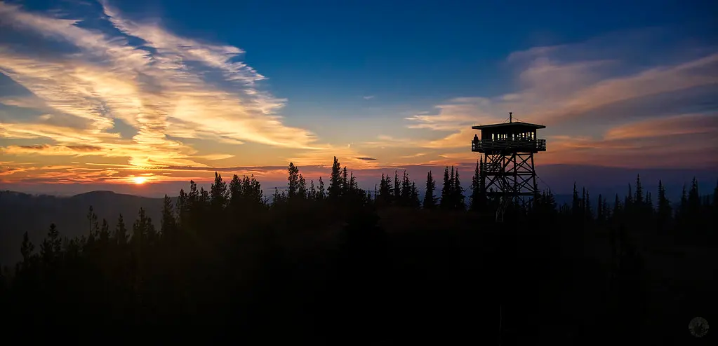
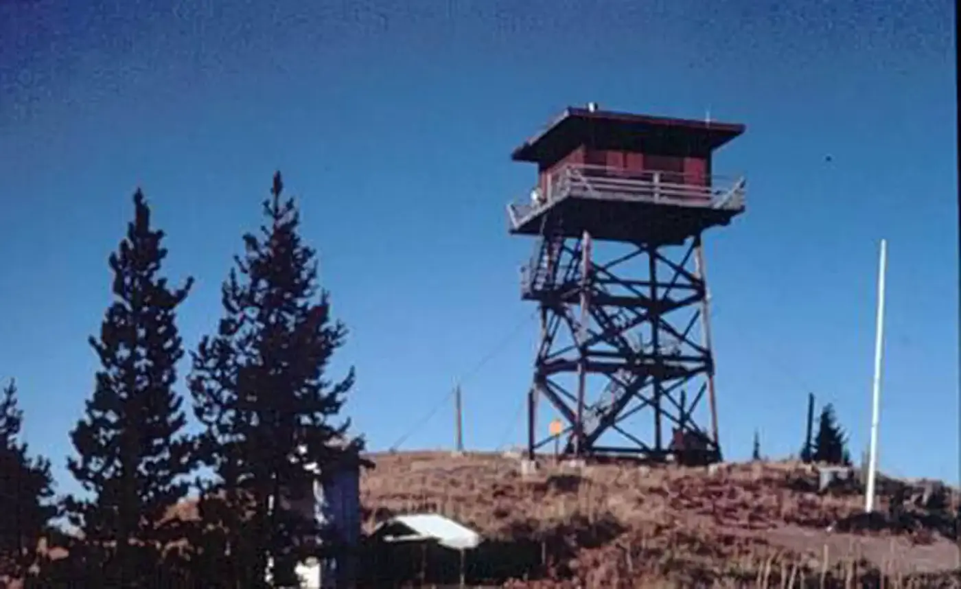
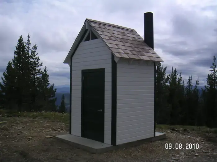
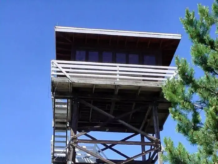
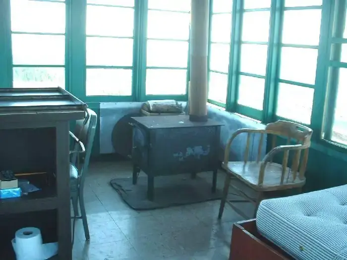
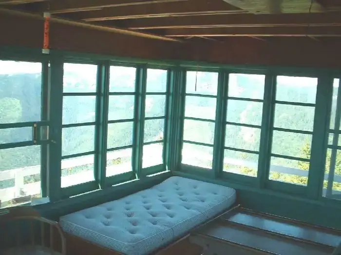
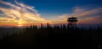
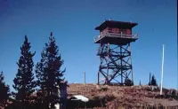
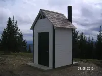
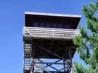
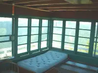
The cab stands thirty feet up on a treated timber tower. It is a flat-roofed R-6 with a catwalk around it, and inside is one room of 225 square feet. The room holds two single beds with mattresses, a table and chairs, a bench, and a wood heating stove, with firewood stacked at the base of the tower. There is no electricity and no drinking water. Guests carry up their own light, cooking gear, food, linens and pillows, and enough water for drinking, cooking and washing. Up to four may stay, and a vault toilet stands outside. The cabin is not cleaned between visits. Each party cleans before it leaves and packs its trash back down the mountain. Pets are not allowed, but campfires are. A food storage order on the forest requires that unattended food and garbage be kept in a bear-resistant container or a closed vehicle.
The Kootenai National Forest rents the lookout through the Cabinet Ranger District for $45 a night. According to the National Historic Lookout Register, Gem Peak is one of three rental lookouts on the district.
The road up Pilgrim Creek
Gem Peak lies about 8 miles southwest of Noxon in Sanders County. It rises above the Clark Fork River at the southern end of the Cabinet Mountains Wilderness. Firelookout.com gives its elevation as 6,092 feet, and the lookout register gives 6,029. In most weather a car can go the whole way. From Noxon, the Pilgrim Creek Road, No. 149, runs about 13 miles to Road 2205, which climbs about 2 miles more to a gravel pull-through below the tower. A longer route from Trout Creek crosses the Marten Creek Bridge and follows roads 151 and 2213 to the same last 2 miles. Access depends on the weather, and the district asks renters to telephone before arrival to confirm the road. The season opens at the end of June, and the summit has cell phone coverage.
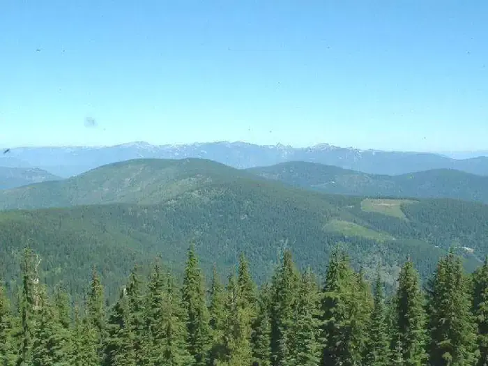
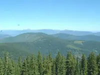
The catwalk looks over the Clark Fork valley and the Noxon country. The river flows north and west through the district, and the Bull and Vermilion rivers come in from the north. Peaks of 6,000 to 8,700 feet stand over the valley floor. In fall, stands of western larch and aspen turn yellow among the reds of huckleberry bushes, mountain maple and mountain ash. Huckleberries are picked in season on the land around the lookout. A trailhead nearby leads hikers and OHV riders into the district’s trails.
A tent on the peak
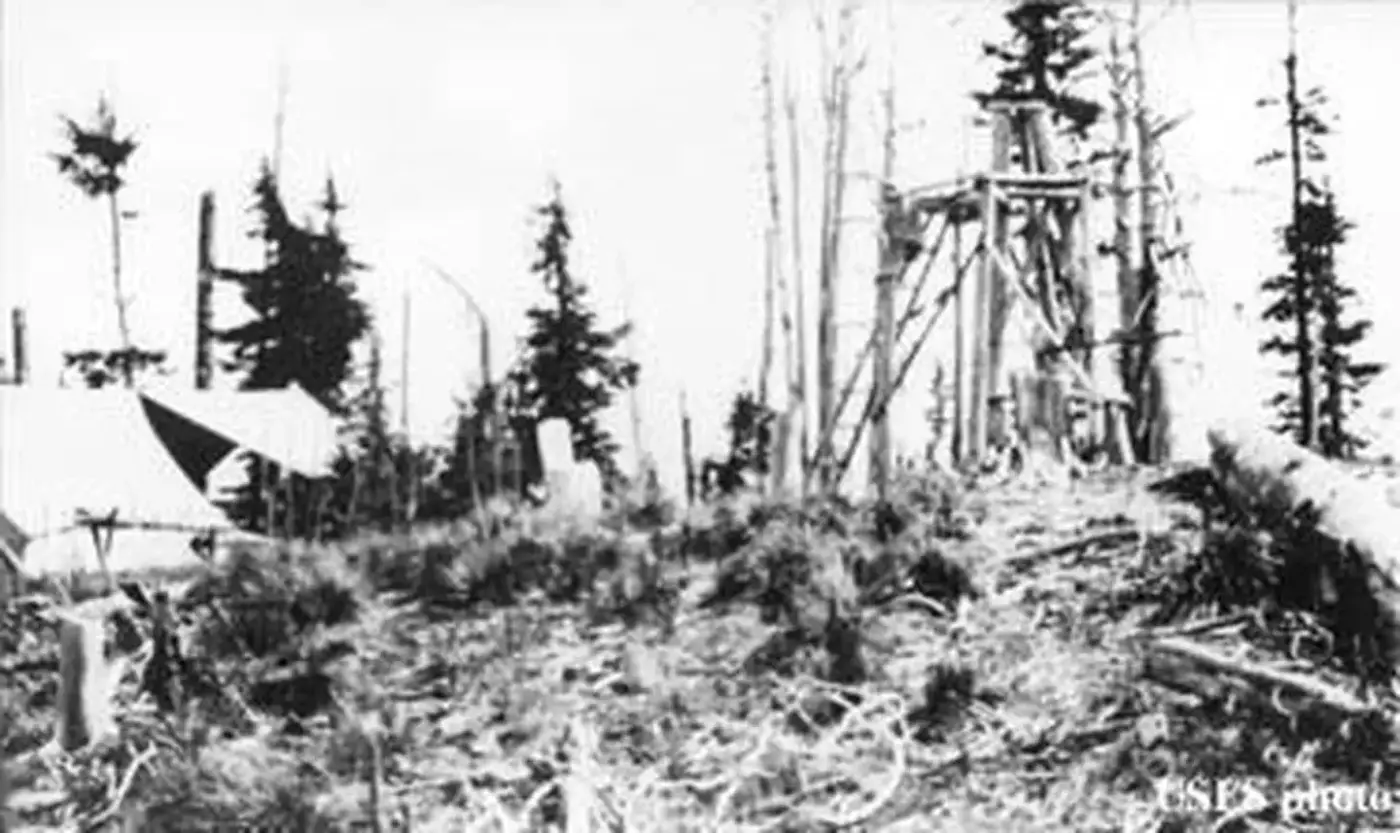
The lookout began as a camp. On July 15, 1920, the Sanders County Independent Ledger at Thompson Falls reported in its Forest Service news that Ranger Saint had installed the Squaw Peak and Gem Peak lookouts “during the last few days.” On August 5 the same column noted that Forest Supervisor Baker had returned from an extended field trip. On that trip he had visited Noxon, Squaw Peak, Gem Peak and the 20 Odd Lookout station, and had inspected a trail on the Idaho-Montana divide near the head of Martin Creek.
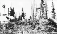
The Forest Service dates the lookout’s activation to 1921. It describes the first station as a “rag outfit”: a pole platform tent near a 15-foot open-platform tower. According to firelookout.com, Gem Peak remained the only one of the Noxon Ranger District’s regular lookouts without permanent living quarters until 1939. That year a 20-foot pole tower with an L-4 cab was built, ending what the lookout register calls “nearly two decades” under canvas. In 1964 the present tower and cab replaced it.
Lookouts staffed the 1964 cab into the 1970s. Firelookout.com records three of their names: Vic Six in 1959, Jan Fisher in 1961 and 1962, and Gary Meyer in 1967. The register says the lookout was staffed through the 1970s and gives no final year.
Number 180 on the register
After staffing ended, the Forest Service placed Gem Peak on its Recreation Rental program. On August 20, 1996, the National Historic Lookout Register entered it as US 180, MT 19, on the nomination of Gary Weber of the Forest Fire Lookout Association.
In 2021 Sherry Hagerman-Benton listed the county’s lookouts in her “Remember When” column for the Sanders County Ledger. Many of the others ended differently. Government Mountain was abandoned in 1950, Loveland Peak was destroyed in 1960, and Green Mountain was destroyed in 1966. Squaw Peak, which Ranger Saint had installed the same week as Gem Peak, was renamed Star Mountain in 2004. Her entry for Gem Peak closes: “Now available for rent on the Recreational Rental program.”
Notable Events
- 1920The newspaper reports that Ranger Saint had installed the Squaw Peak and Gem Peak lookouts during the preceding few days. newspaperarchive.com
- 1921Gem Peak Lookout was activated as a Forest Service pole-platform tent near an open-platform tower. nhlr.org
- 1939Gem Peak got permanent living quarters when a 20' pole tower with L-4 cab was built. firelookout.com
- 1964In 1964, the present 30' treated timber tower with R-6 flat cab was constructed. firelookout.com
- 1970sStaffed into the 1970's, it is now on the Recreation Rental program. firelookout.com
- 1970sThe present lookout was staffed through the 1970s; the source does not give a final staffing year. nhlr.org
- 1996Gem Peak Lookout was registered on the National Historic Lookout Register. nhlr.org
People
- Gary Meyer, lookout (1967).
- Jan Fisher, lookout (1961-1962).
- Vic Six, lookout (1959).
- Baker, Forest supervisor who visited Gem Peak on a field trip (1920).
- Ranger Saint, Ranger reported as having installed the Squaw Peak and Gem Peak lookouts (1920).
- Gary Weber, FFLA nominator of Gem Peak Lookout (1996).
Sources
- recreation.gov/camping/campgrounds/234434
- recreation.gov/api/camps/campgrounds/234434
- fs.usda.gov/r01/kootenai/recreation/gem-peak-lookout
- recreation.gov/camping/campsites/68185
- nhlr.org/lookouts/us/mt/gem-peak-lookout
- newspaperarchive.com/thompson-falls-sanders-county-independent-ledger-jul-15-1920-p-1
- newspaperarchive.com/thompson-falls-sanders-county-independent-ledger-aug-05-1920-p-1
- scledger.net/story/2021/08/26/communities/remember-when/6663.html
- fs.usda.gov/r01/kootenai/recreation/gem-peak-lookout
- firelookout.com/mt/gempeak.html