Flat Tops Trail Scenic Byway
Meeker and Yampa, Colorado. Colorado Scenic and Historic Byway.
Details
- Where
- Meeker and Yampa, CO. No street address stated. Directions
- Season
- The Byway is closed to automobiles in the winter due to snow.
- Getting there
- Begin the Byway at CO Hwy 13 and turn right onto County Rd 8.
- Access
- Allow 2.5 hours to travel the byway; fuel up in Meeker or Yampa before you travel; stop at the Ripple Creek Overlook for interpretive signage, views, restrooms and picnic tables.
- Phone
- (970) 878-5510
- Website
- visitmeekercolorado.com
- Managed by
- Yampa Ranger District, Medicine Bow-Routt National Forests.
At Montgomery’s General Store in Yampa, established in 1890, the cash register is still worked by hand crank and the sums are run on adding machines. Travelers on the Flat Tops Trail stop there for snacks and picnic supplies, and they fill the tank. The 82 miles of County Road 8 between Yampa and Meeker have no gas station and no amenities of any kind. Both towns have electric-vehicle charging, and the state has designated the route a Colorado Electric Byway. Cell service drops out at many points along the way.
Sources disagree on how long the drive takes. The Colorado Department of Transportation gives two hours, the Meeker visitor bureau two and a half, and the state tourism office three to five. About half the road is paved. Recreation.gov describes it from the Meeker end: pavement for about 40 miles into the White River National Forest, then about 40 miles of gravel over Ripple Creek Pass, then pavement again for the last five miles before State Highway 131 at Yampa. Any passenger car can make the trip in summer. The road turns muddy when wet, and rain or snow can make it hazardous. Much of the country is open rangeland, and the road crosses livestock barriers. Cattle, sheep, and horses wander onto the road, and deer and elk are abundant in the White River Valley.
Yampa and Dunckley Pass
Yampa grew from agriculture, lumber, and coal. Crossan’s M&A Market has stood on the corner of First and Main for more than a century and has been restored to hold a visitor center and the Yampa Town Hall. The Yampa-Egeria Museum occupies an original bank building on Main Street. The Yampa Ranger District, which manages the Routt National Forest side of the route, keeps its office in town.
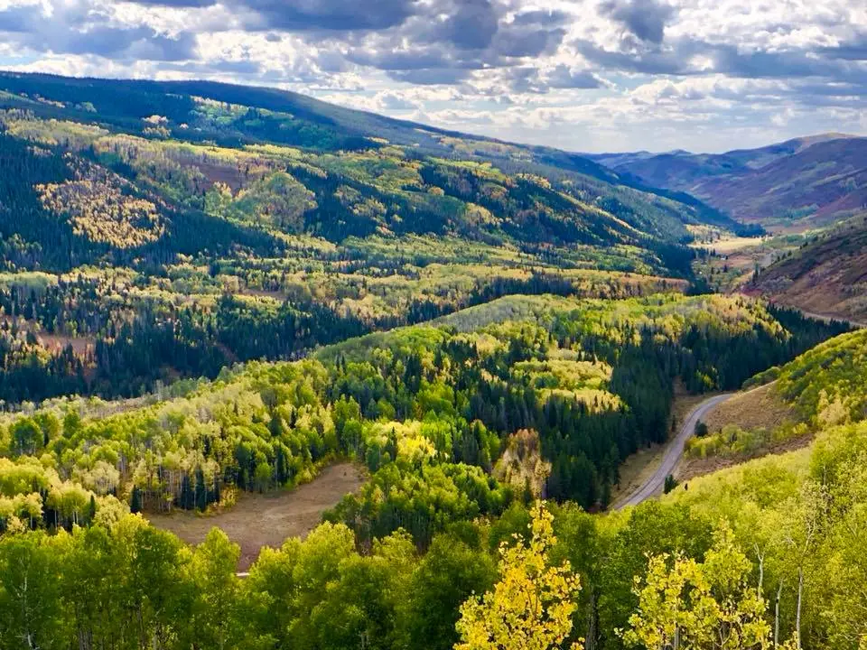
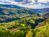
West of Yampa the byway enters the Routt National Forest and passes Trout Creek on the way to Dunckley Pass. The Colorado Department of Transportation spells the name Dunkley. A short trail leads from the pass to an overlook with picnic spots, and in fall the aspen groves below turn yellow. Two Forest Service markers stand side by side at the overlook, “People of the Shining Mountains” and “Footsteps in Time.” The second quotes Eddie Box Senior of the Southern Ute Tribe:
“My people roamed all over this country, over these mountain passes. They gathered to hunt buffalo and went back to the lower country when winter was approaching.”
The marker lists what the Ute hunted, which was deer, elk, buffalo, and rabbits. It also lists what they gathered, including berries, wild onions, and the edible root of the yampa plant, and it carries drawings of juniper, yampa, serviceberry, and wild currant. Campgrounds at Chapman Reservoir, Sheriff Reservoir, and Vaughan Lake lie in the Dunckley Pass area along County Road 8. The Pyramid Guard Station is listed on the National Register of Historic Places, and interpretive guides are on hand there in summer.
Ripple Creek Pass and the White River side
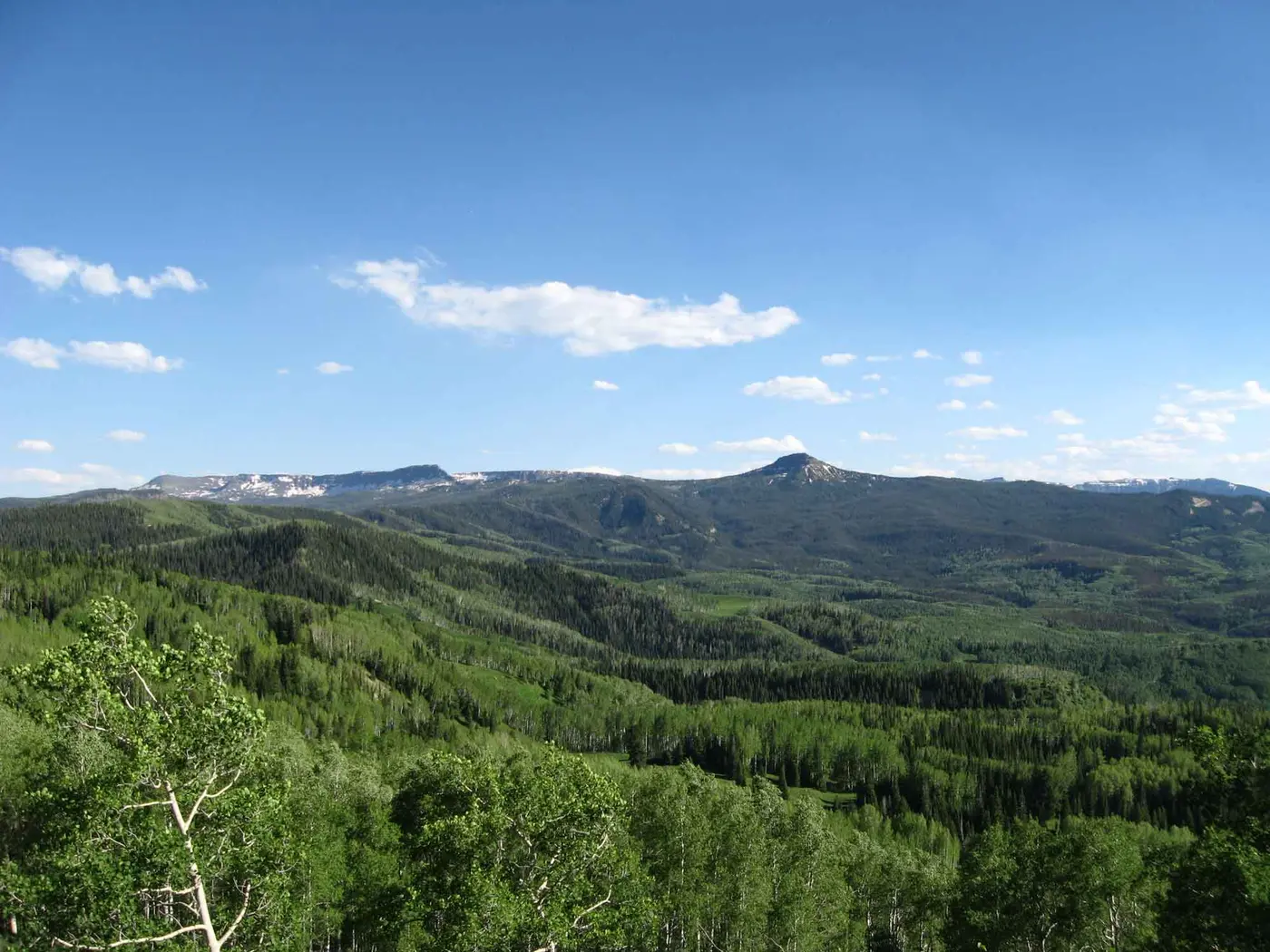
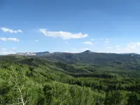
The road reaches its highest point, 10,343 feet, at Ripple Creek Pass. The overlook there has interpretive signs, restrooms, and picnic tables, and it looks out over the White River Valley and the forested Flat Tops Wilderness. Ripple Creek Lodge rents rustic cabins. A spur runs 8 miles south of the byway to Trappers Lake, where Trappers Lake Lodge rents cabins and non-motorized boats and runs a restaurant serving breakfast, lunch, and dinner.
The state calls the route a “working” byway. It is dotted with active mines, ranches, and timber-producing woodlands, and it serves as rangeland for local sheep and cattle ranchers. The Finger Rock Rearing Unit, a wildlife rearing unit, appears on the state’s list of byway features. The road passes through Buford, where the Buford–New Castle road joins it after a 42-mile run north from New Castle. In Meeker, the White River Museum occupies an original officers’ quarters from the late 1800s. The walls of the Meeker Hotel & Cafe are covered with pictures and biographies of past guests, President Theodore Roosevelt among them.
In winter the plowing stops at the Lost Creek trailhead, at mile marker 30 by the Meeker accounts and about mile point 31 by the state’s. A parking lot at the closure serves snowmobilers, snowshoers, and cross-country skiers, who head out from there onto groomed trail. The east side closes at Dunckley Pass. Twenty-eight miles east of Meeker, a turn toward Marvine Campground leads about three miles down County Road 12 to where the plowing ends. There the Marvine Snow Trail begins, a 2.2-mile groomed route with a yurt along the way that locals maintain and that is open to all.
Ute trails and a timber reserve
The byway follows historic Ute trails between winter camps near Meeker and summer camps high in the Flat Tops. A detail on the Dunckley Pass marker reproduces an 1877 drainage map of Colorado that shows the trails as the Ferdinand Hayden Expedition recorded them between 1874 and 1878. According to a Colorado State Library account drawn from the byway’s corridor management plan, the Utes were forced to leave northern Colorado after the Meeker Incident, and European-American settlers then used the trail for hunting and fur trapping.
The road crosses the heart of the original White River Plateau Timberland Reserve. The state describes the reserve as set aside in the late 19th century as the second unit of what became the National Forest system. The library account dates federal protection to 1891 and says the area was named the White River Forest Reserve by Teddy Roosevelt, who frequently visited. The modern road was built in sections as ranching, mining, and recreation opened up the country. It takes its name from the flat-topped mountains along the way, which belong to the White River Plateau, where the average elevation is about 10,000 feet. In 1992 the route was designated both a State Byway and a Forest Service Byway. Its corridor management plan is dated March 1994, and it is one of 26 Colorado Scenic and Historic Byways.
Trappers Lake and the cottages never built
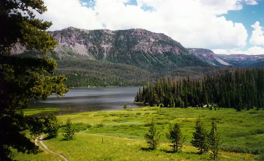
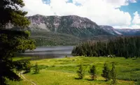
Trappers Lake covers 302 acres and holds native cutthroat trout. Steep volcanic cliffs rise behind it, and beyond them subalpine country gives way to alpine tundra. In 1919 Arthur Carhart, a Forest Service landscape architect, came to the lake to survey a site for summer cottages. The White River National Forest says that what he saw and experienced on the shoreline led him to strongly recommend to his supervisors that the area stay undeveloped. That plea made him the first Forest Service official to call for wilderness preservation. The state places the lake’s development ban two decades after the reserve was created, which it calls a foreshadowing of the 1964 Wilderness Act. The Forest Service calls the Flat Tops the “Cradle of Wilderness,” the place where the idea of wilderness was first applied to public land.
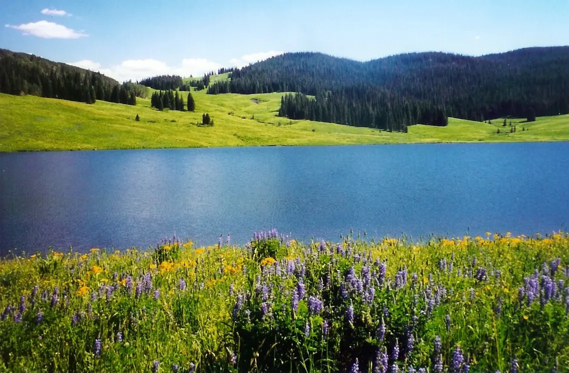
Congress designated the Flat Tops Wilderness in 1975. It covers 235,214 acres across the Routt and White River national forests, at elevations from 7,640 to 12,354 feet. The two forests rank it differently: the White River calls it Colorado’s second-largest wilderness and the Routt calls it the third. It holds roughly 110 lakes and ponds, many of them unnamed, about 100 miles of fishable streams, and more than 160 miles of trail. Motor vehicles, bicycles, carts, and drones are prohibited inside its boundary. On the higher slopes below the tundra stands a skeletal forest of dead spruce and fir, left by a bark beetle epidemic in the 1940s. In 2002 more than 17,000 acres burned around Trappers Lake and over 5,500 acres burned near Lost Lakes in the East Fork of the Williams Fork drainage, together almost 10 percent of the wilderness. The trail that circles the lake today is the Arthur H. Carhart Trail, No. 1815.
Notable Events
- 1874The Ferdinand Hayden Expedition recorded historic Ute trails followed by the byway. hmdb.org
- 1891The natural area received federal protection and was named the White River Forest Reserve by Teddy Roosevelt. coloradovirtuallibrary.org
- 1919Arthur Carhart's visit to Trapper's Lake prompted him to become the first Forest Service official to initiate a plea for wilderness preservation. fs.usda.gov
- 1940sA bark beetle epidemic left a skeletal forest of dead spruce and fir on the higher slopes below the tundra. fs.usda.gov
- 1975The United States Congress designated the Flat Tops Wilderness. fs.usda.gov
- 1992Designated a State Byway and Forest Service Byway. nsbfoundation.com
- 1994Flat Tops Trail Corridor Management Plan dated March 1994. codot.gov
- 2002More than 17,000 acres burned around Trappers Lake and over 5,500 acres near Lost Lakes in the East Fork of the Williams Fork drainage, amounting to almost 10 percent of the Flat Tops Wilderness. fs.usda.gov
- 2008Flat Tops Trail 2008 Marketing Plan. codot.gov
- 2015A Framework for Wayshowing for the Flat Tops Trail Scenic and Historic Byway dated October 2015. codot.gov
- The reserve was set aside as the second unit of what became the National Forest system. codot.gov
People
- Teddy Roosevelt, Named the White River Forest Reserve and frequently visited the area.
- Arthur Carhart, Forest Service landscape architect who stood on the shoreline of Trappers Lake and recognized the location's uniqueness (1919).
Sources
- codot.gov/travel/coloradobyways/northwest/flat-tops-trail
- meekerchamber.com/flat-tops-scenic-byway
- fs.usda.gov/r02/mbrtb/recreation/flat-tops-area
- colorado.com/byways/flat-tops-trail
- visitmeekercolorado.com/attractions/flat-tops-trail-scenic-byway
- fs.usda.gov/r02/whiteriver/recreation/flat-tops-wilderness-white-river
- codot.gov/travel/coloradobyways/northwest/flat-tops-trail
- coloradovirtuallibrary.org/resource-sharing/state-pubs-blog/colorados-scenic-and-historic-byways-flat-tops-trail
- recreation.gov/camping/gateways/13647
- visitmeekercolorado.com/attractions/flat-tops-trail-scenic-byway
- hmdb.org/m.asp?m=163893
- codot.gov/news/2014-news-releases/06-2014/colorado-byways-commemorates-silver-anniversary
- nsbfoundation.com/sb/flat-tops-trail-scenic-byway
- fs.usda.gov/r02/mbrtb/recreation/flat-tops-area