.jpg)
Drake Peak Lookout
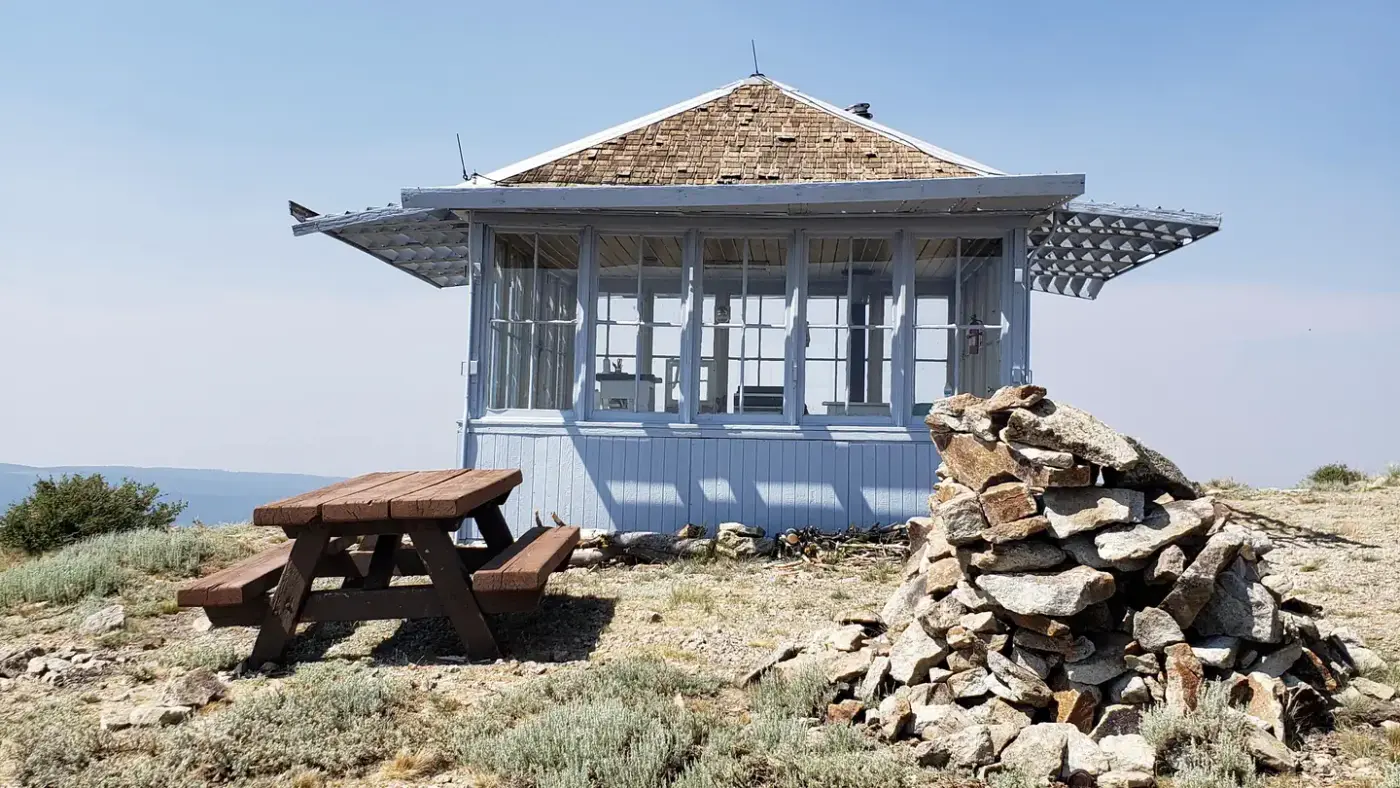
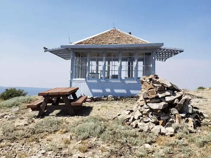
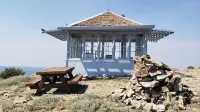
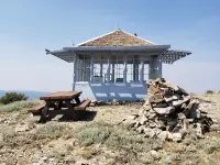
Lakeview, Lake County, Oregon. L-4 Aladdin ground house cabin.
Details

- Where
- Lakeview, Lake County, OR. No street address stated. Directions
- Season
- June 15 - October 15, depending on snow levels.
- Getting there
- From Lakeview, OR take Oregon Highway 140 north toward Paisley, Oregon. Following Hwy 140, turn right onto Hwy 140 east toward Adel, Oregon. Turn left onto Forest Service (FS) Road 3615 traveling north, then right on FS Road FS Road 019. Continue on FS Road 019 to the end of the road to reach the lookout.
- Fees
- $40 per night, per group, with a maximum of four occupants (a maximum of two adults is recommended). Fees are used directly for the maintenance and preservation of the lookout.
- Access
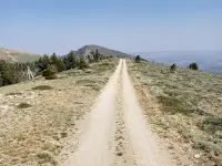
- The last five miles are known for dips, bumps, and boulders on a rough road and may require a four-wheel drive vehicle.
- Walk-in or reserve
- Reserve online at: www.recreation.gov or by telephone at 877-444-6777.
- Phone
- 877-444-6777
- Website
- fs.usda.gov
- Managed by
- Fremont-Winema National Forest.
- Established
- 1948.
- Coordinates
- 42.300518, -120.157721.
Fourteen feet square at the end of Road 019
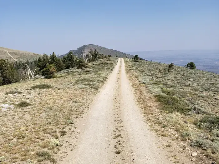
Forest Road 019 ends at a wooden cabin 14 feet on a side, on the crest of the North Warner Mountain Range in the Fremont-Winema National Forest. It is about an hour northeast of Lakeview. The way runs out Oregon Highway 140, north on Forest Road 3615, then onto 019, whose last five miles are known for dips, bumps and boulders and may call for four-wheel drive. Firelookout.com and the National Historic Lookout Register both name it the highest lookout in Oregon with road access. The Forest Service puts it at 8,222 feet. The register gives 8,352.
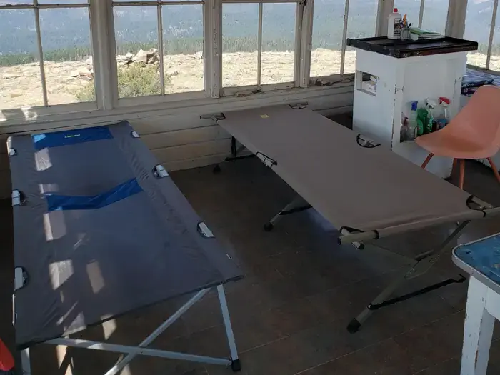
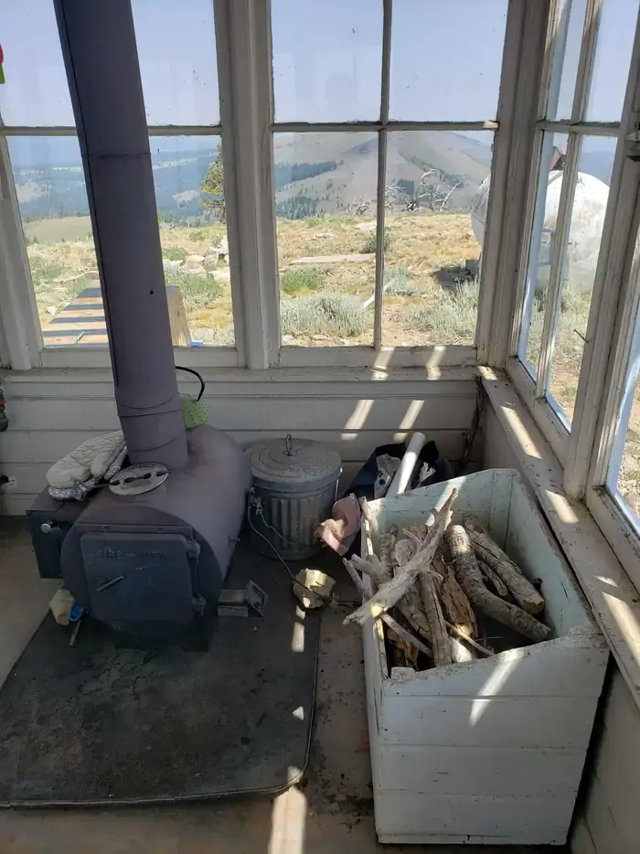
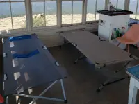
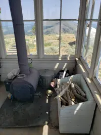
The door opens by combination lock. The Lakeview Ranger District supplies the numbers with the reservation. Inside are fold-up cots, a small table and chair, a propane cook stove, a wood stove for heat, and lights. An Osborne Firefinder also remains in the room: a large disk marked with map and compass directions, by which the lookouts who lived here fixed the position of a fire. Outside stand a picnic table and a vault toilet, with rocky ground for tents. There is no water on the mountain. Guests haul it in or fill jugs at Mud Creek Campground, about six miles away, and they bring their own firewood, bedding and cooking gear. The rent is $40 a night for a party of up to four, and the Forest Service puts the fees toward keeping the building up. The lookout is open from June 15 to October 15 as snow allows, and it may be closed for administrative use when large wildfires start nearby. It is still an active communication site, so renters may share the summit with other visitors, communication site users and Forest Service crews.
Vickie Connor of The Oregonian stayed here one September. She found a desk, chairs, the stoves, one usable cot, “a few goodies from past visitors,” and a very clean pit toilet. The door did not lock, the flies were countless, and the cabin was hot when she arrived in the late afternoon. She had cell service through her provider.
The view into three states
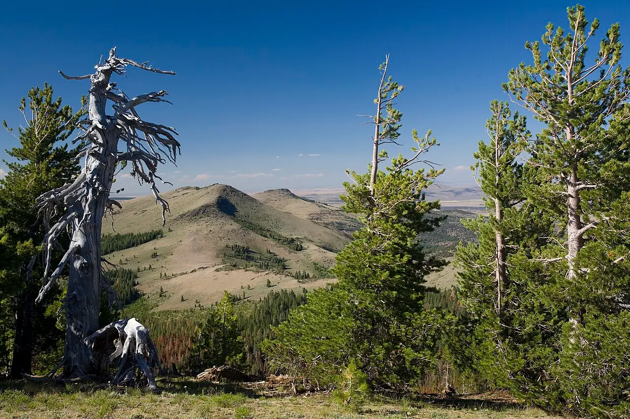
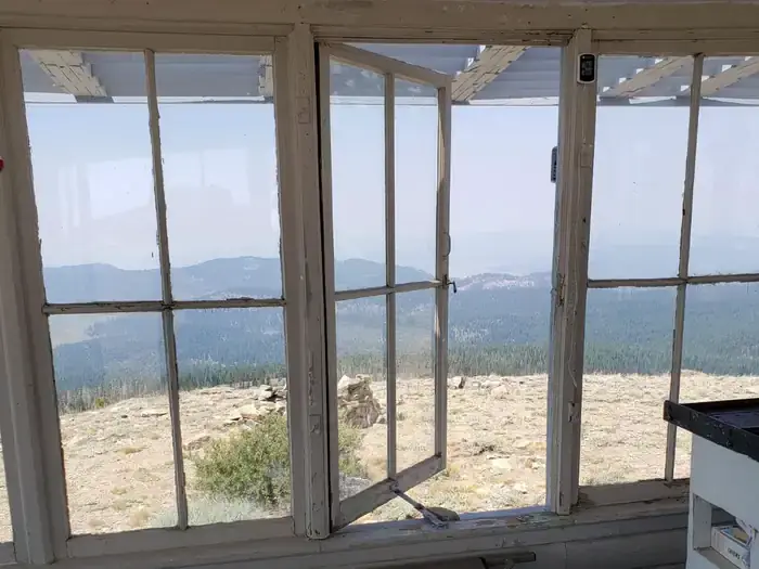
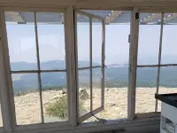
From the cabin the land opens into Oregon, California and Nevada: distant peaks, volcanic country and wide sage basins. The recreation.gov listing notes that the lookout does not stand on Drake Peak itself. That summit is one of several high points close by, along with Twelvemile Peak, Light Peak and Crook Peak, and the hike to it is the usual walk from the cabin. The surrounding Drake-McDowell country looks out on the Warner Mountains, Hart Mountain, Warner Valley and Abert Rim. The National Geodetic Survey lists the Abert Rim lookout tower, about 11.6 kilometers off, and the Cougar Peak lookout house, about 39, among the reference marks for this station.
Deer, Rocky Mountain elk and pronghorn live in the nearby forests, and black bears, mountain lions and bobcats range the area. In spring and fall, geese, ducks and swans pass overhead on migration. After dark the sky takes over. Connor brought a camera and tripod for star photography and wrote, “I couldn’t stop looking up to take in the night sky.”
A rider from Bull Prairie
Before there was any house on the mountain, the fire watch came on horseback. According to the Fremont National Forest’s own history, a man rode to the top of Drake Peak each day to look for smoke, in the years before telephone lines reached Bull Prairie and the peak. In June 1912 that rider was Walt L. Dutton, a forest guard. He reported no fires sighted and no calls to fight fire that summer. Dutton was born in 1889, came to Oregon in a covered wagon, and grew up on a ranch at Lakeview. He worked summers on the Fremont from 1911 while attending Oregon Agricultural College, and he rose to chief of the Division of Grazing in Washington, serving from 1936 until he retired in 1953. A 1940 editorial on supervisor Gilbert D. Brown, who ran the Fremont from 1910 to 1931, credited his administration with the roads, telephone lines and system of lookouts that replaced the old horseback trails.
The lookout register traces the mountain’s next steps. Drake’s Peak was first used as a patrol lookout and received fire-finding instruments in 1915. A small building followed some time later. In the summer of 1927 a standard Forest Service road was built next to the summit. A Forest Service description from 1935, kept in the National Geodetic Survey’s records, places the station on the western summit of Drake Peak, about 12 miles by air northeast of Lakeview. It describes the lookout house as “sitting on ground, and built in 1928.” A survey disk set in a buried boulder lay 23.57 feet west of the building’s center.
Light Peak, Drake Peak, and the 1948 cab
Accounts differ on where the earlier lookout stood. Firelookout.com says a D-6 cupola cabin went up in 1926 on Light Peak, half a mile to the northeast. In this version, the decision came in 1948 that a lookout on Drake Peak would work better. The National Historic Lookout Register puts the D-6 cupola on Drake Peak itself in 1928 and says the present building went up “brand new, next to the cupola.” The Coast and Geodetic Survey visited in 1948 and recorded the old house as wooden, built on the ground, about 12 feet square and 15 feet high. Their note said it would be dismantled in the near future and a new building erected on a foundation about 14 feet to the east.
The new building was an L-4 Aladdin ground house, finished in 1948 at a cost of $3,451.47. The Forest Service describes the life its keepers led: long, lonely hours with no time off, groceries and supplies packed in by horse or mule. Through the daylight they scanned the country for lightning, flames and curls of smoke. When they spotted something, they telephoned the location to the ranger station and helped map the blaze if it spread. At one time hundreds of lookouts like this one were in service across the Pacific Northwest. The Fremont’s history lists Margaret Kintigh as stationed on the Drakes Peak lookout in 1945. Howard Verschoor, the Oregon registrar, nominated the lookout to the National Historic Lookout Register, which entered it on March 31, 2003, as US 487 and OR 80.
A colonel’s name on a rhyolite dome
Oregon Geographic Names, in its 1952 edition, says the peak was named for John M. Drake, an officer in several campaigns against the Snake Indians in south central Oregon. He reached the rank of colonel toward the end of the Snake War.
The mountain is much older than the name. In 1980 Ray E. Wells of the U.S. Geological Survey described Drake Peak as an eruptive center of middle Miocene age, about 25 kilometers northeast of Lakeview. A large body of rhyolite pushed up from below and domed some two thousand meters of older andesite, basalt and volcanic rock. Rhyolite flows then erupted about 14.3 million years ago. Erosion has since cut deep into the core of the dome and exposed a ring of rhyolite three kilometers across.
The lookout register’s entry notes the summit’s present hazards plainly: “The biggest excitement at Drake Mountain Lookout on the Fremont National Forest comes when lightning strikes the adjacent propane tank.”
Notable Events
- 1912Dutton rode each day to the top of Drake Peak to look for fires; he reported no fires sighted or firefighting calls that summer. npshistory.com
- 1915Drake's Peak was first used as a patrol lookout and had fire-finding instruments installed. web.archive.org
- 1926A D-6 cupola cabin was built atop Light Peak 1/2 mile to the northeast in 1926. firelookout.com
- 1927In the summer of 1927 a standard Forest Service road was constructed next to the summit. web.archive.org
- 1928The Forest Service station description records a Drake Peak lookout house sitting on the ground and built in 1928. ngs.noaa.gov
- 1948In 1948 it was decided a lookout on Drake Peak would work better, so this L-4 cab was constructed. firelookout.com
- 1948The survey note says the existing lookout will be dismantled in the near future and a new building erected on a foundation approximately 14 feet east of it. ngs.noaa.gov
- 1948The lookout was built and previously served as an active U.S. Forest Service fire lookout. oregonlive.com
- 1948The present L-4 ground house was constructed, brand new, next to the cupola, at a cost of $3451.47. web.archive.org
People
- John M. Drake, namesake of Drake Peak; well-known officer in several campaigns against the Snake Indians in south central Oregon who reached the rank of colonel toward the conclusion of the Snake War.
- Walt L. Dutton, Forest guard who rode daily to the top of Drake Peak to look for fires (June 1912).
- Margaret Kintigh, stationed on the Drakes Peak lookout (Caruthers, California) (1945).
Sources
- recreation.gov/camping/campgrounds/234185
- fs.usda.gov/r06/fremont-winema/recreation/drake-peak-lookout-recreation-rental
- traveloregon.com/plan-your-trip/places-to-stay/campgrounds/drake-peak-lookout
- npshistory.com/publications/usfs/region/6/fremont/history/chap3.htm
- oregonlive.com/travel/2025/12/why-this-40-fire-lookout-cabin-is-oregons-best-kept-secret-for-incredible-night-photography.html
- ngs.noaa.gov/cgi-bin/ds_mark.prl?PidBox=NY0769
- npshistory.com/publications/usfs/region/6/fremont/history/chap6.htm
- nhlr.org/lookouts/us/or/drake-peak-lookout
- en.wikisource.org/wiki/Oregon_Geographic_Names_(1952)/D
- pubs.usgs.gov/publication/pp1124E
- firelookout.com/or/drakepeak.html