Columbia River Gorge Scenic Byway
Stevenson, Skamania County, Washington. Scenic byway; Year-round.
Details

- Where
- Stevenson, Skamania County, WA. No street address stated. Directions
- Getting there
- State Route 14 between Camas and Maryhill.
- Fees
- Various toll bridges to the Oregon side have fees.
- Phone
- 1-800-98GORGE
- Website
- stateofwatourism.com
- Managed by
- State of Washington Tourism.
State Route 14 follows the north bank of the Columbia River between Camas and Maryhill, along the very bottom of Washington. The Federal Highway Administration gives the byway as 80 miles and allows two to three hours to drive it. The state tourism office gives 90 miles and two hours, and recommends three days. Either way the road stays inside the Columbia River Gorge National Scenic Area, a canyon the Forest Service describes as 80 miles long and up to 4,000 feet deep. At the west end are forests of spruce and fir and basalt cliffs with waterfalls coming down them. By the east end the hills are treeless, the dry country of the Columbia Basin. Pullouts are frequent. Toll bridges cross to the Oregon side, and they charge fees. The road is open year-round. Spring and summer bring wildflowers and more traffic, and the state’s tourism office calls fall the quieter season.
Cape Horn to Stevenson
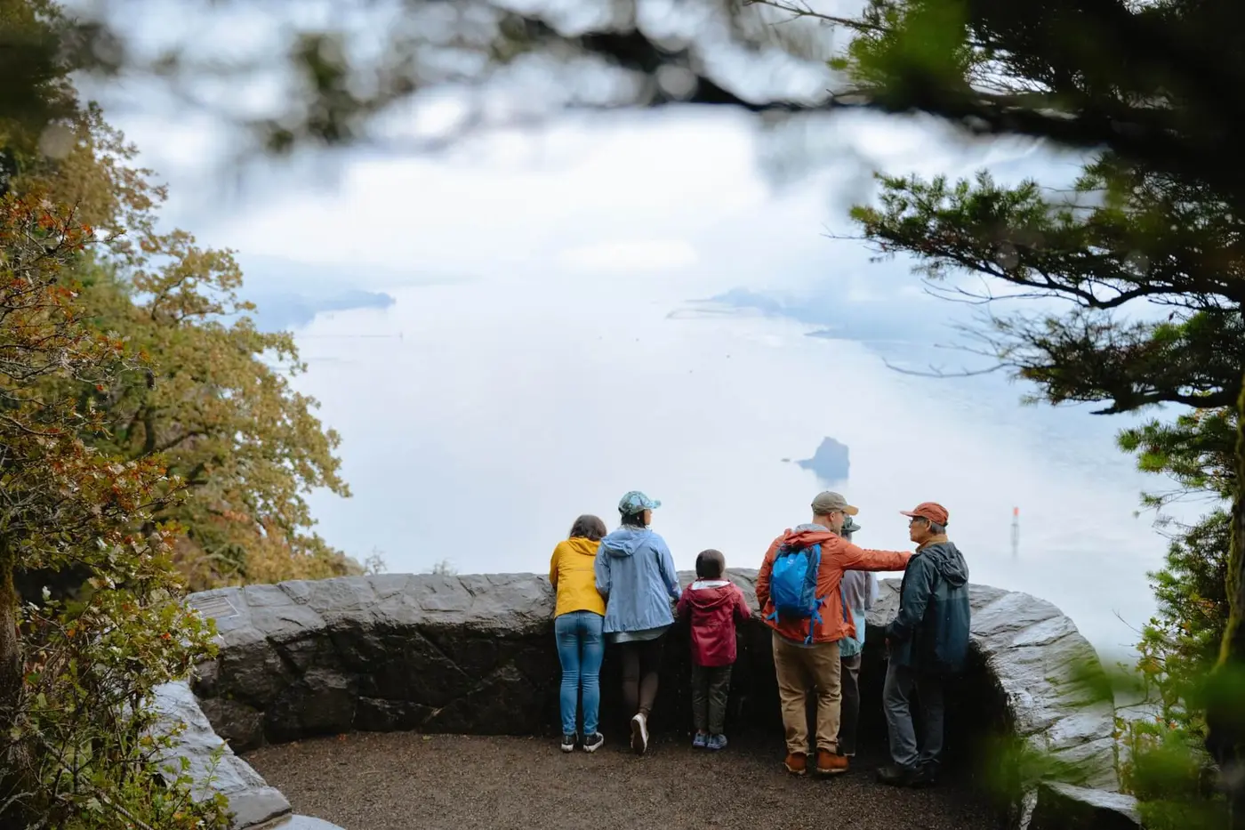
Cape Horn Lookout gives the first long view up the river. Below it, at Cottonwood Beach in Washougal, Lewis and Clark held the Corps of Discovery at “Provision Camp” on March 31, 1806, after tribes told them food was scarce to the east. The site is now Captain William Clark Park. Washougal also has the plant where Pendleton blankets are made, and it offers tours.
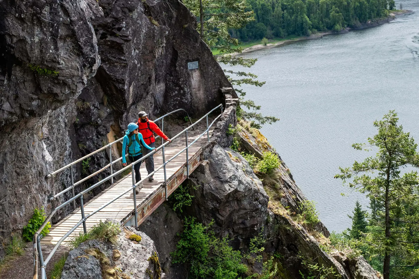
Beacon Rock stands 600 feet high at the water’s edge. It is the core of an ancient volcano. The Seattle Times puts the trail at 1.8 miles round trip, with more than 40 switchbacks that hug the rock. Rock climbers work its sheer walls. The surrounding state park has over 20 miles of roads and trails for hikers, mountain bikers, and riders.
Bonneville Lock and Dam crosses the river a few miles on. Fish ladders carry salmon, steelhead, and other native fish past it to spawn upstream. Migrating salmon can be seen from late April through early November, and the first two weeks of September are the peak. Public tours run as staffing allows, from the Bradford Island Visitor Center and the Washington Shore Visitor Complex. Nearby, Fort Cascades was built in 1855 as one of several forts guarding the portage around the Cascade Rapids. A 1.5-mile interpretive trail now crosses the site.
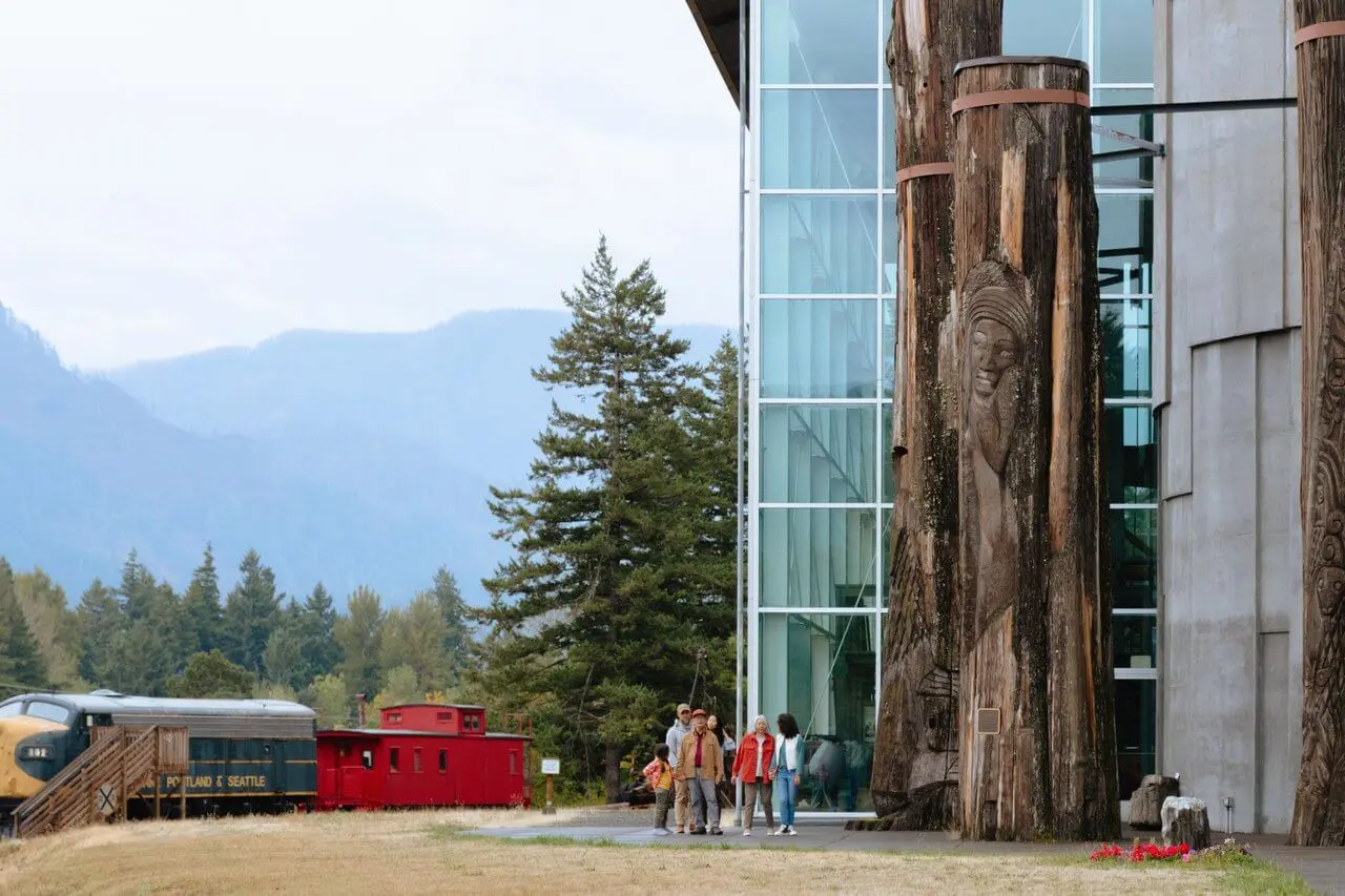
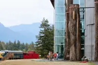
In Stevenson, the Skamania County Historical Society keeps the Columbia Gorge Interpretive Center Museum. Its indoor and outdoor exhibits include baskets, historical photographs, logging equipment, and a 1959 diesel locomotive. In 2012 the director, Sharon Tiffany, said one of the most popular exhibits had little to do with the Gorge. It is founder Don Brown’s collection of more than 4,000 rosaries, among them the one John F. Kennedy carried during World War II. The city advertises that “the Northwest’s best fish stories start in Stevenson.” Anglers take sturgeon near the dam and steelhead and salmon in the Wind River and Drano Lake. Upriver, Carson has mineral hot springs. Between Home Valley and Cook, the Dog Mountain trail climbs almost 3,000 feet in 7.3 miles to an upper meadow that is often covered in wildflowers.
White Salmon to the Maryhill Loops
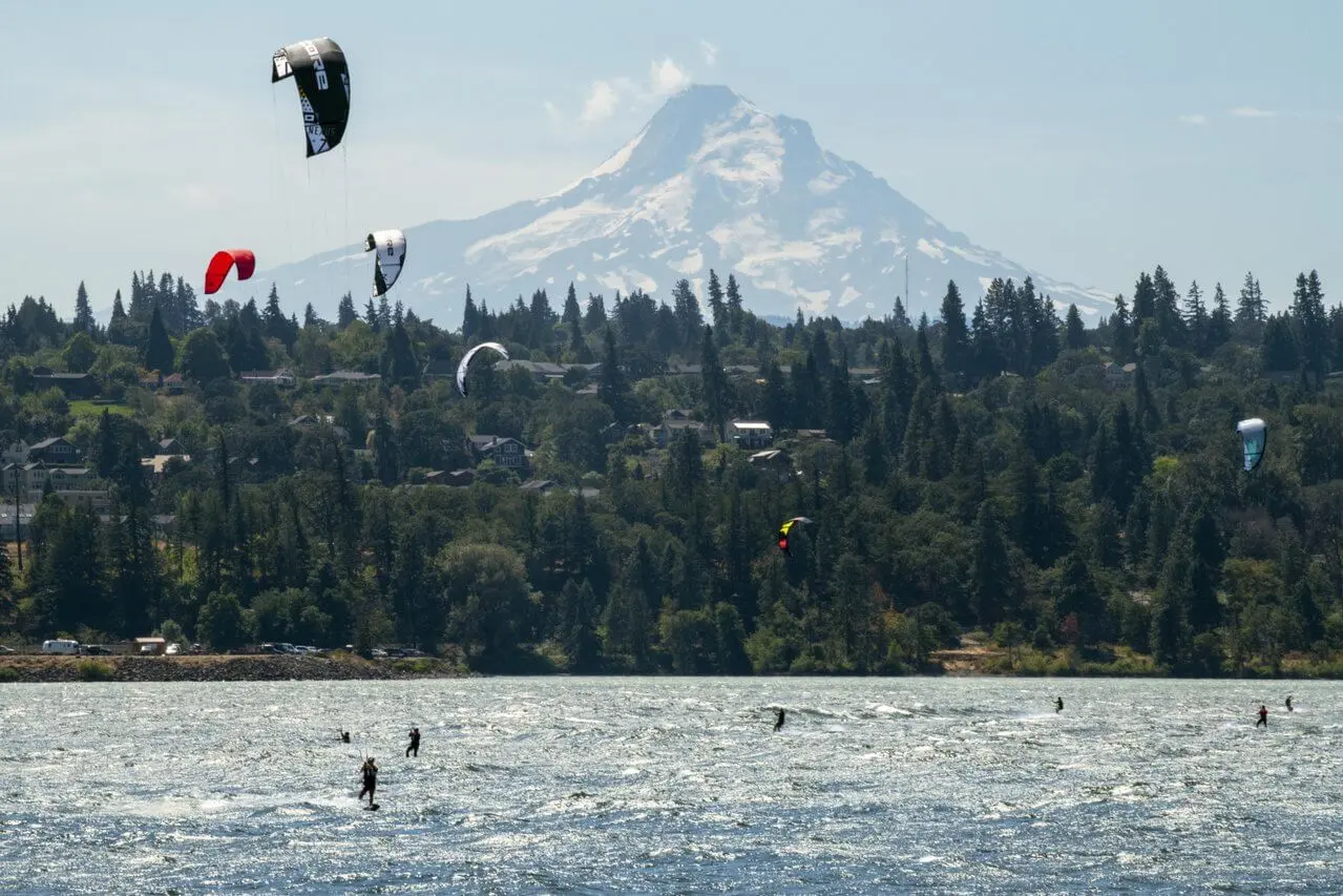
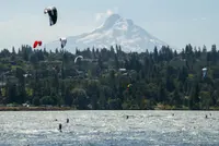
White Salmon and Bingen sit above the river and look across at Mount Hood. Bingen’s Gorge Heritage Museum occupies the former Bingen Congregational Church, dedicated in May 1912. The West Klickitat County Historical Society opened the museum in 1984. On the White Salmon River, Phil Zoller set up a rafting business after the 1980 eruption of Mount St. Helens ended his work as a fishing guide on the Toutle River. By 2012, three generations of his family were guiding trips through Class III and IV rapids. “We have something for everybody,” said Sherri Zoller, his daughter-in-law.
At Lyle, windsurfers launch from Doug’s Beach, which is undeveloped. Brian Hinde of Open Ocean Sailboards told The Seattle Times in 2012 that the best launches in the Gorge are on the Washington side, though the rental shops are in Oregon because Oregon has no sales tax. He warned beginners away from going out alone: “That’s like trying to learn to surf on Hawaii’s North Shore.” From a trailhead at the junction of routes 14 and 142, the unpaved Klickitat Trail runs 31 miles along the Klickitat River and through Swale Canyon. Catherine Creek Day Use Area has trails into the Gorge.
Lewis and Clark camped at Horsethief Lake in October 1805. The lake is now part of Columbia Hills State Park. Petroglyphs and pictographs there were saved from the water rising behind John Day Dam. They commemorate Wakemap Village, which now lies under Celilo Lake. Among them is Tsagagalalal, “She Who Watches.” The Temani Pesh-Wa display is self-guided and open in daylight from April through October. Some of the images can be seen only on scheduled tours.
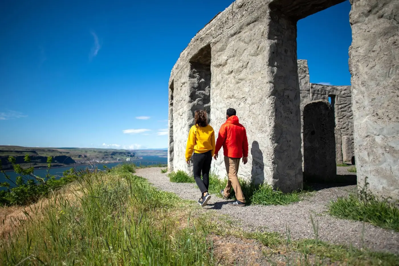
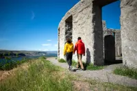
The byway ends at Maryhill. There, Sam Hill’s Beaux Arts mansion stands on 5,300 acres as the Maryhill Museum of Art. Its collection includes more than 80 works by Auguste Rodin, Orthodox icons, and chess sets. It also holds objects from the palaces of the Queen of Romania, who was a close confidant of Hill’s. The Théâtre de la Mode is there too: small mannequins dressed in the designer fashions of postwar France. Hill also built a life-size replica of Stonehenge nearby as a World War I memorial.
A landslide called the Bridge of the Gods
The Gorge is older than any of this. According to HistoryLink, it was formed by the Missoula Floods, the greatest scientifically documented floods in North America. The U.S. Geological Survey counts dozens of them, likely more than a hundred, during the last glacial period. It estimates peak flows of about 5 to 15 million cubic meters per second through Wallula Gap and down the Gorge. People had been in the region since 16,600 to 15,300 years ago, the Survey says, and “almost certainly witnessed the last of the Missoula floods.”
Much later, about 1450 AD by geologist Jim O’Connor’s account, the Bonneville Landslide broke from the southern face of Table Mountain on the Washington side. It filled more than five square miles of the valley with debris up to 400 feet thick. Behind that dam the river formed a lake perhaps 300 feet deep, reaching as far as Wallula Gap. The river eventually cut around the slide. The boulders it could not move became the Cascade Rapids, which Lewis and Clark mapped as “The Great Shoot.” HistoryLink tells it differently. In its version a stone bridge joined the two banks above the river’s tunnel for several hundred years, until an earthquake brought it down in 1700. The Chinookan peoples called it the Great Cross-Over.
O’Connor writes that the landslide almost certainly gave rise to the Klickitat legend. In that tradition people “could cross the river without getting their feet wet.” HistoryLink quotes the legend as the Klickitat tell it: “the Great Spirit had two warring sons, Pahto to the north of the river and Wy’east to the south. The Bridge of the Gods was created as a way for the family to meet, but the brothers fought over a beautiful woman named Loowit. Their anger shook the earth with fire. The bridge fell into the river.” The Great Spirit turned Pahto into Mount Adams and Wy’east into Mount Hood. Loowit became Mount St. Helens.
The river itself carried other names. The Chinookan people on its lower banks called it Wimahl, “the big river.” Sahaptin speakers upriver called it nc’ i-wána. A Spanish explorer named it the San Roque in 1775. Seventeen years later an American merchant seaman named it after his ship, the Columbia Rediviva.
Stevenson grew up just above the rapids. Felix Iman settled at the Cascades in September 1852 and built a water-powered sawmill. In 1893 an unauthorized crew moved the Skamania County records by night from the courthouse at Cascades to Stevenson. The summer flood of 1894 then destroyed Cascades, courthouse and all. The Stevenson Land Company platted the town on August 26, 1893. It was named for the brothers George and Momen Stevenson, who had come from Missouri.
Planning for a highway bridge between Stevenson and Cascade Locks began around 1920. Little was built until the Wauna Toll Bridge Company took over in 1925. The steel bridge was finished in October 1926 and given the old name, Bridge of the Gods. The first car across was a Chevrolet Landau Sedan. In September 1927 Charles Lindbergh flew the Spirit of St. Louis up the Gorge from Portland and passed low over the bridge. Then he “turned around and flew under the bridge.” In 1938 the bridge was raised 44 feet for the rising water behind Bonneville Dam, and the dam drowned the Cascade Rapids that same year. HistoryLink dates the dam’s start to September 1933 and its completion to June 6, 1938. Scenic Washington gives 1934 for the start. The Port of Cascade Locks still runs the bridge as a toll crossing, free to people on foot.
Donkey rails and the North Bank Highway
Getting past the Cascades shaped the corridor from the start. In 1851 a portage railroad powered by donkeys was built around the rapids at Stevenson. It was the first railroad in the Columbia Gorge. Cascade Locks and Canal opened in 1896. On March 11, 1908, James J. Hill’s Spokane, Portland, and Seattle Railway began service along the north bank. Its crews came from around the world: Hindus, Scandinavians, Chinese, Irish, and Greeks. The tracks pushed Stevenson uphill, away from the river.
A road took longer. Sam Hill could not persuade the Washington legislature to fund a river road east from Vancouver. In 1910 he started the Lyle Convict Road instead. Imprisoned men from a work camp near Lyle built it, and it was abandoned in 1911. Oregon took up his idea and built the Historic Columbia River Highway from Troutdale to The Dalles. “It could have been on our side,” Sandra Williams of the Maryhill Museum told The Seattle Times in 2012. “Then, who knows?” Hill finished the Maryhill Loops Road from Goldendale to the river in 1913. A winding 2.2-mile stretch of it is Washington’s first paved road. The museum owns that stretch and keeps it open to non-motorized users. Williams warned of rattlesnakes and wandering cows.
The Hood River–White Salmon bridge, a vertical-lift steel truss, went up in 1924. State Highway 8, the North Bank Highway, reached from Goldendale to Vancouver by 1926. In 1936 the highway was being built beside the railroad tracks across from Hood River. It became State Route 14 in 1967.
Boundaries drawn by Congress
In the 1950s Oregon and Washington each set up a Columbia River Gorge Commission to advise on planning. From 1980 to 1986 Friends of the Columbia Gorge pressed for federal protection of both banks, through nine major hearings in Oregon, in Washington, and in Washington, D.C. On November 17, 1986, President Ronald Reagan signed the Columbia River Gorge National Scenic Area Act. It created the nation’s second national scenic area, which is also its largest. The Forest Service gives the area as 292,500 acres. HistoryLink gives about 295,000 acres along an 83-mile stretch of the river, Stevenson included.
The Act drew thirteen urban areas where towns could grow, and it set aside the most sensitive lands for stricter rules. It authorized $5 million for a conference center in Washington, Skamania Lodge. A bi-state Gorge Commission adopted the management plan on October 15, 1991, and the Secretary of Agriculture concurred on February 13, 1992. The Act also made 11.1 miles of the lower Klickitat River a National Recreation River and 7.7 miles of the lower White Salmon a National Scenic River. Both reach the Columbia along Route 14.
Notable Events
- 1851A donkey-powered portage railroad was constructed to bypass the Cascades at Stevenson, Washington, the first railroad built in the Columbia Gorge. historylink.org
- 1908James J. Hill's Spokane, Portland, and Seattle Railway began providing service along the north bank of the Columbia through Klickitat County, letting farmers ship crops by rail. historylink.org
- 1910The Lyle Convict Road, a would-be north bank highway, was started in 1910 and abandoned in 1911, built by imprisoned men whose work camp was near Lyle. gorgefriends.org
- 1913Sam Hill finished work on the Maryhill Loops Road from Goldendale to the river; a winding 2.2-mile section, Washington's first paved road, is owned by the Maryhill Museum of Art. seattletimes.com
- 1924The bridge that carries SR 14 across the Columbia at Bingen and White Salmon was first built, a vertical lift steel truss bridge greatly altered since. historylink.org
- 1926The Wauna Toll Bridge Company took over the project in 1925 and completed the steel bridge in October 1926; a Chevrolet Landau Sedan was the first car across. historylink.org
- 1926State Highway 8, the North Bank Highway, was completed from Goldendale to Vancouver by 1926. historylink.org
- 1936Washington SR 14 was under construction next to the railroad tracks west of Hood River. hoodriverhistorymuseum.org
- 1950sBoth states created their own versions of a Columbia River Gorge Commission, which gave advice on planning and set legal boundaries for the areas they covered. gorgecommission.org
- 1967Since 1967 this scenic two-lane road has been designated State Route 14. historylink.org
- 1980Friends of the Columbia Gorge built political support for a national scenic area covering both sides of the Gorge, through nine major state and federal hearings in Oregon, Washington, and Washington, D.C. gorgefriends.org
- 1986An act of Congress created the Columbia Gorge National Scenic Area to protect an 83-mile-long stretch of the river, encompassing about 295,000 acres, including Stevenson. historylink.org
- 1991The Columbia River Gorge Commission adopted the Management Plan, and the U.S. Secretary of Agriculture concurred on February 13, 1992. fs.usda.gov
People
- Sam Hill, lobbyed Washington to build a paved highway on the north side of the Columbia River, and when the state balked went to Oregon; built the Maryhill Loops Road and founded the Maryhill Museum of Art at the eastern end of the route.
- James J. Hill, whose Spokane, Portland, and Seattle Railway brought north-bank rail service along the Columbia through Klickitat County in 1908, opening the corridor the byway follows (1828-1916, as stated in this essay).
- Meriwether Lewis, explorer of the gorge route the byway follows.
- William Clark, explorer of the gorge route the byway follows.
Sources
- stateofwatourism.com/scenic-byways/columbia-river-gorge-scenic-byway
- fhwaapps.fhwa.dot.gov/bywaysp/byway/2235
- scenicwa.com/story/two-days-exploring-the-columbia-river-gorge-scenic-byway
- oregonencyclopedia.org/articles/bridge_of_the_gods
- usgs.gov/publications/missoula-and-bonneville-floods-a-review-ice-age-megafloods-columbia-river-basin
- scenicwa.com/columbia-river-gorge
- gorgefriends.org/find-a-hike/lyle-cherry-orchard
- hoodriverhistorymuseum.org/sr-14-construction-2
- washingtonruralheritage.org/digital/collection/skamania