_(TL)_panorama.jpg)


Chinook Scenic Byway
Enumclaw, King County, Washington. All-American Road.
Details

- Where
- Enumclaw, King County, WA. No street address stated. Directions
- Getting there
- from Enumclaw, over Chinook Pass, to the fertile valley of Naches.
- Fees
- Some campgrounds charge fees.
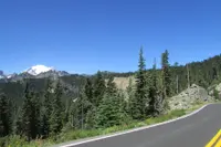
State Route 410 leaves Enumclaw at 770 feet and follows the White River toward Mount Rainier. It is a two-lane highway that crosses the Cascade Range at Chinook Pass, runs through the northeast corner of Mount Rainier National Park, and comes down on the dry side to Naches at 900 feet. The sources disagree on its length. The byway’s organizers give 92 miles and about two hours of driving. The Federal Highway Administration gives 85 miles and three hours. The Yakima Herald-Republic gave 87 miles in 2013. In winter the middle of the road is shut. The park service places the closures at milepost 57, Crystal Mountain Boulevard, 12 miles west of the summit, and at milepost 74.5, Morse Creek, five miles east. The road over the pass is typically open from late May into November.
Up the White River
The White River heads at Mount Rainier, which carries 26 glaciers. The U.S. Geological Survey starts its field guide to the mountain’s volcanic hazards in Enumclaw, then works back up the White River valley to study lahars. According to the Survey, Rainier’s steep, glacially carved valleys channel these flows, and even mild eruptions have sent large lahars into country now home to hundreds of thousands of people.
East of town the byway passes Mud Mountain Dam Park and Federation Forest State Park, where walks lead through stands of old growth. At Greenwater there are a general store, the Naches Tavern, a wool shop called Wapiti Woolies, and a ski shop that opens only in winter. Skookum Falls drops 250 feet on the far side of the White River and can be seen from the highway. Farther on, a moderate hike reaches Snoquera Falls, 450 feet and at full force in spring, and a half-mile path leads to Goat Falls. Morels grow in the Greenwater woods. The Dalles Campground, which the organizers place about halfway along the byway, sits among old-growth trees near one called the Granddaddy Tree.
At milepost 57 the Silver Creek Guard Station stands half a mile short of the park entrance. It is staffed some days between Memorial Day and Labor Day and serves more than 8,000 visitors between May and October. The turnoff there climbs to Crystal Mountain, which the byway calls the state’s only destination alpine ski resort: 57 marked runs, more than 350 inches of snow a year, and views of Rainier, St. Helens, Adams, Hood, and Baker. Much of the byway has no cell service. The organizers note that the short drive up to the resort will put a traveler back in range.
Inside the park the road bends south with the White River to Cayuse Pass, 4,675 feet, where State Route 123 comes in from the south. From there it turns east and climbs. The 11.6 miles between Chinook Pass and the park’s northeast boundary are a contributing structure of the park’s historic district. No park entrance fee is charged to drive through.
The arch at Chinook Pass
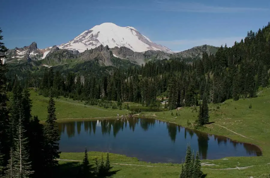
Tipsoo Lake lies near the top of the pass. Snow lingers there well into June or even July. Flowers open from late June through August, depending on melt and weather, and the list includes avalanche lilies, Hooker fairybells, and Lewis’ monkey flowers. Photographers, the byway organization reports, claim the display rivals any flowery meadow. Hoary marmots and browsing mule deer use the meadows. There are picnic tables near the parking area, swimming and wading in the lake are not allowed, and parking fills on busy days.
The Chinook Entrance Arch spans the highway at the summit, on the park’s eastern boundary. The park service gives the elevation there as 5,432 feet, two feet higher than the state’s figure. The Civilian Conservation Corps built the arch in 1936 as both an entrance portal and an overpass for hikers and horses on the Pacific Crest Trail. It is 90 feet long. Its deck rests on two cedar logs 36 inches thick, two more logs 30 inches thick serve as guardwalls, and its abutments are laid from irregular, mostly five-sided stones gathered along the roadsides. The words “Mount Rainier National Park” are carved into the wood. After nearly eight decades of weather and use, the park restored the arch in 2011 and 2012. The Naches Peak Loop, 3.4 miles from Tipsoo Lake, joins the Pacific Crest Trail and crosses the arch on its way back to the lake, past wildflowers in midsummer, huckleberries in early fall, and autumn color.
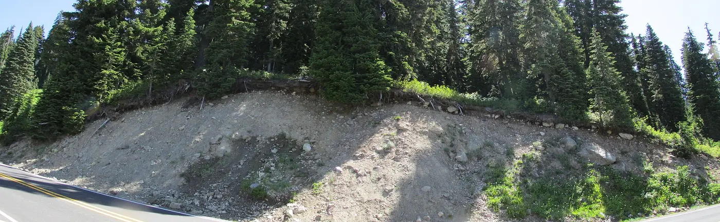
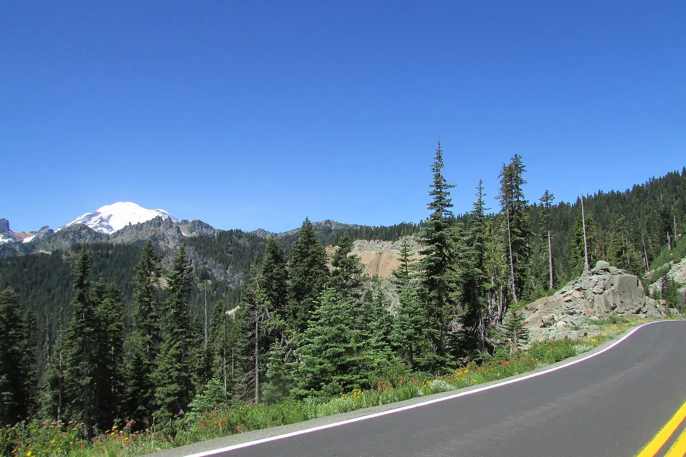
The WPA guide to Washington described the view from the summit. To the west lay “a tumbled rampart of mountain peaks”. To the east lay the deep valley of the American River. Northward stood “an orderly staircase of cliff-sided peaks”. To the south were jagged hills, “their snowy slopes stubbled with sparse green forests.” The sharp peaks around the pass are remnants of old lava flows, tilted steeply by intrusions from below. Only the rock pyramids resting on solid foundations escaped being ground down by glaciers. Red rock, andesite, and gray granite show in patches along the road. The pass takes its name from the chinook, a warm southwest wind that can melt deep snow in a few hours. According to the same guide, Native people named the wind for the direction it came from, the country of the Chinook tribe near the mouth of the Columbia River.
Down the American River to Naches
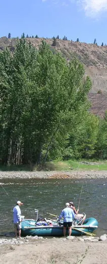
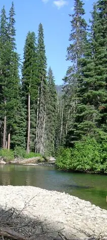
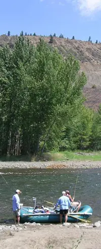
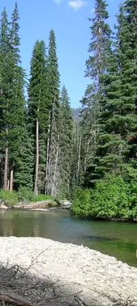
East of the pass the road leaves the park for the Okanogan-Wenatchee National Forest and follows the American River and then the Naches River. The country changes from dense western forest to talus slopes and basalt. Mountain goats climb the slopes below Fife’s Peak Viewpoint. Each August, Chinook salmon can be watched moving upstream past Pleasant Valley Campground to spawn. Huckleberries ripen in late summer and early fall around the Little Naches River.
The Bumping River Road runs south to Bumping Lake in the William O. Douglas Wilderness. The byway organization describes the lake as eighteen miles long in one place and as 1,300 acres in another. Its peaks hold snow until late June. A small marina, open May to September, sells supplies, rents boats, and runs a launch, and the lake holds rainbow and cutthroat trout, silvers, and whitefish. In 1913 the Yakima Herald-Republic’s editorial board called the Bumping Lake country the hiking grounds of “Yakima’s own William O. Douglas,” the late Supreme Court justice.
Whistlin’ Jack Lodge at Cliffdell sells gas. It is 27 miles from there to the summit and the park’s east entrance. Downriver are Gold Creek Station and Mountain Mamma’s Home Cooking, then the Nile Valley, then Naches, which has a single gas station at the stoplight on Highway 12. A brewery and a wine tasting room stand on that highway, and two more wineries sit in the hills above the valley. Suntides Golf Course lies near rock cliffs inscribed with ancient Indian petroglyphs. Past Naches the Yakima Valley wine country begins.
Wagon road, highway, parkway
A park service account dates the road over the pass to the 1890s. It says the state built it, probably along several older trails, and first called it State Road 1 and then the White River-Naches Road. The Yakima Herald-Republic is more exact: as a state route it began as a wagon road late in 1897, eight years after Washington became a state. At various times it formed part of a longer McClellan Pass Highway, and then of the Naches Pass Highway. The WPA guide placed the pass some 20 miles south of the old immigrant crossing through Naches.
The park service gives two dates for the modern road’s construction. Its account Highways in Harmony says the state began the Naches Pass Highway in 1927, running from Auburn through Enumclaw, along the park’s eastern edge to Cayuse Pass, then east over Chinook Pass toward Yakima. Its list of historic structures gives the road’s construction as 1916 to 1932, by the Washington State Department of Highways. In 1931 the park boundary was extended to take in the Ohanapecosh area and the highway. The road was finished in 1932 and renamed Mather Memorial Parkway for Stephen T. Mather, first director of the National Park Service, who had led the plan to preserve a timber belt along the highway both in the park and in the national forests beside it. A park photograph from the 1930s shows officials inspecting snow removal at the Chinook Pass entrance.
In the 1930s the road also became part of State Road No. 5, the National Park Highway. The Eastside Highway, now State Route 123, reached Cayuse Pass in 1940, and the two roads together formed the first through-road in the park. Near Cayuse Pass its retaining walls rise as high as 25 feet. In 1970 the state renamed the road over the pass State Route 410. A park photograph from June 1984 looks west from the summit along a freshly plowed road between tall snowbanks, with Rainier behind.
Two All-American Roads in Washington
Congress created the national scenic byway program in 1991. On June 9, 1998, the Chinook Scenic Byway was designated an All-American Road. Of Washington’s 28 scenic byways, only it and the International Selkirk Loop, near Spokane, hold that rank. A corridor management plan was drawn up in 1999. The Chinook Scenic Byway, a nonprofit board of citizens and agency representatives, adopted a strategic plan in 2007.
Even so, the Herald-Republic reported in 2013 that “for decades, SR 410’s designation as Chinook Scenic Byway has gotten limited attention.” That year a $60,000 federal grant and a $20,000 match from the park paid for a new plan that would take in the east side for the first time. Public meetings were held at the Naches Train Depot on October 15, 2013, at the Nile Clubhouse the next night, and at the Enumclaw Community/Senior Center on November 13. Ron Myers, owner of Gold Creek Station, said he was “completely in the dark now” about what the plans could mean for his business, but intended to find out. The finished plan, credited to the board and to Curt Warber of Parametrix, was released at the annual meeting in September 2016.
Danielle Surkatty, a board member, described the travelers the road draws: “People take this route because they want to, not because they need to get somewhere.”
Notable Events
- 1890sThe road over Chinook Pass was started in the 1890s by the state of Washington and probably followed several older trails. tumblr.com
- 1897As a state route, the road over Chinook Pass started as a wagon road late in 1897, just eight years after Washington became a state. yakimaherald.com
- 1927The State of Washington began construction of the route. npshistory.com
- 1930sIn the 1930s, this section of road was included in the bigger State Road No. 5, also known as the National Park Highway. tumblr.com
- 1931Mount Rainier National Park expanded to include the Ohanapecosh area and the Naches Pass Highway. nps.gov
- 1932The Naches Pass Highway was completed and renamed Mather Memorial Parkway. nps.gov
- 1936The rustic-style arch over the park road at Chinook Pass was built in 1936 by the Civilian Conservation Corps. nps.gov
- 1970In 1970 the state of Washington renamed the road over Chinook Pass as State Route 410. tumblr.com
- 1991The national scenic byway program was established by Congress in 1991 to preserve and protect the nation's scenic but often less-traveled roads and promote tourism and economic development. yakimaherald.com
- 1998The Chinook Scenic Byway was designated on 6/9/1998 as an All-American Road in Washington. scenic.org
- 1999The byway's historic documents list a Chinook Scenic Byways Corridor Management Plan dated 1999. chinookscenicbyway.com
- 2011Deteriorated by the elements and nearly eight decades of use, the arch prompted Mount Rainier National Park to undertake a massive restoration project in 2011 and 2012. nps.gov
- 2013Public workshops for community input on the Corridor Management Plan opened at the Naches Train Depot, with further meetings at the Nile Clubhouse and the Enumclaw Community/Senior Center. chinookscenicbyway.com
- 2016The Chinook Scenic Byway Corridor Management Plan, the effort of many years of work, was released at the Annual Meeting in September 2016. chinookscenicbyway.com
People
- Stephen T. Mather, The first National Park Service director and namesake of Mather Memorial Parkway; he promoted preserving a timber belt along the highway.
- Stephen Mather, first director of the National Park Service, in honor of whom the road is known as the Mather Memorial Parkway.
- Danielle Surkatty, member of the Chinook Scenic Byway's board of directors, speaking for the corridor's promotion and planning.
- William O. Douglas, the late Supreme Court justice of Yakima, whose hiking grounds along the byway included the Bumping Lake area east of Chinook Pass.
Sources
- chinookscenicbyway.com
- chinookscenicbyway.com/aboutus.html
- chinookscenicbyway.com/pointsofinterest.html
- chinookscenicbyway.com/activities.html
- chinookscenicbyway.com/planyourtrip.html
- chinookscenicbyway.com/corridormanagementplan.html
- fhwaapps.fhwa.dot.gov/bywaysp/byway/2226
- wsdot.com/travel/real-time/mountainpasses/Chinook
- chinookscenicbyway.com/contactus.html
- chinookscenicbyway.com/news.html
- chinookscenicbyway.com/photogallery.html
- chinookscenicbyway.com/360photogallery.html
- facebook.com/ChinookScenicByway
- tumblr.com/mountrainiernps/679278937839403008/the-road-over-chinook-pass-on-the-modern-day
- scenic.org/all-national-scenic-byways-and-all-american-roads
- nps.gov/mora/learn/historyculture/historic-roads-and-other-structures.htm
- npshistory.com/publications/highways/mount_rainier/mount_rainier9.htm
- usgs.gov/publications/geologic-field-trip-guide-volcanism-and-its-interaction-snow-and-ice-mount-rainier