Castle Butte Lookout
Kooskia, Idaho County, Idaho. Lookout cabin.
Details

- Where
- Fenn Ranger Station 831 Selway Rd, Kooskia, ID 83539. Directions
- When
- Check-In: 2:00 PM; Check-Out: 2:00 PM.
- Season
- Season Start Jul 31, 2027; Season Closes Sep 15, 2027.
- Getting there
- From Missoula, MT: Take US Highway 12 West about 78 miles (milepost 139.7) to Forest Service Road #107. Turn right onto Forest Service Road #107 (Saddle Camp and Gravey Creek) approximately 8 miles. Turn left at the first left in the intersection onto Forest Service Road #500 (Lolo Motorway).
- Access
- No cell phone coverage; nearest payphone 45 miles away in Powell, Idaho; bring a map. Access road is very rough, high clearance 4x4 vehicles advised. No water is available at the lookout.
- Walk-in or reserve
- Reservation through Recreation.gov; sites operate on a 6-month rolling booking window; availability released Jan 31, 2027 at 08:00 AM MDT through Jul 31, 2027.
- Phone
- 208-926-4258
- Website
- recreation.gov
- Managed by
- Nez Perce-Clearwater National Forests.
- Established
- 1950.
- Coordinates
- 46.4341667, -115.2191667.
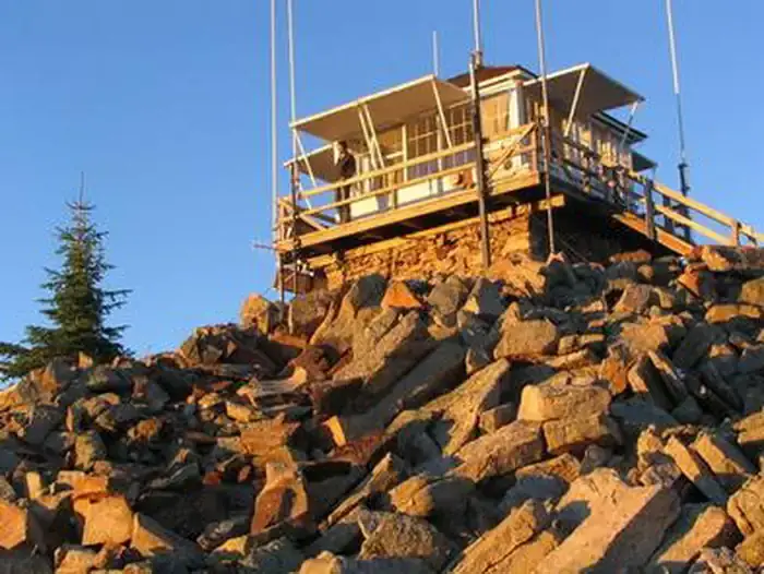
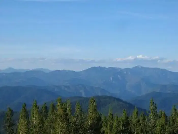
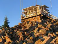
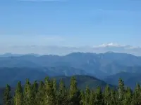
The last stretch is on foot: about 100 feet up steep, rocky ground to a square cab with a catwalk, set on a rocky point 6,659 feet above sea level by the Forest Service’s figure. The National Historic Lookout Register gives 6,632. From the catwalk the view runs all the way around: the Selway-Bitterroot Wilderness, the Seven Devils Mountains, the Great Burn, and the deep canyons at the head of the North Fork of the Clearwater River. Close in, the rock gives way quickly to dense lodgepole and ponderosa pine. The Nez Perce-Clearwater National Forests rent the lookout by the night, and the lock combination arrives with the confirmation email.
Four sleepers and a propane stove
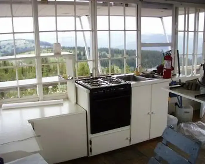
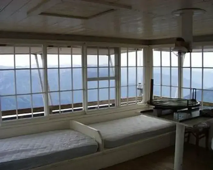
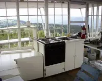
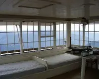
The cab sleeps four, on two twin beds with foam mattresses and two cots. There is a table with two chairs, a mop and bucket, and propane for the cook stove, the lights, and the heater. There is no electricity and no water, and there is no close water source. Guests bring their own water, bedding, matches, cookware, toilet paper, and emergency lighting. Candles are not allowed. The toilet is a pit toilet in a separate building outside, and garbage goes back down the mountain with the guests. Pets are allowed and livestock are not. The Forest Service discourages bringing children “because of the inherent danger of such a facility.”
The point is not wholly private. The Forest Service notes that its employees and members of the public sometimes come up to use the pit toilet or to look out from the peak and the cabin walkway. The rental description lists eagles, bears, moose, elk, deer, and mountain goats in the country below, and it commends the point for sunrises, sunsets, and stars. Huckleberries are abundant in summer. For the 2026 season the Forest Service listed the lookout open by reservation from July 13 to September 14.
Road 500 and the Castle Butte spur
The way in is the Lolo Motorway, Forest Service Road 500. It is a primitive single-lane road built by the Civilian Conservation Corps in the early 1930s, and it runs 100 miles through the mountains with no services along it. The Forest Service also calls it the Lolo Trail National Historic Landmark Corridor. Along it, hikers and off-road riders follow the routes of the Nez Perce and of Lewis and Clark, and four high mountain lakes lie in the area. In summer the meadows and hillsides along the road are covered in wildflowers. Large RVs, trailers, and low-clearance vehicles are advised to stay off it.
Every road beyond US Highway 12 is gravel or dirt. From Missoula the route leaves the highway at milepost 139.7 onto Road 107, then follows the Motorway west for about nine and a half windy, narrow miles. It then turns south onto Road 561, the Castle Butte Road. Recreation.gov puts that spur at about a mile and a half of very rough, rocky, bumpy going, and the Forest Service puts the lookout two miles off the Motorway. The estimated drive is three hours from Missoula, four from Kamiah, and five from Kooskia. There is no cell coverage, and the nearest pay phone is 45 miles away in Powell. Cat House, writing for the Idaho Fire Lookouts site, gave this verdict: “Some call this road challenging – we called this road FUN!”
Castle Rocks to an L-4 cab, 1898–2004
The butte was on paper before it held a building. J.B. Leiberg’s 1898 map of the Bitter Root Forest Reserve names Castle Butte along with Rhodes Peak, Indian Post Office, Sherman Peak, Rocky Ridge, and Weitas Meadows. The Clearwater Story, a history of the Clearwater National Forest, credits no earlier map with the name. The same history says the place was first called Castle Rocks: before the top was flattened for a building, the rocks were said to resemble a castle.
The first building went up in 1916. The National Historic Lookout Register calls it a frame cabin, and the Idaho Fire Lookouts site calls it “the first log frame lookout cabin.” Citing a Lochsa book, that site names the men on the point in 1922: Elmer Wierings, Elmer Thompson, Roy Canfield, Charlie Catherman, George Kernan, and Hugh Curry. It lists Troy Bokstruck for 1924. Bob Chenowith follows for 1927, drawn from Fire Lookouts of the Northwest.
In 1928 the first cabin gave way to an R-1 log cabin with a cupola, and the site lists “Chenowith & Larsen” there the following year. That cabin stood until 1950, when the present cab was built: 14 by 14 feet, an L-4 with a catwalk, on a ten-foot base. The register says the base is stone, and the Idaho Fire Lookouts site says concrete.
The register entered the lookout on March 22, 2004, as US 573 and ID 43, on the nomination of Virginia Tillotson. Its entry records that the cab had been “recently rehabbed” and placed in the recreation rental system.
Notable Events
- 1898Castle Butte is one of the features named on J.B. Leiberg's 1898 map of the Bitter Root Forest Reserve, the earliest map this forest history credits with the name. npshistory.com
- 1916In 1916 the first log frame lookout cabin was built. idahofirelookouts.com
- 1928In 1928 a log cabin featuring a cupola was built. idahofirelookouts.com
- 1930sThe Lolo Motorway, the primitive single-lane road that reaches the lookout, was constructed by the Civilian Conservation Corps in the early 1930s. recreation.gov
- 1950In 1950 the current L-4 cabin on a 10' concrete base was built; this page states a concrete base where the National Historic Lookout Register states a stone base. idahofirelookouts.com
- 2004Registered on the National Historic Lookout Register March 22, 2004, under registry numbers US 573 and ID 43; nominated by Virginia Tillotson. web.archive.org
People
- Charlie Catherman, known staff of the lookout (1922).
- Elmer Thompson, known staff of the lookout (1922).
- Elmer Wierings, known staff of the lookout (1922).
- George Kernan, known staff of the lookout (1922).
- Hugh Curry, known staff of the lookout (1922).
- Roy Canfield, known staff of the lookout (1922).
- Troy Bokstruck, known staff of the lookout (1924).
- Virginia Tillotson, nominated the lookout to the National Historic Lookout Register.
Sources
- recreation.gov/camping/campgrounds/234325
- recreation.gov/camping/campsites/83873
- npshistory.com/publications/usfs/region/1/clearwater/story/appb.htm
- npshistory.com/publications/usfs/region/1/clearwater/story/chap8.htm
- fs.usda.gov/r01/nezperce-clearwater/recreation/castle-butte-lookout
- web.archive.org/web/2024id/https://nhlr.org/lookouts/us/id/castle-butte-lookout
- idahofirelookouts.com/st-joe-clearwater-region/castle-butte-lookout
- web.archive.org/web/20250323040908/http://nhlr.org/lookouts/us/id/castle-butte-lookout