
Cascade Valleys Heritage Corridor
Washington. Washington State Scenic Byway; Open year-round.
Details
- Where
- WA. No street address stated. Directions
- Getting there
- State Route 202 between Woodinville and North Bend.
State Route 202 leaves the Sammamish River Valley at Woodinville and runs southeast to North Bend, keeping to the Snoqualmie River for much of its length. The national byway listing gives the drive as 28 miles and 40 minutes. The state tourism office gives 30 miles and an hour, and suggests two days. A 1998 county funding request called it a 35-mile route. The road is open year-round, and the state tourism office points travelers to the fall, when the valley foliage turns gold and red.
Wine country to the falls
The north end is wine country. Woodinville is home to more than 130 Washington wine producers, spread across four wine districts, with breweries, spas, and restaurants among them. Scenic Washington, the state’s road-trip guide, suggests a wine walk through the Hollywood District, a ride along the riverside, or a look at what is in bloom at Molbak’s garden+home.
Redmond comes next. Its largest shopping complex, Redmond Town Center, holds more than 110 shops, restaurants, and entertainment venues, and the city keeps visitor centers for Microsoft and Nintendo. Marymoor Park covers 640 acres of open space and waterfront and draws more than 3 million visitors a year, which makes it King County’s most active park. It has the state’s only velodrome. Scenic Washington proposes a picnic there while the bicycles race the banked track, and the park holds concerts in the warmer months. Lake Sammamish State Park is also on the state’s list of stops.
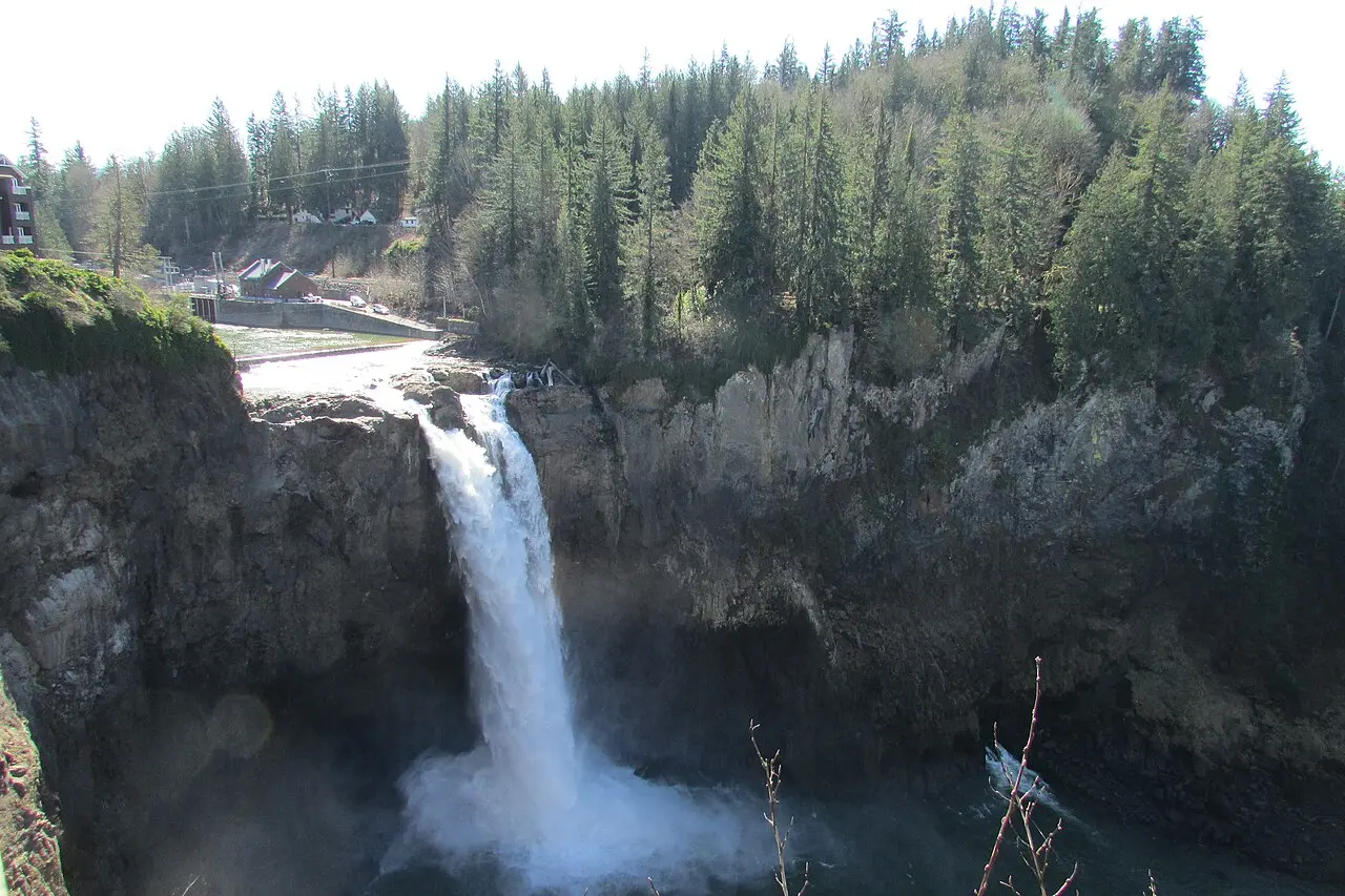
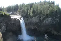
Fall City, about 26 miles east of Seattle, sits below Snoqualmie Falls. The falls are 268 feet high by Scenic Washington’s count, 270 by the same guide’s introduction, and 300 by local historian Dave Battey. The Snoqualmie Tribe has held the falls sacred from time immemorial as its birthplace of creation. The mists from the falls carry prayers to the ancestors, and the falls give food, water, life, health, and healing. The Tribe, in Scenic Washington’s words, “warmly welcomes all visitors to this sacred place to experience its power in their own way.” The sdukwalbixw Gift Shop & Visitor Center at Salish Lodge & Spa explains what the falls mean to the Tribe, and the lodge serves a four-course breakfast. Beneath the falls runs the underground power plant that civil engineer Charles Baker built in the late 1890s. Battey writes that Baker’s original generators are still spinning.
In Snoqualmie the Northwest Railway Museum occupies the Snoqualmie Depot, built in 1890. Locomotives, freight cars, and passenger cars stand around town. A five-mile ride in a historic coach passes within view of the falls. The town also has a brewery, shops, and wine tasting.
Mount Si and the Twin Peaks town
Snoqualmie and North Bend served as filming locations for David Lynch’s television series “Twin Peaks.” In North Bend is the restaurant behind Agent Cooper’s line about cherry pie and a “damn fine cup of coffee.” The town has hiking and mountain-biking trails, rock-climbing spots, campgrounds, and kayaking on the Snoqualmie River. The Snoqualmie Valley Trail runs 29 miles for hikers and cyclists. The Palouse to Cascades State Park Trail starts on the western slopes of the Cascades and crosses the state to the Idaho border, through forest and tunnels and over high trestles, for cyclists, hikers, riders, skiers, and snowshoers.
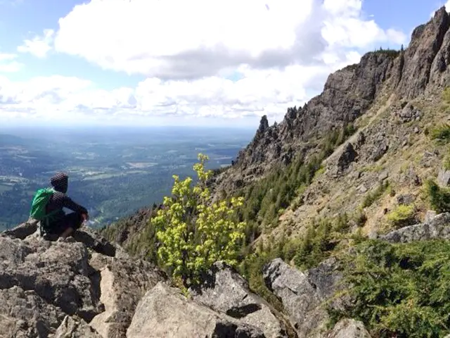
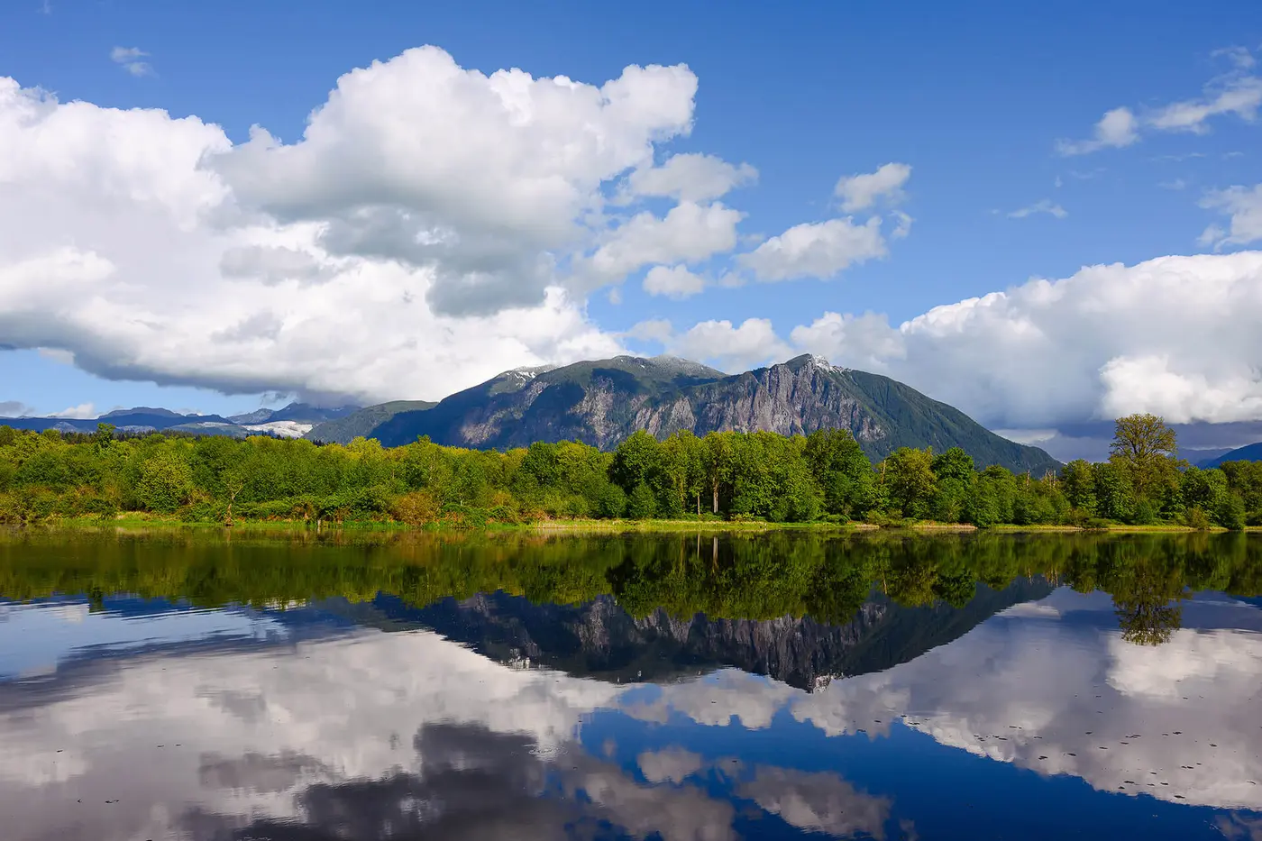
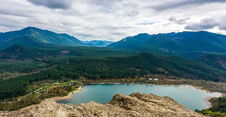
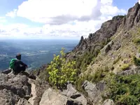
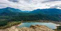
Mount Si stands behind the town. It is said to be the most-climbed mountain in the United States, with upwards of 100,000 hikers a year, and its parking lot fills on any nice day and many poor ones. The round trip is 8 miles and gains 3,700 feet. The trail ends on the summit ridge at the base of the so-called “Haystack.” The last pitch to the true summit is a scramble, and it can be dangerous when wet or snowy. From the top the view reaches Puget Sound. Nearby, the trail to Rattlesnake Ledge looks over Rattlesnake Lake, Mount Si, the Cedar River watershed, and Chester Morse Lake.
Ice, cedar, and a prairie kept by fire
Battey dates the valley’s recent geology to about 20,000 years ago. The Frazer River ice sheet came out of Canada at that time, filled Puget Sound, and pushed up the river valleys as far as North Bend to meet the Cascade glaciers. It left gravel at the lip of the Upper Valley. Some 14,000 years ago that gravel shoved the Snoqualmie River onto bedrock, and the falls formed there. The retreating ice also scarred the cliffs of Mount Si.
People came about 5,000 years ago, give or take a thousand years. Battey thinks they were likely coastal people traveling up the rivers. Salmon could not pass the falls, so there was little to hold a year-round population above them. Instead the upper prairie became a seasonal meeting ground and somewhat neutral ground for trade between the tribes of western and eastern Washington. North Bend marked the end of the salmon run. The Snoqualmie burned off underbrush and small trees to keep the prairie producing bracken fern, tiger lily, trailing blackberry, camas, and fireweed. They hunted mountain goat on Mount Si and the lower Cascades. Western redcedar grew along the corridor, and Battey calls it the most useful natural product the region’s Native peoples had.
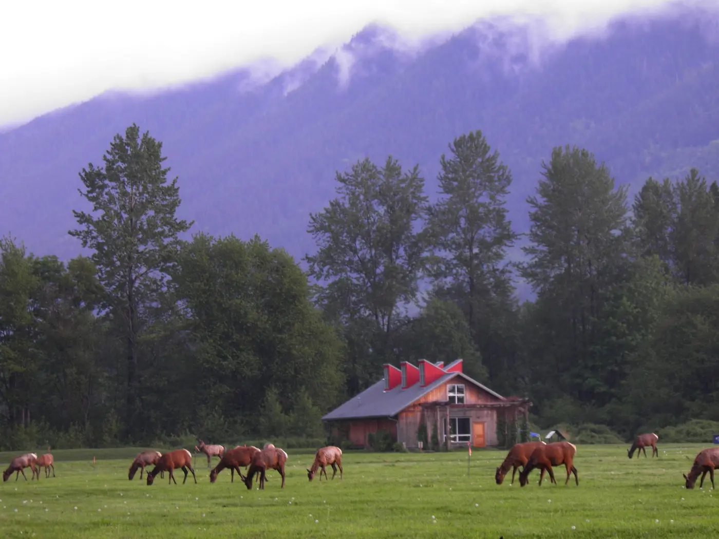
The Tribe’s own account describes an extensive trail system linking villages on Lake Sammamish and Lake Washington with fishing, hunting, and gathering places, and with relatives as far as Yakama across the mountains. The creation story of the Snoqualmie people took place on what is now Meadowbrook Farm, on SR 202 between Snoqualmie and North Bend. It is a preserve today, and Scenic Washington notes that the Snoqualmie once maintained the prairie there by traditional methods.
Hancock, Borst, and the hop ranch
In 1851 a trader named Samuel Hancock hired Snoqualmie guides to take him upriver by canoe in search of coal. Just above the site of the present Meadowbrook Bridge he asked what they called the place. They answered in Chinook Jargon, Hyas Kloshe Illahee, a good or productive land. Battey’s 1997 themes paper calls Hancock the first white man to see the falls and write about them at length. His later short history says others came first but left nothing in writing. Hancock carried word of the timber and farmland back to his neighbors near what became Tacoma.
The cleared prairies drew settlers. By 1856, Battey writes, the taking of Native food-gathering grounds had set off the Puget Sound Indian Wars. Territorial militia built small wooden forts in the valley, Fort Alden at Meadowbrook among them, to keep the Yakamas and other eastern tribes from joining the fight. No one came west, and the forts were quickly abandoned. In the spring of 1858 Jeremiah Borst, twenty-eight years old and bound east over the Cedar River trail, looped down into the valley and settled in what was left of Fort Alden. He stayed the rest of his life. He raised hogs and apples for the Seattle market and lent money to neighbors, often ending up with their land. He platted Fall City, first known as Falls City. He is remembered as the Father of the Snoqualmie Valley.
Watson Allen built the valley’s first mill, driven by water, at the mouth of Tokul Creek below the falls in 1873. Battey’s later history says about 1872. Logs went over the falls and downriver in booms to Everett, and Borst once lost more than $4,000 on a drive when lumber prices dropped there. In 1882 the Hop Growers Association bought Borst land at Meadowbrook. The holding grew past 1,500 acres, about 900 of them in hops, and was billed as “The largest Hop Ranch In the World.” It lasted about a dozen years before the world market and aphids brought it down. From about 1904, A. W. Pratt and Angus J. Moffat ran Meadowbrook mainly as a dairy into the 1950s. In late 1993 Snoqualmie and North Bend bought most of what remained as open space, using King County Conservation Futures bonds.
From wagon road to Route 202
Before roads there was the river. Dugout cedar canoes carried settlers, mail, butter, and apples, and flat-bottomed steamboats hauled farm produce to Snohomish City from the 1860s through the 1880s. Fall City was first settled in 1869 beside an existing Snoqualmie settlement and became a river shipping point. Public road building in the region began in 1852, and the first roads in the Snoqualmie Valley widened the old trails for wagons. After an 1865 survey, local money paid for 25 miles of road from Ranger’s Prairie, now North Bend, toward the pass. The rough wagon road reached from Seattle to Ellensburg in 1867. Repairing it in the summer of 1899, David Denny counted 1,148 horses and 94 wagons and carriages crossing the pass. The Seattle, Lake Shore and Eastern Railway reached Fall City in 1889 and cut the trip to Puget Sound from two days to a few hours.
Governor Lister dedicated the Sunset Highway in 1915 as the “first passable route between east and west sides of the mountains.” In 1942 the highway was cut straight from North Bend to Preston instead of winding through Snoqualmie and Fall City. State Route 202 was then extended from Fall City to North Bend along the old Sunset Highway section. A 1970 statute defined SR 202 from SR 522 near Bothell to I-90 west of Snoqualmie Pass, and in 1993 the legislature added it to the state’s scenic and recreational highway system.
The heritage corridor took shape from March 1997 to May 1998. The project was funded by the corridor’s citizen organization, King County, the state, WSDOT, and the cities of North Bend and Woodinville. Kay Reinartz of the King County Heritage Corridors Program coordinated it, and Don Julien chaired Cascade Valleys. Citizens had laid groundwork for a public participation plan in November 1996. Volunteers surveyed farms, viewsheds, trails, and archaeological sites. Battey, an upper-valley leader on the steering committee, wrote the themes paper. Sara Berry offered a room in the North Bend Depot as a field office. In May 1998 Brenda Vanderloop, formerly director of the Woodinville Tourism Partnership, agreed to design the tourism brochure at a reduced fee. Before the interpretive guide went out, volunteers drove the corridor to check its directions.
Notable Events
- 1851The account identifies Hancock as the first white person to see and extensively describe Snoqualmie Falls; he recognized the Upper Valley's timber and agricultural value, setting the stage for European-American settlement. cdm16977.contentdm.oclc.org
- 1852Public road building began in the region in 1852; major Snoqualmie Valley construction followed in the 1860s, expanding existing trails into wagon roads. snoqualmievalleymuseum.org
- 1856The account says taking traditional Native food-gathering land triggered the Puget Sound Indian Wars, and territorial militia were sent to the valley to keep the Yakimas and other eastern tribes from joining the Puget Sound Indians. cdm16977.contentdm.oclc.org
- 1858Jeremiah Borst reached the valley by the Cedar River trail and settled in the abandoned fort at Meadowbrook, remaining for the rest of his life; the account calls him the Father of the Snoqualmie Valley. cdm16977.contentdm.oclc.org
- 1865A survey was completed in 1865, money was raised for 25 miles of road from North Bend toward the pass, and the rough wagon road from Seattle to Ellensburg was completed in 1867. snoqualmievalleymuseum.org
- 1873Watson Allen built the valley's first mill, a water-driven mill at the mouth of Tokul Creek below the Falls. cdm16977.contentdm.oclc.org
- 1942The highway was rerouted directly from North Bend to Preston rather than through Snoqualmie and Fall City; the essay says State Route 202 was extended from Fall City to North Bend along the old Sunset Highway section. historylink.org
- 1970The law established SR 202 from a junction with SR 522 near Bothell southeasterly to a junction with SR 90 west of Snoqualmie Pass. leg.wa.gov
- 1993The statute designates SR 202 from its SR 522 junction eastward to the SR 90 junction near North Bend as part of the scenic and recreational highway system. lawfilesext.leg.wa.gov
- 1996Citizens along the route laid the groundwork for the Public Participation Plan. cdm16977.contentdm.oclc.org
- 1997The grant-funded project ran from March 1997 through May 1998 and produced corridor-management planning elements, publications, and maps. cdm16977.contentdm.oclc.org
- 1998Brenda Vanderloop, former Woodinville Tourism Partnership director, agreed to design the brochure at a reduced fee and contributed administrative services without charge. cdm16977.contentdm.oclc.org
- Gravel deposits at the lip of the Upper Valley pushed the Snoqualmie River onto bedrock, forming Snoqualmie Falls. cdm16977.contentdm.oclc.org
- Work funded under FFY96 formed community-management organizations for SR 202 and SR 410, while expanding and strengthening the existing SR 2 organization. cdm16977.contentdm.oclc.org
People
- Jeremiah Borst, Settler at the abandoned Meadowbrook fort, known as the Father of the Snoqualmie Valley (1858).
- Samuel Hancock, Trader who sought coal with Snoqualmie Indian guides in the upper Snohomish river basin (1851).
- Watson Allen, Builder of the valley's first water-driven mill at the mouth of Tokul Creek (1873).
- Brenda Vanderloop, Former partnership director who agreed to design the tourism brochure at a reduced fee and contributed administrative services without charge (May 1998).
- David Battey, Upper-valley leader on the community steering committee for the corridor survey and inventory project.
- Don Julien, Cascade Valleys Chairperson.
- Kay Reinartz, Project coordinator and King County Heritage Corridors Program Coordinator.
- Sara Berry, Offered a room in the North Bend Depot as a temporary field-research office for the corridor survey and inventory project.
Sources
- scenicwa.com/cascade-valleys-heritage-corridor
- scenicwa.com/about-us
- scenicwa.com/contact-us
- commons.wikimedia.org/wiki/File:Falls_0075.jpg
- scenicbyways.info/byway/2229.html
- stateofwatourism.com/scenic-byways/cascade-valleys-heritage-corridor
- scenicwa.com/maps/cascade-valleys-heritage-corridor
- scenicwa.com/maps/cascade-valley-heritage-corridor
- facebook.com/365WashingtonState
- instagram.com/scenicwa
- historylink.org/File/20914
- leg.wa.gov/CodeReviser/documents/sessionlaw/1970ex1c51.pdf?cite=1970+ex.s.+c+51+s+6
- lawfilesext.leg.wa.gov/biennium/1993-94/Pdf/Bills/Session%20Laws/House/2023-S.SL.pdf?cite=1993%20c%20430%20s%207
- app.leg.wa.gov/RCW/default.aspx?cite=47.39.020
- cdm16977.contentdm.oclc.org/digital/api/collection/p16977coll2/id/832/download
- cdm16977.contentdm.oclc.org/digital/api/collection/p16977coll2/id/773/download
- stateofwatourism.com/scenic-byways/cascade-valleys-heritage-corridor
- fhwaapps.fhwa.dot.gov/bywaysp/byway/2229
- snoqualmietribe.us/snoqualmie-tribe-ancestral-lands-trails
- snoqualmievalleymuseum.org/transportation
- snoqualmiewa.gov/328/History