
Cape Flattery Tribal Scenic Byway
Neah Bay, Clallam County, Washington. Scenic byway.
Details

- Where
- Neah Bay, Clallam County, WA. No street address stated. Directions
- When
- Cape Flattery Trail open daily at dawn, closes 30 minutes after sunset, year-round.
- Season
- Year-round (typically), with occasional Makah reservation access restrictions.
- Getting there
- Strait of Juan de Fuca Highway 112 to Neah Bay; use Bayview Avenue through town.
- Fees
- Makah Recreation Permit: $20 per vehicle, valid for the calendar year.
- Access
- Makah Recreation Permit must be displayed in the window of your vehicle while enjoying the trails, beaches and other attractions.
- Walk-in or reserve
- Makah Recreation Permit required for recreational activities; bought in person at various locations or online.
- Phone
- (360) 645-2201
- Website
- stateofwatourism.com
- Managed by
- Makah Tribe.
At the west end of State Route 112 the highway gives out at the boundary of the Makah Reservation and becomes the tribe’s own road. In Neah Bay it runs as Bayview Avenue, posted at 25 miles an hour, past the stores, fuel, eateries, and lodging of the town. The tribe asks drivers to keep to Bayview, because Google Maps sometimes sends them by Backtrack Road instead, onto a truck route and eventually gravel. A Makah Recreation Permit, $20 a vehicle and good for the calendar year, rides in the windshield of every car bound for the trails and beaches. It is sold at the marina, the Makah Mini Mart, the museum at the Makah Cultural and Research Center, the two resorts, and a booth near the Cape Flattery trailhead. The tribe adds a request: “Please respect the culture of the Makah Tribe and limit your activities to designated visitor facilities.”
Bayview Avenue to the foot of Bahokus Peak
Bayview Avenue becomes Cape Flattery Road for anyone following the yellow lines on the pavement. On the west side of the downtown it turns sharply left, then sharply right after a tenth of a mile, then past the clinic and sharply left again to run along the foot of Bahokus Peak. From there it is 5.1 miles to the trailhead. The state’s geology survey notes that the road becomes Cape Loop Road before it ends.
Washington’s tourism office and the Makah’s own planners give the whole byway as 12 miles. State tourism calls it the shortest scenic byway in Washington and allows 30 minutes to drive it. The federal America’s Byways listing gives 36 miles and 55 minutes, and lists no fee. State tourism also warns that the reservation occasionally restricts access.
Along the way lie Hobuck Beach Resort at the west end of the reservation and Shi Shi Beach west of Neah Bay. Shi Shi is a driftwood-strewn shore with sea stacks, reached by a 3.3-mile hike. Camping there overnight takes both the Makah pass and an Olympic National Park wilderness permit. Neah Bay itself remains a salmon fishing port for commercial and sport anglers, and state tourism notes fresh seafood among its dining.
Four decks above Tatoosh Island
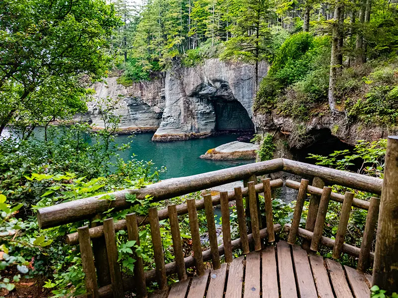
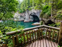
The Cape Flattery Trail opens at dawn and closes 30 minutes after sunset, every day of the year. Restrooms and day parking, with limited room for RVs, sit at the trailhead. Camping and overnight parking are prohibited. The tribe gives the trail as 0.75 miles from trailhead to overlook, over boardwalks, stairs, and dirt. It loses 200 feet on the way down, and the tribe warns that the walk back to the car takes a moderate amount of exertion; Scenic Washington calls it short and easy. There are no garbage cans. Dogs go on leash, and people and pets keep to the main trail.
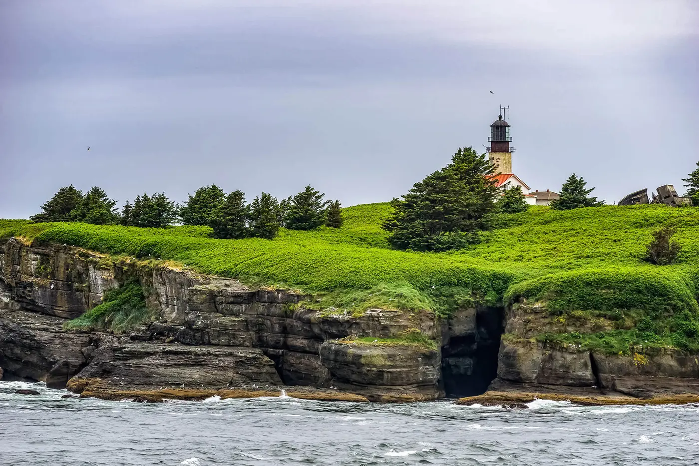
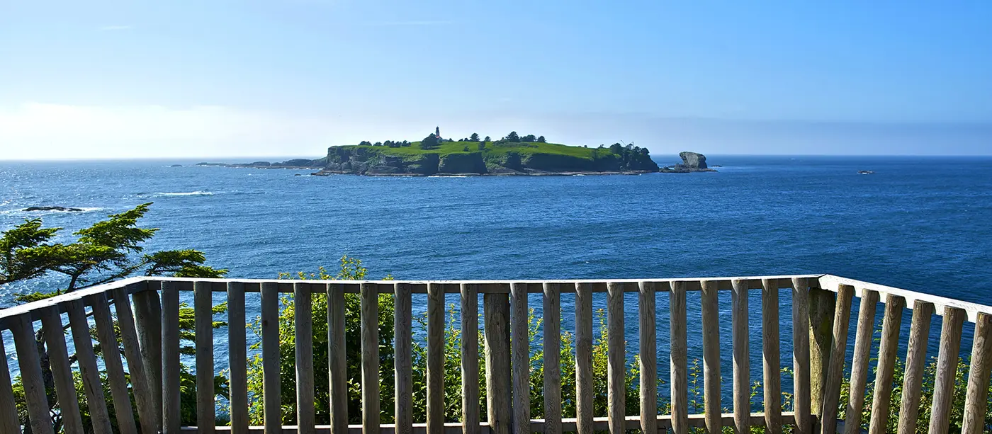
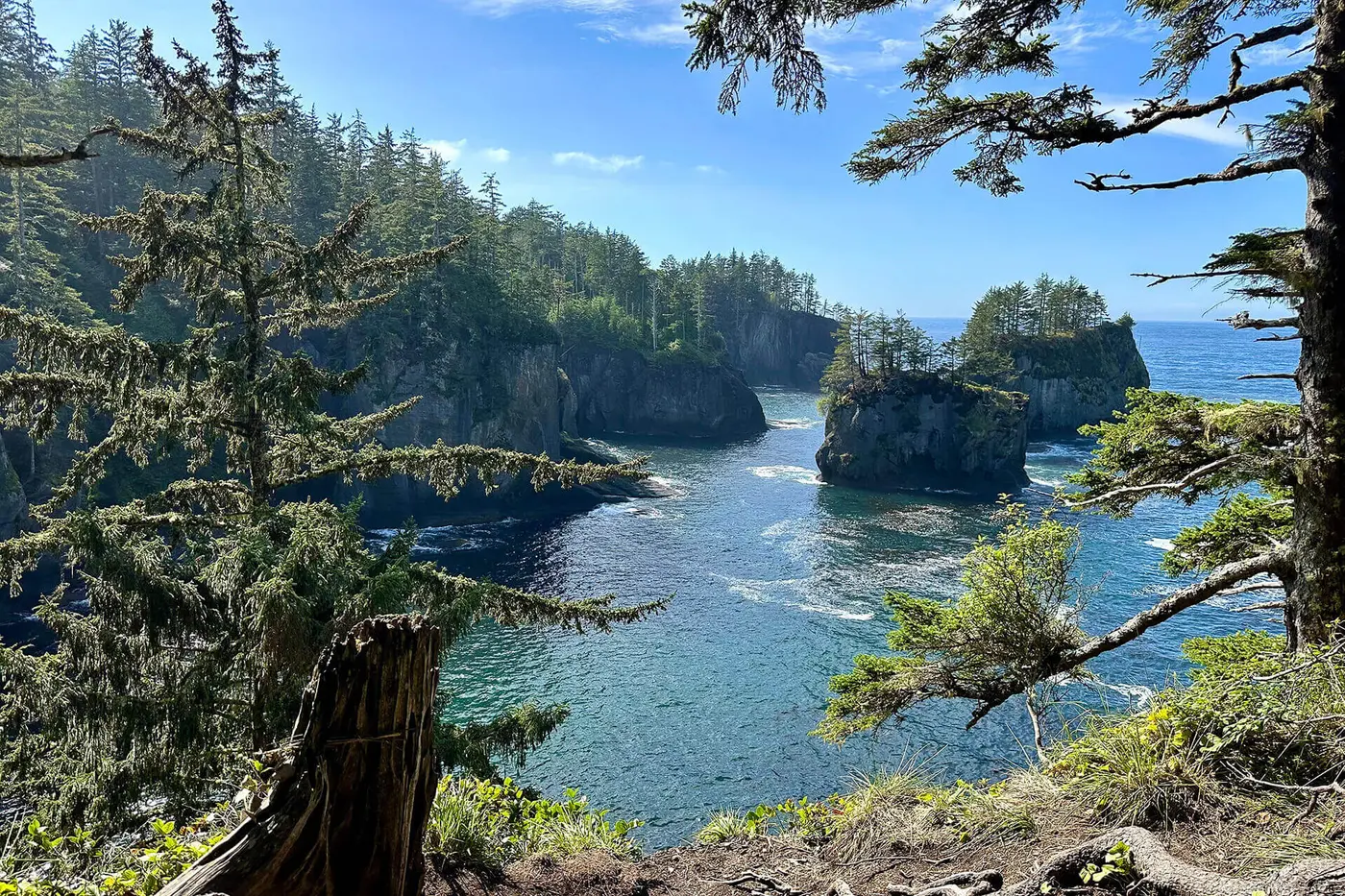
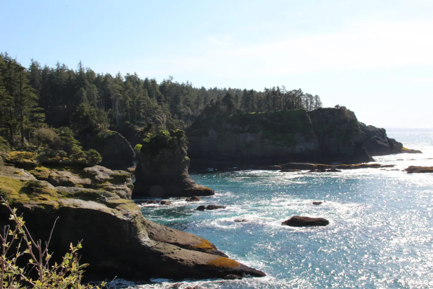
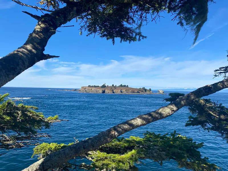
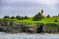
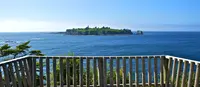
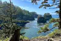
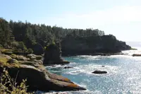
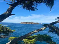
Four observation decks look out on rock, birds, and the jade water of the Pacific. The tribe writes that the sea runs from steel gray to light pink or yellow at sunset. Its trail page tells visitors to watch for gray whales off the cape and for sea lions on Snake Rock, just east of Tatoosh Island. The National Scenic Byway Foundation adds puffins and eagles. Tatoosh carries a lighthouse. Picnic tables stand near the last platform, which overlooks the island.
The cape is generally called the most northwesterly point in the contiguous United States. The state’s geologists qualify this: Cape Alava, to the south, stretches just slightly farther west. Underfoot are breccias and conglomerates, broken fragments of sandstone, chert, and volcanic rock cemented together. They were scraped off onto the North American continent about 30 million years ago and are covered in places by glacial sediment from the last ice age. Waves have scoured sea caves into the bluff. Given tens to hundreds of thousands of years, such caves widen, break through as arches, and leave sea stacks standing offshore.
The federal byway listing puts it this way: “It is the most northwestern point in the contiguous states, but it is also a sacred place on the land of the Makah.”
Five villages and a treaty at Neah Bay
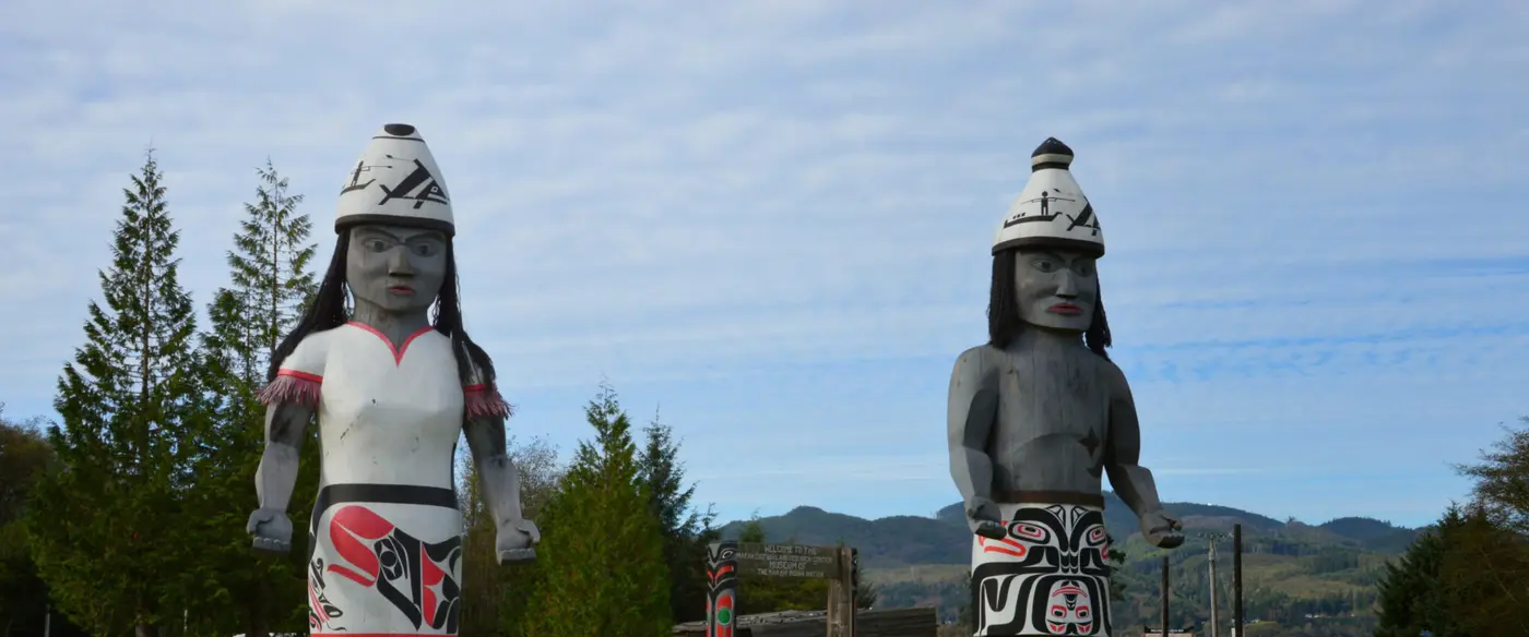
The tribe says it has called this country home since time immemorial. Its welcome, given in Makah and English, reads: “Welcome while you are in Neah Bay, the beginning of the world and the home of the Makah — the Cape People.”
The name has more than one telling. The tribe says neighboring tribes gave it the name Makah, meaning “people generous with food” in the Salish language. HistoryLink records “Makah” as the Klallam name for the Qwiqwidicciat, “people of the cape.” Its essay on Cook calls both “Makah” and “Classet” translations into other Indian languages of the people’s name for themselves.
The tribe’s history places five permanent villages along this shore: Waatch, Sooes, Deah (present-day Neah Bay), Ozette, and Bahaada. In the early 1800s they held between two thousand and four thousand people. Several generations shared cedar-plank longhouses about 30 feet wide and 70 feet long. In summer, families moved to camps nearer the fishing, whaling, and gathering grounds, among them Tatoosh Island, Hoko, and Ozette Lake. Halibut was dried or smoked and stored for winter. Seal blubber was rendered into an oil eaten as a condiment at every meal. Canoes carved from western red cedar were built for war, whaling, halibut, salmon, sealing, and cargo, with small ones for children to practice in. They were landed stern first, so paddlers could leave quickly if they had to.
Fur traders were calling at the Neah Bay villages within a few years of 1788. In 1792 Spanish forces under Salvador Fidalgo built a fort at Neah Bay, which Manuel Quimper had named Núñez Gaona when he claimed it for Spain two years before. HistoryLink calls it the first non-Indian settlement in the future Washington. The Spanish left within a few months, after conflicts with the Makah and for want of a secure winter anchorage. Epidemics of smallpox, tuberculosis, influenza, and whooping cough followed contact. The tribe writes that successive outbreaks of smallpox reduced the southernmost villages in 1852.
On January 31, 1855, 42 Makah dignitaries met Governor Isaac Stevens at Neah Bay. They negotiated in the Chinook language, with an English interpreter present. To keep their whaling rights, the tribe ceded title to 300,000 acres and kept the land around Cape Flattery. Congress ratified the treaty in 1859. The tribe dates from then the start of radical cultural changes: Indian agents, missionaries, and teachers enforced laws against potlatches, ceremonies, and the Makah language.
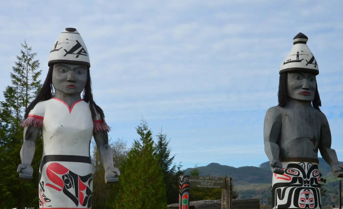
In 1970 the southernmost village, Ozette, was found where a mudslide had buried its houses. HistoryLink gives the burial as 500 years earlier; Scenic Washington gives 300 to 500 years. Scenic Washington counts more than 50,000 artifacts recovered, and HistoryLink credits the find with spurring a Makah cultural revival. The museum at the Makah Cultural and Research Center in Neah Bay shows about one percent of them, the tribe says. The exhibits include whaling and fishing gear, basketry, and replicas of a full-size longhouse and canoes.
The harbour that flattered Cook
The name on the cape is older than any other non-Indian place name still on Washington maps. On Sunday, March 22, 1778, Captain James Cook, sailing the Resolution and Discovery in search of the Northwest Passage, saw between a low cape and a steep island “a small opening which flattered us with the hopes of finding an harbour.” The hope faded as the ships closed in. Cook judged the opening shut by low land, turned away, and named the point Cape Flattery. In turning away he crossed the mouth of the Strait of Juan de Fuca without knowing it.
A decade later the fur traders Charles William Barkley and John Meares entered that strait. They named it for a Greek sailor whose purported voyage there in 1592 HistoryLink calls “probably apocryphal.” For a time the charts disagreed about where Cook’s cape lay. A number of them from the 1800s put Cape Flattery at what is now Cape Alava, some 15 miles south, and called the present cape Cape Classet. George Vancouver had sailed with Cook. In 1792 he returned in command of his own expedition and settled the question for the northern point. He gave the name Flattery Rocks to a group of rocks near Cape Alava.
County dirt, state route, tribal byway
The highway that brings travelers to the reservation boundary began in 1929. That year a 12.5-mile dirt section was added to Clallam County Road 9A, running from the Hoko-Ozette Road junction to the reservation. The state bought the right-of-way from Sekiu to Neah Bay in 1947 and paved 8.8 miles in 1948. It folded the road into Secondary State Highway 9A in 1955 and renumbered it State Route 112 in 1963.
The state transportation department has found that segment eligible for the National Register of Historic Places. It keeps its original alignment, 10-foot lanes, and 2-foot shoulders. It hugs the Strait between the water and a line of escarpments until it bends inland near Kydaka Point. Sight distance is short around sharp corners, rock outcrops, and cliff faces, and there are few pull-offs.
At the end of December 2001 the Makah were drafting a tribal resolution to make their road across the reservation a tribal scenic byway. Blanchard Matte, the tribe’s transportation planner, described the plan as a first step toward extending SR 112’s national designation onto the reservation road. Officials said it would be the first non-state or federal highway in the nation to win such a designation. Greig Arnold, the outgoing tribal council chairman, said tribal members hoped it would draw more tourists to Neah Bay and “point them in the right direction” on a main road through town.
In April 2002 the state Transportation Commission voted unanimously to designate the 12-mile road the Cape Flattery Tribal Scenic Byway, the state’s first tribal-sponsored scenic byway. “That’s good news,” said Gordon Smith, chairman of the Makah Tribal Council. “We’ve definitely been pushing for that.” Not everyone agreed. Margaret Owens of Joyce, co-founder of Peninsula Citizens for the Protection of Whales, said that as long as the Makah hunt gray whales, “There will be very little cooperation or camaraderie on this corridor.”
Notable Events
- 1778Captain James Cook names Cape Flattery, the oldest non-Indian place name still in use on Washington state maps. historylink.org
- 1792Captain George Vancouver, who had sailed on Cook's voyage, returned with his own expedition and concluded that the northern point was the place Cook had named Cape Flattery. historylink.org
- 1855Makah villagers, represented by 42 dignitaries, negotiated and signed a treaty with the United States; the negotiations with Gov. Isaac Stevens were held at Neah Bay in the Chinook language with an English interpreter present. makah.com
- 1859To retain whaling rights the Makah ceded title to 300,000 acres of tribal land to the U.S.; Congress ratified the treaty, beginning radical cultural changes imposed on the Makah. makah.com
- 1931The opening of the 330-mile Olympic Loop Highway, U.S. 101, brought easy automobile access to large areas of the Peninsula for the first time. historylink.org
- 1947The state purchased the right-of-way from Sekiu to Neah Bay, the road's first step into the state system. wsdot.wa.gov
- 1948An 8.8-mile stretch of the highway was paved. wsdot.wa.gov
- 1955The roadway from Sekiu to Neah Bay was incorporated into the SSH 9A route. wsdot.wa.gov
- 1963The route designation of Secondary State Highway 9A was changed to State Route 112, the number the byway carries today. wsdot.wa.gov
- 1970The 1970 discovery at Ozette of thousands of artifacts from homes buried in a mudslide 500 years earlier spurred Makah cultural revival. historylink.org
- 2001Makah leaders worked on a tribal resolution to designate the road a tribal scenic byway before seeking to extend the Route 112 national designation to the reservation road. peninsuladailynews.com
- 2002The state Transportation Commission unanimously approved designation of the 12-mile road across the Makah reservation as the Cape Flattery Tribal Scenic Byway, the state's first tribal-sponsored scenic byway. peninsuladailynews.com
People
- Captain George Vancouver, explorer who identified the present point as Cook's Cape Flattery (1792).
- Captain James Cook, British explorer who named Cape Flattery (1728-1779).
- Isaac Stevens, Washington Territory's first governor and Superintendent of Indian Affairs, assigned to obtain legal title from the Indian peoples whose cape and strait the byway now follows (1818-1862).
- Blanchard Matte, Makah transportation planner who described the tribal resolution to designate the road a scenic byway (2001).
- Greig Arnold, outgoing Makah tribal council chairman who hoped a scenic byway would attract more tourists to Neah Bay (2001).
- Gordon Smith, Makah Tribal Council Chairman, who pushed for the designation.
- Margaret Owens, Joyce resident and co-founder of Peninsula Citizens for the Protection of Whales, who criticized the designation.
Sources
- makah.com/attractions/cape-flattery-trail
- makah.com/attractions/recreation-permits
- makah.com/directions
- olympicpeninsula.org/road-trips/cape-flattery-tribal-scenic-byway
- stateofwatourism.com/scenic-byways/cape-flattery-scenic-byway
- wsdot.wa.gov/construction-planning/protecting-environment/historic-highways/historic-highway-sr-112
- historylink.org/File/7576
- makah.com
- makah.com/makah-tribal-info/about-history
- historylink.org/File/5035
- peninsuladailynews.com/2002/04/18/neah-bay-makah-route-wins-scenic-designation
- peninsuladailynews.com/2001/12/30/neah-bay-makah-seek-road-across-reservation-as-a-scenic-byway
- nsbfoundation.com/sb/cape-flattery-tribal-scenic-byway
- scenicwa.com/cape-flattery-scenic-byway
- fhwaapps.fhwa.dot.gov/bywaysp/byway/54774
- wa100.dnr.wa.gov/olympic-peninsula/cape-flattery