Boundary Reservoir / Forebay Recreation Area (BLM), Pend Oreille County, WA
Metaline, Pend Oreille County, Washington. Campground, day-use area, and boat launch.
Details

- Where
- Metaline, Pend Oreille County, WA. No street address stated. Directions
- When
- Memorial Day through Labor Day.
- Season
- Forebay and boat-in campsites are open year-round; winter water and road service may be unavailable.
- Getting there
- To reach the Forebay Recreation Area, leave Highway 31 in the town of Metaline, WA, and follow Boundary Dam Rd. (County Road 2975) approximately 11 miles until you reach the dam.
- Fees
- Free.
- Hours
- Campground quiet hours 10:00 PM–7:00 AM; generators allowed only 8:00 AM–9:00 PM.
- Access
- City Light does not sanction swimming; swimmers proceed at their own risk and may not swim in boat-launching, moorage or other watercraft-use areas.
- Walk-in or reserve
- Boat-in campsites are first-come, first-served; campers are encouraged to register before launching.
- Phone
- (206) 858-3061
- Website
- blm.gov
- Managed by
- Seattle City Light.
Boundary Road leaves Highway 31 just north of Metaline, Washington, and ends at a guard station and a concrete arch dam on the Pend Oreille River. The Bureau of Land Management and City Light’s tour notice give the drive as 12 miles. City Light’s campground notice says about 11 miles, by way of County Road 2975. City Light gives the pronunciation as Pon-deh-RAY. The dam stands at river mile 17, in a narrow canyon of the Selkirk Mountains, about ten miles north of the town of Metaline Falls and one mile south of the Canadian border.
Beside the dam lies the Forebay Recreation Area, a campground, day-use ground, and boat launch owned and kept by Seattle City Light. The campground has 22 sites: six walk-in tent sites, three car sites, and 12 sites for RVs up to Class C. Every site has a fire ring and a picnic table. Camping is free and first-come. Campers fill out a form and drop it in the registration box. There are flush toilets and potable water. City Light’s recreation page and its 2019 opening notice list no hook-ups, dump station, or showers, though the utility’s power-supply page says the campground has them. The day-use ground has seven picnic tables, four barbecue grills, and a group shelter. The launch ramp was lengthened so boats can be put in and taken out as the water rises and falls, and boats may tie at the boarding float for only 30 minutes. The posted rules set quiet hours from 10 p.m. to 7 a.m. They also say fish heads and guts go back into the river, “preferably in deep water,” not into the trash or the fire rings.
The campground, day-use ground, and launch reopened in May 2019 after substantial improvements. City Light keeps the Forebay open year-round, warning that in winter there may be no water and the road may not be plowed. The BLM gives the main season as Memorial Day through Labor Day.
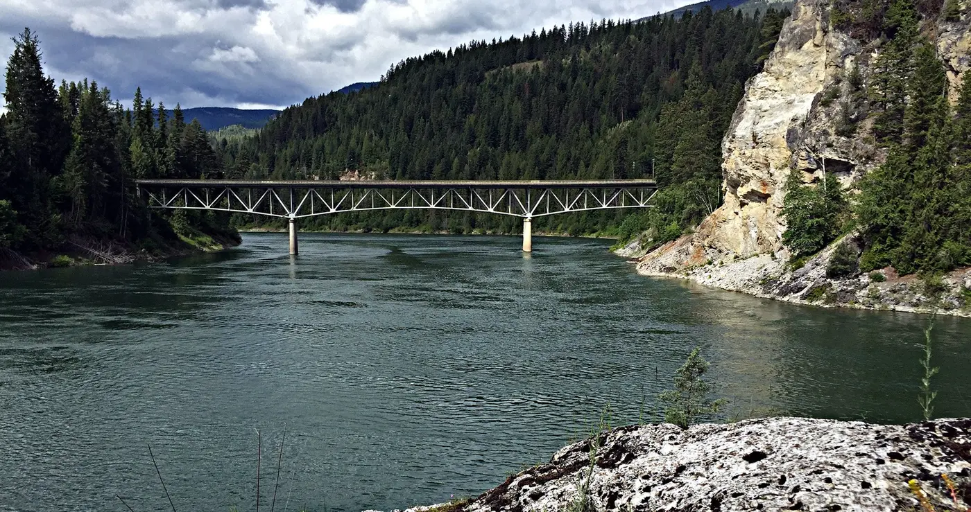
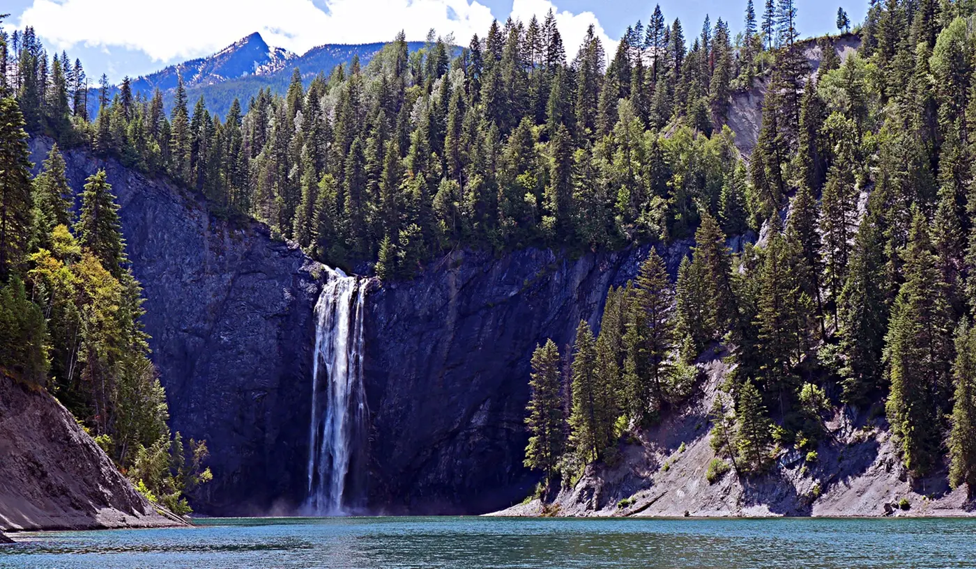
From the ramp the reservoir runs 17.5 miles upriver and covers 1,794 acres. City Light reckons that at roughly three times the size of Seattle’s Lake Union. It is a stretch of the Pend Oreille River Water Trail, which follows the river for 70 miles. Between Metaline Falls and the dam, City Light describes steep rock faces, dense forest, nearby mountains, and waterfalls, among them Peewee Falls. The BLM warns that water levels and flows can change suddenly and without warning, that currents, rapids, and half-sunk debris may lie in the way, and that there are no services and no cell signal on the reservoir. City Light does not sanction swimming in the reservoir. Anyone who swims does so at their own risk, and never at the launch or the moorage.
Bear boxes at Everett Slough and Ledbetter Cove
City Light keeps six boat-in camps along the shore: Lime Creek, Everett Slough, Monument Bar, Grandview, Slumber Cove, and Ledbetter Cove. They stand on land managed by the BLM and the U.S. Forest Service and are operated under City Light’s federal license for the dam. All are pack-it-in, pack-it-out, and none has a trash can. Tents go only on the marked pads. Campers may burn only dead wood found on the ground. Generators are discouraged, and where used they run only from 8 a.m. to 9 p.m. Campers are asked to leave a registration form at the launch marked “On River.”
Three of the camps sit on BLM land on the west bank. Each has a toilet behind a privacy fence. Everett Slough has three campsites, each with a tent site, table, fire ring, and bear-proof storage box. It is also the only one of the three with a walk. Dense forest and steep canyon slopes rule out trails elsewhere, but here an old dirt road grade, a little over a mile long and closed to public vehicles, runs through the forest and ends at the camp. Ledbetter Cove has four tent sites, two tables, two fire rings, and two bear-proof boxes. Grandview has two campsites. City Light has closed Grandview until further notice because of standing hazard trees. Across the water, Forest Service land offers more primitive camping, at developed sites and on open ground.
Fifteen stories down in the limestone
On the canyon’s east rim stands the Vista House, a modernist viewing room built in 1965. It looks out over the dam site in a near-full sweep and holds interpretive displays, flush restrooms, and a picnic area. It opens daily from Memorial Day to Labor Day. Farther along the east side are two overlooks that opened in 2023, Peewee Falls and Riverside Canyon. Each has restrooms, picnic tables, parking, gravel paths on easy grades, and wide platforms with benches. The Salmo Passage Trail, nine miles long, connects them. City Light described it as nearing completion in 2024.
Tours of the dam meet at the guard station. Adults show photo ID, everyone wears closed-toe shoes, and each group is capped at 25. In 2026 the free tours ran from July 3 through August, Friday through Monday, four times a day, and lasted about an hour. Guides take visitors to the Machine Hall Visitor Gallery, inside a limestone cavern, among turbines rated at 299,000 horsepower. The hall was cut 477 feet long, 76 feet wide, and 170 feet deep, 15 stories below ground, and its walls were left as bare natural rock. According to HistoryLink, the powerhouse went underground because the canyon left no room to build one in the open.
The dam rises 340 feet. Its concrete is 32 feet thick at the base and 8 feet thick at the crest. The city archives credit the “eggshell-like double curve” of the thin arch with giving it great strength for so little mass. There are two large spillgates at the top and seven sluice gates 200 feet below the crest, and the gates can drain the reservoir within 24 hours. The spillways are cut into the rock and aimed so that, at full discharge, their two streams meet in mid-air and spend their force before they reach the canyon walls. Together they carry 108,000 cubic feet per second.
The archives say more than 40 City Light employees run the plant. In 2013 the Spokesman-Review put the dam’s jobs at 50. Its share of Seattle’s power is told differently from year to year. The Spokesman-Review gave 25 percent of the city’s electricity in 2013. City Light gave about 55 percent of its own generating supply in 2019. The archives give up to 35 percent of Seattle’s energy needs. City Light also sells 48 megawatts at cost to the Pend Oreille County Public Utility District.
Z Canyon and the mining men
The city archives name the Kalispel Tribe of Indians as the first reported people of this country. Kalispel ancestors hunted, fished, and lived along the Pend Oreille for more than 8,000 years. In the mid-1800s fur traders, prospectors, and settlers came in around what are now Metaline Falls, Metaline, and Ione. The zinc and lead beneath them made the Metaline Mining District one of the country’s largest producers of both metals for most of the 20th century.
Others saw power in the river. In 1914 the engineer Col. Hugh L. Cooper began surveying Z Canyon for a large dam. The plan failed for lack of money and an abundance of red tape. A June 1933 panorama in the archives shows the river at Z Canyon with Peewee Falls in the background. By 1944 Z Canyon was one of many dam sites proposed around the state.
On Oct. 27, 1953, City Light announced it would acquire the site and build a power plant. The local mining industry protested, fearing damage to the mines. The county public utility district filed a competing application for three dams of its own, and the dispute went to the courts. City Light’s project records include a case before the U.S. Supreme Court and folders on tunnel plugs, a pumping plant, and other mine protection works. The Federal Power Commission granted City Light its license on July 10, 1961.
Excavation began in August 1963. Crews carved 500,000 cubic yards of limestone out of the mountain for the machine hall, then the largest underground powerhouse in the world. More than a million cubic yards more came out to make the forebay. Herbert V. Standberg, City Light’s project engineer, directed the engineering and architectural firms. Cr. Hoidal oversaw the civil engineering and Robert L. Skone the electrical. Turbine parts were unloaded at Pier 20 on May 1, 1965. A progress report of September 10, 1965 noted that “shipments of turbine parts are arriving regularly at the project site, while fabrication of generators continues at the manufacturer’s plant.” The first bucket of concrete was poured on November 12, 1965. In all, 1,300 workers built the dam.
On September 1, 1967, Boundary sent its first commercial electricity to Seattle. The power went a short way to Bonneville Power Administration lines, and Bonneville delivered an equal amount to the city, 300 miles off. Mayor J.D. (Dorm) Braman spoke at the dedication on September 27. Two days later the Seattle Times ran the headline “Braman Hails Dam as Boon to Recreation.” The cavern held room for six generators, but only four were installed at first. The other two were added in 1985, by HistoryLink’s account, or 1986, by the city archives’, in bays left ready so that no further blasting was needed. City Light later planned a $143 million, 12-year rehabilitation of the dam and powerhouse. Its own employees bid on the work at 25 percent below the estimate and won it.
Bridge City and a license to 2055
For a time in 1997 the face of the dam carried the false front of a town. Part of The Postman, directed by and starring Kevin Costner, was filmed there, and in the film the town was called Bridge City.
Talks to renew the dam’s license began in 2004. In March 2013 the Federal Energy Regulatory Commission approved a new 42-year license, which runs through 2055. Its terms paid for new trails on the east side of the reservoir, a portage for paddlers at Metaline Falls, and upgrades to the shoreline camps, including toilets, tables, fire rings, and places to land and tie up boats.
On May 1, 2018, the Boundary Hydroelectric Project was listed on the National Register of Historic Places. “Determining the Boundary Project’s eligibility for the National Register is a requirement of our license to operate the dam, but to be listed on the National Register is an honor,” said City Light’s Mike Aronowitz. The listed district covers 167 acres: the dam, forebay, powerhouse, transmission line, Vista House, and the recreation buildings. All are linked by the original looped road that begins at the gate at the end of Boundary Road.
Notable Events
- 1914Engineer Col. Hugh L. Cooper began surveying Z Canyon on the Pend Oreille River for a large dam; the plan failed for lack of funding and red tape. seattle.gov
- 1953City Light announced plans to acquire the Boundary Dam site and construct a hydroelectric power plant. powerlines.seattle.gov
- 1961City Light received permission to use a section of the Pend Oreille River and construct Boundary Dam. powerlines.seattle.gov
- 1963Construction began by removing limestone to make way for what was then the world's largest underground powerhouse. powerlines.seattle.gov
- 1965The first bucket of concrete was poured. seattle.gov
- 1965The Vista House was built, providing panoramic views of the dam and surrounding landscape. seattle.gov
- 1967Boundary began operations and supplied over half of City Light's power generation. archiveswest.orbiscascade.org
- 1967The facility built between 1963 and 1967 was completed with four generation units, a dam, powerhouse, Vista House and supporting recreation resources. powerlines.seattle.gov
- 1967Boundary Dam produced commercial electricity for the first time. seattle.gov
- 1967Mayor J.D. Braman at the Boundary Dam dedication. seattle.gov
- 1985Room was left for more units, and in 1985 two more generators were completed. historylink.org
- 1986Boundary's power output grew with the addition of two new turbine generators to the machine hall. seattle.gov
- 1997Part of Kevin Costner's film The Postman was filmed on the front of the dam, whose face carried a town facade known in the film as Bridge City. seattle.gov
- 2004The relicensing process and negotiations that bring conditions benefiting recreationists and fish started in 2004. spokesman.com
- 2013City Light was issued a new license to operate Boundary through 2055. powerlines.seattle.gov
- 2018The Boundary Hydroelectric Project was formally listed on the National Register of Historic Places. seattle.gov
- The campground, day-use area and boat launch reopened in May after substantial improvements. powerlines.seattle.gov
People
- Cr. Hoidal, Civil engineering oversight of the Boundary Project.
- Herbert V. Standberg, City Light project engineer directing the engineering and architectural firms.
- Mike Aronowitz, City Light representative explaining the Boundary Project's National Register eligibility requirement.
- Robert L. Skone, Electrical engineering oversight of the Boundary Project.
- Col. Hugh L. Cooper, engineer who surveyed Z Canyon for a dam site (1914).
- J.D. (Dorm) Braman, Seattle mayor who lauded the dam at its dedication.
Sources
- blm.gov/visit/boundary-reservoir-recreation-area
- seattle.gov/city-light/in-the-community/tours-recreation-and-education/boundary-tours-and-recreation
- seattle.gov/documents/Departments/CityLight/ForebayRulesRegs.pdf
- seattle.gov/documents/Departments/CityLight/BoatInRulesRegs.pdf
- powerlines.seattle.gov/2018/03/09/boundary-hydroelectric-project-receives-national-historical-recognition
- archiveswest.orbiscascade.org/ark:80444/xv62719
- seattle.gov/city-archives/exhibits-and-education/online-exhibits/boundary-dam
- historylink.org/File/2861
- spokesman.com/stories/2013/mar/24/boundary-dam-relicensing-will-boost-recreation