
Bighorn Scenic Byway
Greybull, Big Horn County, Wyoming. Scenic byway.
Details

- Where
- Greybull, Big Horn County, WY. No street address stated. Directions
- Getting there
- Stretching from the Powder River Basin to the Big Horn Basin, the Big Horn Byway follows US 14 from the west outside Greybull.
- Access
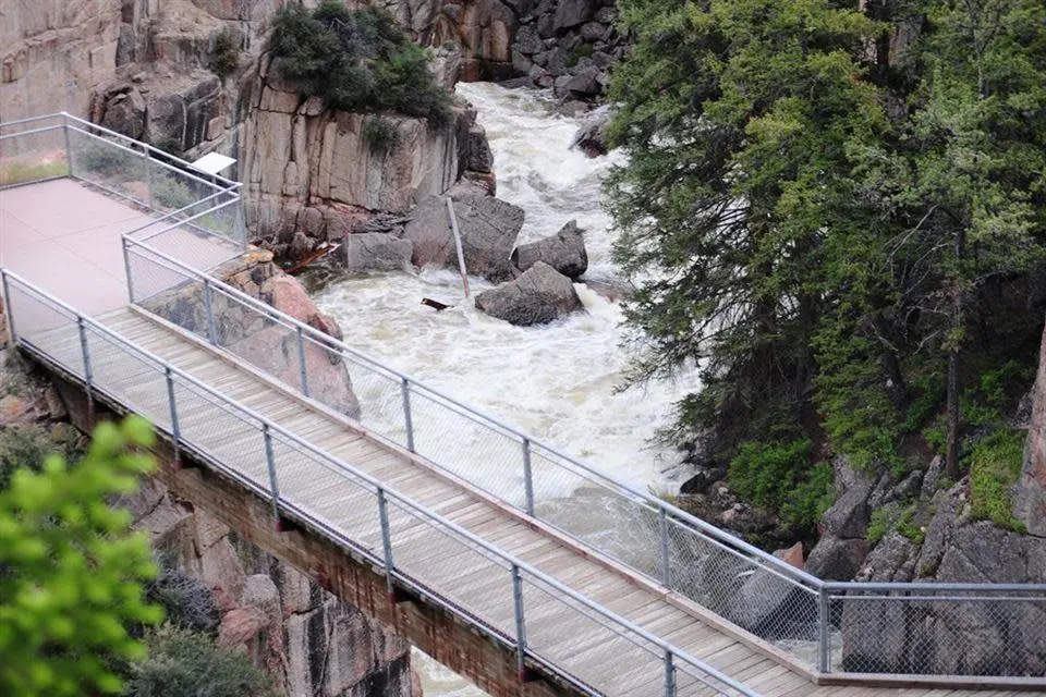
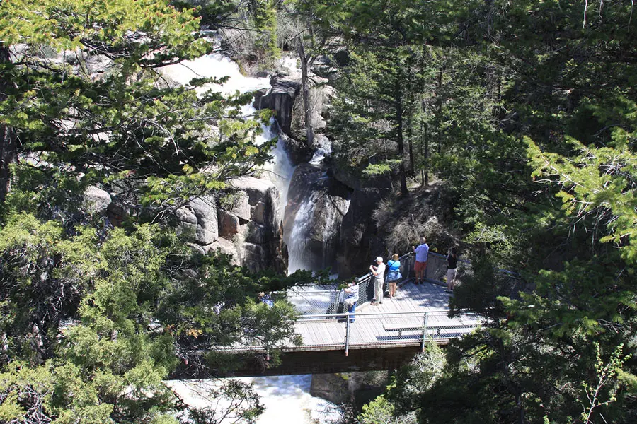
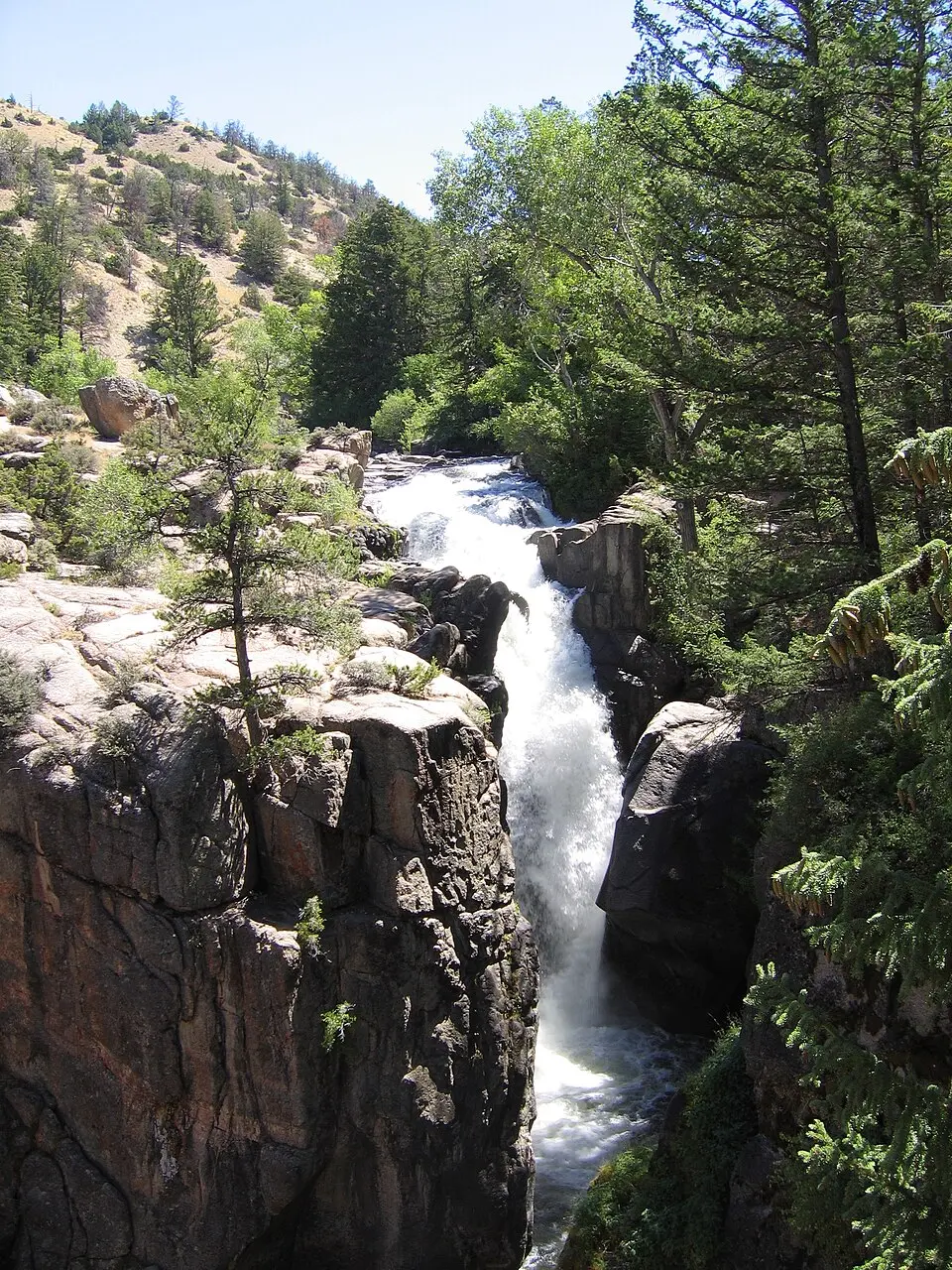
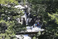
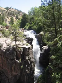
- On the western end of the Big Horn Scenic Byway, Shell Creek Canyon and Shell Falls create some of the most spectacular scenery along the route. The 120-foot plunge of Shell Falls is accompanied by nature trails and interpretive signs. The site is open 8 a.m. to 5:30 p.m. daily from mid-May through mid-September.
- Phone
- 307-674-2600
- Website
- fs.usda.gov
- Managed by
- Big Horn County.
- Coordinates
- 44.58674758, -107.615193.
About eleven miles east of Shell, Shell Creek drops 120 feet over Precambrian granite. The geologists who compiled the GeoWyo road log date that granite at 2.9 billion years and put the creek’s greatest flow at 3,600 gallons a second. The Forest Service keeps a visitor center and an interpretive trail at the falls, at 6,269 feet, and asks that dogs stay leashed on the trail. Its page for the site, updated July 9, 2026, lists it as closed for construction, with no restrooms and no drinking water. North of the falls, on the skyline, stands a peak called Copemans Tomb.
The falls lie near the western end of the Bighorn Scenic Byway, the stretch of U.S. 14 that crosses the Bighorn National Forest. Recreation.gov gives its length as 47 miles. The Wyoming Department of Transportation’s 2009 program book also gives 47 miles, between Dayton and Shell. Big Horn County calls it a 58-mile paved highway running from the Powder River Basin to the Big Horn Basin. It is one of three byways that cross the forest from east to west. The other two are the Cloud Peak Skyway and the Medicine Wheel Passage.
Below the falls, Shell Creek has cut a narrow V-shaped canyon in the last million years. The canyon runs more than 8 miles long and 2,500 feet deep. The creek starts at 11,000 feet in the Cloud Peak Wilderness and falls to under 3,800 feet where it meets the Bighorn River. Bob Larson, an interpretive specialist with the Paintrock Ranger District, described the canyon to the Deseret News in 1994: “This area has been under the ocean seven times and then uplifted. All of the geological formations in Wyoming are exposed there.” He said the canyon was then the only place in the range to see bighorn sheep: “In the last four years we’ve reintroduced them there.” The GeoWyo log marks Elephant Head Rock beside the fold called the Shell Monocline. Geologists once used that fold to argue a “block uplift model” of mountain building, and seismic data from the 1980s showed the model to be wrong. The log also marks a spire known as Chimney Rock, “The Guardian of the Canyon.”
Up Shell Canyon to Granite Pass
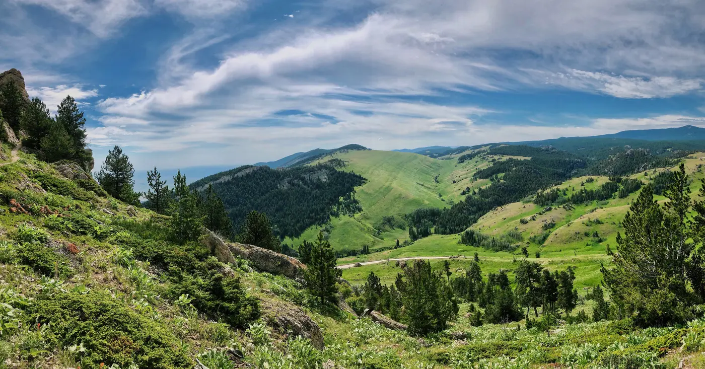
Above the falls the road zigzags up the mountain, with turnouts along the way. The 1994 Deseret News account put its steepest grades at 6 percent. Cabin Creek, Shell Creek, and Ranger Creek campgrounds lie between the falls and Granite Pass. At the Cabin Creek picnic ground, four tables and a vault toilet sit in the woods beside a small creek. The Adelaide Trail starts near Ranger Creek and leads into the Cloud Peak Wilderness. Cloud Peak itself, at 13,175 feet, is the highest point in the range.
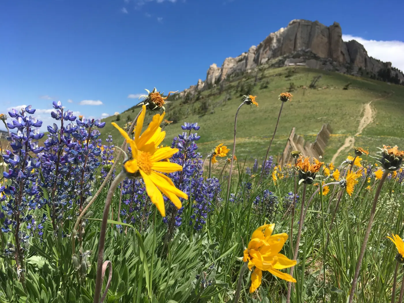
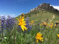
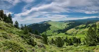
The highway levels out at Antelope Butte, a ski area with 3 lifts and 30 runs on 225 acres, with 1,000 feet of vertical rise. Beyond it is Granite Pass, over 9,000 feet and the highest point on U.S. 14. The GeoWyo log maps a fault near the pass and outlines a stand of timber blown down by a tornado in 1959. On top, the 1994 account describes rolling meadows and pine forest, lupine and balsamroot coloring the grass purple and yellow in early summer, and gold coming into the hills by September. Dennis Eckardt, then district ranger for the Medicine Wheel Ranger District, advised: “Dress for changeable weather. Carry water, food and coats in your car.”
The byway then runs north to Burgess Junction, where U.S. 14A comes in as the Medicine Wheel Passage. The visitor center there stands at 7,950 feet and has exhibits, a theater, a self-guided trail, flush toilets, and drinking water. About a mile and a half north of the highway, the Burgess picnic ground sits on the North Tongue River among rock formations. At the Camp 6–Bruce Creek interpretive site, loggers, tiehackers who cut railroad ties, cowboys, and forest rangers once lived in cabins.
Down the east slope to Dayton
From Burgess Junction the road turns northeast past Twin Buttes, Sibley Lake, and Steamboat Rock, with views into Tongue River Canyon and the Sheridan Valley. About nine miles west of Dayton, at 6,600 feet, a pullout on the left faces Fallen City. Here the uplift that raised the range fractured thick limestone parallel to the valley. When a section of the crust sank, huge blocks broke loose. Their geometric shapes suggested the name: the toppled buildings of a “fallen city.”
Three miles lower, the Hogback pullout looks onto long, sharp red ridges. Its sign tells the older part of the story. About 500 million years ago, seas covered all of Wyoming, and no animal yet lived on land. Around 75 million years ago, the crust ground together, buckled, and heaved up the Bighorn Mountains. The GeoWyo log puts the arching at about 70 million years ago. It describes a northwest-trending arch 200 miles long, raised over basement rock of the Wyoming Craton that is 2.8 to 3.0 billion years old. At the forest boundary, about 5.5 miles from Dayton, the Entrance Portal pullout faces a thrust fault and a downward fold exposed in the road cut. The Forest Service says the range reached its greatest height about 60 million years ago.
Sheep, a reserve, and a town of shells
The mountains were named for the bighorn sheep once plentiful there. A 2022 Sheridan Media history says Native Americans named the river for the sheep, and Lewis and Clark carried the name to the range. On February 22, 1897, President Grover Cleveland proclaimed the Big Horn Forest Reserve, and the Buffalo Bulletin printed the proclamation that April. By 1905 the reserve covered 1,151,680 acres. That year it became the first reserve to get a system of telephone lines so rangers could report fires to one another. The Forest Service also had an offer that year of $12.60 a thousand feet for 50,000,000 feet of lodgepole pine and Engelmann spruce, to be cut largely for railroad ties and mine props.
In 1906 W. E. Jackson, superintendent of the reserve, announced that 40,000 head of horses and cattle and 40,000 sheep would be allowed on its range. An act of Congress made the reserve the Big Horn National Forest in 1907. In 1908 an executive order from President Theodore Roosevelt fixed the spelling as Bighorn National Forest.
The town at the byway’s western end was platted on April 28, 1900. It sits on Shell Creek in the foothills of the western slope, and it was named for the many shells and fossils found around it.
The Black and Yellow Trail
In February 1912, delegates from more than 40 towns in South Dakota and Wyoming met in Deadwood. There they formed the Chicago, Black Hills and Yellowstone Park Highway Association, soon known as the Black and Yellow Trail. Anson Higby, a Basin businessman and a delegate to the highway convention, drove across the Bighorn Mountains in an old Studebaker to prove that an auto road could cross the range. Boosters at first followed the logging, mining, and mail roads already on the mountain. The first official construction across the Bighorns ran from 1915 to 1917. Counties paid for the road elsewhere; in the Bighorn Mountains, the U.S. Forest Service paid. U.S. 16 still keeps the trail’s original route over the range, while U.S. 14 crosses by way of Dayton and Burgess Junction.
From 1938 to 1940, the Civilian Conservation Corps built roads, bridges, ranger stations, fire lookouts, reservoirs, telephone lines, campgrounds, and trails across the Bighorn National Forest. The Wyoming Transportation Commission later adopted the 47 miles of U.S. 14 between Dayton and Shell as the Big Horn Scenic Byway.
Copemans Tomb
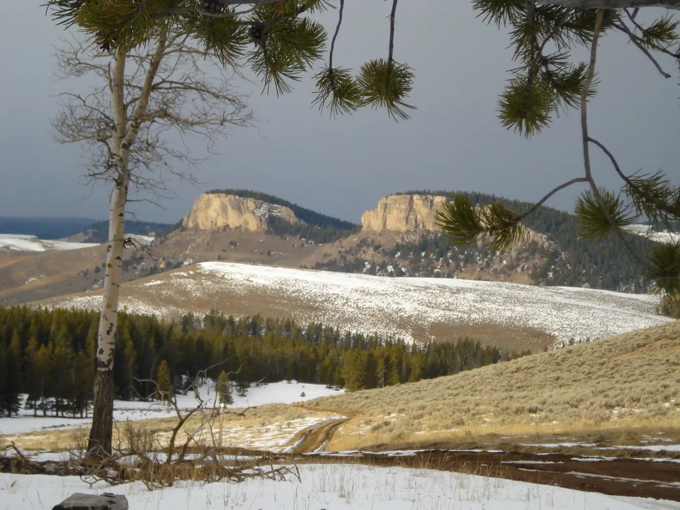
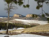
The peak above Shell Falls carries the name of Wolfgang Robert Copeman, a pioneer sheepman in the Shell country. According to the GeoWyo log, he loved the area so much that he wanted his ashes scattered on that summit. When he died in 1907, his wife’s religious objections to cremation kept his wish from being carried out, so the people of the area gave the peak his name instead. The Forest Service’s observation site downcanyon spells it Copman’s Tomb and points to the red cliff face beside Sunlight Mesa. The peak later served as a temporary headstone for Nathan A. Lindsey, who went for the mail and supplies in 1920 and never came back.
Notable Events
- 1897President Grover Cleveland signed legislation creating the Big Horn Forest Reserve over the Bighorn Mountains the byway crosses. fs.usda.gov
- 1900Shell, on Shell Creek in the foothills of the western slope of the Bighorn Mountains, was platted, fixing the town at the byway's western end. wyohistory.org
- 1907A Congressional Act changed the Big Horn Forest Reserve to the Big Horn National Forest. fs.usda.gov
- 1912Delegates from more than 40 towns in South Dakota and Wyoming met in Deadwood and formed the Chicago, Black Hills and Yellowstone Park Highway Association, soon known as the Black and Yellow Trail. wyohistory.org
- 1915After boosters followed established logging, mining and mail roads, the first official construction began on the challenging route across the Bighorn Mountains. wyohistory.org
People
- Bob Larson, interpretive specialist with the Paintrock Ranger District who described Shell Canyon's exposed geology.
- Grover Cleveland, President who created the Big Horn Forest Reserve whose mountains the Bighorn Scenic Byway crosses (February 22, 1897).
- Theodore Roosevelt, President whose Executive Order changed the forest's name to Bighorn National Forest (1908).
- W. E. Jackson, superintendent and then supervisor of the Big Horn Forest Reserve, authorized to build ranger cabins and a wagon road in cooperation with the county.
- Anson Higby, Basin businessman and highway convention delegate who drove across the Bighorn Mountains in an old Studebaker to prove an auto road could cross the range.
Sources
- travelwyoming.com/places-to-go/destinations/scenic-byways
- travelwyoming.com/listing/bighorn-scenic-byway/136
- fs.usda.gov/r02/bighorn/recreation/shell-falls-interpretive-site
- fs.usda.gov/r02/bighorn/recreation/bighorn-byway-recreation-region
- fs.usda.gov/r02/bighorn/recreation/discover-history
- sheridanmedia.com/news/98713/history-of-the-bighorn-national-forest
- dot.state.wy.us/files/live/sites/wydot/files/shared/Planning/The%20Wyoming%20Scenic%20Byways%20Program%20Book%202009.pdf
- sheridanwyoming.org/discover/scenic-drives
- geowyo.com/bighorn-mountain-byways-part-i.html
- deseret.com/1994/9/11/19130180/scenic-byways-big-horn-mountains
- wyohistory.org/encyclopedia/big-horn-county-wyoming
- wyohistory.org/encyclopedia/let-us-ramble-exploring-black-and-yellow-trail-wyoming
- fs.usda.gov/r02/bighorn/recreation/opportunities/scenic-drives
- fs.usda.gov/r02/bighorn/recreation/fallen-city-interpretive-site
- fs.usda.gov/r02/bighorn/recreation/hogback-interpretive-site
- bighorncountywy.gov/news/18-bighorn-scenic-byway