
Big Elk Guard Station
Butte Falls, Jackson County, Oregon. Rustic log cabin.
Details

- Where
- Big Elk Road, Eagle Point, Butte Falls, OR 97524. Directions
- Getting there
- From Butte Falls, OR, drive east on the Butte Falls-Fish Lake Highway (County Road 821) for approximately 19 miles to the junction with State Highway 140. Turn right, go one-eighth mile on Highway 140 to junction with Forest Road 37. Turn left, go approximately 2 miles to the junction with the guard station driveway, (the station is visible on the left from this location). Turn left, travel through the gate to the guard station.
- Fees
- $75 per night.
- Access
- Potable water is not available at this site. Visitors must bring plenty of water for drinking, cooking and washing. Water can be obtained at the North Fork Campground approximately 1 mile north on Forest Road 37.
- Walk-in or reserve
- Reservations can be made online at Recreation.gov or by calling 1-877-444-6777.
- Phone
- (541) 560-3400
- Website
- fs.usda.gov
- Managed by
- Rogue River-Siskiyou National Forest, High Cascades Ranger District.
- Established
- 1929 (replaced a 1907 cabin).
- Coordinates
- 42.35901, -122.35701.
The cabin on Big Elk Prairie
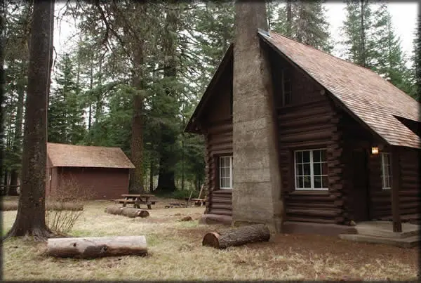
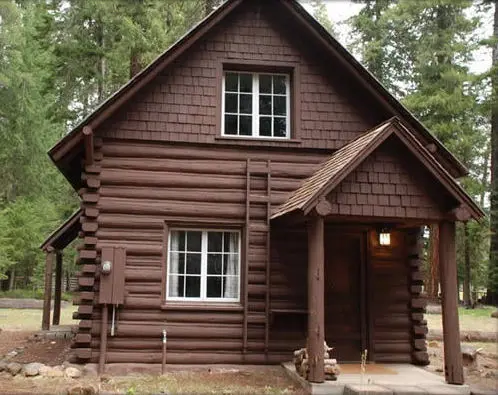
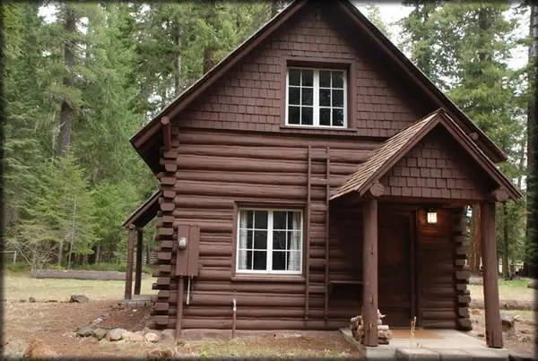
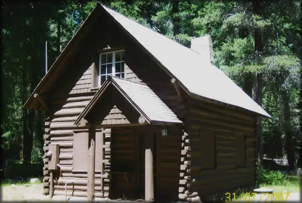
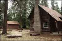
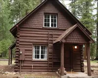
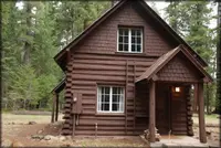
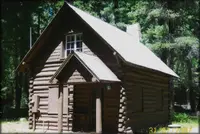
The cabin stands on the southwestern margin of Big Elk Prairie, at about 4,700 feet, inside a fenced yard reached by a short driveway and a gate. The site lies roughly 19 miles east of Butte Falls in Jackson County. The walls are peeled lodgepole logs, square-notched at the corners, chinked with mortar, and painted a dark red-brown. A steep gable roof of wood shingles carries exposed pole-rafter ends, and the building rests on a foundation of mortared basalt rubble. It is a story and a half and measures 18 feet 4 inches by 22 feet. The windows are six-light casements. There are two doors, one near the northwest corner and one at the southeast corner under a small gable-roofed porch.
The ground floor holds a main room and a kitchen. The 1999 National Register nomination calls the main room the “main room/office.” Its walls are horizontal boards painted white “in order to maximize interior light,” in the nomination’s words. The original fir flooring is still underfoot, and five-panel doors hang throughout. A mortared-rock fireplace with its chimney against the north wall faces a loveseat sofa. The kitchen has a table and chairs, a dry sink, and an electric range and refrigerator. In 1999 the nomination recorded the light and cooking fixtures as propane-powered. A double-landing stairway climbs to two bunkrooms holding one king bed and two twin beds. The Forest Service notes that the stairway is steep and that young children need help on it. The two agencies describe the heat differently. The Forest Service page lists electric heat throughout and says firewood is provided. The Recreation.gov listing says the cabin is heated with a wood stove, makes no guarantee of firewood, and warns that guests may have to split what is there with the tools provided.
Meadow, lava, and mountain
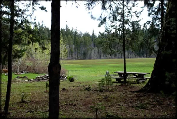
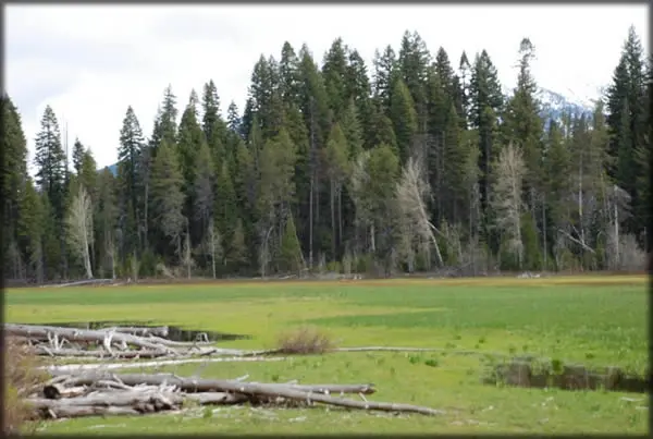
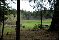
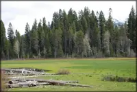
The prairie outside is a former lake basin, according to the nomination, that still holds a shallow depth of water each year from March to June. The Forest Service describes a grassy expanse that floods to a shallow pond in spring and dries out by summer, with grazing enough for a dozen or more horses. Blue camas and scrubby serviceberry grow in the grass. Lodgepole pine stands thick at the meadow’s edge, with old-growth Shasta red fir, white fir, and Douglas-fir behind it, and the Forest Service adds quaking aspen to the list. Blacktail deer, elk, mountain lion, black bear, and bald eagle are recorded in the area.
A walk across the meadow opens a view of Mt. McLoughlin, 9,495 feet. The 1999 multiple property form calls it the highest point in the Cascade Range between Three Sisters and Mount Shasta. The same walk reaches the edge of the Brown Mountain lava flow. The Forest Service gives the flow’s age as 20,000 years. The nomination puts it at approximately 20,000 to 30,000.
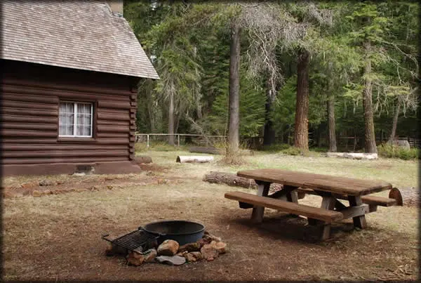
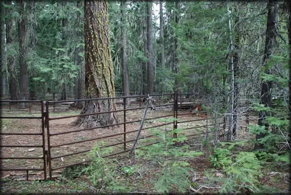
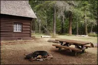
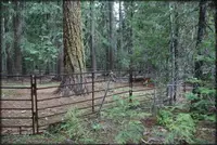
Around the cabin are the outbuildings of a working station. A Civilian Conservation Corps garage and storage shed stands about 50 feet east and now holds firewood. A small gas-and-oil shed sits on a raised wooden platform about 100 feet north. The nomination dates it to about 1935 and says it was probably moved to Big Elk later. Guests have a vault toilet, a picnic table, a fire ring, and room for tents. The corral beside the yard is still kept clear for Forest Service projects, and renters are asked neither to use it nor to block it. The site has no water. The nearest source is North Fork Campground, about a mile north on Forest Road 37.
A two-pen cabin, October 1907
The Forest Service chose its early guard station sites for good grazing, because riding and pack horses carried the guards and their equipment. In October 1907 a crew under foreman Delbert Myers built a two-pen cabin of peeled lodgepole logs at Big Elk Prairie. The crew included Fred Stanley, Samuel Dorran, and John D. Hoist. That was the first year of the Crater National Forest, which was renamed the Rogue River National Forest in 1932.
In 1929 the Forest Service judged the original cabin inadequate. It abandoned the building, later destroyed it, and had Forest Service personnel build the present cabin. For many decades the station served as summer headquarters for solitary forest guards who built trails, fought fires, and patrolled on horseback. The Forest Service calls Big Elk the oldest continuously used administrative site in the Rogue River-Siskiyou National Forest and the last remaining example of Forest Service log construction on the Forest. Recreation.gov calls the cabin one of the few remaining examples.
Russell Winn and the move to Lake of the Woods
The forest history for 1933 lists Russell Winn as Protective Assistant at Big Elk Guard Station on the Dead Indian District. His district neighbors that season included Frank Driscoll, fireman at Moon Prairie; John Neely, fireman at Clover Creek Guard Station; and lookouts on Buck Peak and Bald Mountain. On October 15 of that year Jesse G. C. Elgan resigned from the Klamath District by request. Hugh A. Ritter, ranger of the Dead Indian District, took charge of both districts as the “Dead Indian-Klamath District.” Headquarters moved from Big Elk Ranger Station to Lake of the Woods for the summer, with winter headquarters in the Federal Building at Klamath Falls. The nomination later fixed the station’s period of significance at 1929 to 1932.
The Civilian Conservation Corps added the garage and storage shed in about 1938. The Forest Service dates it to the mid-1930s. The Living New Deal reports that in 1937 five men from the Applegate and South Fork CCC camps were assigned to build sheds of this kind, at a cost of $200 to $300 each depending on location. The shed is about 18 by 16 feet, sided in horizontal shiplap, and has no foundation. Double doors on the north end open onto an earth floor across its western two-thirds. A partition closes off the eastern third, which has a wooden floor. In about 1950 a pole barn damaged by windfall was taken down. In recent years, before the cabin was offered for rent, it housed seasonal fire crews.
The cabin has changed little. Its roof, probably sugar pine shakes at first, is now cedar shingle, and the chimney has been mortared over. On the west side, decayed logs were replaced to a height of three logs.
In November 1999 Katherine C. Atwood, writing for the Forest Service from Ashland, prepared the nomination. Big Elk was one of fourteen Forest Service structures submitted together, and one of three administrative buildings in the group, alongside Star Ranger Station (1911) and Willow Prairie Cabin (1924). The Federal Register of April 24, 2000, listed it as pending at “FS Rd. 3706 approx. 5 mi. N. of Dead Indian Memorial Road.” It was entered in the National Register on December 29, 2000, as reference 00000462, with the cabin and its CCC shed counted as contributing buildings. The Keeper added Architecture as an area of significance under Criterion C. Under current function, the 1999 form had entered “Vacant/Seasonal Use.”
Notable Events
- 1907Forest Service employees Delbert Myers, Fred Stanley, Samuel Dorran, and John D. Hoist erected a two-pen peeled-lodgepole-log cabin at Big Elk Prairie. npgallery.nps.gov
- 1929The Forest Service abandoned and later destroyed the original inadequate cabin and built the present cabin. npgallery.nps.gov
- 1933Headquarters moved from Big Elk Ranger Station to Lake of the Woods as a summer station; winter headquarters were in Klamath Falls. npshistory.com
- 1938Civilian Conservation Corps enrollees built the garage/storage shed as an addition to the guard station. livingnewdeal.org
- 1950A windfall-damaged pole barn was removed from the site. npgallery.nps.gov
- 2000The pending nominations notice identifies Big Elk Guard Station in Jackson County as 00000462. govinfo.gov
People
- Delbert Myers, Foreman of the Forest Service crew that erected the original cabin (October 1907).
- Fred Stanley, Forest Service employee who erected the original cabin (October 1907).
- Samuel Dorran, Forest Service employee who erected the original cabin (October 1907).
- Hugh A. Ritter, District Ranger who took charge of the combined Dead Indian and Klamath districts when headquarters moved from Big Elk (1933).
- Russell Winn, Protective Assistant at Big Elk Guard Station (1933).
Sources
- recreation.gov/camping/campgrounds/234630
- fs.usda.gov/r06/rogue-siskiyou/recreation/big-elk-guard-station
- heritagedata.prd.state.or.us/historic/index.cfm?do=v.dsp_siteSummary&resultDisplay=39482
- livingnewdeal.org/sites/big-elk-garagestorage-shed-umpqua-national-forest-or
- heritagedata.prd.state.or.us/historic/index.cfm?do=main.loadFile&load=NR_Noms%2F64500516.pdf
- npshistory.com/publications/usfs/region/6/rogue-river/history/2/chap6.htm
- govinfo.gov/content/pkg/FR-2000-04-24/html/00-10200.htm
- npgallery.nps.gov/NRHP/GetAsset/NRHP/00000462_text
- fs.usda.gov/r06/rogue-siskiyou/recreation/big-elk-guard-station
- npshistory.com/publications/usfs/region/6/rogue-river/history/1/chap5.htm