Bear Basin Lookout and Cabin
Gasquet, Del Norte County, California. Historic fire lookout and 1930s-style cabin rental; July, August and September.
Details

- Where
- Gasquet, Del Norte County, CA. No street address stated. Directions
- When
- Rented as a pair from July 1 to September 30.
- Getting there
- From Smith River NRA Visitor Center, drive 10.6 miles east on Highway 199 to Little Jones Creek Road (FS 16/17N05/Jawbone Road), follow signs to Bear Basin Lookout and stay on the paved road.
- Fees
- $75 per night for one to eight persons; $5 per night for each additional person, maximum 12.
- Access
- Narrow gravel access roads; a steep unpaved 250-foot path leads to the lookout, which is reached by 13 stair steps.
- Walk-in or reserve
- Required through Recreation.gov; one to four nights.
- Phone
- 707-457-3131
- Website
- fs.usda.gov
- Managed by
- U.S. Forest Service.
- Established
- Lookout built in 1935, moved to Bear Basin Butte in 1997; cabin built at that time.
- Coordinates
- 41.809246, -123.741047.
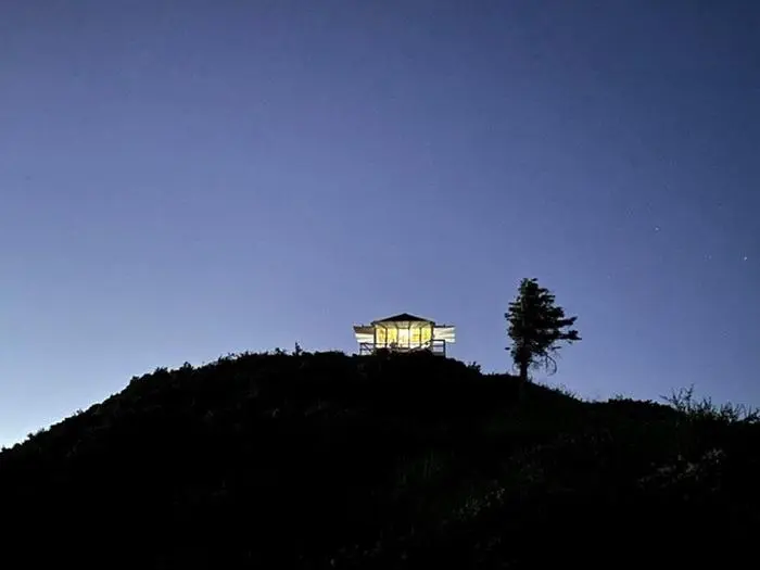
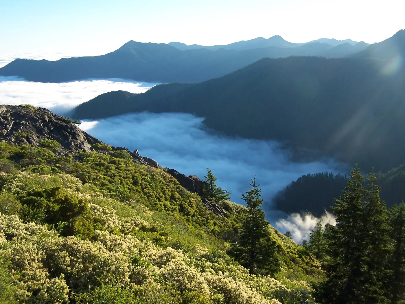
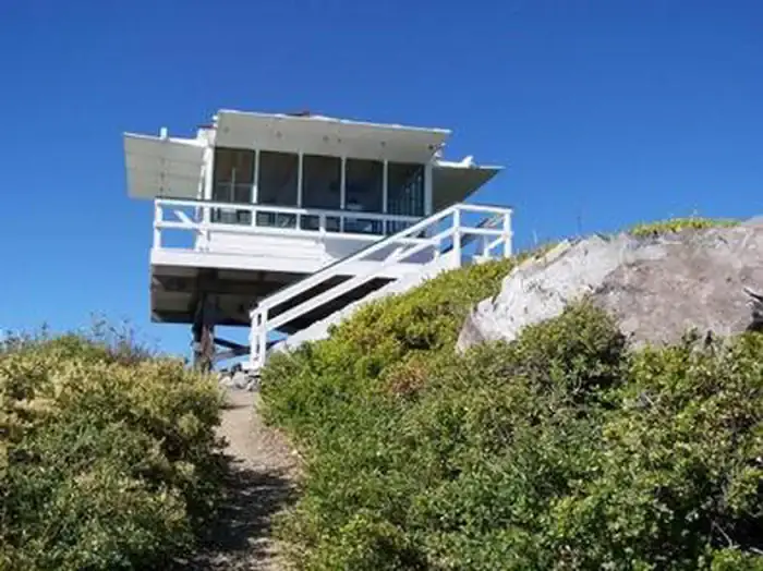
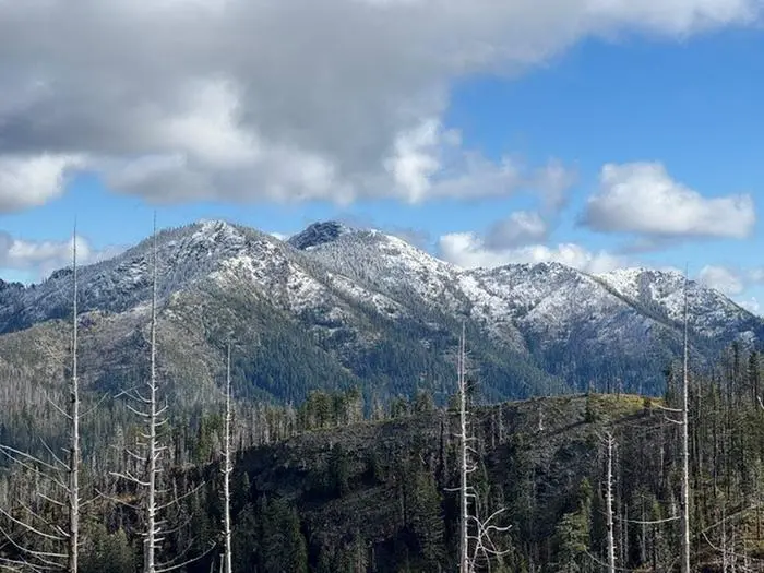
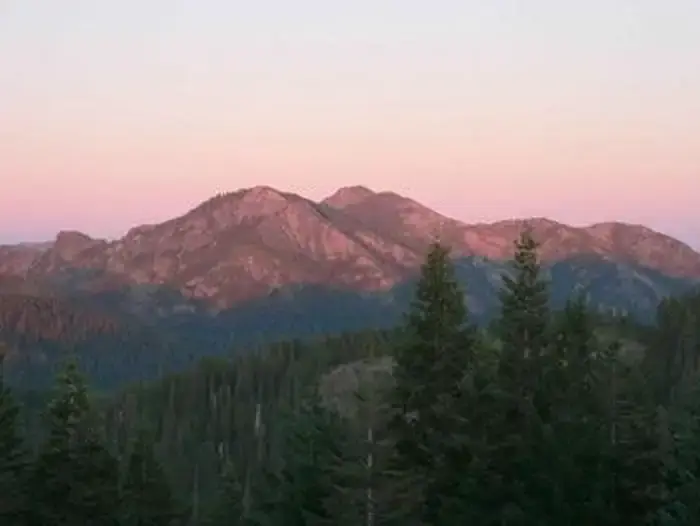
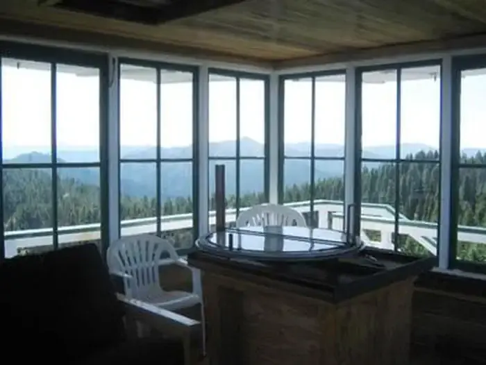
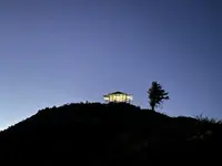
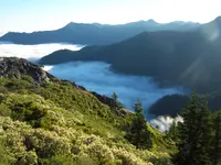
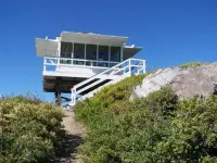
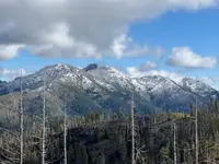
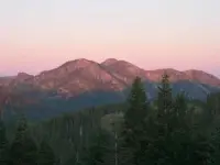
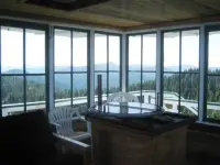
On Bear Basin Butte, about 5,300 feet up in the Six Rivers National Forest, a glass-walled lookout cab stands on a treeless rock outcrop at the crest of a narrow ridge. A catwalk and railing run around it, and windows line all four sides. Inside are a table, a double futon, a bookcase, chairs, and an Osborne Firefinder, a device used in fire lookout towers. Guests use it to locate named peaks. The mountain tops of the Siskiyou Wilderness fill the eastern horizon: Twin Peaks, Prescott Mountain, Baldy Peak. Sanger Peak, Broken Rib Mountain and the meadow of High Dome lie to the north, and Ship Mountain lies to the south. To the west is the Pacific Ocean, past forested mountainsides and the valleys drained by the Smith River and its tributaries.
The Forest Service rents the lookout and the Pierson Cabin below it as a pair from July 1 to September 30. According to Recreation.gov, the lookout closes on October 1 each year to protect the building from damaging winds. It may close earlier when a strong storm is forecast, while the cabin stays available. The Forest Service says reservations often fill as soon as they open online.
The cab and the cabin
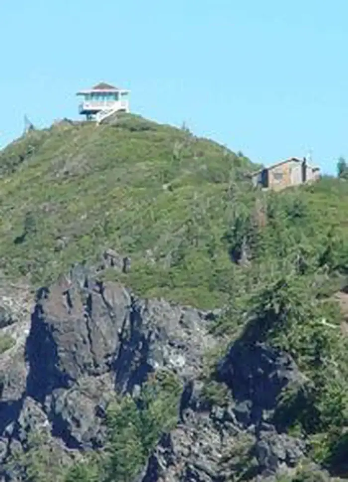
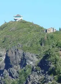
The lookout sits at the apex of the butte, about 250 feet from the cabin by a steep, unpaved uphill path, and a flight of 13 stairs climbs to the cab. The ridge has very steep drop-offs on two sides. The Forest Service brochure warns that the cliff edges are not fenced and that the catwalk railings are at adult heights. It also tells guests not to sit or lean on the deck railing.
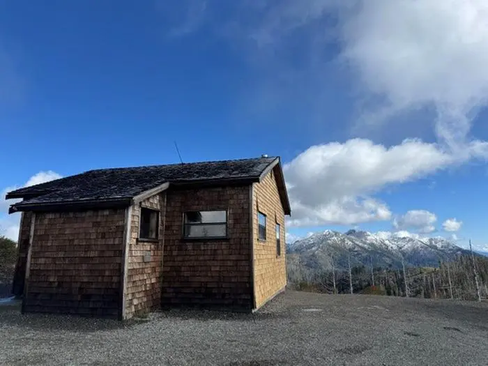
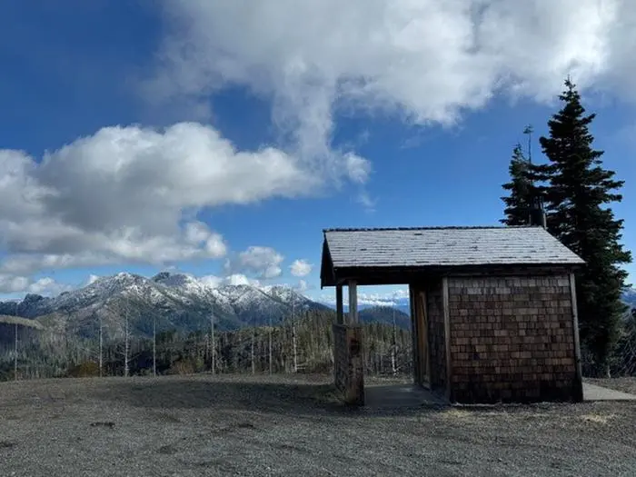
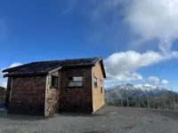
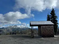
The cabin is 20 by 30 feet and sits on a graveled level spot on the ridge, built in a 1930s style after a Civilian Conservation Corps design. One room holds a wood-burning stove, a bench, a bookcase, a small dining table, and three double beds, one of them a bunk above another. A seven-foot picture window faces east toward the Siskiyou Mountains. The other six windows are screened and open for cross-ventilation. A second room has 18 feet of counter space for food and gear, and a covered entry holds the firewood. Outside are three picnic tables, four Adirondack chairs, a fire ring, a wood shed and a vault toilet. There is no electricity, no water, no well and no indoor plumbing. The brochure tells guests to think of a night there “as camping, except you won’t need a tent.” Guests pack in their own water, lantern, cooking stove and bedding. They also clean the cabin and lookout before they leave.
Booklets, checklists and books in the cabin help guests identify what they find outside. The butte lies within the Bear Basin Butte Botanical Area, home to more than 14 species of conifers and, in the Forest Service’s words, “an unusual and beautiful array of wildflowers and plants.” The surrounding National Recreation Area counts more than 300 resident wildlife species, among them black bear, coyote, gray fox, mountain lion, bobcat, mountain beaver and quail. “Remember the name of the butte?” the brochure asks. “This is their space too.” The Doe Flat and Island Lake trailheads, both within three miles, lead into the Siskiyou Wilderness toward Buck Lake, the Devil’s Punchbowl, Island Lake and the Clear Creek Recreational Trail.
Jawbone Road and the locked gate
Guests first stop at the Smith River National Recreation Area Visitor Center in Gasquet, where they pick up the permit and the key in person. From there the drive is 21.5 miles and takes about an hour. Highway 199 runs east 10.6 miles to Little Jones Creek Road, which is also called Jawbone Road. About 5.8 miles up Jawbone the lookout first comes into view on its ridge. A left turn onto road 16N02 leads to a locked gate. Over half the drive is on a single-lane, steep, winding mountain road with pullouts, and the final stretch is gravel. Recreation.gov advises high-clearance vehicles and notes that rocks and debris often lie on the paved portion even in summer.
The gate gives the site some privacy. Occasional visitors may hike in for the view, and the brochure says that anyone who drives in will be there on official business. The 2015 edition lists the nearest gas at Hiouchi, 31 miles away, and the nearest potable water at Patrick Creek Campground, 13 miles away. It puts the nearest known pay telephone in Brookings, Oregon, 56 miles off.
The weather at this height, this close to the ocean, changes quickly. It may be sunny on the butte and raining in Gasquet, or the reverse. During lightning storms, the brochure tells guests to close the lookout’s windows and doors, turn off radios, damper the stove, and touch nothing metal. A guest who spots a fire from the cab is asked to report it to the visitor center.
Camp Six on French Hill
The building in which guests now sleep began five miles west, on French Hill. The brochure says that in about 1926–27 the Civilian Conservation Corps helped build the French Hill county road, County Road 411, between Gasquet and Big Flat. The Camp Six Lookout was built in about 1935 at the sixth location of the road’s construction camp, and it took its name from that camp. It replaced an earlier lookout and stood one mile northwest of it, giving a better view into the Smith River canyon and the Gasquet Flat area. The Forest Service gives 1935 as the year the CCC built it. A 2026 post by Six Rivers National Forest gives 1934. A history of the forest names the lookout’s earlier home as Upper Coon Mountain.
Accounts also differ on its working life. The Forest Service pages say the lookout was part of fire detection operations through the 1990s. The 2026 post says it was retired in the 1950s and earned historic recognition in 1991. By 1956, according to the forest history, the Six Rivers had 14 lookout stations, and aircraft were already reducing the number of towers needed for fire surveillance.
Bear Basin Butte had lookouts of its own. Recreation.gov says the original Bear Basin Butte lookout existed in the 1930s, and the brochure places the rebuilt tower at the site of another former lookout. The forest history records lightning striking a lookout on the butte in 1942. The strike went through the south side of the building to the telephone switch box and knocked the lookout and his wife flat, and they felt groggy afterward. The 2026 post tells a different story of the first lookout. By that account it was built in 1924 and was “not actually on Bear Basin Butte.” It was destroyed by lightning in 1936, and Old Camp Six, “just to the east,” succeeded it.
Carried to Bear Basin Butte
By the 2026 account, vandalism threatened the old lookout. A partnership between the forest and Pierson Building Center of Eureka then proposed moving it whole. The brochure gives the sequence: the lookout was dismantled on French Hill in the summer of 1996 and rebuilt on Bear Basin Butte the following summer. Its cab was rehabilitated, and the tower, once 30 feet tall, was cut down to rise six feet above the rock base. Recreation.gov gives 1996 as the year of the move, and another Forest Service page gives 1997. The cabin was built at the same time and named for the building center. The brochure credits Forest Service staff, Pierson Construction employees and volunteers who contributed “countless hours” to the work.
The San Francisco Chronicle reported the work on October 9, 1997. The lookout had been relocated to the mountaintop that July, and a cedar-shake cabin that slept eight stood nearby. Overnight stays would cost $50, with reservations taken starting January 1, and five more lookouts in the recreation area were under consideration for similar rentals. Ranger Brian Morris spoke to the paper from the visitor center in Gasquet. “We’re a long way off from anywhere,” he said. “So our numbers are small: roughly 200,000 visitors a year or so.” By 1998 the lookout and cabin were open to the public.
Notable Events
- 1924The original lookout was built in 1924. facebook.com
- 1930sThe original Bear Basin Butte lookout existed in the 1930s. recreation.gov
- 1934The CCC (California Conservation Corps)-built "Old Camp Six" lookout was constructed in 1934, just to the east, and stepped in as the successor. facebook.com
- 1936The original lookout was destroyed by a lightning strike in 1936. facebook.com
- 1942Lightning went through the south side of the building to the telephone switch box; the lookout and his wife were knocked flat and afterward felt groggy. npshistory.com
- 1950sThe Old Camp Six lookout was retired in the 1950s. facebook.com
- 1991After retiring in the 1950s, the lookout earned historic recognition in 1991. facebook.com
- 1996The Old Camp Six lookout was carefully taken apart, transported, and fully reassembled atop Bear Basin Butte, complete with a 1930s-style cabin inspired by classic CCC architecture, after a partnership between the forest and Pierson Building Center in Eureka. facebook.com
- 1998By 1998 the mountaintop retreat opened for public rentals. facebook.com
- 1998Visitors were to have the chance to lodge in the cabin and lookout beginning in spring of 1998. sfgate.com
- A new 1930s-style cabin modeled after a CCC cabin design was constructed near the lookout through a partnership between Pierson Building Center of Eureka, CA, and the Six Rivers National Forest; the cab was rehabilitated and the tower reduced from its former 30' height to rise six feet above the rock base. fs.usda.gov
Sources
- recreation.gov/camping/campgrounds/234262
- fs.usda.gov/r05/sixrivers/recreation/bear-basin-butte-lookout-pierson-cabin
- fs.usda.gov/visit/destination/bear-basin-butte-lookout-and-pierson-cabin
- fs.usda.gov/sites/nfs/files/r05/sixrivers/publication/Bear%20Basin%20Butte.pdf
- fs.usda.gov/visit/destination/bear-basin-butte-lookout-and-pierson-cabin
- facebook.com/SixRiversNF