Battle Pass Scenic Byway
Encampment, Carbon County, Wyoming. Scenic byway; Memorial Day through October.
Details

- Where
- Wyoming Highway 70, Encampment, WY. Directions
- When
- Open Memorial Day through October, weather permitting.
- Getting there
- From Encampment, Wyoming, head west on Wyoming Highway 70 over the Sierra Madre Mountains to Baggs.
- Hours
- Open Memorial Day through October, weather permitting.
- Access
- The byway is open Memorial Day through October and closes for the winter due to snow.
- Phone
- 307-324-3020
- Website
- wyomingcarboncounty.com
- Managed by
- Carbon County Visitors Council.
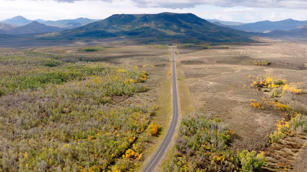
Wyoming Highway 70 leaves Encampment heading west and begins to climb into the Sierra Madre. The whole road runs 57 paved miles over the range to Baggs, through Medicine Bow National Forest. The part inside the forest, from milepost 22 to milepost 50, was designated a state scenic byway in 2012. GeoWyo and the Carbon County Visitors Council both give that section as 28 miles, and the county allows 45 minutes to drive it. There are no gas stations or stores along the way. The National Scenic Byway Foundation advises filling the tank in Saratoga, Riverside or Encampment, or Baggs.
The road is open from Memorial Day through October and is closed in winter by the mountain snow. Radio station owner Joe Kenney’s father grew up in Encampment, and his mother, Maudie Lake, grew up in Savery on the far side of the range. When columnist Bill Sniffin asked how the two had courted with the highway shut all winter, Kenney said, “they always met up in Rawlins.”
Aspen, evergreen, and the Divide
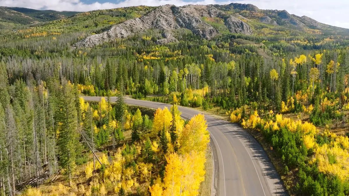
The trees thin as the road gains elevation, and the views widen. In summer the slopes are covered in evergreens and aspens. In September and October the aspens turn. Rev. Warren Murphy, whose first assignment was the churches at Dixon and Baggs, wrote of mid-September on Route 70: “They cover the highway and when driving along you are riding on a carpet of gold. There is so little traffic.” Aspen Alley, a narrow road cut through an aspen grove, lies a few miles north of the pass on Wyoming 71. Murphy noted that “the alley trees are aging out. However, the young ones are growing fast.”
Sources describe the road itself differently. The county says traffic is light and the shoulders wide enough to make it a good bicycle route. The byway foundation warns that it can be narrow and winding in places. Elk, deer, moose, and bears range through the forest. Campgrounds include Lost Creek, Battle Creek, and Hog Park. Trails reached from the road include the Baby Lake, Green Mountain Falls, and Bottle Creek trails and the Continental Divide Trail, which crosses Highway 70 about 12 miles west of Encampment.
Battle Pass crosses the Continental Divide at 9,955 feet, according to GeoWyo. The Battle Townsite Overlook stands there, open June through October, weather permitting, by the Forest Service’s listing, with no drinking water. It looks out over the Sierra Madre. Little remains of the town of Battle, and the interpretive panels describe it as it was in the mining years. Beneath the road is the basement core of the range, a northwest-southeast arch raised during the Laramide Orogeny. Alongside it runs the Cheyenne Belt, a suture zone two to three miles wide and about 125 miles long. It formed between 1.8 and 1.6 billion years ago, when an island arc collided with the continent. It separates the older Archean granites and gneisses of the Wyoming Province to the north from the younger Proterozoic rocks of the Colorado Province to the south.
Rudefeha and the copper towns
Battle was one of several mining camps on the route. The others included Rudefeha, Dillon, Rambler, and Copperton, and the byway foundation’s page spells the second “Redefeha.” Signs along the road tell their stories. GeoWyo dates the first copper find in the Doane-Rambler area to 1874. WyoHistory.org says George Doane reportedly found copper in the mountains near Battle Lake in the late 1880s and began the Doane-Rambler mine with partners.
The boom came in 1897. A sheepherder, Ed Haggarty, found gossan in what became the Ferris-Haggarty area. Gossan is a highly weathered, iron-rich rock that marks a sulfide ore body below. Haggarty formed a mine with his boss George Ferris and partners Robert Deal and J. M. Rumsey, and named it Rudefeha from the first two letters of each surname. Rumsey sold out to Ferris for $1,000, Deal backed out, and the property became the Ferris-Haggarty. In 1899 Haggarty sold his share to Ferris for $30,000. Ferris was killed in a wagon accident that same year, and his wife, Julia, inherited his interest.
The mine sat about 16 miles west of Encampment, on the west side of the Divide, at 9,888 feet. WyoHistory.org says that under Ferris it employed 250 men and 400 horses, and that its average daily shipments of 80,000 pounds of ore went to Colorado. GeoWyo says the ore was hauled 60 miles by wagon to the nearest Union Pacific junction and shipped to a smelter in Chicago.
In 1902 the North American Copper Company bought the mine for $1 million. That year the Boston & Wyoming Smelter, Power and Light Company opened in Encampment. A 16-mile aerial tramway carried ore down from the mountains to the smelter in 840 buckets that each held as much as 700 pounds. At the time it was the longest tramway in the world.
The Saratoga & Encampment Railway reached town in August 1908. By then copper had fallen from 20 cents a pound to 13, and a series of fires had struck the smelter. The Ferris-Haggarty, the most productive copper mine in the district, closed that year, though its ore was not played out. In 2015 the Ferris-Haggerty Mining Corporation of Colorado bought the abandoned mine with plans to reopen it, and estimated that up to 95 percent of the original copper was still in place. At the Grand Encampment Museum, at the east end of the road, reconstructed tram towers stand on the grounds with ore buckets hanging from the cables.
A fishing pole at Battle Lake
About 14 miles west of Encampment, at 9,490 feet, a marker stands on the left side of the road for westbound drivers. Bill Sniffin describes it as a plaque mounted on a big brick podium. Beyond it, in the distance, is Battle Lake. The inscription reads: “Camped near this spot in 1878, while on a fishing trip. It was here that his attention was directed to the fiber from his bamboo fishing pole which he tested as a suitable filament for his incandescent electric lamp.” The Historical Landmark Commission of Wyoming erected it in 1949. GeoWyo says the legend gives the glow of a burning bamboo fishing pole as the spark of the idea.
Thomas Edison was 31 that summer and already known for the phonograph. According to the Historical Marker Database, he had joined astronomer Henry Draper’s expedition to watch the total solar eclipse of July 29, 1878, from Rawlins. During the eclipse Edison tried to measure the heat of the sun’s atmosphere with a sensitive thermometer of his own design, and it did not work. Afterward members of the party explored the Rockies, and Edison camped at Battle Lake. Sniffin writes that Edison killed elk and deer on the trip and that his fishing party reportedly caught 3,000 trout.
Laramie historian Phil Roberts, as Sniffin reports him, calls the filament story a wonderful tale that is just not true. GeoWyo, citing Roberts, says Edison tested bamboo only after trying about 6,000 other materials, and that his first success came a year after the fishing trip, with carbonized cotton thread. The Historical Marker Database says carbonized bamboo was not the first material his laboratory tested, but that it proved the key to making the light bulb a commercial success.
Below Bastion Mountain, August 1841
West of the pass the road drops into the Little Snake River Valley and passes through Savery, Dixon, and Baggs. Each year in mid-July the Ride the Divide Antique Tractor Drive leaves the Little Snake River Museum in Savery, crosses the pass, stays the night in Encampment, and returns the next day.
The pass, the creek, the lake, and the mountain all take their name from a fight in this valley. Henry Fraeb, called “Frapp” by some who knew him, was a German-born trader from St. Louis and a former partner of Jim Bridger in the Rocky Mountain Fur Company. In the summer of 1841 his party traded whiskey for meat with a group of Sioux, Cheyenne, and Arapaho in northern Colorado. When the tribesmen sobered and found they had given up most of their provisions, they moved north, attacked a Shoshone village tied to Fraeb’s camp, and took more than 100 horses. Bridger, on the Green River, sent Jim Baker to warn Fraeb.
On August 20 Fraeb’s men moved up the Little Snake to the base of what was then Bastion Mountain, near the mouth of Battle Creek. GeoWyo places the site 18 miles southwest of the pass. There they built a rough fort or corral. On the morning of August 21 the warriors charged it more than forty times. Fraeb was killed, along with several trappers, Shoshone allies, and more than 100 horses. Baker, 21 years old, took command. The trappers held out until nightfall. Low on powder and lead, they buried their dead, cached their supplies, and reached Bridger’s post on the Green River on August 27.
Accounts of the fight differ. GeoWyo calls it a two-day battle between about 23 trappers and 500 to 700 warriors, the largest fight between Indians and fur trappers in the Rocky Mountains. Sniffin calls it a six-day fight. Bastion Mountain became Battle Mountain, and the name spread across the range.
Wyoming and Colorado records list a “Bridger and Fraeb trading post” at the site, said to have operated from about 1839 to 1841. The label comes from trail maps compiled in the early 1970s from local tradition. Archaeologists searched the valley in 2011. Their 2015 report in Plains Anthropologist concluded that the “fort” was most likely the defensive work Fraeb’s men threw up the day before the battle, and WyoHistory.org says the question remains open.
Baker later built a cabin in the valley near Savery, and it now stands at the Little Snake River Museum. He is buried in the family cemetery on a hill above the Little Snake River valley, within sight of Bakers Peak and Battle Mountain.
Notable Events
- 1830sTrappers and fur traders held rendezvous in that decade at the base of the Sierra Madre Mountains, in the country the byway now crosses from its Encampment end. wyohistory.org
- 1841A fierce two-day battle between about 23 fur trappers and 500 to 700 Sioux, Cheyenne and Arapaho warriors, reckoned the largest fight in the Rocky Mountains between Indians and fur trappers. geowyo.com
- 1841A famous fight between Indians and some trappers; mountain man Jim Baker, just 21, had to lead his men after Captain Henry Frapp was killed. After a six-day fight, the trappers left. powelltribune.com
- 1841The party moved up the Little Snake River to the base of what became known as Battle Mountain, near the confluence of Battle Creek, and built a temporary fortification, described in historical accounts as a rudimentary fort or corral. wyohistory.org
- 1850Gold seekers on their way to California travelled along the nearby Southern Cherokee Trail. geowyo.com
- 1874Copper was discovered in the Sierra Madre Range in the Doane-Rambler area. geowyo.com
- 1878Camped near this spot in 1878, while on a fishing trip. It was here that his attention was directed to the fiber from his bamboo fishing pole which he tested as a suitable filament for his incandescent electric lamp. hmdb.org
- 1890sDuring the peak of the copper mining era, Encampment at the byway's east end boasted a 16-mile-long aerial tramway carrying ore from the mountains to the smelter. carbonwyedc.com
- 1897After Ed Haggarty's discovery of a highly weathered iron-rich quartzite rock, called gossan, in the Ferris-Haggarty area, prospectors, miners and merchants flooded into new mines and towns in the area. geowyo.com
- 1908The most productive copper mine in the district closed that year, though the ore was not played out. geowyo.com
- 1949Erected 1949 by the Historical Landmark Commission of Wyoming. hmdb.org
- 2011Field investigations in the Little Snake River Valley looked for the battlefield and any possible post remains. wyohistory.org
- 2012The portion of Wyoming Highway 70 inside the Medicine Bow National Forest, milepost 22 to 50, was designated a scenic byway. geowyo.com
- 2015The published conclusion was that the so-called fort near the battlefield was most likely the temporary defensive fortification Fraeb's men built before the battle rather than a permanent commercial establishment, and the question remains open. wyohistory.org
- On the morning of the 21st the warriors charged more than forty times during the day, killing Fraeb, several other trappers and Shoshone allies and more than 100 horses; the trappers held off the attack until nightfall, then buried their dead, cached their supplies and reached Bridger's post on the Green River on the 27th. wyohistory.org
People
- Ed Haggarty, whose gossan discovery in the Ferris-Haggarty area brought the mining flood into the country around the byway (1897).
- Jim Baker, Mountain man, just 21 at the time, who led the trappers after Captain Henry Frapp was killed in the 1841 fight.
- Thomas A. Edison, Inventor who camped near the spot on a fishing trip in 1878 (February 11, 1847 -- October 18, 1931).
- Henry Frapp, Captain of the trappers, killed in the 1841 fight.
- George Doane, reportedly discovered copper in the mountains near Battle Lake and began the Doane-Rambler mine (late 1880s).
- Henry Fraeb, veteran mountain man and one-time partner of Jim Bridger, killed in the battle that gave the pass its name (d. August 1841).
- Jim Bridger, Fraeb's partner, on the Green River, who sent Jim Baker to warn him of the approach of the warriors.
Sources
- travelwyoming.com/places-to-go/destinations/scenic-byways
- wyomingcarboncounty.com/things-to-do/scenic-drives/battle-pass-highway
- nsbfoundation.com/sb/battle-pass-scenic-byway
- geowyo.com/battle-pass-byway---wy-highway-70.html
- wyohistory.org/encyclopedia/fraebs-post
- fs.usda.gov/r02/mbrtb/recreation/sierra-madre-area-0
- carbonwyedc.com/communities/encampment
- wyomingcarboncounty.com/things-to-do/scenic-drives/battle-pass-highway
- powelltribune.com/stories/battle-mountain-small-towns-and-edisons-favorite-fishing-hole,21881
- hmdb.org/m.asp?m=107499