

Barnston Island Ferry
Port Kells, British Columbia. Inland ferry.
Details
- Where
- Bottom of 104th Avenue, Surrey, Port Kells, BC. Directions
- When
- On demand.
- Getting there
- Port Kells is in the northeast corner of Surrey at the bottom of 104th avenue.
- Fees
- free of charge to users.
- Hours
- On demand, Monday–Thursday 6:15 am–11:55 pm; on demand, Friday–Sunday 6:15 am–12:55 am.
- Access
- Vehicle capacity 5 Passengers 50 Trip time 5 minutes Weight limit 40000kg Service hours: On demand, Monday – Thursday 6:15 am – 11:55 pm* On demand, Friday – Sunday 6:15 am – 12:55 am* *Service is interrupted as/when river traffic warrants. Trucks with a GVW in excess of 20,000kg will be transported separately from other passengers and vehicles.
- Phone
- 604 681 5199
- Managed by
- Western Pacific Marine.
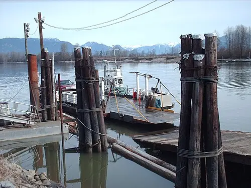
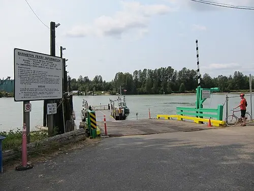
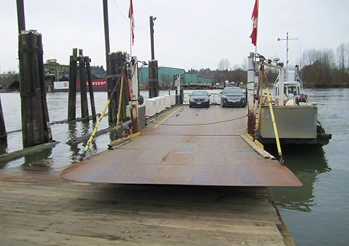
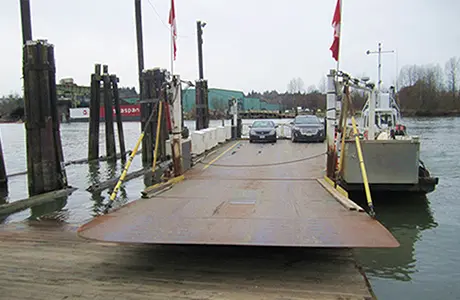
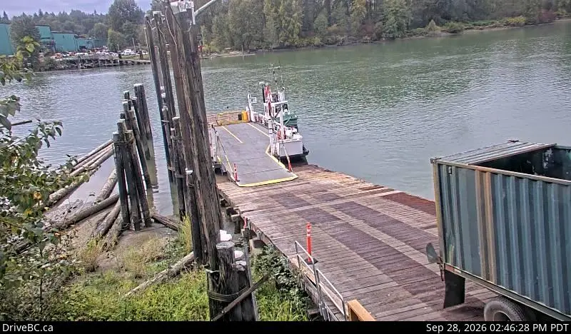
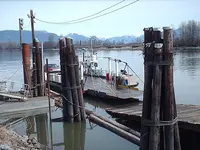
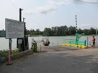
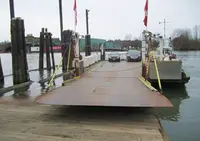
104th Avenue runs out in the northeast corner of Surrey, and at its foot in Port Kells a landing drops to Parsons Channel, the arm of the Fraser River on its south side. Barnston Island lies across the water. The Barnston Island Ferry makes the crossing: a barge moved by an attached tugboat, five minutes from slip to slip. It runs on demand from 6:15 in the morning and charges no fare, as no inland ferry in British Columbia does. When river traffic warrants, the crossing waits.
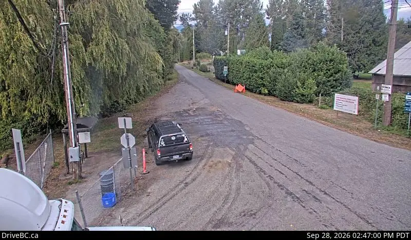
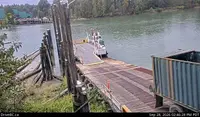
The sources differ on what the barge holds. The province lists 5 vehicles and 50 passengers, with a maximum load of 40,000 kilograms, and carries trucks over 20,000 kilograms gross weight separately from other traffic. Wikipedia gives 6 vehicles and 52 passengers, and only 28 passengers when all six vehicles are aboard. A 2020 TranBC article named the barge Barnston Island No. 3 and put it at five vehicles and 52 passengers. Western Pacific Marine runs the service under private contract with the provincial Ministry of Transportation and Transit. Transport Canada inspects the operation every year and certifies every crew member. Highway cameras watch the landings from both banks.
Backing off at Barnston Island
Drivers back their vehicles off the barge when they reach the island and back them on again to leave. Most of the traffic belongs to the island. On school days the school bus boards first. Milk tankers cross one at a time with no cars beside them, about six a day by TranBC’s 2020 count. Avalon Dairy, which began in 1906, is among the farms the ferry has served. Livestock seldom rides, for safety reasons and because long-haul cattle liners will not fit. Cranberries and herbs now grow on the island along with the older livestock, vegetable, hay, and dairy farms. Most of its 567 hectares lie within the Agricultural Land Reserve.
The island is unincorporated and belongs to no municipality. TranBC counted about 170 residents in 2020, among them about 49 Katzie First Nation members living on Katzie First Nation Reserve #3. CBC News had given the population as 140 in 2015.
Visitors cannot park anywhere on the island, the two park areas included, so they come over on foot or by bicycle. They ride the flat, narrow road along the top of the dike that rings the island against the spring freshet. There are no stores, no public drinking water, and no medical services. On a sunny afternoon, CBC reported in 2015, cyclists off the ferry can outnumber the people who live there. “It’s phenomenal,” said Laurie Archibald, out riding with friends. “It’s fun. It’s so short and it adds to the charm of the whole visit.”
A cable ferry and the morning milk run
The island is named for George Barnston. He was born about 1800 in Edinburgh and joined the North West Company as an apprentice clerk in 1820. He passed into the Hudson’s Bay Company when the two companies united in 1821. Barnston had trained as a surveyor and did charting on the lower Fraser. He was one of three clerks, with Annance and Manson, who went with James McMillan on the 1827 expedition to establish Fort Langley. He spent his retirement on botany and entomology, served as president of the Natural History Society of Montreal in 1872–73, and died in Montreal on 14 March 1883. A Dominion sectional sheet of 1913 spelled the island “Barnstown.” On 11 February 1936 the name was adopted as early Admiralty charts had labelled it.
The year of that misspelling, 1913, was also the year the Canadian Pacific Railway withdrew its steamboat services on the Fraser. According to Wikipedia, this left the island’s farmers no realistic way to get their produce to market. A government wharf went in that year. Residents petitioned, and in May 1916 the government ferry began operating. It was a cable ferry that had worked the Pitt River crossing. Here, floating driftwood fouled it and the underwater cable snagged fishing nets. The next year it was completely overhauled. Service stopped for six weeks in the spring high water, and again in winter when ice floes made the channel hazardous. Each stoppage held up the island’s milk, grain, hay, and potatoes. In 1918 a gasoline boat pushing a small scow took over, with room for passengers and a little produce.
Island milk production kept rising, and so did the farmers’ requests for better service. In 1921 the government bought a fish boat to run as the ferry: 11.6 metres long by TranBC’s figure, 12 metres (38 feet) by Wikipedia’s. The roads were poor. So each morning the boat circled the island’s 10-kilometre shore, picked up milk cans at the farms, and delivered them to Port Kells before starting its regular crossings. At the end of the day it carried the empty numbered cans back to the farmers for the next morning’s haul. By 1927 the boat was old and inadequate.
In 1930 a 9.8-metre tug and an 11-metre barge replaced it. The barge could carry two vehicles, the first the ferry had taken. The tug left the barge at the slipway and went on around the island for the milk. Len Thompson became the first skipper of the vehicle ferry on July 1, 1930, and held the post until December 9, 1962. Travel was free by 1933, though Wikipedia notes that the year the tolls ended is unclear.
When the river froze solid, produce was skated across the ice. In the winter of 1936–37, floating ice rammed the ferry against the island slip. Residents crossed in rowboats until it was refloated. That September a ferry worker backing a car at the mainland slip drove into the river. He struggled to get out of the submerged car and finally surfaced. In 1940 a new 11-metre wooden tug, the Barnston Island, arrived. The Province reported it was built to carry 60 cans of milk and had “a spacious and comfortable cabin for passengers.” The trips around the island ended that year, and the ferry kept hours of 7 a.m. to 7 p.m. From then on a truck rode the ferry daily and collected the cans around the island. TranBC counts about 100 cans a day, and Wikipedia says they went to Dairyland, until about the 1950s. A barge able to carry two trucks, 4.9 by 16.5 metres, came in 1944.
The barges in the flood of 1948
The 1948 flood on the Fraser still holds the record as the region’s worst in living memory. In Surrey the lowlands from Bridgeview and Port Mann up to Barnston Island, Port Kells, and Tynehead took the worst of it. Ellen Tompson Edwards, a young child then, remembered watching a house float down the river near Port Kells.
On Friday, May 28, 1948, the river began rising fast, and local officials and the military decided to evacuate Barnston Island. Thirty-five families lived there, with 500 head of cattle, 300 sheep, and many chickens, pigs, and horses. Crews fitted the ferry barges with extra heavy planks and side racks to hold the animals across the swirling river. Sue Bryant tells the story in the Cloverdale Reporter. Wikipedia adds that the ferry slip was by then 4.6 metres under water, and that the B.C. Packers boat Salmon Prince helped carry the animals off. All but two horses came off the island. Cloverdale took in families and stock. The Cloverdale Rodeo had just finished new buildings with larger barns, and many of the animals were sheltered there.
By Saturday the river stood two metres above the highest ground on the island. That evening volunteer firefighter Bruno Zappone was on the dyke with his gravel truck when he heard a worrisome noise. Truckers behind him saw rocks crumbling under his wheels. Zappone gunned the engine as the dyke gave way beneath him, and within minutes a four-metre gap had opened in the island’s wall. No one was hurt. In 1949 a freshet carried off the island landing ramp, and for months the ferry had to land on the beach. An old ferry scow had sunk above the slip, and in 1948 the wreck upended; its eddy was eroding the shore. In 1951 the public works department blew it up with explosives.
Steel tugs and a bridge left unbuilt
A steel barge, 18 metres long, was built in 1954. It was named Barnston Island No. 3 and carried three vehicles. In 1963 the Barnston Island No. 1, a 20-metre steel tug, replaced the wooden one, and the island landing was rebuilt. Western Pacific Marine took over the service on April 1, 1984. It has since run a series of similar tugs, the Centurion V among them in the early 1990s.
The Fraser once had at least 35 ferry crossings, from Croydon near its headwaters to Ladner near its mouth. Most closed as roads and bridges spread. After the Albion Ferry was withdrawn in 2009, Barnston Island, Lytton, and Big Bar were the last free inland ferries on the river, and Barnston the only one on the lower Fraser.
According to Wikipedia, residents have sought a bridge for more than a hundred years. In March 2015 they pressed the case again, because the ferry stops overnight. “I have neighbours that have actually moved off the island,” Jennifer Hoffman, a longtime resident, told CBC News. “One neighbour, she was pregnant and she went off the island two weeks before the due date just in case. Because, once the ferry is shut down, you have to call the RCMP and they have to get a captain to come over. It can be a two hour stretch.” Farmers said it was hard to keep staff on an island so hard to reach. Metro Vancouver staff began studying three choices: run the ferry around the clock, leave it as it was, or replace it with a bridge. Some feared a permanent link would revive an earlier attempt to turn island farmland into an industrial park. Maria Harris, director for Electoral Area A, which includes the island, said: “We need to do whatever we can to preserve farmland for future generations.” She said she would wait for the Metro Vancouver report before choosing.
In January 2024 the Vancouver Fraser Port Authority invited public comment on repairs the provincial ministry proposed at the Port Kells terminal. The plan called for steel piles in place of five timber ones, two new steel berthing pontoons each 12.6 metres long, and a timber log debris boom. The 2026 timetable still ends the crossings at 11:55 p.m. Monday through Thursday and at 12:55 a.m. Friday through Sunday.
Notable Events
- 1827George Barnston was one of three HBC clerks who accompanied James McMillan on his expedition to establish Fort Langley; the island and in time the ferry carry Barnston's name. apps.gov.bc.ca
- 1920sThe ferry served as a milk shuttle for Barnston Island farms. tranbc.ca
- 1936The name was adopted on February 11, 1936 on sheet 92 G/2, as labelled on early Admiralty Charts. apps.gov.bc.ca
- 1948After the river rose, local officials and the military decided to evacuate Barnston Island; the ferry barges were quickly adapted with extra heavy planks and side racks to hold the livestock, and all but two horses came off the island. cloverdalereporter.com
- 1950sAfter roads improved, a truck drove onto the ferry daily to collect about 100 milk cans around the island. tranbc.ca
- 2015Island residents said the overnight ferry shutdown left them without round-the-clock emergency access, and Metro Vancouver staff began studying whether the ferry should run 24 hours a day, remain as is, or be replaced with a bridge. web.archive.org
- 2024The BC Ministry of Transportation and Infrastructure proposed repairs to the Barnston Island Ferry Port Kells terminal on the south bank of Parsons Channel, and the Vancouver Fraser Port Authority invited public comment on whether the work was likely to cause significant adverse environmental effects. iaac-aeic.gc.ca
People
- James McMillan, led the expedition to establish Fort Langley, which George Barnston accompanied (1827).
- George Barnston, namesake of Barnston Island; HBC surveyor (1800–).
- Bruno Zappone, volunteer firefighter on the Barnston Island dyke with his gravel truck when the dyke gave way in the Fraser flood.
- Ellen Tompson Edwards, recalled as a young child watching a house float down the Fraser River near Port Kells, the ferry's mainland end.
- Jennifer Hoffman, longtime Barnston Island resident who said neighbours moved off the island because the ferry shuts down overnight.
- Maria Harris, District Director for Electoral Area A, which includes Barnston Island, weighing a bridge against the ferry service.
Sources
- www2.gov.bc.ca/gov/content/transportation/passenger-travel/water-travel/inland-ferries/barnston-island-ferry
- www2.gov.bc.ca/gov/content/transportation/passenger-travel/water-travel/inland-ferries
- drivebc.ca/?start=null&end=null&type=ferry&id=3
- apps.gov.bc.ca/pub/bcgnws/names/11670.html
- biographi.ca/en/bio/barnston_george_11E.html
- cloverdalereporter.com/2018/07/03/history-memories-of-1948-fraser-river-floods-still-run-strong
- cbc.ca/news/canada/british-columbia/barnston-island-residents-want-to-see-ferry-replaced-with-a-bridge-1.2981898
- iaac-aeic.gc.ca/050/evaluations/proj/87250/document/155081?culture=en-CA
- tranbc.ca/2020/12/09/how-the-barnston-island-ferry-supports-an-agricultural-oasis
- nancymargueriteanderson.com/george-barnston