Bald Mountain Lookout (Nez Perce-Clearwater National Forests, ID)
Potlatch, Latah County, Idaho. Fire lookout; July 1 - October 4, 2026.
Details

- Where
- 1700 HIGHWAY 6, Potlatch, ID 83544. Directions
- When
- Check in and out time is 2:00 PM.
- Getting there
- From Coeur d'Alene, Idaho, drive 70 miles south on U.S. Highway 95 to State Highway 6. Turn left on State Highway 6, White Pine Scenic Byway, travel through Potlatch and continue on for 22 miles. Turn right on Forest Road 377, Palouse Divide Road.
- Fees
- $45.00.
- Access
- Constructed in 1964 on one of the highest peaks in the Hoodoo Mountain Range and used as a Forest Service fire lookout until 1984.
- Walk-in or reserve
- Guests need a lock combination to access the lookout cabin; combination will be on confirmation letter. The combination is required to enter the facility. If you did not obtain the combination code in your confirmation letter renters must contact the Potlatch Ranger Station at (208) 875-1131 during business hours, Monday through Friday between 7:30 a.m. and 4:00 p.m.
- Phone
- 208-875-1131
- Website
- recreation.gov
- Managed by
- Nez Perce-Clearwater National Forests.
- Established
- It was built in 1956 and was used as a fire lookout until 1984.
The cab and the catwalk
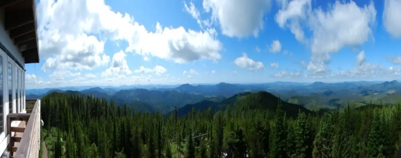
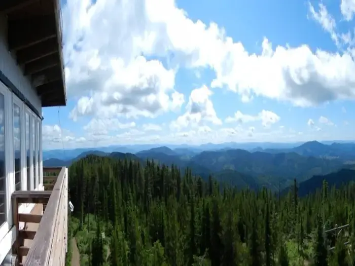
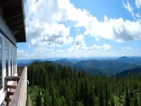
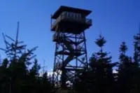
A stairway climbs the tower on Bald Mountain to a catwalk that runs all the way around a small cab, 5,334 feet above sea level. Bald Mountain is one of the highest peaks in the Hoodoo Mountain Range, 20 miles south of St. Maries in Latah County, Idaho. Its slopes are heavily forested with larch, red cedar, hemlock, western white pine, Douglas fir and Engelmann spruce. From the catwalk the rolling hills of the Palouse lie to the south, “honey-colored” in the Forest Service’s words and “golden” in Recreation.gov’s, with St. Maries to the north. Both pages point visitors to the sunrises, the sunsets and the stars. Eagles cross the sky, and bear, moose, elk and deer are frequently seen in the area.
Inside, the cab holds four people. It has a table and four chairs, a futon that folds into a twin bed with a foam pad, two cots, and cookware, dishes and utensils. A propane stove and heater make up the rest of the kitchen, though Recreation.gov posted a notice that both were inoperable while crews worked out a plan for repairs. The refrigerator has been removed. There is no water and no electricity, so guests bring their own drinking water, flashlights, bedding, and bags to pack out their trash. A pit toilet stands just below the tower. The Nez Perce-Clearwater National Forests rent the cab for $45 a night, by reservation only. The 2026 dates ran July 1 to October 4. Recreation.gov discourages bringing children and pets “because of the inherent danger of such a facility.” Renters may not have the summit to themselves: Forest Service employees and members of the public sometimes come up to use the outhouse or look at the view from the stairway.
Palouse Divide Road
The way up begins on State Highway 6, the White Pine Scenic Byway, an 80-mile drive through forest, small towns and farmland. The Palouse District office stands off the highway on the west edge of Potlatch, with a sign at the foot of its driveway. Twenty-two miles past Potlatch, Forest Road 377, the Palouse Divide Road, turns off to the right. It is a single-lane dirt road, rarely graded and slippery when wet, and logging can bring delays, truck traffic and dust. After about 8 miles, Forest Road 377A climbs the last mile to the lookout. That mile is rough and crossed by many water bars, so travel is slow. The Forest Service says high-clearance vehicles can make it but trailers should stay behind. The cab door has a combination lock, and the code comes with the reservation letter.
Two trails start near the summit. Strychnine Ridge Trail 319 begins just southwest of the lookout and runs 4 miles. Half a mile below the lookout it meets Beason Meadows Trail 228, which descends 8.9 miles to Giant White Pine Campground. Hikers, mountain bikers, motorcyclists and riders on horseback all use both trails.
Cabin, pole tower, timber tower
The Forest Service’s recreation page says the lookout was built in 1964, and Recreation.gov gives 1956. A list of Clearwater National Forest lookouts gives a longer account. It was compiled in June 2016 by Margaret Sand of Walde Lookout and archaeologist Cindy Schacher, drawing on Ray Kresek’s Fire Lookouts of the Northwest, Forest Service records and other sources. By that list, the site began as a cabin in 1913. A 50-foot pole tower with an L-4 cab went up in 1938. In 1960 it was replaced by the present structure, a 41-foot treated-timber tower with an R-6 flat cab. The Fire Lookout Museum’s entry at firelookout.com repeats those dates and adds a patrol point set 2 miles southwest in 1935. The recreation pages put the tower at 50 feet. Both say its fire-watching years ended in 1984.
The same Clearwater list records Osier Ridge, northeast of Kelly Creek, going through nearly the same sequence: a log cabin in 1912, a 50-foot pole L-4 in 1938, a 41-foot treated-timber R-6 flat cab in 1961. Osier Ridge is still staffed. The firelookout.com entry says Bald Mountain had gone unstaffed for several years when it was refurbished in 1998. The list’s status column for Bald Mtn. reads: “In Recreation Rental program since 1998.”
Notable Events
- 1913The historical list dates the Bald Mtn cabin south of St. Maries to this year. fs.usda.gov
- 1938An L-4 tower on poles was built. fs.usda.gov
- 1956Recreation.gov dates construction of the lookout to this year. recreation.gov
- 1960A treated-timber tower with an R-6 flat cab was built. fs.usda.gov
- 1964The USFS recreation page dates lookout construction to this year. fs.usda.gov
- 1984The USFS recreation page says fire-lookout use ended in this year. fs.usda.gov
- 1998The lookout entered the Recreation Rental program. fs.usda.gov