

Atlanta Cabin
Atlanta, Elmore County, Idaho. Historic ranger station compound cabin; End of May - End of September.
Details

- Where
- Atlanta, Elmore County, ID. No street address stated. Directions
- Getting there
- From Idaho City, take State Highway 21 north 18 miles to Crooked River/Little Owl Road 384, then right to the North Fork Boise River Road 327, then left to the Middle Fork Boise River Road 268, then left 17 miles upriver to Atlanta; take the first left into the historic ranger station compound to the cabin.
- Fees
- $45 per night.
- Access
- The Forest Service page shows a Site Closed banner and lists an UPDATED Sept. 19 Crooked Fire Area, Road, and Trail Closure on the alerts page.
- Walk-in or reserve
- Once the reservation is made, cabin quests will receive an email from Recreation.gov with the combination to the cabin. For site specific questions, contact the Idaho City Ranger District.
- Phone
- 208-392-3700
- Website
- fs.usda.gov
- Managed by
- Idaho City Ranger District, Boise National Forest.
- Established
- 1933.
- Coordinates
- 43.80485, -115.13016.
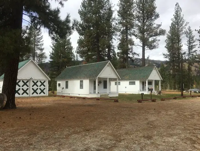
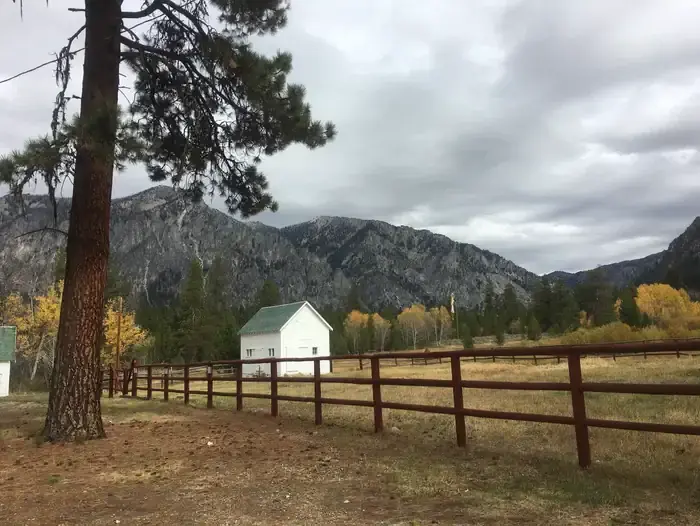
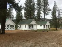
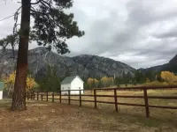
The rental cabin is the first one on the left inside the old ranger station compound at Atlanta, with a “Recreation Cabin” sign out front. It stands at 5,800 feet in a grassy meadow among lodgepole pines. From the front porch the view runs to the edge of the Sawtooth Wilderness and to Greylock Mountain, 9,363 feet. The Middle Fork Boise River is about a quarter mile off.
The cabin on Road 205
The way in is a chain of Forest Service roads. From Idaho City, State Highway 21 runs north about 18 miles to the Crooked River/Little Owl Road, FS 384. That road runs 13.5 miles to the North Fork Boise River Road, FS 327, which runs about 13 miles to the Middle Fork Boise River Road, FS 268. FS 268 climbs about 17 miles upriver to Atlanta. The first left on entering town, Road 205, leads a quarter mile to the compound. The Forest Service calls these roads generally good but somewhat rough, with washboard sections. In fair weather they can be driven in two-wheel-drive cars and trucks. Access may be difficult in fall and late winter.
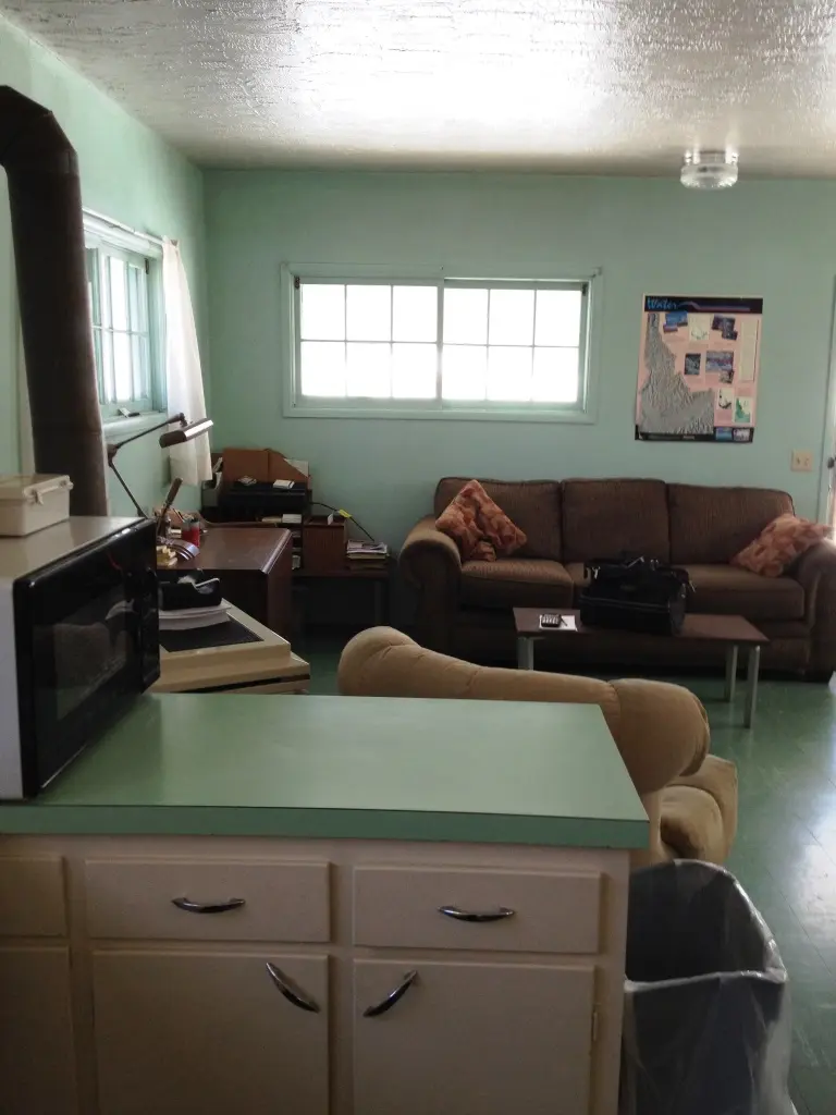
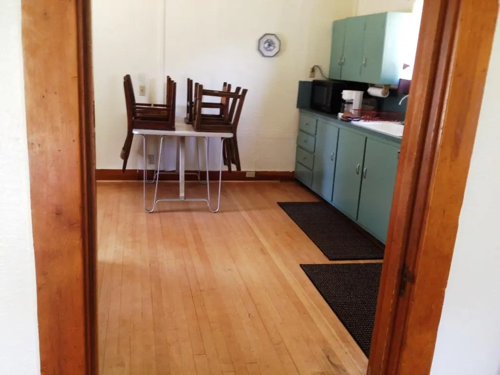
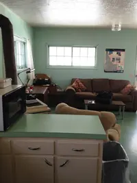
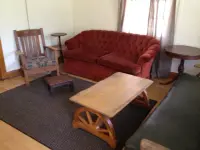
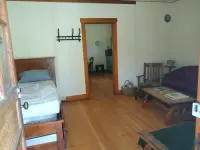
No one is on duty. After a reservation through Recreation.gov, guests receive the door-lock combination by email. Inside are plumbing and electricity, and an indoor bathroom with a flush toilet, sink, and shower. The kitchen has a sink with hot water, a table and chairs, a propane stove, and a refrigerator, which the Forest Service describes as propane. Propane wall heaters warm the rooms.
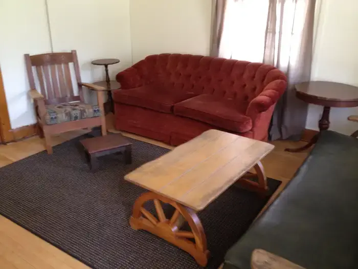
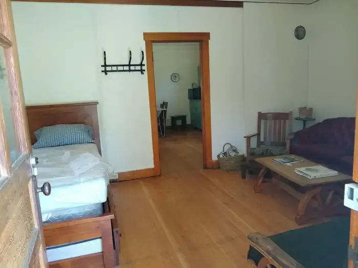
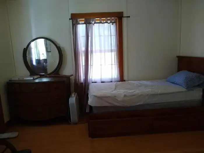
The two listings describe the beds differently. The Forest Service lists one set of bunk beds, two single beds with mattresses, and a couch that folds out. Recreation.gov lists a full-size hide-a-bed in the living room and a queen bed in the kitchen, with bedding not provided. Either way the limit is four people, and tents, motor homes, and RVs are not permitted. They also disagree on animals: the Forest Service page lists horses and pack animals as allowed, and the Recreation.gov listing says saddle, pack, and draft animals are not.
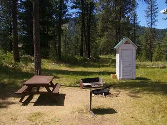
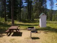
Behind the cabin are a picnic table, a fire ring, a pedestal grill, and a few bear-proof trash bins. A broom and dustpan are provided, and guests are asked to clean before checkout.
The season runs from the end of May to the end of September, at $45 a night. As of its September 24, 2026 update, the Forest Service page for the cabin carried a “Site Closed” banner. Beside it was an alert, updated Sept. 19, for a Crooked Fire area, road, and trail closure.
Trails, hot springs, and the Beaver Creek Lodge
The Middle Fork Boise River Trail and the Powerplant Trail begin nearby, for walkers and riders, and off-road trails branch through the surrounding country. The Forest Service lists the Middle Fork for trout fishing, and big game hunters work the area in season. Hot springs lie within reach: Atlanta, Powerplant, and Chattanooga. Watchers may see mule deer, Rocky Mountain elk, chukars, wild turkeys, eagles, and now and then a black bear or a wolf. Because bears do come through, guests are asked to keep food and trash off the outside of the cabin.
The town was settled in the 1860s in a gold and silver rush, and remnants of that period still stand along its streets. The Beaver Creek Lodge serves meals and has pool and shuffleboard.
Camp Alexander Flat and the R-4 plans
The Civilian Conservation Corps and the Forest Service built the compound in 1933, the first year of the Corps. The CCC enrolled mainly young unmarried men at $30 a month, $25 of which went home to their families. About three-quarters of enrollees worked on projects run by the Department of Agriculture, the Forest Service’s parent agency.
The University of Idaho’s register of surviving CCC structures links the Atlanta Ranger Station Historic District to Camp Alexander Flat, F-175. The same register lists the Dutch Creek Guard Station, near Atlanta, from 1934. Congress voted to liquidate the Corps on June 30, 1942.
The compound is listed on the National Register of Historic Places as the Atlanta Ranger Station Historic District, in Elmore County, reference number 02001726. It is listed for conservation and architecture, with a period of significance of 1925 to 1949 and a significant year of 1933. The National Archives file classifies its buildings under Forest Service R-4 Standard Plans. The National Park Service record bears a publication date of January 23, 2003.
Gold on the Yuba River, 1864
The camp around the compound is older by seventy years. In 1964 the Idaho State Historical Society told its story in Reference Series Number 202. On July 4, 1864, a party led by John Stanley left Warrens and came through Bear Valley and Stanley Basin to the head of the middle fork of the Boise. There they struck gold on the Yuba River, and on July 20 they organized a mining district. Placer mining began at the end of September, with considerable difficulty. In November, John Simmons found the Atlanta lode, rich in both gold and silver.
Quartz mills were brought into the district from 1866, and the first ran in the summer of 1867. They were built to save gold only, though in some properties silver was worth more. In 1868 British investors put in heavily, with little to show beyond expensive machinery. In 1869 the Monarch company, financed by Indiana capitalists, took up important properties and tried stamp milling. By the end of that year all three mills that had made a serious effort had stopped. The Atlanta silver ore was extremely refractory, and working it for gold alone did not pay.
The Monarch kept milling a little high-grade rock for its Indiana owners. In winter its water-power turbine ran on natural hot water so it would not freeze. Meanwhile promoters sold weaker claims to outside investors, who were invariably disappointed. A resident wrote on March 22, 1871: “This country has been infested with a set of ‘bilks’ as trifling as ever cursed any quartz country.” He added, “Thank God, they have none of the good ledges in this camp, and they will not get them unless they can show something more substantial than jawbone.”
Half a century of refractory ore
In the summer of 1874 a rich surface discovery revived the Monarch. Warren Hussey bought 5,500 pounds of selected ore in Atlanta for $5,000. It was packed out to Rocky Bar, freighted to Kelton, Utah, and shipped by rail to Salt Lake, where smelting brought $11,000.
Investors from Buffalo, New York, bought an extension of the discovery lode that same summer. In 1876 they packed a ten-stamp mill into Atlanta over the hill from Rocky Bar, with no decent road to carry it. That year brought the camp’s first building boom. With smaller outfits the two companies supported a community of about 500 people. The Buffalo mill’s trial run on May 3, 1877, recovered 55 percent, against about 20 percent at earlier mills. In 1878 Ralf Bledsoe built a long-awaited road from Rocky Bar.
The camp stayed busy from about 1878 to 1884, milling only the high-grade ore. Then the Tahoma failed to meet its payroll, and liens of $18,000 were filed against it. Creditors sued one another, and the first boom ended. In 1891 V. S. Anderson reported a $3,500,000 sale of the major properties to London capitalists. The new owners could not work the lower-grade ore at a profit either. Mills started and stopped through 1894, 1902, and 1906, and by 1912 all were shut again, waiting for a recovery process.
The Saint Joseph Lead Company found one. Early in 1932 it started an amalgamation-flotation concentrator, solving the refractory-ore problem after more than half a century. The historical society dates modern production at Atlanta from then, and credits that period with most of a total yield of sixteen to eighteen million dollars. The CCC compound went up the following year. In 1936 a road up the middle fork from Boise reached Atlanta, and, in the society’s words, “the last of the old-time problems of that camp was solved.”
Notable Events
- 1864In November, John Simmons discovered the Atlanta lode, rich in both gold and silver. history.idaho.gov
- 1864A party led by John Stanley, which had left Warrens on July 4, struck gold on Yuba River at the head of the middle fork of the Boise and organized a new mining district there on July 20. history.idaho.gov
- 1932The Saint Joseph Lead Company started up an amalgamation-flotation concentrator early in 1932, solving the refractory-ore problem after more than half a century; modern production at Atlanta dates from that time. history.idaho.gov
- 1936Construction of the middle fork road from Boise to Atlanta in 1936 realized another long-awaited improvement in mining at Atlanta. history.idaho.gov
- 2003The National Park Service asset gives January 23, 2003 as its publication date. npgallery.nps.gov
People
- John Simmons, Discovered the Atlanta lode in November 1864, a massive discovery rich in both gold and silver (1864).
- John Stanley, Led the party from Warrens that struck gold on Yuba River and organized a new mining district there (1864).
Sources
- recreation.gov/camping/campgrounds/234134
- fs.usda.gov/r04/boise/recreation/atlanta-guard-station-rental-cabin
- recreation.gov/api/camps/campgrounds/234134
- history.idaho.gov/wp-content/uploads/0202.pdf
- nps.gov/articles/ccc-properties-listed-in-the-national-register-of-historic-places.htm
- lib.uidaho.edu/digital/cccidaho/structures
- catalog.archives.gov/id/84249886
- npgallery.nps.gov/AssetDetail/NRIS/02001726