Adams Ranger Station
Grangeville, Idaho County, Idaho. Log cabin.
Details

- Where
- Hungry Ridge Road #309, Grangeville, ID 83530. Directions
- When
- Open 24 hours/day.
- Season
- Year-round, except during spring melt (typically mid-March to late May).
- Getting there
- From the town of Grangeville, turn south on the Grangeville-Salmon Road and follow the signs toward Gospel Hump and Salmon River. At mile marker 29, turn left (east) onto Hungry Ridge Road #309 and drive approximately 1 mile. Turn left at the signs for Adams Ranger Station/Wilson Cow Camp.
- Fees
- $50 per night, with a minimum of two nights stay on weekends.
- Access
- Pack-it-in/pack-it-out facility; no water available on-site (bring your own or melt snow in winter); no one under 21 can reserve the cabin; reservation holder must be present during entire stay; camp trailers, RVs and tents not permitted; pack and saddle stock not permitted on the cabin site.
- Walk-in or reserve
- Advanced reservation only; no walk-ups; lock combination emailed prior to reservation.
- Phone
- 208-983-1950
- Website
- fs.usda.gov
- Managed by
- Nez Perce-Clearwater National Forests (Salmon River Ranger District).
- Established
- 1932.
- Coordinates
- 45.65504, -116.038719.
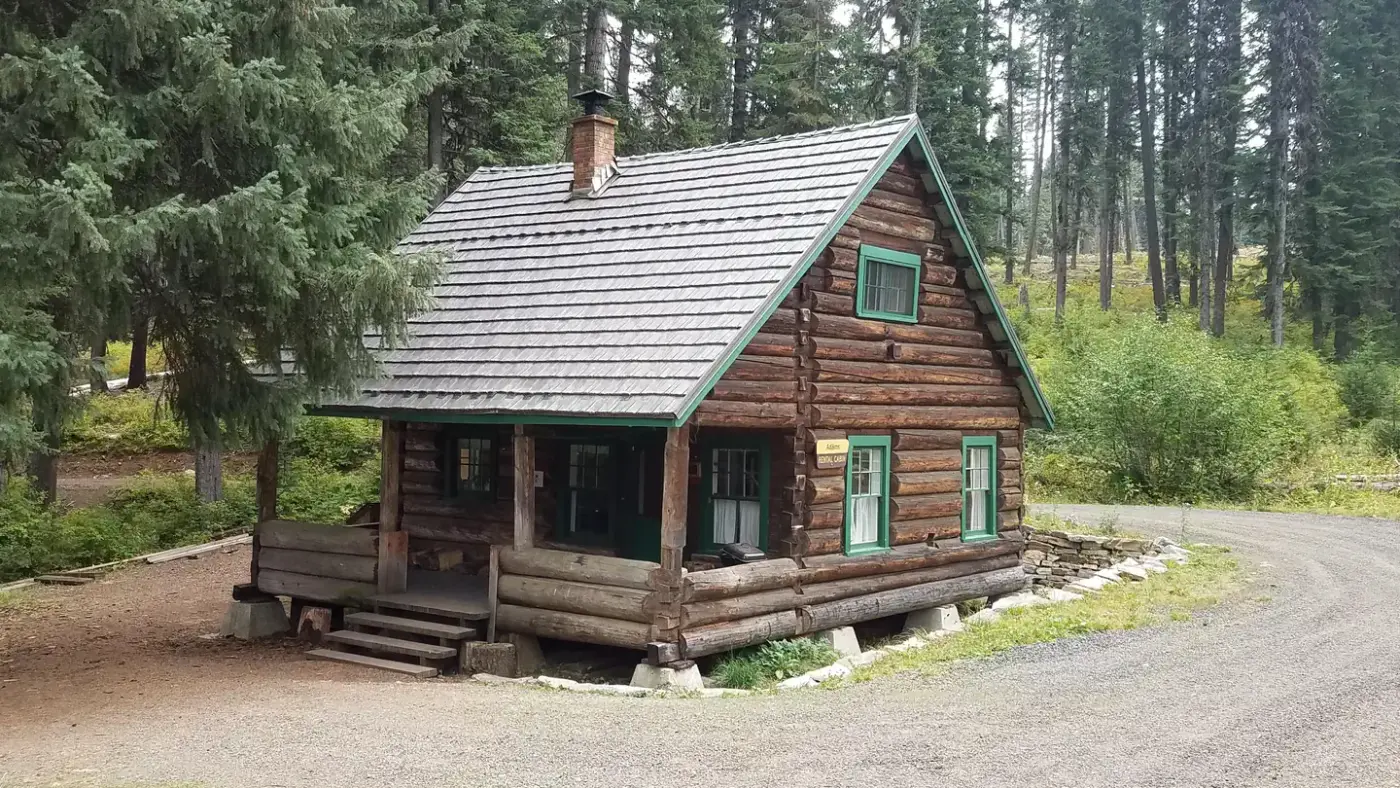
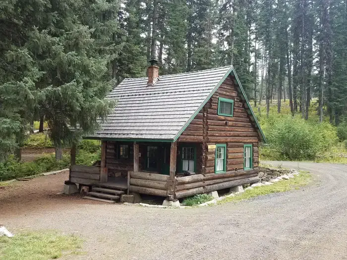
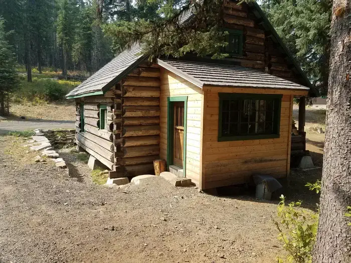
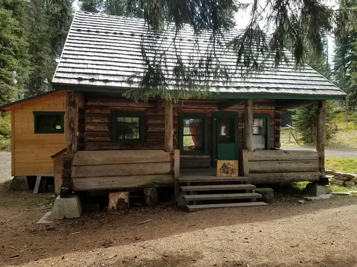
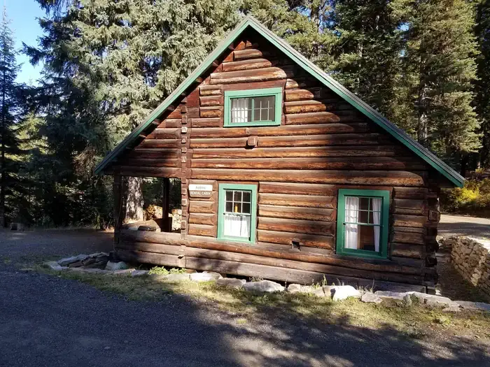
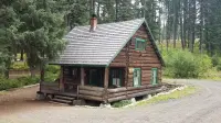
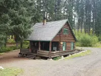
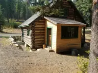
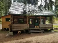
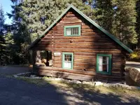
From Grangeville the Grangeville-Salmon Road runs south toward the Gospel Hump and the Salmon River. At mile marker 29 a turn east onto Hungry Ridge Road #309 leads about a mile to signs for Adams Ranger Station and Wilson Cow Camp. A short climb up a small hill ends at a two-story log cabin with a front porch and a side porch. It was built in 1932, at 5,150 feet, as the house of the district ranger and his family. The Salmon River Ranger District of the Nez Perce-Clearwater National Forests now rents it by the night to parties who reserve in advance. There are no walk-ups and no cell phone reception.
The ranger’s house on Hungry Ridge
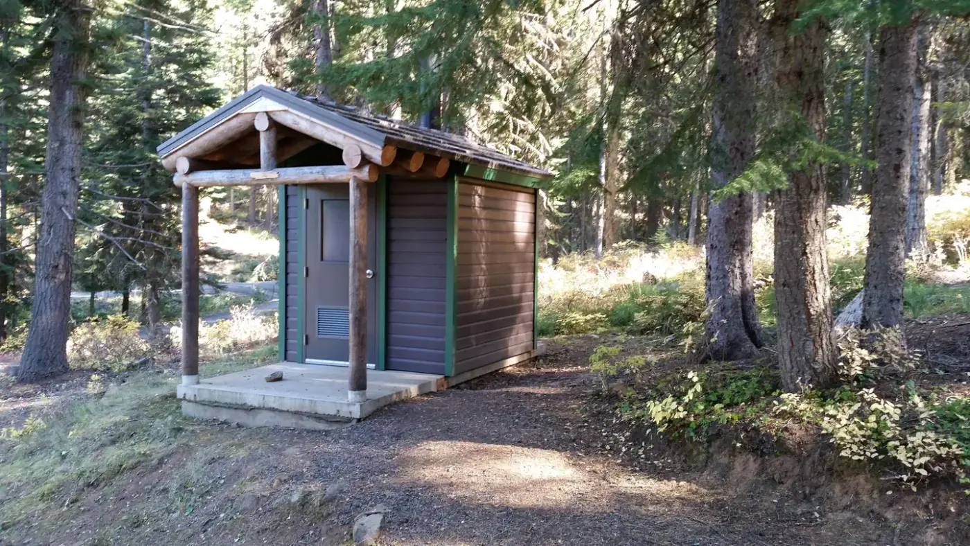
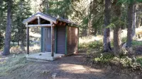
The house sleeps eight, on one futon, one double bed, two single beds and two cots. The kitchen has a propane cook stove whose oven is not hooked up to the propane and does not work. There are also propane lanterns, dishes, silverware, cookware, bakeware, a table and chairs. A broom, bucket and mop stand with the snow shovels, axes and mauls. Firewood rounds are supplied for heating the cabin. Recreation.gov says bedding and blankets are not provided, while the Forest Service brochure lists “some sheets and blankets” among the items on hand. A vault toilet stands outside.
There is no potable water on the site. Recreation.gov tells guests to bring their own or melt snow in winter. Terry Musgrove spent six nights at the station in June 2020 with Woody the dog and wrote about it for the National Forest Foundation. He found that many small streams crisscross the area and that “you won’t have to go far to get a bucket of water.” The supply for the wood stove sits near the front door, uncovered, and he warned that a guest “may find yourself with a big pile of wet wood like we did.” Outside are a large covered porch and a fire ring, which takes firewood brought by the guest. The supplied rounds are for the stove indoors.
Adams was once a large administrative site with several outbuildings and corrals. Besides the rental cabin, Musgrove found a warming hut, two bunkhouses, a large barn and a toolshed, all kept locked. One bunkhouse appeared to be still in use by Forest Service staff.
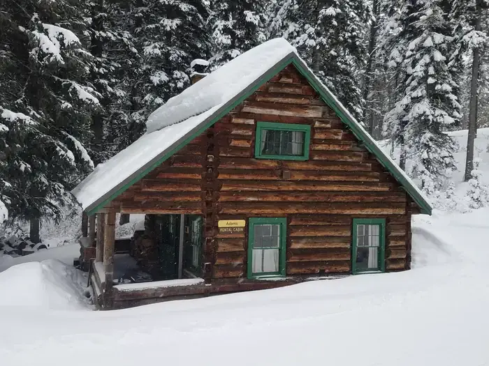
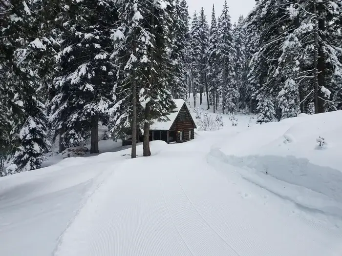
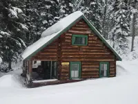
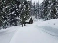
The cabin is rented year-round except during spring melt. The Forest Service gives that as typically mid-March to late May. Its brochure gives March 16 to May 20 and calls it “spring mud season.” Musgrove puts it at about three months, when the wetlands around the cabin turn muddy. He also called the house a popular rental in winter. In that season the approach is about 30 miles by snowmobile from Fish Creek Snow Park, over Forest Service Road #221 to Four Corners and then onto Hungry Ridge Road. The route should be groomed all the way to the cabin.
Roads and trails toward the Gospel Hump
The Gospel-Hump Wilderness runs from 1,970 feet at the Wind River pack bridge on the Salmon River to 8,940 feet on the summit of Buffalo Hump. Its northern part is wetter and heavily forested, and its southern part is dry and sparsely vegetated. A rugged, glaciated divide separates the two and holds the peaks that give the wilderness its name. Recreation.gov lists mountain lions, moose, bighorn sheep, mountain goats and wolves in the country. Musgrove gives the nearest wilderness access at Rocky Bluff Campground, about three miles from the cabin. Corral Creek, a stock facility and trailhead, serves horses and hikers. Pack and saddle stock are not allowed on the cabin site itself.
The turnoff for the Gospel Hump Corridor Road #444 is a couple of miles from Adams. For 12 miles the road has wilderness on each side, with trailheads along it and Square Mountain Lookout at its end. The brochure calls the road very steep in places and “not for the weak heart.” Bicycles and motors stay on the road. The Milner Trail, now Road #641, carries off-road vehicles in summer and snowmobiles in winter.
Old Florence lies about 15 miles off by Musgrove’s figure. He gives it a population of 9,000 at one time. Nearly all its buildings are gone, but the cemetery is kept by volunteers and the Forest Service. The Nezperce Story, a history of the forest, records only a few graves there as identifiable from original headboards. One is H. J. Talbotte, January 5, 1863, 29 years, native of Georgia, better known as Cherokee Bob. According to The History of North Idaho (1903), he and William Willoughby armed themselves after a woman was ejected from a New Year’s Eve ball at Florence, and both were later killed. Musgrove notes that New Florence is nearby, much of it on private land and still actively mined for gold.
A stopping place on Milner’s toll trail
Gold was found in the Florence basin on August 20, 1861. The next spring Moses E. Milner and his partner, Francis, cut a pack trail from Mount Idaho to the Florence camp. Milner was born in Kentucky on May 8, 1829, and was one of fifty-two men who had found gold at Elk City the summer before. His route ran south from Mount Idaho along a hogback to the Adams Way Station and on into Florence. It avoided the great climbs of White Bird Hill and the high ridge above the mines.
Cindy L. Schacher, an archaeological technician on the Nez Perce National Forest, wrote a Forest Service history of the trail. By her account it opened in May or June of 1862, and provisions in Florence got cheaper once it did. Hundreds, even thousands, of people and pack animals walked it, and the trip took two or three days. Empty pack trains had to yield and give loaded trains the inside of the trail. Among the early parties were Seth and Jane Jones, and Jane was the first white woman to travel the route. Milner let their whole party pass without paying toll, and they reached Florence on June 1, 1862. The Nezperce Story calls Adams Camp a favorite stopping place on the old Milner road, dating to 1862.
The territorial legislature authorized the route as a toll trail in 1864. It charged $3 per wagon and horse or mule, $1 per horseman, and 50 cents per loaded pack animal. On July 1, 1872, Idaho County declared it a county trail. Milner himself did not stay long. Schacher writes that he was badly wounded by a mountain lion in 1862, sold his trail and moved to Virginia City, Montana. A family biography quoted in the same pamphlet dates his first Mount Idaho cabin to 1859 and the cougar to 1861. It says Milner picked up the name California Joe in Virginia City and kept it until his death.
In 1890 the territorial legislature appropriated $50,000 for a State Wagon Road, built in 1890–91 largely on the old Milner line. The survey that year put Mount Idaho at 36.25 miles from Florence. A bicyclist who rode the route in 1897 took thirteen hours. He counted three way stations with food and beds between Mount Idaho and Florence and nothing else along the way. One roadhouse, Dead Horse Camp, four miles north of Adams Camp, kept a tavern, hotel, barn and small store until 1906. In 1922 Adams Camp was still operating.
District headquarters, 1919 to 1958
The Forest Service made the ground next to Adams Camp an administrative site in 1919. According to the Forest Service brochure, the employees stationed there evaluated homestead and mining claims, timber and boundary surveys. They supplied camps, administered grazing permits, ran fire protection and supported lookouts such as Slate Point. They also kept the switchboard, because Adams routed all incoming calls on the telephone lines in the area.
The ranger’s house went up in 1932. According to Recreation.gov, Adams last served as district headquarters in 1958 and afterward as a work center for summer crews. The Forest Service says the house has not been lived in since the 1960s, when the district’s administration moved to Slate Creek Ranger Station, and that its condition slowly declined after that. Renovation began in 2003. The Nez Perce National Forest did the work with the North Idaho Resource Advisory Committee and numerous volunteers. The house has been rented to the public since 2008. The brochure says it remains eligible for the National Register of Historic Places.
Notable Events
- 1862Adams Camp served travelers on the old toll wagon road leading to Florence as early as 1862. fs.usda.gov
- 1919The Forest Service established the area adjacent to Adams Camp as an administrative site. fs.usda.gov
- 1932The old Adams Ranger's house was built for the District Ranger and his family. fs.usda.gov
- 1958The station last served as district headquarters in 1958 and afterward served as a work center for summer crews. recreation.gov
- 1960sThe house had not been occupied since the 1960's, when Ranger District administration moved to Slate Creek Ranger Station. fs.usda.gov
- 2003Renovation efforts began among the Nez Perce National Forest, North Idaho Resource Advisory Committee and numerous volunteers. fs.usda.gov
- 2008The historic ranger's house became available to the public for rental. fs.usda.gov
People
- Francis, Milner's partner who helped cut the Mount Idaho-to-Florence pack trail, the route serving Adams Way Station (spring of 1862).
- Moses E. Milner, Builder of the Milner Trail, whose route passed Adams Way Station on the way to Florence (1862).
- Lloyd Butzien, Alternate at Adams Ranger Station who ran the district for extended periods when the ranger was called away (many years).
Sources
- recreation.gov/camping/campgrounds/233132
- fs.usda.gov/r01/nezperce-clearwater/recreation/adams-ranger-station
- fs.usda.gov/r01/nezperce-clearwater/recreation/adams-ranger-station
- nationalforests.org/article/explore-it-all-adams-ranger-station
- npshistory.com/publications/usfs/region/1/nez-perce/history/sec9.htm