







Acker Rock Lookout
Tiller, Douglas County, Oregon. Lookout; August 1 - November 15.
Details

- Where
- Tiller, Douglas County, OR. No street address stated. Directions
- When
- Open 24 hours/day.
- Getting there
- From Tiller, drive northeast on Douglas County road 46 / South Umpqua Forest Service Road 28, then up Forest Service Road 29, Road 2838 and spur Road 2838-950 to the trailhead.
- Fees
- $40.
- Access
- The FS 2828-950 road is closed with a locked gate. Please check with Ranger Station to ensure the lookout is open. This site is closed to recreation use from January 1 through June 30.
- Walk-in or reserve
- Reservation required.
- Phone
- 541-825-3100
- Website
- fs.usda.gov
- Managed by
- Umpqua National Forest.
- Established
- 1960s.
- Coordinates
- 43.05243, -122.6457.
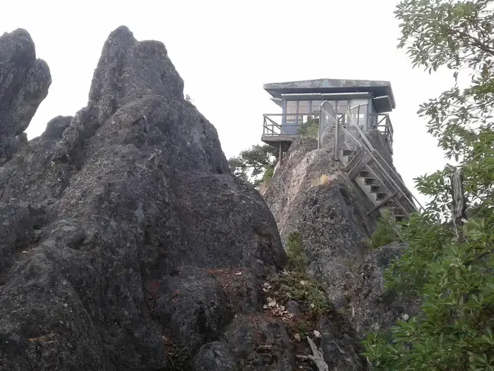
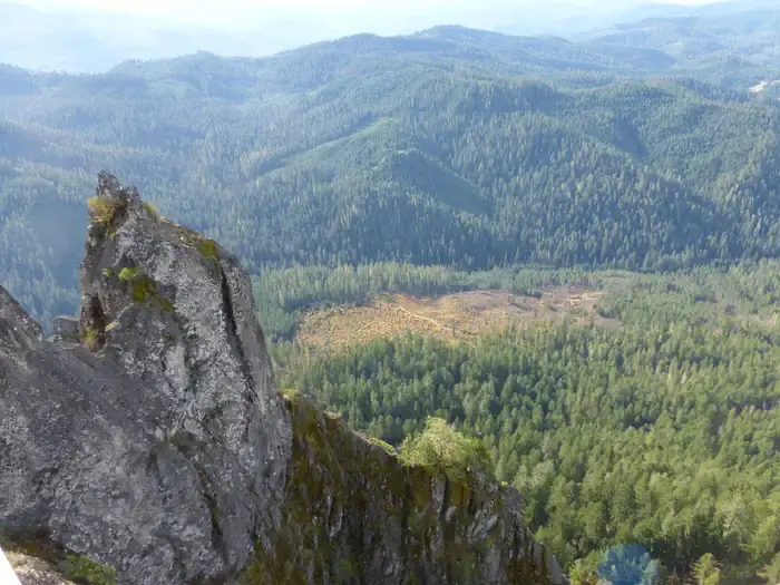
The lookout on Acker Rock is a single room, twelve feet by twelve, at the edge of a cliff in the Tiller Ranger District of the Umpqua National Forest. Its foundation rests on a thin volcanic ridge, and part of the floor hangs over several hundred feet of open air above the tree canopy. Terry Musgrove, writing for the National Forest Foundation, said it “looks more like a bird’s nest than living quarters for humans.” On the west and south sides the cliffs drop sheer for several hundred feet.
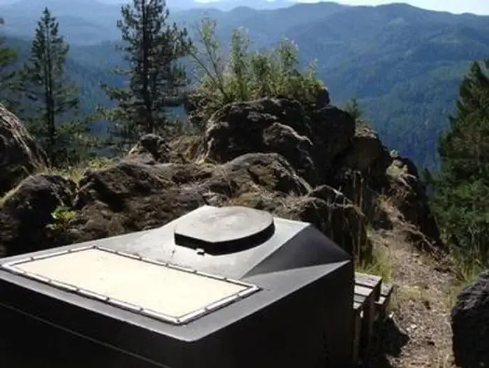
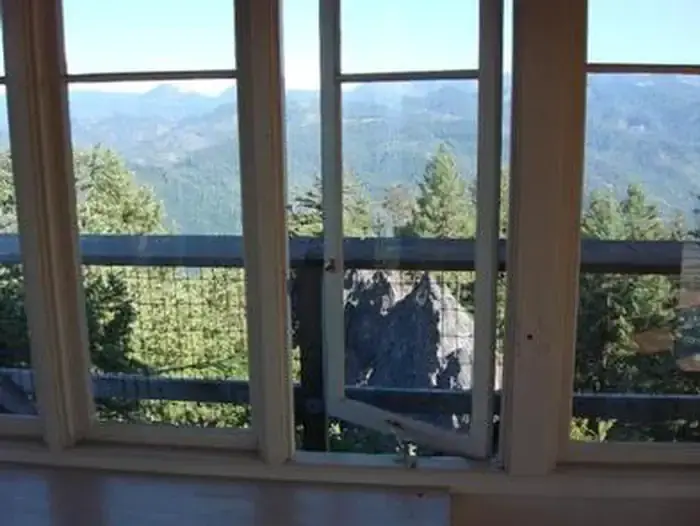
From the windows the view takes in the South Umpqua River valley, several of its tributaries, and landmarks on the Rogue-Umpqua Divide. The sources disagree about how far a clear day reaches. The Forest Service lookout page names mountains on the Willamette, Rogue, and Umpqua River watersheds. The Recreation.gov listing and the Forest Service trail page name the Willamette, Rogue, and Deschutes. Recreation.gov and Musgrove both add the rim of Crater Lake.
The cab and its catwalk
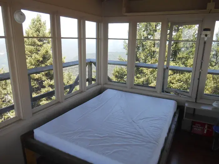
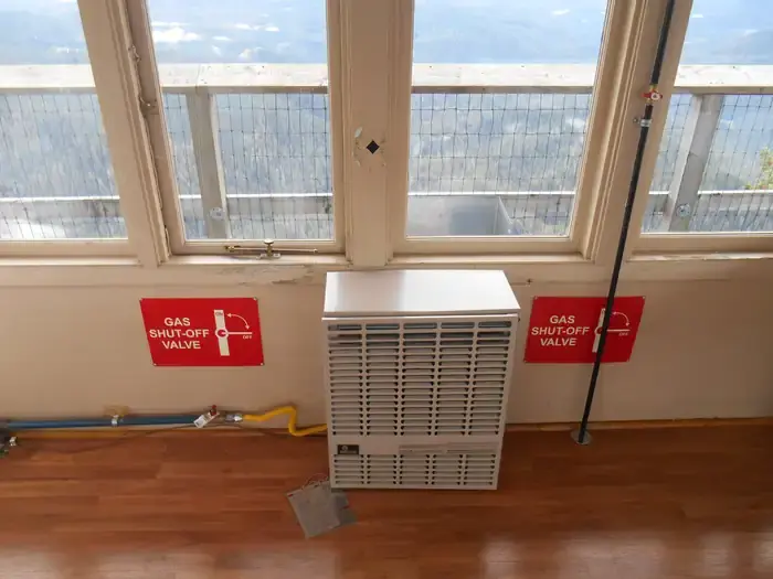
The Tiller Ranger District rents the lookout to the public for $40 a night, and no more than four people may be in the tower at one time. The Forest Service lists the furnishings as a single bed, a small table and chair, a propane wall heater, lanterns, a cooking stove with oven, and a refrigerator, with propane supplied. A composting toilet stands at the site. There is no water. The nearest potable water is a spigot in front of the Tiller Ranger Station office, a 45-minute drive. Renters bring their own food, cooking gear, sleeping bags and pads, towels, dish soap, matches, toilet paper, and garbage bags. The propane lights are there, but the listing recommends bringing another light source.
Musgrove spent four nights at the lookout in October 2013 with a companion he calls Yogi, and a friend, Mark, arrived unannounced on the fourth night. He found one twin bed, a table, some counter space, two chairs, a mini refrigerator, an oven and stove, and two propane wall lights. The bed had only a box spring, which he found very uncomfortable to sleep on, and there were no cots or pads. The heater listed on the reservation site was not there, and he wrote that “the nights got pretty chilly.” A narrow catwalk runs around the outside of the cab, and he found the exterior shutters easy to fold up or down.
The building is still used for active fire detection, and the Forest Service says it can serve fire management during the summer season. The trail page asks hikers to respect renters, Forest Service personnel, and contractors alike. Rentals generally run from August 1 through November 15, depending on snow. The site is closed to recreation from January 1 through June 30, and the lookout page notes that the area typically closes from January through July for falcon nesting. The lookout is not rented in winter because of wind and snow weight restrictions on the building.
Forest roads out of Tiller
Tiller lies about 23 miles from Canyonville on OR-227. From Tiller, Douglas County Road 46 runs northeast and becomes Forest Service Road 28, the South Umpqua road. After 18.5 miles it meets Buckeye Creek Road, Forest Service Road 29. Seven miles up that road is Road 2838, which turns north for 1.5 miles to the spur, 2838-950. The spur runs another 1.5 miles to the trailhead. A locked gate closes the spur. Renters receive the combination with their confirmation letter, and other hikers may walk in from the gate during a stay. The Forest Service recommends high-clearance four-wheel or all-wheel drive. Recreation.gov warns that GPS units “can, and have sent guests down the wrong roads,” and advises following the written directions.
Acker Rock Trail #1585 climbs 0.4 mile through forest at a moderate to steep grade. Recreation.gov elsewhere calls it about a half mile of uphill trail and tells renters to be ready to carry their bedding that distance. The trail runs from about 3,700 feet at its lowest point to about 4,100 feet at its highest, and it may hold snow from late fall through mid-spring.
Ropes below the floor
Experience Roseburg describes Acker Rock as a coarse, shallow intrusive quartz latite volcanic plug. The News-Review notes that the quartz in the rock gives it a good texture for climbing. Greg Orton has climbed locally since the early 1990s and has taught rock climbing at UCC. He groups the rock with a landmark on the North Umpqua: “The primary rock formations attracting climbers to the Umpqua are the shallow intrusive rhyodacitic welded tuffs that form Old Man Pinnacle on the North Umpqua River and Acker Rock outside of Tiller.”
Experience Roseburg counts 17 established routes on the rock, two of them among the longest in Oregon. The rappel off it is measured three ways. Experience Roseburg calls it almost 600 feet and one of the state’s longest. The News-Review calls it Oregon’s second-longest at 600 feet. Musgrove describes a multiple rappel from the ridge at the lookout to the base of Eagle’s Dare as Oregon’s longest, at close to 550 feet. Orton counts Eagle’s Dare among the forest routes that “have become Oregon classics.” Many climbers finish their routes near the lookout, and Musgrove told renters to “expect to see a few climbers during your visit.”
A helicopter and a dozen lookouts gone
The National Forest Foundation gives 1964 as the year the lookout was built, at an elevation of 4,000 feet. Recreation.gov says it was placed on the cliff by helicopter in the 1960s. Before airplanes took over fire detection, the Tiller Ranger District had more than a dozen lookouts. Acker Rock and Pickett Butte are the only ones left.
In 2003 Kay Atwood, Dennis J. Gray, and Ward Tonsfeldt completed a historical study of the lookout. It is now held in the Kay Atwood Collection of Regional History at Southern Oregon University’s Hannon Library, catalogued as MSS025:02.39. The authors found historical significance that would make the lookout eligible for the National Register of Historic Places “when the time is right,” and they suggested its eligibility be reviewed in ten years.
Notable Events
- 1964Acker Rock Lookout was built in 1964 at an elevation of 4,000 feet, perched above the South Umpqua River Valley in Umpqua National Forest. nationalforests.org
- 2003A historical study of Acker Rock Lookout by Kay Atwood, Dennis J. Gray and Ward Tonsfeldt is held in the Kay Atwood Collection of Regional History at Southern Oregon University Hannon Library; the authors point out the historical significance that would make it eligible when the time is right for nomination to the National Register of Historic Places. archiveswest.orbiscascade.org
People
- Greg Orton, Quoted local climber on Acker Rock's rock and classic routes, who has been climbing locally since the early 1990s and has taught rock climbing at UCC.
Sources
- recreation.gov/camping/campgrounds/233322
- fs.usda.gov/r06/umpqua/recreation/acker-rock-lookout
- fs.usda.gov/r06/umpqua/recreation/trails/acker-rock-trail
- recreation.gov/api/camps/campgrounds/233322
- experienceroseburg.com/blog/post/recreation-on-the-rocks
- nrtoday.com/news/exploring-the-umpqua-national-forest/article_8e2c210e-4f7a-5e42-8cbd-a3d48c49678a.html
- sou.libraryhost.com/agents/people/101
- fs.usda.gov/r06/umpqua/recreation/acker-rock-lookout
- nationalforests.org/article/explore-it-all-acker-rock-lookout-umqua-national-forest-oregon
- archiveswest.orbiscascade.org/ark:80444/xv998106